Top

Mountain cinema - Waltherplatz | Piazza Walther

Welschnofen
Add to favourites
Difficulty
Easy
Activity time
1:02
Duration in hours
Distance
2
Distance in km
WSEN
Suggested period
Jan
Feb
Mar
Apr
May
Jun
Jul
Aug
Sep
Oct
Nov
Dec
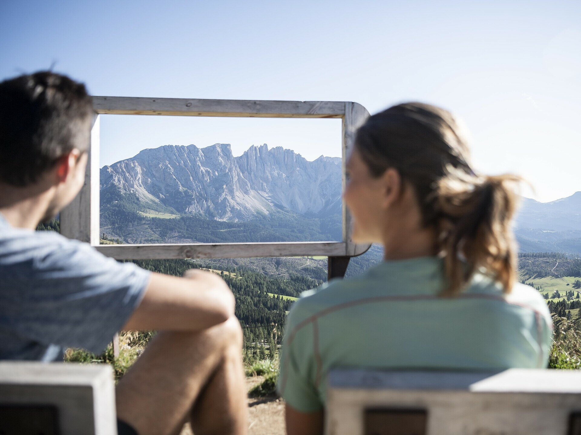
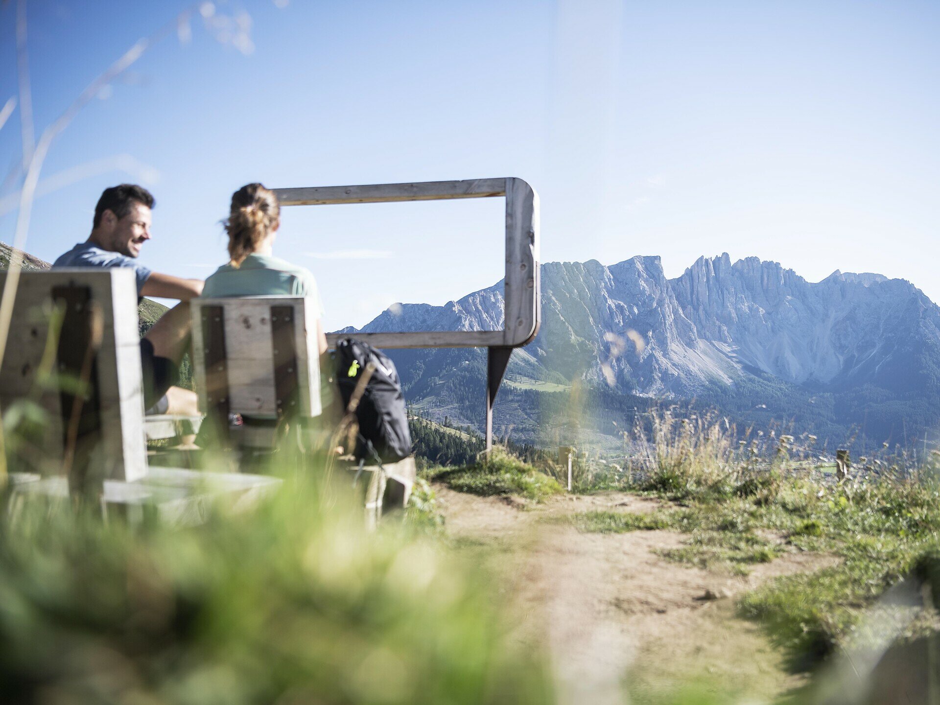
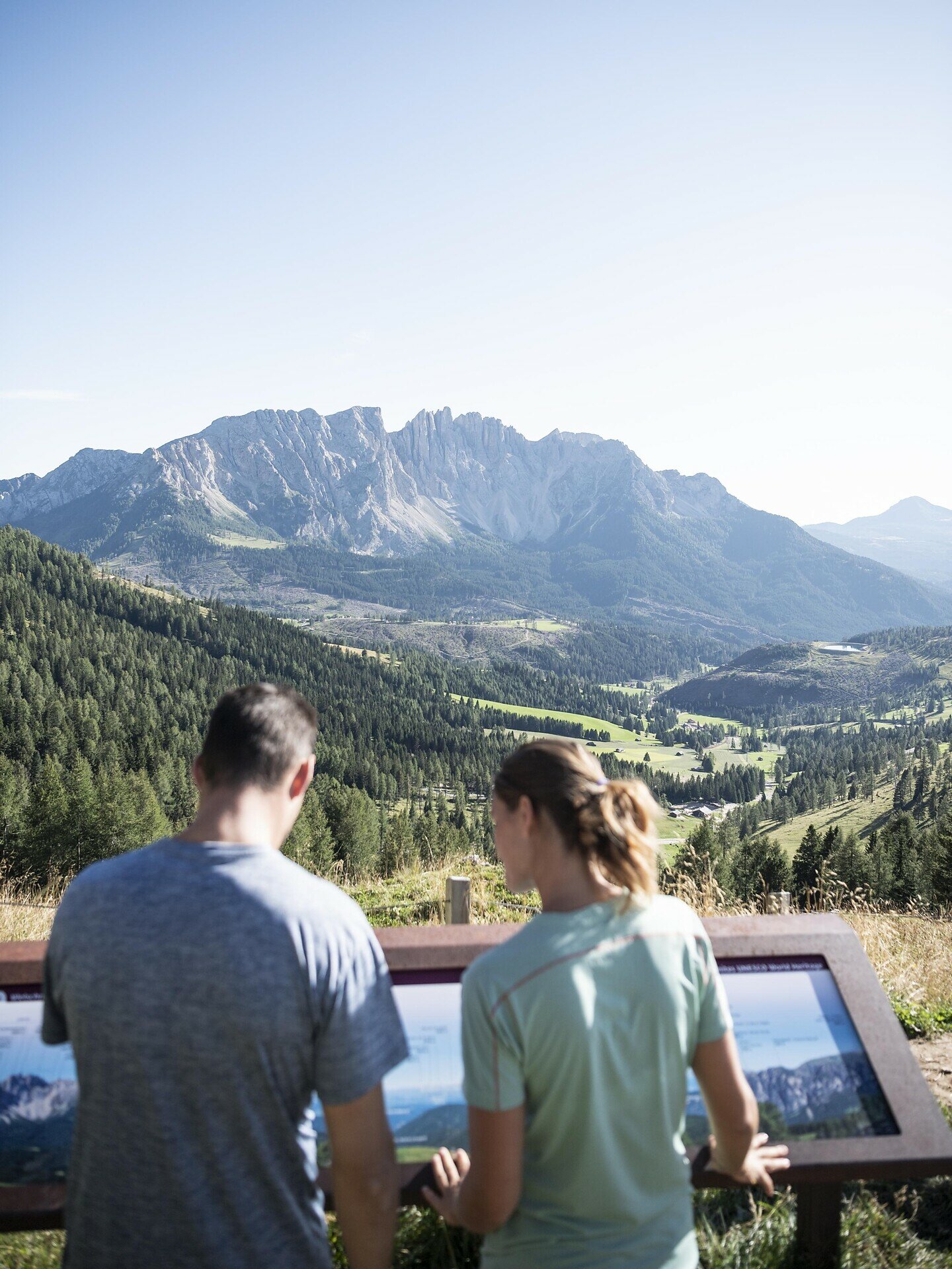
Hike to the Waltherplatz mountain cinema with stunning views of the Rosengarten, Latemar, Ortler and more. The partly steep trail is richly rewarded with breathtaking panoramas.

On beautiful forest and alpine trails, you reach the Waltherplatz | Piazza Walther mountain cinema at the foot of the Rosengarten | Catinaccio. Surrounded by idyllic alpine meadows, you can enjoy the phenomenal view of countless mountain peaks such as Latemar, Schwarzhorn | Corno Nero, Weißhorn | Corno Bianco, Ortler | Ortles, the Stubai and Zillertal Alps (Austria), Tschafon | Monte Ciavone and Schlern | Sciliar, which more than make up for the partly steep ascent.

Route info
Easy
Distance
2,0 km
Activity time
1 h 02 min
Ascent
314 m
Descent
0 m
Physical effort
Scenary
Highest point
2.059 m
Lowest point
1.739 m
Suggestions
Refreshment stop: Frommer Alm hut - Opening hours and closing day: https://eggental.com/en/info/restaurant-frommeralm_5125
Directions
The route starts at the Frommer Alm hut (1743 m) and leads via path [15] to the Eggental mountain cinema "Waltherplatz | Piazza Walther" (1881 m).

Refreshment stop: Frommer Alm hut - Opening hours and closing day: https://eggental.com/en/info/restaurant-frommeralm_5125
public transportation
Getting to the starting point of the tour by public transport is easy and convenient. 

By public bus line:
- 180 from Bozen | Bolzano, Birchabruck | Ponte Nova
- 180 from Fassatal | Val di Fassa, Karersee | Carezza, Karerpass | Passo Costalunga
- 184 from Weissenstein | Pietralba, Petersberg | Monte San Pietro, Deutschnofen | Nova Ponente, Stenk (or 181 and change 180)
- 184 from Obereggen, Eggen | Ega (or 184 and change 180)
- 186 from St. Zyprian | S. Cipriano, Nigerpass | Passo Nigra with change 180
- 187 from Steinegg | Collepietra, Gummer | San Valentino (or 182 and change 180)

Bus stop: Welschnofen Zentrum | Nova Levante centro (centre) + ascent with the cable car; online timetable search at www.suedtirolmobil.info/en/
How to get there
Getting to the starting point of the tour by public transport is easy and convenient. 

By public bus line:
- 180 from Bozen | Bolzano, Birchabruck | Ponte Nova
- 180 from Fassatal | Val di Fassa, Karersee | Carezza, Karerpass | Passo Costalunga
- 184 from Weissenstein | Pietralba, Petersberg | Monte San Pietro, Deutschnofen | Nova Ponente, Stenk (or 181 and change 180)
- 184 from Obereggen, Eggen | Ega (or 184 and change 180)
- 186 from St. Zyprian | S. Cipriano, Nigerpass | Passo Nigra with change 180
- 187 from Steinegg | Collepietra, Gummer | San Valentino (or 182 and change 180)

Bus stop: Welschnofen Zentrum | Nova Levante centro (centre) + ascent with the cable car; online timetable search at www.suedtirolmobil.info/en/

By car: 
Destination: Welschnofen | Nova Levante
Parking: Parking lor cable car Laurin I + ascent with the cable car
Where to park
Parking: parking lot cable car Welschnofen | Nova Levante Laurin I, https://maps.app.goo.gl/sArFu4rWe1AirKsZ7 
Ascent with the cable car.
You might be interested in
Discover related tours
Intermediate
Add to favourites
Karersee, Welschnofen
To the Christomannos Monument via the Hirzelsteig path
Distance 8,6 km
Activity time 2 h 38 min
Ascent 399 m
Descent 399 m
Deutschnofen
LATEMAR.360°
Distance 1,0 km
Activity time 25 min
Ascent 86 m
Descent 89 m
Welschnofen
Frin - Kaiserstein Tour
Distance 17,2 km
Activity time 3 h 30 min
Ascent 329 m
Descent 329 m
Intermediate
Add to favourites
Karersee, Deutschnofen, Welschnofen
Hike from Obereggen to Passo Costalunga
Distance 11,0 km
Activity time 3 h 15 min
Ascent 290 m
Descent 104 m
Karersee
Family hike from the Paolina hut to the Rotwand | Roda di Vael hut and Pederiva hut
Distance 3,9 km
Activity time 1 h 13 min
Ascent 208 m
Descent 208 m
Intermediate
Add to favourites
Welschnofen
To the Latemar Labyrinth from Lake Carezza
Distance 9,4 km
Activity time 2 h 55 min
Ascent 457 m
Descent 457 m