Top

Randonnée familiale du col Niger au refuge Messnerjoch

Karersee, Welschnofen
Add to favourites
Difficulty
Easy
Activity time
1:16
Duration in hours
Distance
3.9
Distance in km
Status
open
Suggested period
Jan
Feb
Mar
Apr
May
Jun
Jul
Aug
Sep
Oct
Nov
Dec
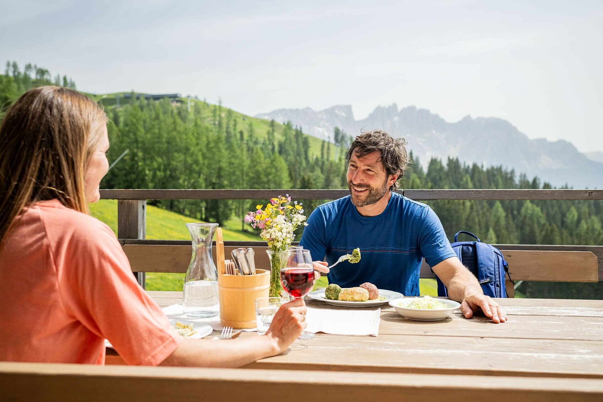
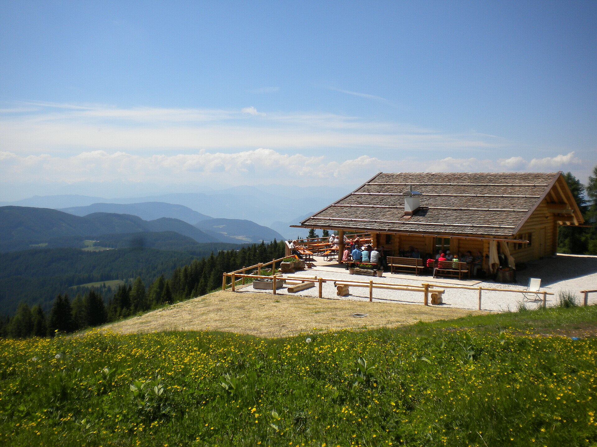
Easy, buggy-friendly hike from Nigerpass to the Messnerjoch hut below the Rosengarten – with Dolomite views, South Tyrolean cuisine, and a playground.
This family-friendly hike begins at the Nigerpass | Passo Nigra and follows a wide, well-maintained forest path through idyllic woodland. The destination is the scenic Messnerjoch hut, beautifully situated just below the majestic Rosengarten | Catinaccio mountain range. Once there, the hut invites you to relax and enjoy: with breathtaking views of the Dolomites, warm South Tyrolean hospitality, and a playground for young adventurers.
Tags
  • Suitable for strollers
  • Out and back
  • Family-friendly
Route info
Easy
Distance
3,9 km
Activity time
1 h 16 min
Ascent
242 m
Descent
242 m
Physical effort
Scenary
Highest point
1.925 m
Lowest point
1.683 m
Suggestions
Refreshment stop Messnerjoch hut - Opening hours and closing day: https://eggental.com/en/info/almhtte-messnerjoch_5238
You might be interested in
Discover related tours
Obereggen, Deutschnofen
Hike from Obereggen to Lavazè
Distance 15,0 km
Activity time 4 h 41 min
Ascent 585 m
Descent 585 m
Status
open
Deutschnofen
Randonnée au Weißhorn
Distance 17,7 km
Activity time 6 h 00 min
Ascent 834 m
Descent 835 m
Status
closed
Deutschnofen
Circular family-hike at Jochgrimm/Passo Oclini
Distance 5,3 km
Activity time 1 h 30 min
Ascent 166 m
Descent 166 m
Status
open
Karersee, Welschnofen
From Passo Costalunga to Lake Carezza
Distance 4,4 km
Activity time 1 h 06 min
Ascent 16 m
Descent 224 m
Status
open
Welschnofen
Family walking tour from Lake Carezza to the Stadl Alm hut
Distance 4,2 km
Activity time 1 h 04 min
Ascent 31 m
Descent 82 m
Status
open
Intermediate
Add to favourites
Deutschnofen
Hike & Bike | From Obereggen to Pietralba
Distance 16,8 km
Activity time 4 h 59 min
Ascent 554 m
Descent 607 m
Status
closed