Top

Randonnée jusqu'au Wölflhof

Deutschnofen
Add to favourites
Difficulty
Intermediate
Activity time
2:25
Duration in hours
Distance
9
Distance in km
Status
open
WSEN
Categories
  • Hiking trail
Suggested period
Jan
Feb
Mar
Apr
May
Jun
Jul
Aug
Sep
Oct
Nov
Dec
Scenic hike to Wölflhof with local food and Dolomite views – ideal for nature lovers, hikers, and those who enjoy a rewarding rest stop.

This hike is a perfect blend of nature, relaxation, and local flavor. Starting from the edge of Deutschnofen, the route leads through peaceful roads, open meadows, and quiet forest trails – with views that become more impressive with every step.

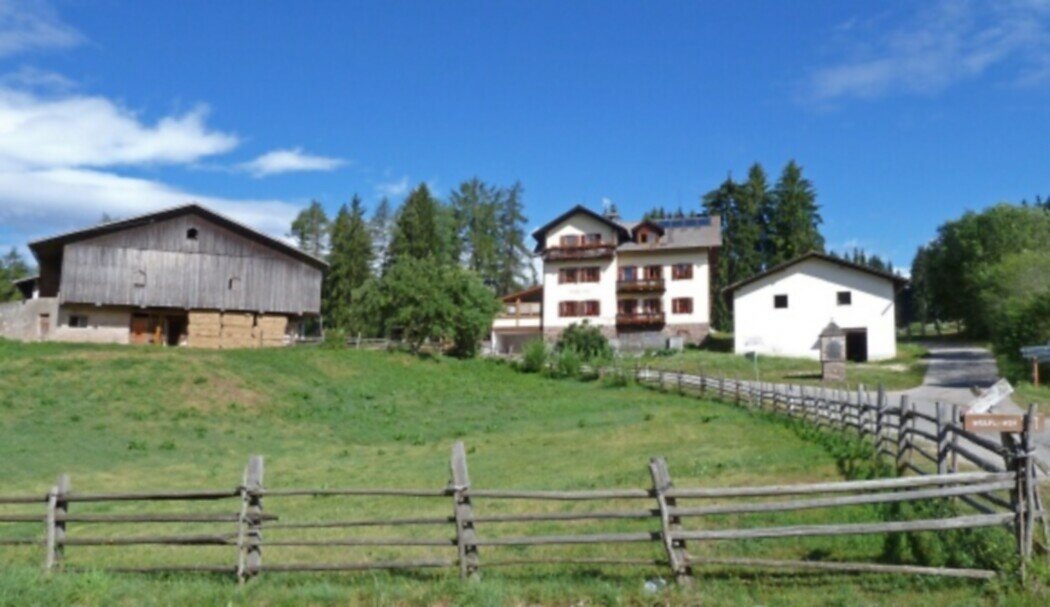
The destination is the Wölflhof, a welcoming, family-run farmhouse where hikers can enjoy hearty South Tyrolean dishes and genuine hospitality. It’s the ideal spot to take a break and soak in the surrounding peace.

The return leg offers wide, sweeping views of the Sarntal valley, the Ritten plateau, the Schlern, and – on clear days – even the South Tyrolean lowlands and the Brenta Dolomites. A hike made for nature lovers, foodies, and anyone who enjoys quiet paths with great rewards.

Gallery
Categories
  • Hiking trail
Route info
Intermediate
Distance
9,0 km
Activity time
2 h 25 min
Ascent
212 m
Descent
212 m
Physical effort
Scenary
Highest point
1.428 m
Lowest point
1.284 m
You might be interested in
Discover related tours
Intermediate
Add to favourites
Deutschnofen
Randonnée jusqu'à l'alpage de Lieg
Distance 16,0 km
Activity time 4 h 44 min
Ascent 590 m
Descent 590 m
Status
open
Intermediate
Add to favourites
Welschnofen
Du lac de Carezza au labyrinthe rocheux du Latemar
Distance 9,6 km
Activity time 3 h 00 min
Ascent 447 m
Descent 447 m
Status
open
Welschnofen
Circuit de Kaiserstein
Distance 17,9 km
Activity time 1 h 45 min
Ascent 113 m
Descent 256 m
Status
closed
Deutschnofen
Randonnée circulaire panoramique à Deutschnofen
Distance 9,0 km
Activity time 2 h 19 min
Ascent 117 m
Descent 116 m
Status
open
Welschnofen
Randonnée autour des lacs Karer See et Mittersee
Distance 5,7 km
Activity time 1 h 35 min
Ascent 127 m
Descent 122 m
Status
open
Intermediate
Add to favourites
Steinegg
Le sentier des étoiles, de Viltun près de Gummer à Steinegg
Distance 11,1 km
Activity time 3 h 43 min
Ascent 534 m
Descent 138 m
Status
open
© Gabriel Eisath
Neu
Der offizielle WhatsApp-Kanal von Eggental Tourismus!
Abonniere unseren Kanal

Verpasse keine Neuigkeiten mehr! Folge unserem neuen WhatsApp-Kanal und erhalte aktuelle News, Veranstaltungstipps und besondere Highlights aus dem Eggental direkt auf dein Handy.

Wir freuen uns auf dich!