Ferienregion
Check-in
Check-out
adults
Children
Category
Difficulty
Intermediate
Activity time
2:42
Duration in hours
Distance
9.2
Distance in km
Suggested period
Jan
Feb
Mar
Apr
May
Jun
Jul
Aug
Sep
Oct
Nov
Dec
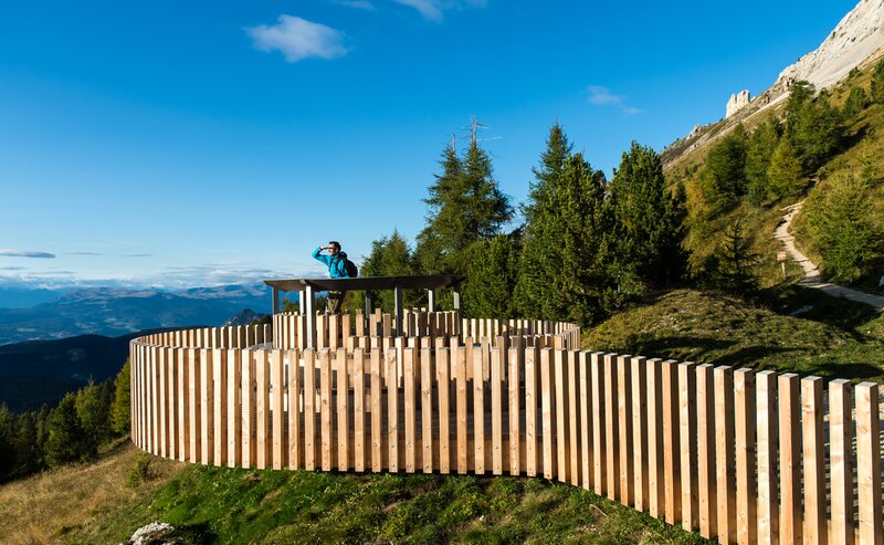
Beautiful snowshoe hike from Lake Carezza through the Latemar forest to the Mitterleger | Radura di Mezzo viewpoint, where the Latemar is impressively close up.
This rewarding snowshoe hike takes you through the Latemar forest with views of the Latemar. Starting from Lake Carezza (Karer See | Lago di Carezza), path l leads to the Mitterleger | Radura di Mezzo viewpoint, a lovely little clearing in the forest, where you can get a close-up view of the Latemar. The peaceful atmosphere and pristine landscape make this outing an ideal experience for nature lovers seeking tranquility and relaxation, along with a fantastic view.
Tags
- Round trip
Route info
Intermediate
Distance
9,2 km
Activity time
2 h
42 min
Ascent
332 m
Descent
332 m
Physical effort
Scenary
Highest point
1.825 m
Lowest point
1.538 m
Directions
The starting point is the Lake Carezza. From there you follow path [11] and get directly to the Mitterleger | Radura di Mezzo viewpoint. Then continue on path [21], turn left onto path [13] and finally return to Lake Carezza on path [10].
public transportation
Getting to the starting point of the tour by public transport is easy and convenient.
By public bus line:
- 180 from Bozen | Bolzano, Birchabruck | Ponte Nova, Welschnofen | Nova Levante
- 180 from Fassatal | Val di Fassa, Karer Pass | Passo Costalunga, Karersee | Carezza
- 184 from Weissenstein | Pietralba, Petersberg | Monte San Pietro, Deutschnofen | Nova Ponente, Stenk with change 180 (or 181 and change 180)
- 184 from Obereggen, Eggen | Ega with change 180 (or 184 and change 180)
- 186 from St. Zyprian | S. Cipriano, Nigerpass | Passo Nigra with change 180
- 187 from Steinegg | Collepietra, Gummer | San Valentino with change 180 (or 182 and change 180)
Bus stop: Karer See | Lago di Carezza. Online timetable search at www.suedtirolmobil.info/en/
How to get there
Getting to the starting point of the tour by public transport is easy and convenient.
By public bus line:
- 180 from Bozen | Bolzano, Birchabruck | Ponte Nova, Welschnofen | Nova Levante
- 180 from Fassatal | Val di Fassa, Karer Pass | Passo Costalunga, Karersee | Carezza
- 184 from Weissenstein | Pietralba, Petersberg | Monte San Pietro, Deutschnofen | Nova Ponente, Stenk with change 180 (or 181 and change 180)
- 184 from Obereggen, Eggen | Ega with change 180 (or 184 and change 180)
- 186 from St. Zyprian | S. Cipriano, Nigerpass | Passo Nigra with change 180
- 187 from Steinegg | Collepietra, Gummer | San Valentino with change 180 (or 182 and change 180)
Bus stop: Karer See | Lago di Carezza. Online timetable search at www.suedtirolmobil.info/en/
By car:
Destination: Karersee | Carezza
Parking: Parking lot Karer See | Lago di Carezza
Where to park
Parking: Parking lot Karer See | Lago di Carezza (with costs): https://goo.gl/maps/w4SVXQJJyxtUaLdUA
Good winter and snowshoe equipment is required.
You might be interested in
Discover related tours


