Top

Balade hivernale de Welschnofen au lac Karer

Welschnofen
Add to favourites
Category
Difficulty
Intermediate
Activity time
2:54
Duration in hours
Distance
9
Distance in km
Suggested period
Jan
Feb
Mar
Apr
May
Jun
Jul
Aug
Sep
Oct
Nov
Dec
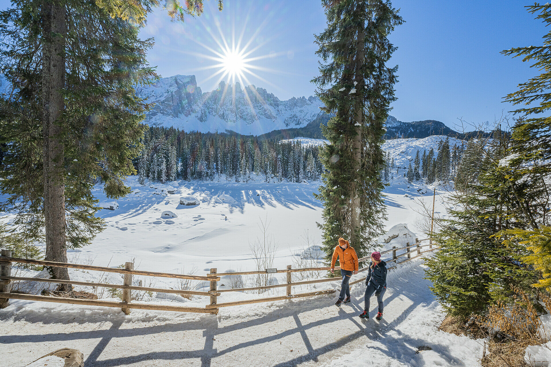
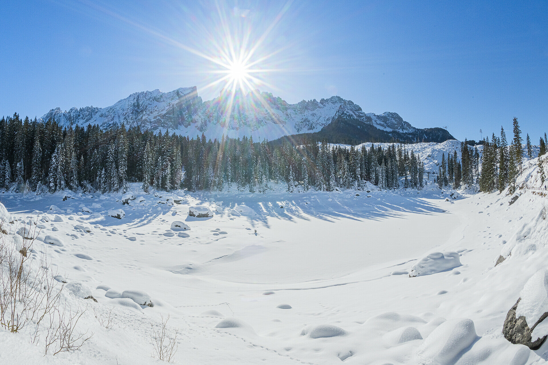
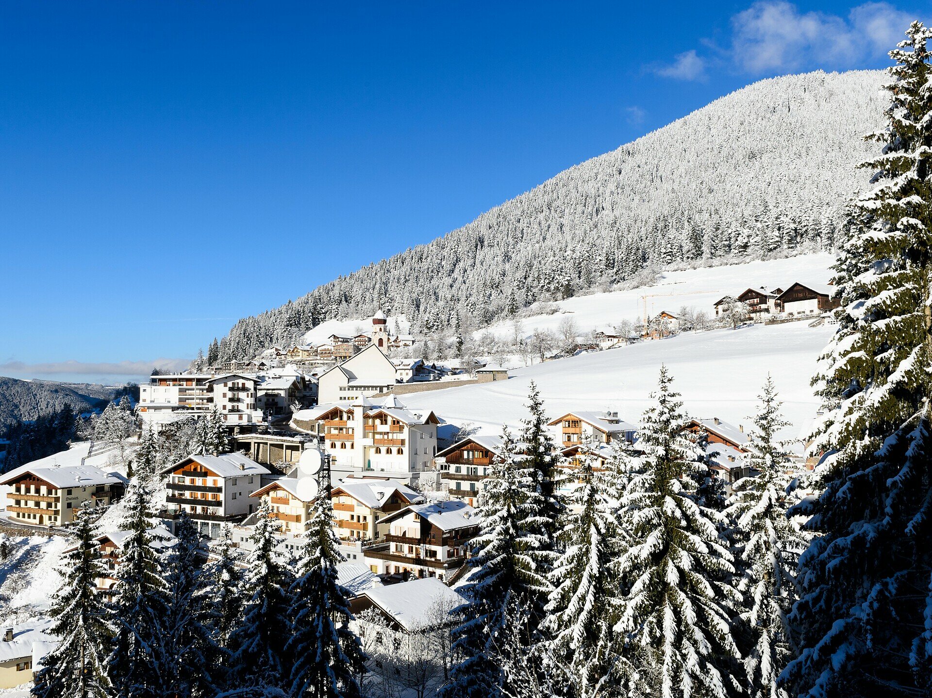
The winter hike along the Herrensteig leads from Welschnofen to the frozen Karer See. Gentle ascents and views of Welschnofen, Rosengarten, and Latemar await you.

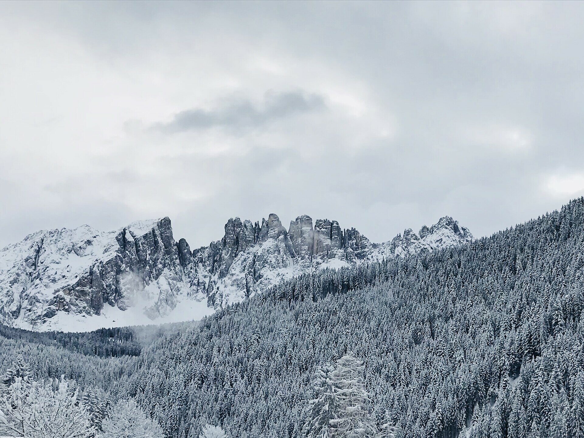
This winter hike leads along the "Herrensteig" from Welschnofen to Karer See, considered one of the most magnificent Alpine lakes. The lake, located at the foot of the Latemar and especially known for its deep green water and beautiful mountain backdrop, is frozen in winter and usually covered by a white layer of snow.

From Welschnofen, the trail ascends steadily but gently to Karer See. Along the way, the Herrensteig offers repeatedly beautiful views of the picturesque village of Welschnofen. Once at the lake, a breathtaking panorama opens up with views of the impressive mountain ranges of the Rosengarten and Latemar.

Tags
  • Out and back
Route info
Intermediate
Distance
9,0 km
Activity time
2 h 54 min
Ascent
518 m
Descent
518 m
Technical skills
Physical effort
Scenary
Highest point
1.549 m
Lowest point
1.160 m
You might be interested in
Discover related tours
Welschnofen
Winter hike from the Paolina car park to Lake Carezza
Distance 2,0 km
Activity time 29 min
Ascent 0 m
Descent 91 m
Deutschnofen
Winter Hike from Obereggen to the Eggentaler Almen
Distance 11,3 km
Activity time 3 h 40 min
Ascent 524 m
Descent 524 m
Steinegg
Randonnée circulaire dans le village étoilé de Steinegg en hiver
Distance 4,3 km
Activity time 1 h 17 min
Ascent 171 m
Descent 171 m
Welschnofen
Winter hike from Lake Carezz to the Stadl Alm hut
Distance 8,0 km
Activity time 2 h 08 min
Ascent 111 m
Descent 111 m
Deutschnofen
Winter hike to the Lieg hut
Distance 8,3 km
Activity time 2 h 40 min
Ascent 474 m
Descent 469 m
Welschnofen
Randonnée hivernale vers les prairies de Frinwiesen à Karersee
Distance 4,0 km
Activity time 1 h 10 min
Ascent 141 m
Descent 141 m