Top

Court circuit hivernal autour du lac Karer

Welschnofen
Add to favourites
Category
Difficulty
Easy
Activity time
0:20
Duration in hours
Distance
1.3
Distance in km
Status
open
Suggested period
Jan
Feb
Mar
Apr
May
Jun
Jul
Aug
Sep
Oct
Nov
Dec
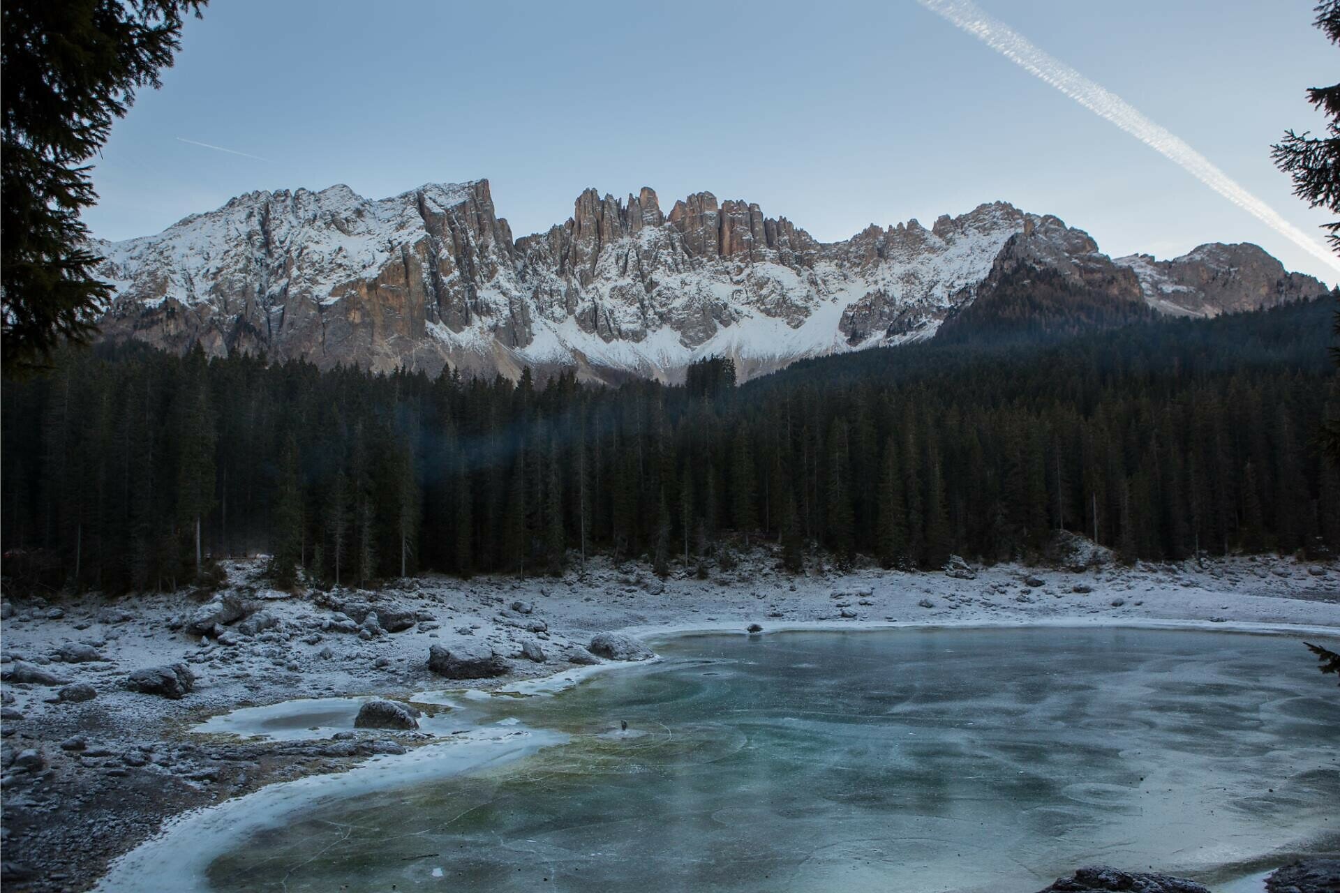
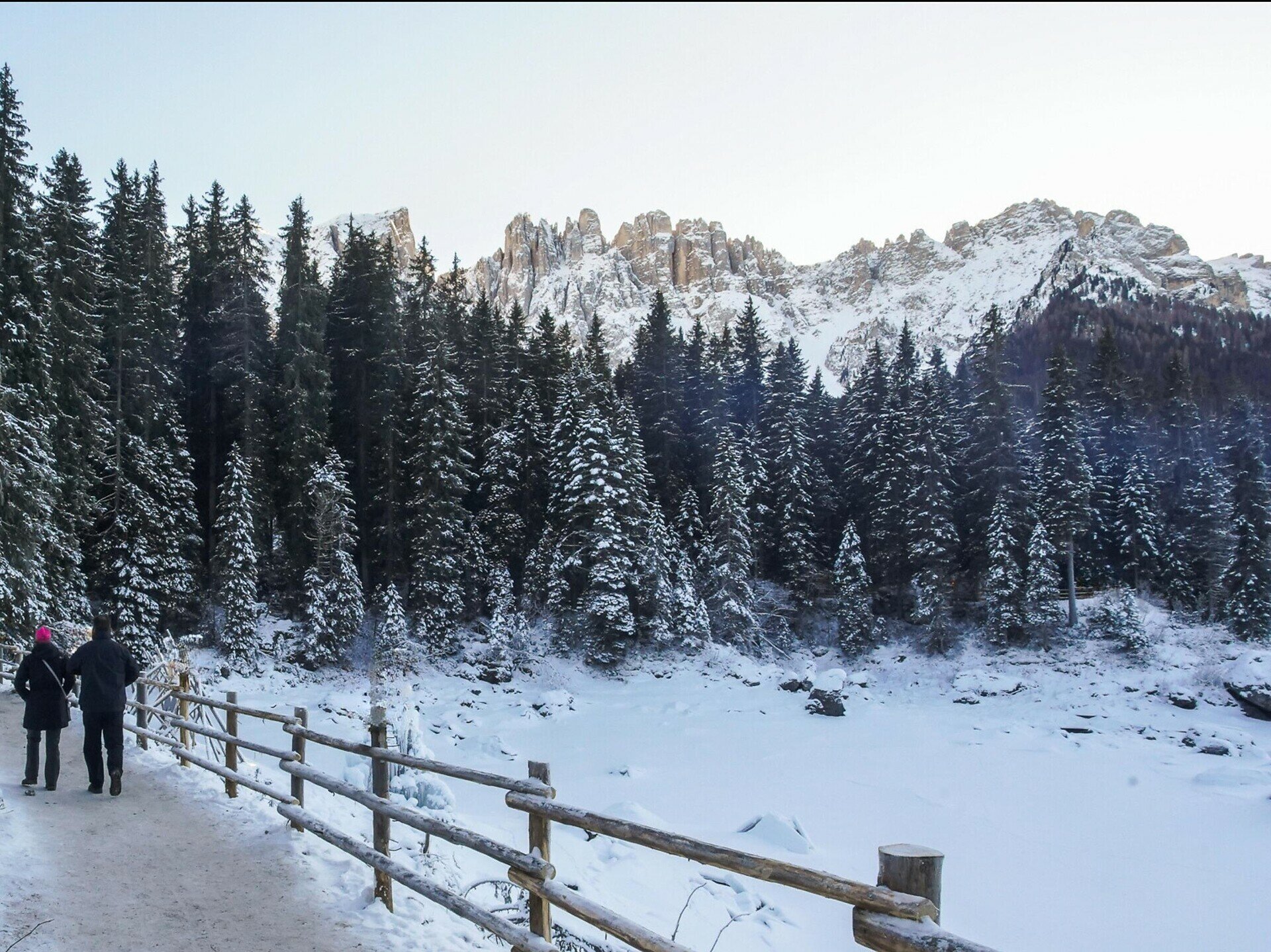
A relaxed circular path around the frozen Lake Carezza, surrounded by the impressive peaks of the Dolomites, ideal for a rejuvenating break in the snowy nature.
The short circular trail leads directly around Lake Carezza (Karer See | Lago di Carezza), which is often frozen and covered in a blanket of snow during winter. Surrounded by the impressive peaks of the Latemar and Rosengarten | Catinaccio, it offers a picturesque view of the Dolomites. The prepared path is particularly suitable for a relaxed winter walk. The peaceful, snow-covered landscape and the frozen waters of the lake, with its sparkling ice crystals, create a special atmosphere, ideal for a short break in nature.
Tags
  • Linear route
Route info
Easy
Distance
1,3 km
Activity time
20 min
Ascent
21 m
Descent
28 m
Technical skills
Physical effort
Scenary
Highest point
1.554 m
Lowest point
1.534 m
You might be interested in
Discover related tours
Karersee, Welschnofen
Winter alpine hut hike from Karersee | Carezza to Welschnofen | Nova Levante
Distance 19,5 km
Activity time 5 h 10 min
Ascent 244 m
Descent 708 m
Status
open
Intermediate
Add to favourites
Deutschnofen
Randonnée hivernale de Deutschnofen via Unterkaplun jusqu’au Wölflhof
Distance 7,5 km
Activity time 2 h 05 min
Ascent 194 m
Descent 195 m
Status
open
Welschnofen, Karersee
Randonnée d'hiver du col de Karer au lac de Karer
Distance 4,7 km
Activity time 1 h 10 min
Ascent 11 m
Descent 221 m
Status
open
Steinegg
Randonnée hivernale à l'observatoire de Gummer
Distance 4,8 km
Activity time 1 h 16 min
Ascent 57 m
Descent 57 m
Status
open
Intermediate
Add to favourites
Deutschnofen
Winter Hike Bühl
Distance 7,4 km
Activity time 1 h 57 min
Ascent 130 m
Descent 130 m
Status
open
Intermediate
Add to favourites
Deutschnofen
Randonnée hivernale jusqu'à la Lieg Alm
Distance 8,3 km
Activity time 2 h 40 min
Ascent 474 m
Descent 469 m
Status
open