Top

Du col de Karer au lac de Karer

Karersee, Welschnofen
Add to favourites
Difficulty
Easy
Activity time
1:06
Duration in hours
Distance
4.4
Distance in km
Status
open
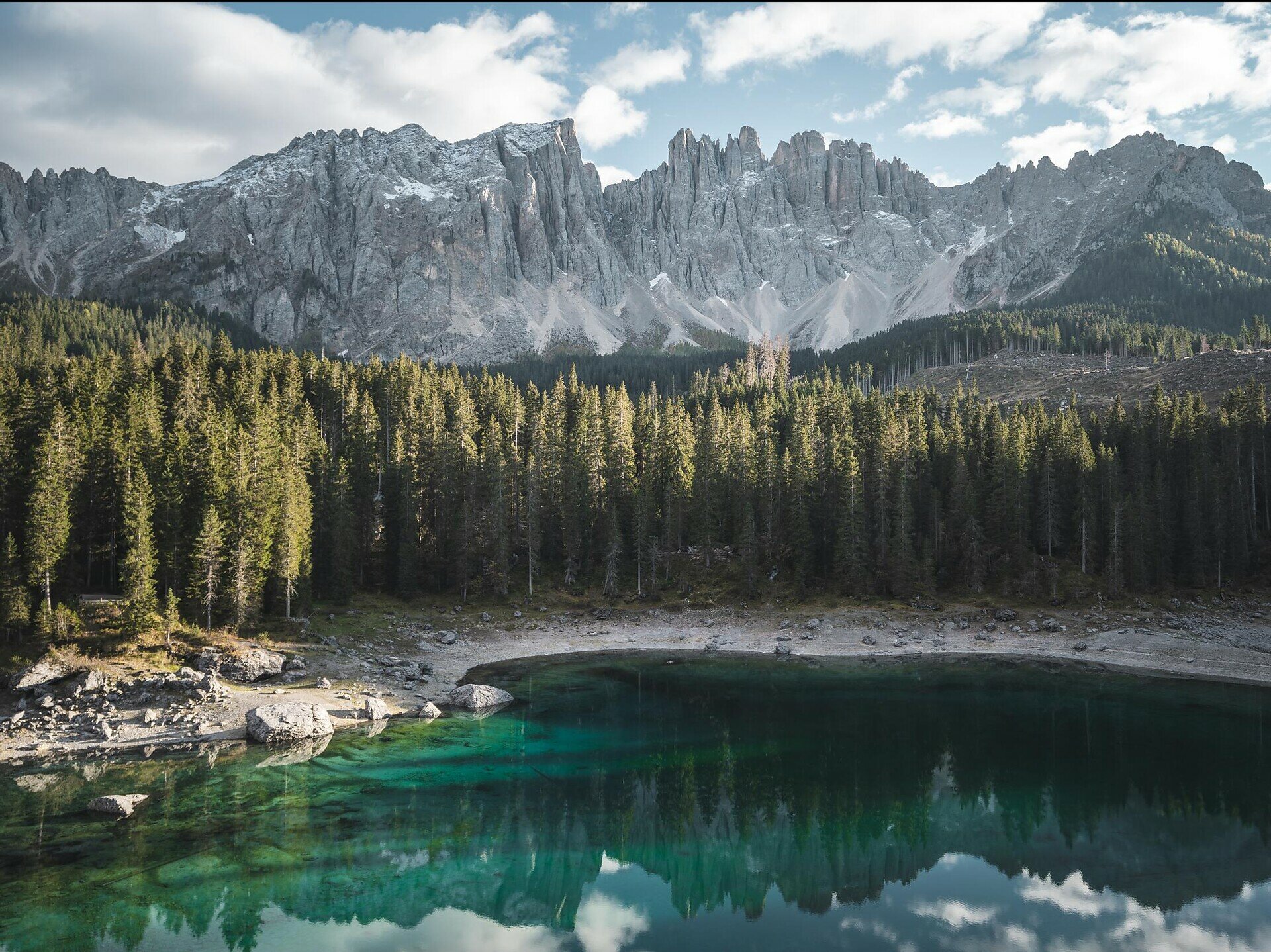
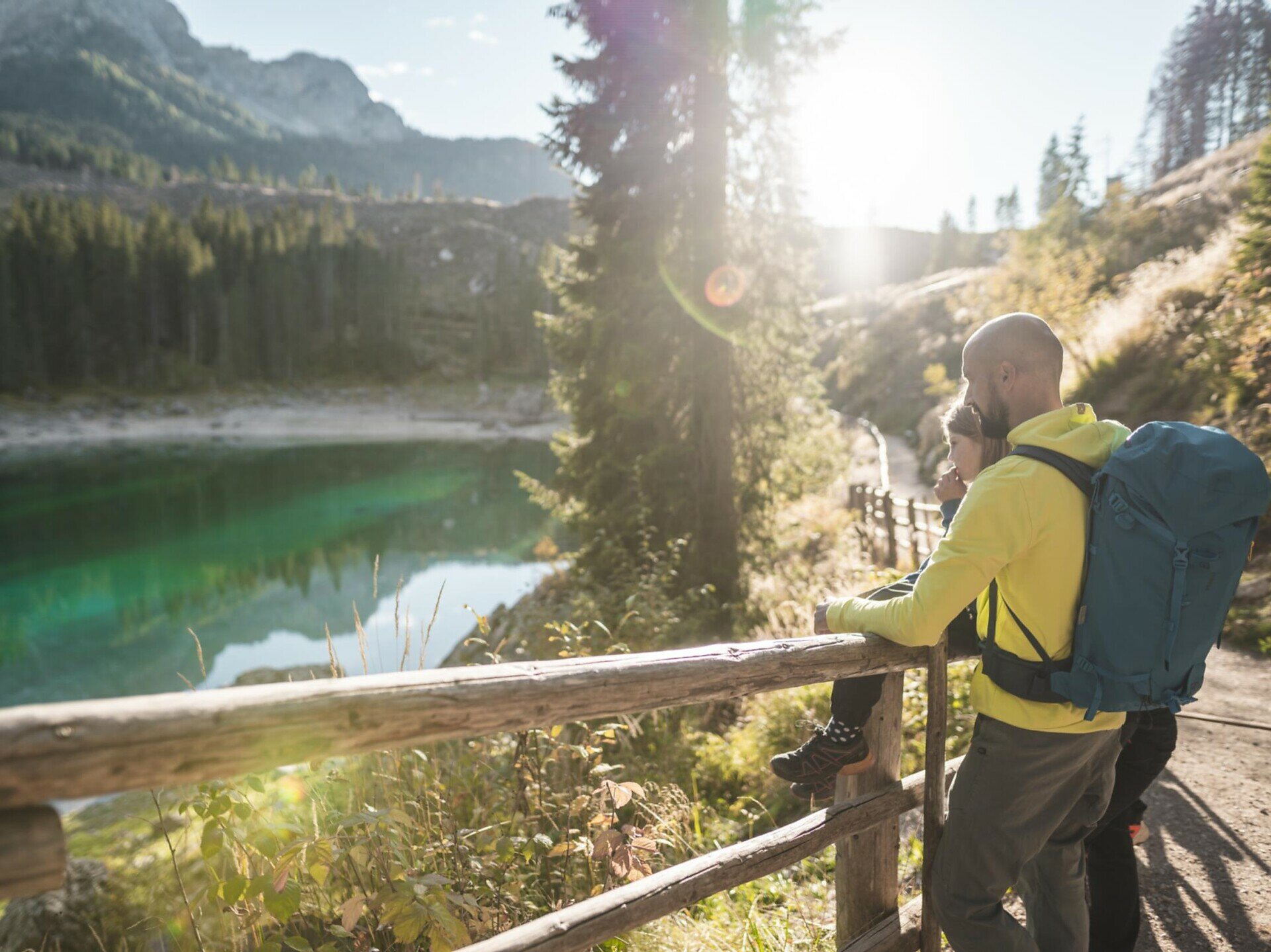
This easy hike leads from the Karerpass through the Latemar forest to the legendary Lake Carezza.
This hike leads from the Karerpass | Passo di Costalunga through the Latemar forest to Lake Carezza. The Latemar forest is renowned for its spruce, whose wood, thanks to its unique properties, is highly valued as tonewood for the construction of string instruments. After crossing the forest, you reach Lake Carezza, one of the most beautiful alpine lakes. It captivates with its deep-green waters and the impressive mountain backdrop of the Latemar and Rosengarten | Catinaccio.
Tags
  • Linear route
Route info
Easy
Distance
4,4 km
Activity time
1 h 06 min
Ascent
16 m
Descent
224 m
Physical effort
Scenary
Highest point
1.764 m
Lowest point
1.540 m
Suggestions
Refreshment stops:
You might be interested in
Discover related tours
Intermediate
Add to favourites
Deutschnofen
Chemin de l’église vers le village préhistorique d'Enzbirch
Distance 12,9 km
Activity time 3 h 48 min
Ascent 397 m
Descent 397 m
Status
open
Intermediate
Add to favourites
Welschnofen
Randonnée circulaire de Welschnofen au monument Elisabeth
Distance 7,9 km
Activity time 2 h 33 min
Ascent 467 m
Descent 457 m
Status
open
Steinegg
Randonnée familiale vers la cabane dans les arbres en forme de fusée à Steinegg
Distance 2,7 km
Activity time 43 min
Ascent 38 m
Descent 38 m
Status
open
Obereggen, Deutschnofen
Randonnée familiale du col de Lavazè à la Lieg Alm
Distance 5,1 km
Activity time 1 h 20 min
Ascent 78 m
Descent 78 m
Status
open
Intermediate
Add to favourites
Karersee, Welschnofen
Randonnée familiale du col de Karer au Mitterleger et aux prairies du Latemar
Distance 8,3 km
Activity time 2 h 32 min
Ascent 383 m
Descent 383 m
Status
open
Intermediate
Add to favourites
Karersee, Welschnofen
Randonnée circulaire du col de Karer au labyrinthe rocheux et au cinéma de montagne du Latemar
Distance 8,6 km
Activity time 2 h 53 min
Ascent 378 m
Descent 378 m
Status
open