Top

From Nova Levante to Lake Carezza

Welschnofen
Add to favourites
Difficulty
Easy
Activity time
3:09
Duration in hours
Distance
10.1
Distance in km
Suggested period
Jan
Feb
Mar
Apr
May
Jun
Jul
Aug
Sep
Oct
Nov
Dec
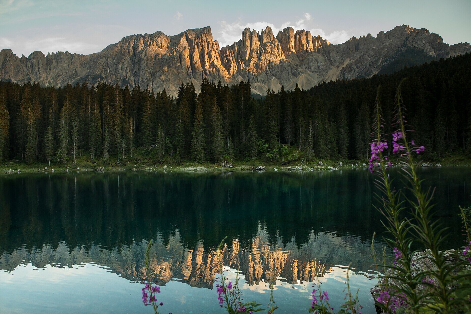
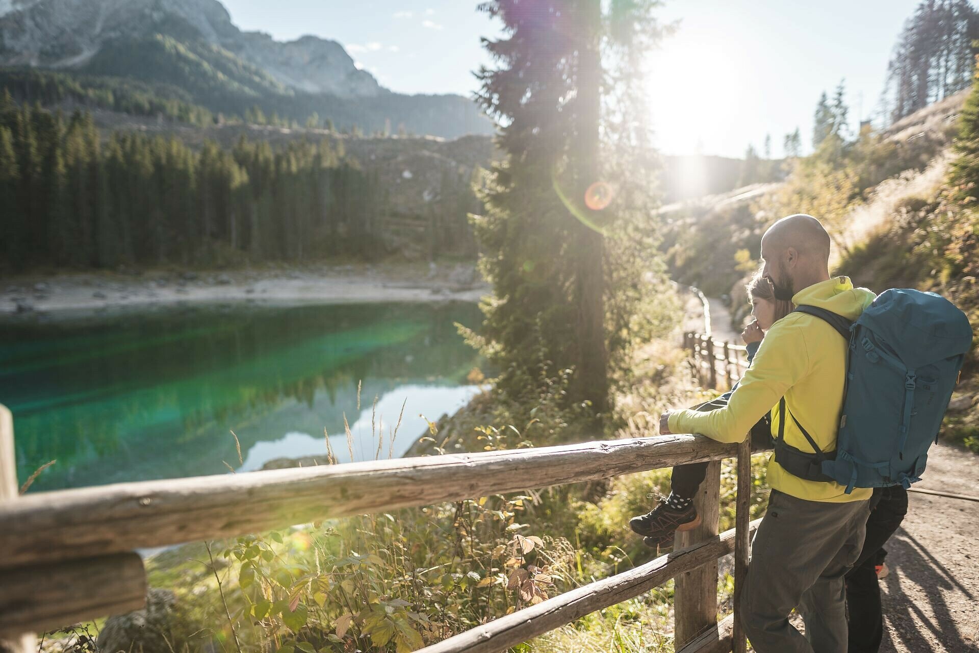
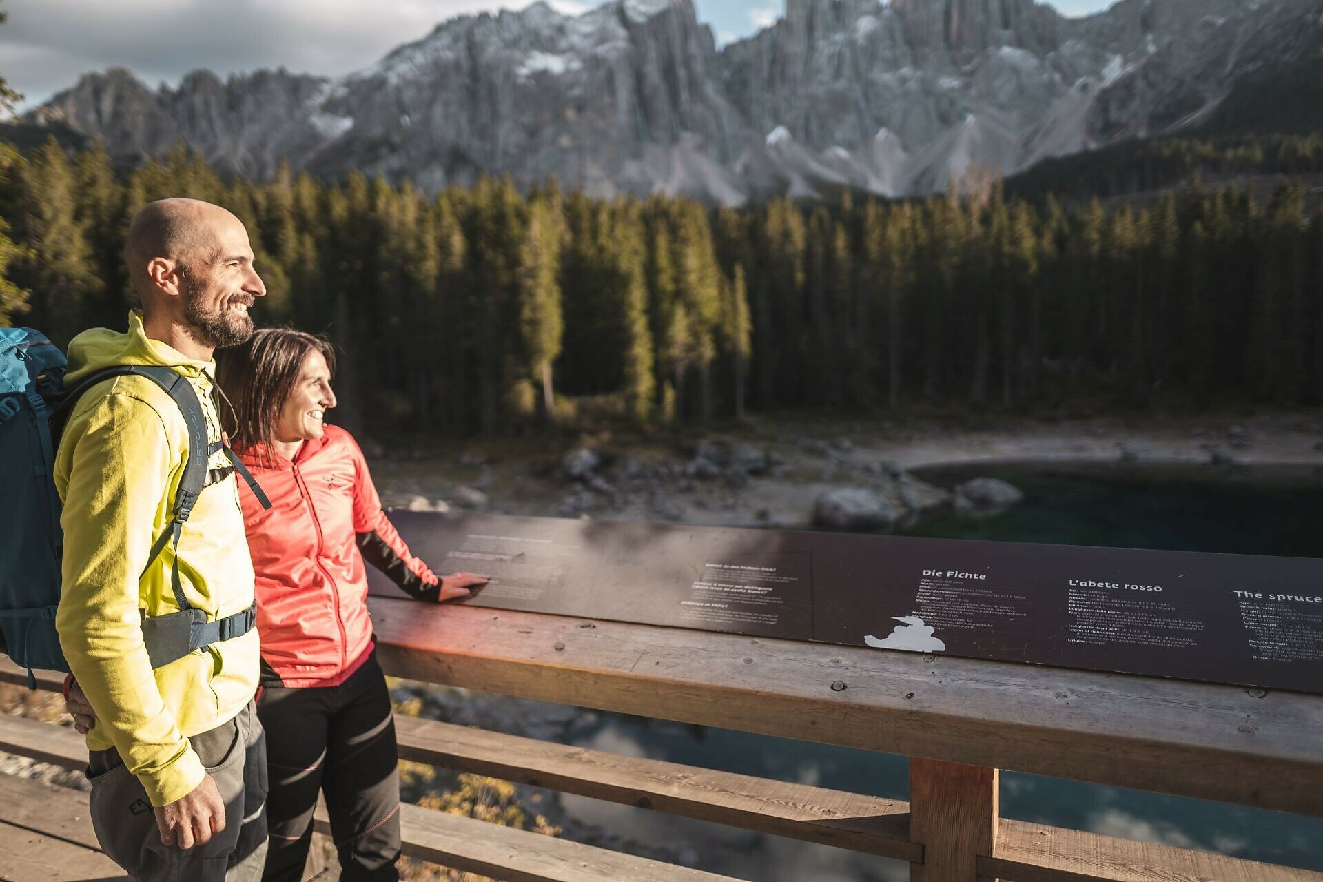
Circular hike from Welschnofen to Lake Carezza, featuring its emerald-green waters and the dramatic Dolomite backdrop.
This circular hike from Welschnofen | Nova Levante leads along a shady forest path following a stream to Lake Carezza, one of the most magnificent alpine lakes, famous for its deep green water and the stunning mountain backdrop. The return to Welschnofen follows the historic "Herrensteig" path, which offers recurring views of the village of Welschnofen | Nova Levante and the peaks of the Latemar.
Route info
Easy
Distance
10,1 km
Activity time
3 h 09 min
Ascent
515 m
Descent
515 m
Physical effort
Scenary
Highest point
1.549 m
Lowest point
1.107 m
Suggestions

Refreshment stops:

Directions

The starting point is in Welschnofen | Nova Levante at the parking area of the cable car. From there, follow the sidewalk along the main road, passing the Despar supermarket, downhill through the village until you reach the Civil Protection Center, where the Volunteer Fire Brigade and the White Cross are located. At this point, hiking path [10A] branches off. This path leads through the forest to the hotel Adler, where you cross the road and continue on path [10A] until you reach Lake Carezza. After walking around the lake, return on path [10A] to the hotel Adler, then follow paths [7A] and [7] back to Welschnofen | Nova Levante. Path [7] leads directly to the parking area of the Welschnofen | Nova Levante cable car.

Refreshment stops:

public transportation

Getting to the starting point of the tour by public transport is easy and convenient. 

By public bus line:
- 180 from Bozen | Bolzano, Birchabruck | Ponte Nova
- 180 or 184 from Karersee | Carezza, Karerpass | Passo Costalunga
- 184 from Weissenstein | Pietralba, Petersberg | Monte San Pietro, Deutschnofen | Nova Ponente, Stenk (or 181 and change 180)
- 184 from Obereggen, Eggen | Ega (or 184 and change 180)
- 187 from Steinegg | Collepietra, Gummer | San Valentino (or 182 and change 180)
- 180 from Val di Fassa

Bus stop: Welschnofen Zentrum | Nova Levante centro (centre), at the cable car; online timetable search at www.suedtirolmobil.info/en/

How to get there

Getting to the starting point of the tour by public transport is easy and convenient.

By public bus line:
- 180 from Bozen | Bolzano, Birchabruck | Ponte Nova
- 180 or 184 from Karersee | Carezza, Karerpass | Passo Costalunga
- 184 from Weissenstein | Pietralba, Petersberg | Monte San Pietro, Deutschnofen | Nova Ponente, Stenk (or 181 and change 180)
- 184 from Obereggen, Eggen | Ega (or 184 and change 180)
- 187 from Steinegg | Collepietra, Gummer | San Valentino (or 182 and change 180)
- 180 from Val di Fassa

Bus stop: Welschnofen Zentrum | Nova Levante centro (centre), at the cable car; online timetable search at www.suedtirolmobil.info/en/

By car:
Destination: Welschnofen | Nova Levante
Parking: Parking lot cable car

Where to park

Parking: parking lot cable car Welschnofen | Nova Levante Laurin I, https://maps.app.goo.gl/sArFu4rWe1AirKsZ7  

You might be interested in
Discover related tours
Intermediate
Add to favourites
Karersee, Welschnofen
From Welschnofen | Nova Levante to the Messnerjoch hut
Distance 15,9 km
Activity time 4 h 56 min
Ascent 779 m
Descent 779 m
Karersee, Welschnofen
Family hike from the Nigerpass | Passo Nigra to the Messnerjoch hut
Distance 3,9 km
Activity time 1 h 16 min
Ascent 242 m
Descent 242 m
Karersee, Welschnofen
From Passo Costalunga to Lake Carezza
Distance 4,4 km
Activity time 1 h 07 min
Ascent 16 m
Descent 228 m
Welschnofen
From the Frommer Alm to the Lake Carezza
Distance 5,6 km
Activity time 1 h 31 min
Ascent 97 m
Descent 275 m
Welschnofen
Sissi Tour
Distance 10,3 km
Activity time 2 h 53 min
Ascent 357 m
Descent 357 m
Intermediate
Add to favourites
Deutschnofen
Adventure hiking trail "Kirchsteig"
Distance 9,5 km
Activity time 2 h 55 min
Ascent 361 m
Descent 361 m