Top

From Welschnofen | Nova Levante to the Messnerjoch hut

Karersee, Welschnofen
Add to favourites
Difficulty
Intermediate
Activity time
4:55
Duration in hours
Distance
15.9
Distance in km
Status
closed
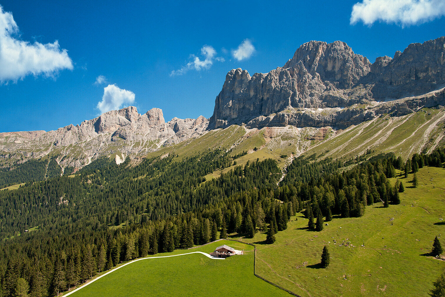
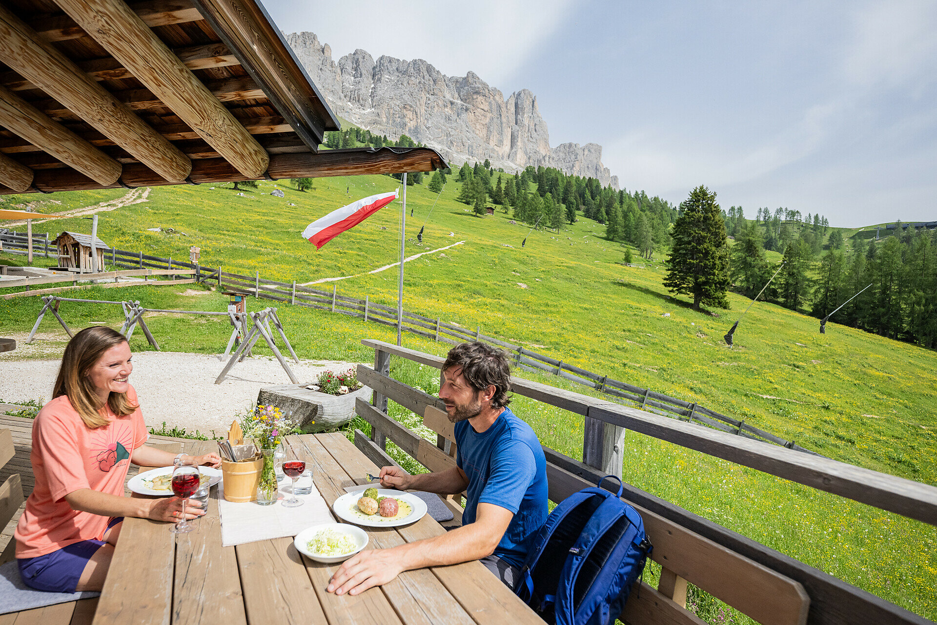
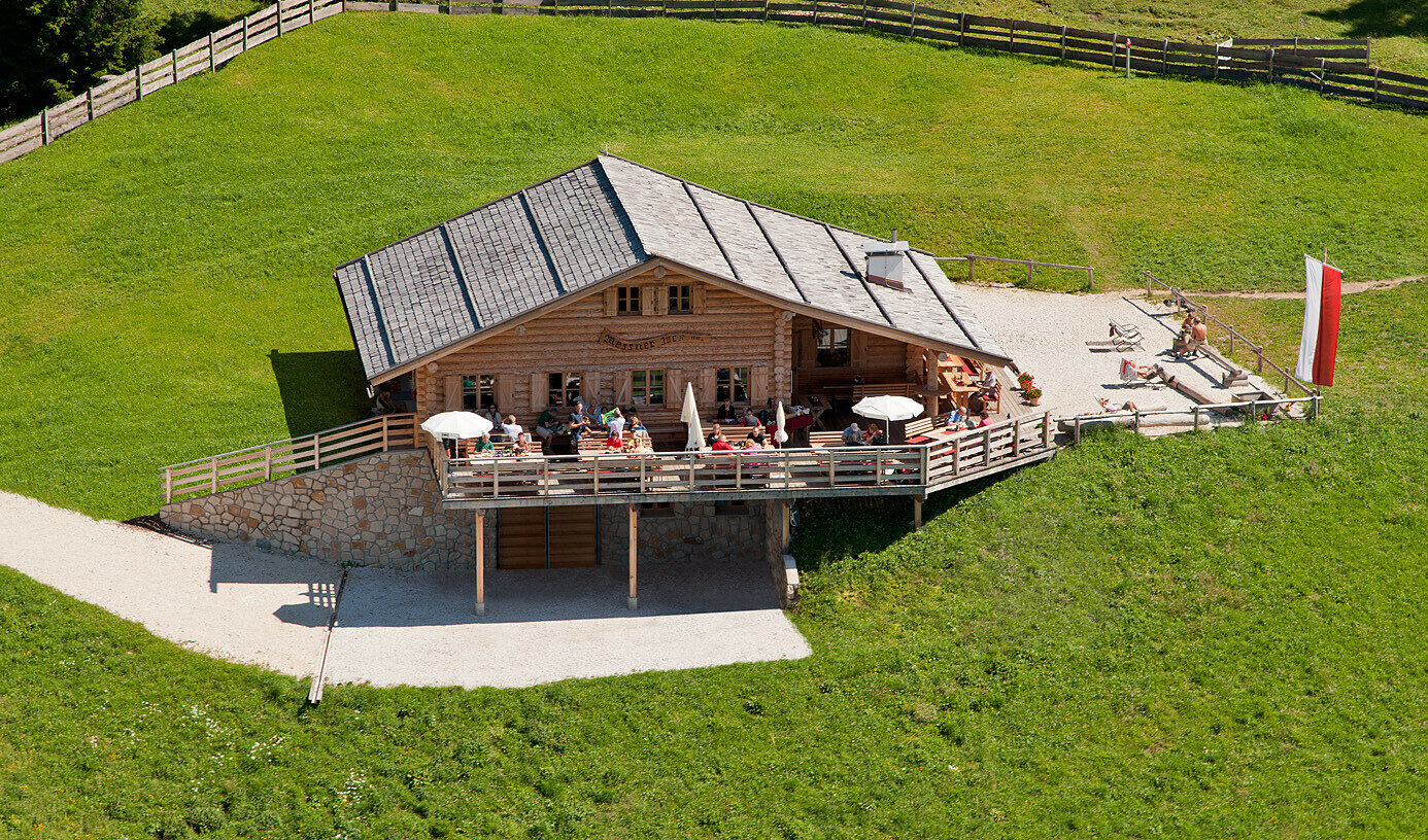
Leisurely full-day hike from Welschnofen to Nigerpass and Messnerjoch along forest paths, with Rosengarten panoramas and homemade treats at the mountain hut.

For those seeking a leisurely full-day hike at lower elevations, without the use of lifts, this route is a rewarding option. It begins in Welschnofen | Nova Levante and leads through tranquil woodland as well as along forest roads and paths up to the Nigerpass | Passo Nigra and further to the Messnerjoch hut. At the top, the ascent is rewarded with breathtaking views of the Rosengarten | Catinaccio, while homemade specialties and delicious cakes invite you to enjoy a well-deserved break.

Tags
  • Round trip
Route info
Intermediate
Distance
15,9 km
Activity time
4 h 55 min
Ascent
764 m
Descent
739 m
Physical effort
Scenary
Highest point
1.925 m
Lowest point
1.162 m
Suggestions

Refreshment stops:

You might be interested in
Discover related tours
Intermediate
Add to favourites
Deutschnofen
Randonnée familiale sur le sentier des alpages à Obereggen
Distance 10,7 km
Activity time 3 h 15 min
Ascent 442 m
Descent 442 m
Status
closed
Intermediate
Add to favourites
Welschnofen
Randonnée circulaire de Welschnofen au monument Elisabeth
Distance 7,9 km
Activity time 2 h 33 min
Ascent 467 m
Descent 457 m
Status
closed
Intermediate
Add to favourites
Deutschnofen
Hike to the Wölflhof
Distance 9,0 km
Activity time 2 h 27 min
Ascent 220 m
Descent 220 m
Status
open
Obereggen
Summer hike from Baita Gardonè into the dragon forest
Distance 1,5 km
Activity time 27 min
Ascent 32 m
Descent 32 m
Status
open
Intermediate
Add to favourites
Deutschnofen
Hike from the Laab Alm to the Neuhütt Alm & the Leger Alm in Petersberg / Monte S. Pietro
Distance 6,8 km
Activity time 2 h 10 min
Ascent 269 m
Descent 269 m
Status
open
Welschnofen
Du village de Karersee au lac de Karersee
Distance 1,9 km
Activity time 27 min
Ascent 0 m
Descent 90 m
Status
open