

An attractive hike around the centrepiece of the Rosengarten massif, the Rotwand mountain. For excitement this tour is hard to beat, offering spectacular views of the surrounding mountains in good weather.
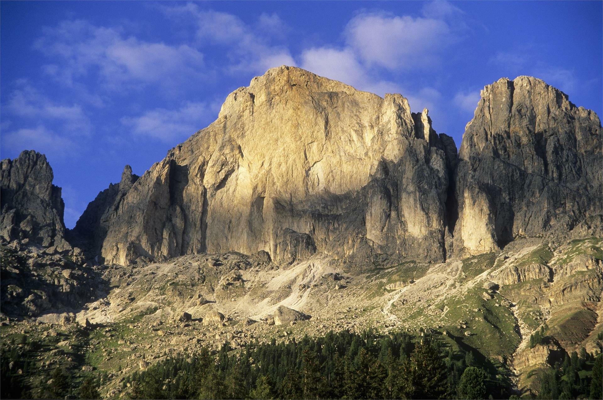
Route: starting from the Karerpass, follow trail [552] via the Hirzelsteig trail, continuing on trail [9] via the Vajolon Pass. Head on to the Rotwandhütte mountain hut on trail [551] and [541]. Return via trail [548] to the Karer Pass (challenging mountain hike, a good head for heights and good equipment are essential).
Getting to the starting point of the tour by public transport is easy and convenient.
By public bus line:
- 180 from Bozen | Bolzano, Val di Fassa, Welschnofen | Nova Levante
- 180 from Karer See | Lago di Carezza
- 180 from Birchabruck | Ponte Nova
- 184 and change 180 from Obereggen, Eggen | Ega
- 181 and change 180 from Weissenstein | Pietralba, Petersberg | Monte San Pietro, Deutschnofen | Nova Ponente, Stenk
- 187 from Steinegg | Collepietra, Gummer | San Valentino
Bus stop: Welschnofen | Nova Levante, Karer Pass | Passo Costalunga; online timetable search at: https://www.suedtirolmobil.info/en/
Location: https://goo.gl/maps/AdxYwxVHPeAMiynm6
By car:
Destination: Karer Pass | Passo Costalunga
Parking: Parking lot Karer Pass | Passo Costalunga
Location: https://goo.gl/maps/AdxYwxVHPeAMiynm6
Location: https://goo.gl/maps/AdxYwxVHPeAMiynm6


