Hike to the Weißhorn Mountain

Deutschnofen
Add to favourites
Category
Difficulty
Difficult
Activity time
5:49
Duration in hours
Distance
17.7
Distance in km
Status
open
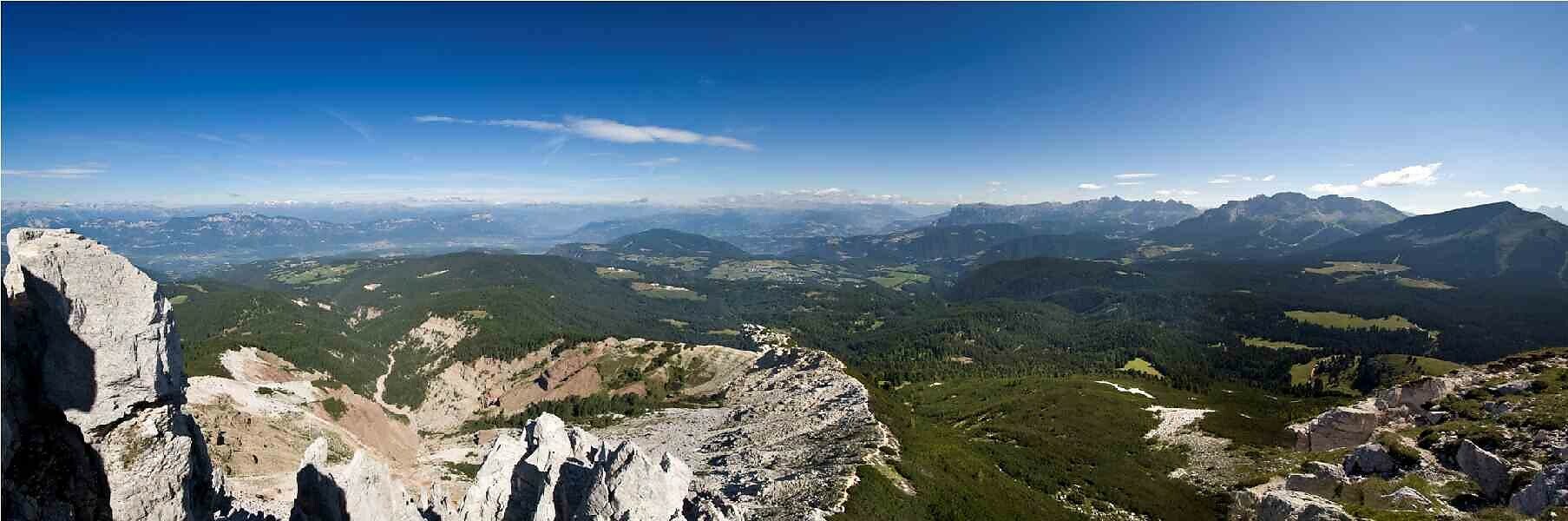
This uniquely beautiful summit tour offers panoramic views of the Rosengarten, Latemar, and Zanggen peaks, as well as the surrounding villages in the Val d'Ega/Eggental valley.
Route info
Difficult
Distance
17,7 km
Activity time
5 h 49 min
Ascent
834 m
Descent
834 m
Physical effort
Scenary
Highest point
2.313 m
Lowest point
1.521 m
You might be interested in
Discover related tours
Karersee, Deutschnofen, Welschnofen
Chemin de crête du Latemar au Rosengarten
Distance 25,9 km
Activity time 10 h 18 min
Ascent 1.579 m
Descent 1.945 m
Status
closed
Intermediate
Add to favourites
Karersee
Sur le Schafsteig de la vallée de Fassa au refuge Paolina
Distance 5,8 km
Activity time 2 h 01 min
Ascent 459 m
Descent 316 m
Status
open
Intermediate
Add to favourites
Karersee, Welschnofen
Circuit sur le Hirzelsteig
Distance 8,1 km
Activity time 2 h 27 min
Ascent 336 m
Descent 339 m
Status
open
Karersee, Welschnofen
Au cœur du Rosengarten - Vajolon
Distance 10,7 km
Activity time 3 h 47 min
Ascent 887 m
Descent 868 m
Status
closed
Obereggen, Deutschnofen
Randonnée circulaire Lavazè-Zanggen-Reiterjoch
Distance 11,3 km
Activity time 4 h 25 min
Ascent 763 m
Descent 763 m
Status
open
Obereggen, Deutschnofen
Randonnée au refuge Latemar | Rifugio Torre di Pisa
Distance 8,1 km
Activity time 4 h 00 min
Ascent 719 m
Descent 719 m
Status
open