Top

Randonnée familiale de l'Alpe Frommer à la cabane Ochsenhütte

Welschnofen
Add to favourites
Difficulty
Easy
Activity time
0:38
Duration in hours
Distance
2.1
Distance in km
Status
open
Suggested period
Jan
Feb
Mar
Apr
May
Jun
Jul
Aug
Sep
Oct
Nov
Dec
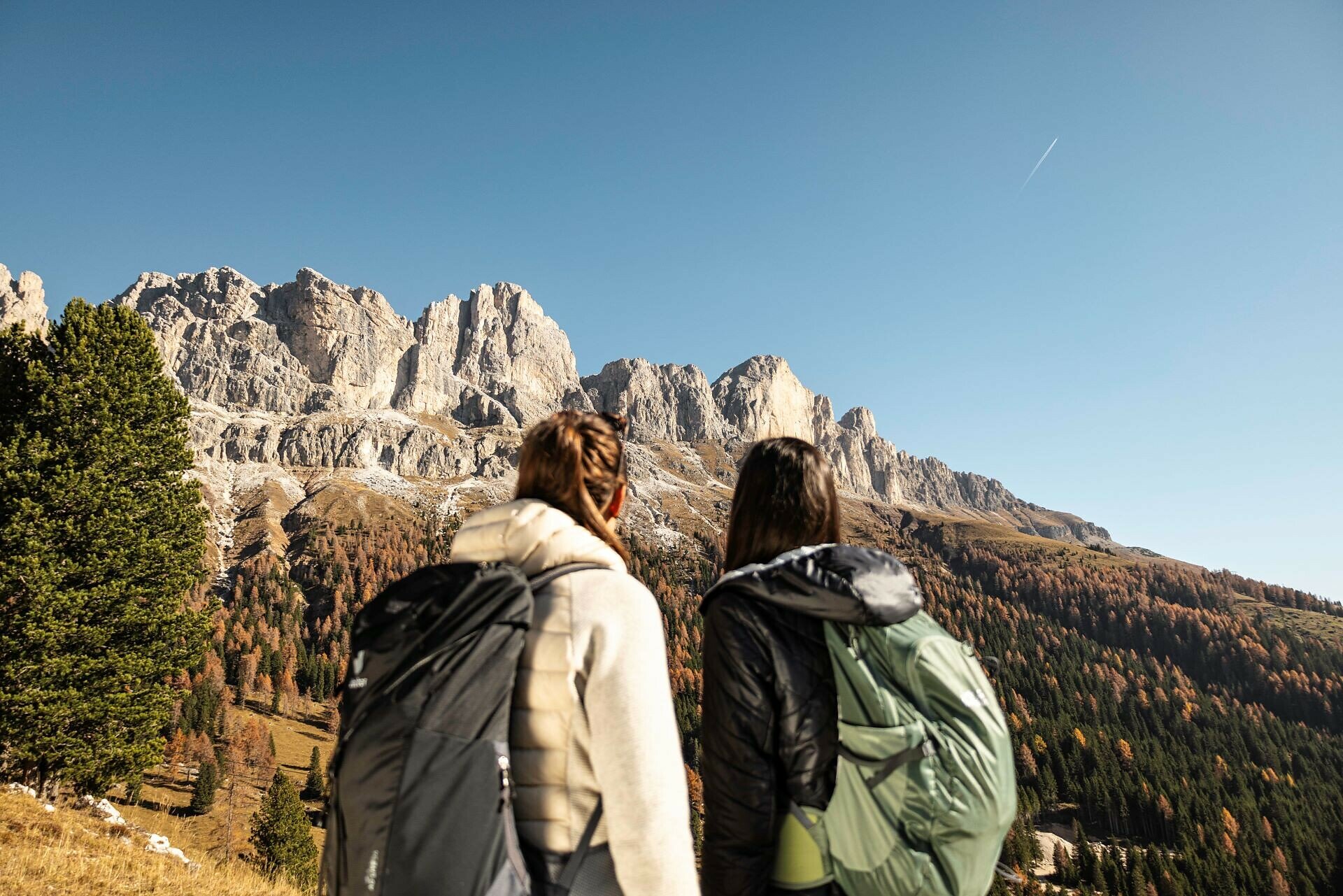
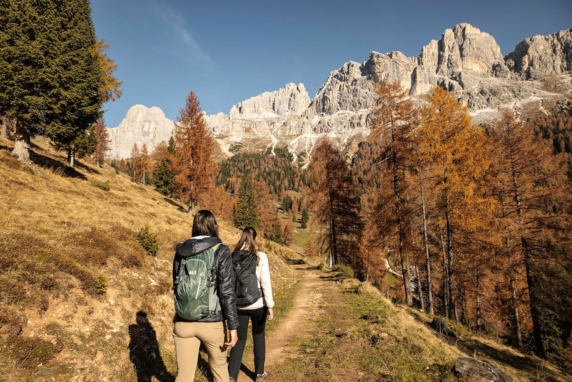
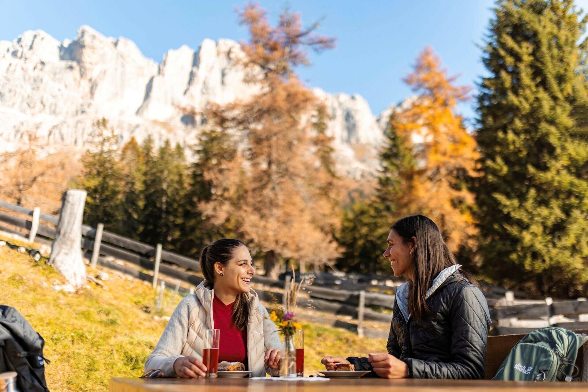
Leisurely hike below the Rosengarten from the Frommer Alm hut to the Ochsenhütte hut, with South Tyrolean specialties, a sunny terrace, mountain views, and a playground for kids.
This leisurely hike leads below the Rosengarten | Catinaccio on a pleasant and flat trail through forest and flowering mountain meadows to the Ochsenhütte hut. Homemade South Tyrolean specialities and delicious cakes can be enjoyed on the beautiful sun terrace with mountain views, while the children let off steam on the playground.

Tags
  • Linear route
  • Family-friendly
Route info
Easy
Distance
2,1 km
Activity time
38 min
Ascent
102 m
Descent
53 m
Physical effort
Scenary
Highest point
1.805 m
Lowest point
1.738 m
Suggestions

Refreshment stops:

You might be interested in
Discover related tours
Deutschnofen
Randonnée familiale aux fermes originelles d'Eggner au Städtl
Distance 1,9 km
Activity time 30 min
Ascent 51 m
Descent 50 m
Status
open
Obereggen, Deutschnofen
LATEMAR.PANORAMA : randonnée familiale sur le sentier nature
Distance 10,6 km
Activity time 3 h 50 min
Ascent 471 m
Descent 991 m
Status
open
Intermediate
Add to favourites
Karersee, Welschnofen
Randonnée circulaire du parking Kaiserstein au monument Christomannos
Distance 9,7 km
Activity time 3 h 11 min
Ascent 616 m
Descent 616 m
Status
open
Intermediate
Add to favourites
Deutschnofen
Randonnée vers Kohlern et Bolzano
Distance 11,0 km
Activity time 3 h 20 min
Ascent 342 m
Descent 593 m
Status
open
Intermediate
Add to favourites
Deutschnofen
Randonnée de Laab Alm à Neuhütt Alm et Petersberger Leger Alm
Distance 8,5 km
Activity time 2 h 32 min
Ascent 273 m
Descent 373 m
Status
open
Intermediate
Add to favourites
Karersee, Deutschnofen, Welschnofen
Randonnée & VTT | Obereggen - Circuit König Laurin
Distance 36,2 km
Activity time 13 h 18 min
Ascent 2.133 m
Descent 2.496 m
Status
open