Top

Randonnée panoramique circulaire à Deutschnofen

Deutschnofen
Add to favourites
Difficulty
Easy
Activity time
2:19
Duration in hours
Distance
9
Distance in km
Status
open
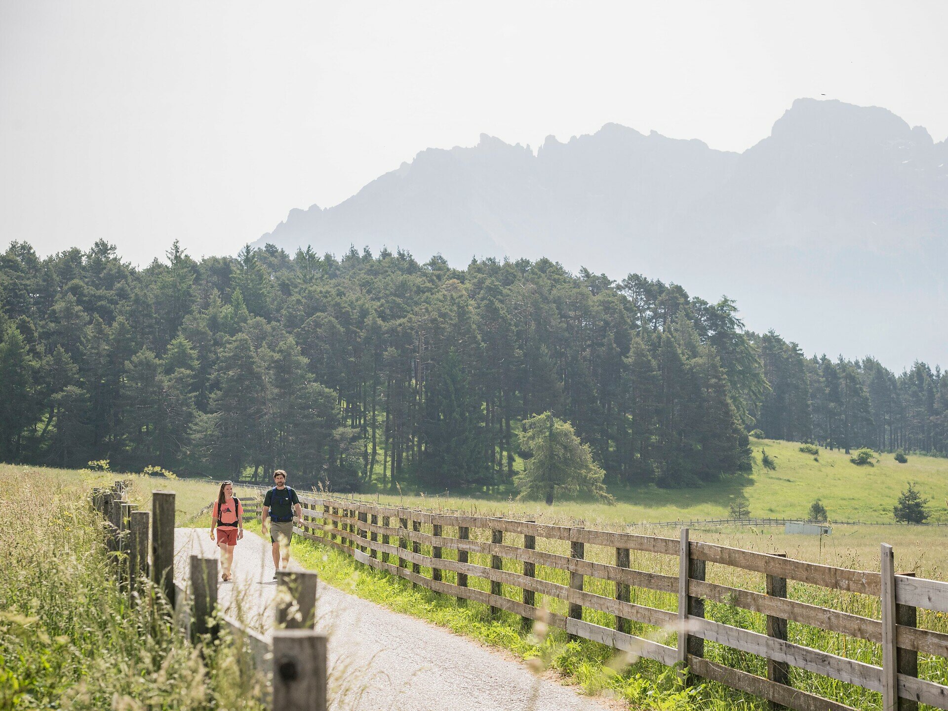
7.5 km stroller-friendly circular trail through meadows, open woodlands & scenic viewpoints. Highlight: St. Helena Church & Jausenstation Kreuzhof.

This 7.5 km circular trail delights with stunning views and diverse nature. The easily walkable path passes meadows, open woodlands, and scenic viewpoints – also suitable for strollers.

A highlight is St. Helena Church, known for its impressive Gothic frescoes. Right next to it, the Jausenstation Kreuzhof invites you to enjoy local specialties and refreshing drinks. With only about 150 meters of elevation, the trail is perfect for relaxed family hiking.

Tags
  • Suitable for strollers
  • Round trip
  • Family-friendly
Route info
Easy
Distance
9,0 km
Activity time
2 h 19 min
Ascent
117 m
Descent
116 m
Physical effort
Scenary
Highest point
1.429 m
Lowest point
1.360 m
You might be interested in
Discover related tours
Intermediate
Add to favourites
Welschnofen
Du lac de Karer au labyrinthe rocheux du Latemar
Distance 9,4 km
Activity time 3 h 00 min
Ascent 448 m
Descent 449 m
Status
closed
Deutschnofen
Randonnée vers l'alpage Laab et l'alpage Petersberger Leger
Distance 7,4 km
Activity time 2 h 14 min
Ascent 267 m
Descent 268 m
Status
open
Intermediate
Add to favourites
Karersee, Welschnofen
Randonnée circulaire d'exception : lac de Carezza - labyrinthe rocheux du Latemar - cinéma de montagne de la vallée d'Ega, prairies du Latemar - col de Carezza
Distance 11,7 km
Activity time 3 h 40 min
Ascent 607 m
Descent 607 m
Status
closed
Steinegg
Randonnée familiale vers l'observatoire à Gummer
Distance 2,4 km
Activity time 38 min
Ascent 34 m
Descent 28 m
Status
open
Welschnofen, Deutschnofen
Randonnée familiale du lac de Karer à l'auberge d'altitude Häusler Sam
Distance 13,0 km
Activity time 3 h 30 min
Ascent 214 m
Descent 214 m
Status
open
Deutschnofen
Randonnée familiale : randonnée panoramique circulaire
Distance 9,7 km
Activity time 2 h 26 min
Ascent 98 m
Descent 98 m
Status
open