Top

Randonnée & Vélo | De Welschnofen au refuge Latemar Pisa

Welschnofen, Obereggen, Deutschnofen
Add to favourites
Difficulty
Intermediate
Activity time
5:30
Duration in hours
Distance
23.5
Distance in km
Status
closed
Suggested period
Jan
Feb
Mar
Apr
May
Jun
Jul
Aug
Sep
Oct
Nov
Dec

Hike & Bike Eggental – You can't decide whether you'd rather explore the Eggental on foot or by bike? Then it's best to do both! The Eggental E-Bike Sharing in combination with our countless hiking routes make it possible.

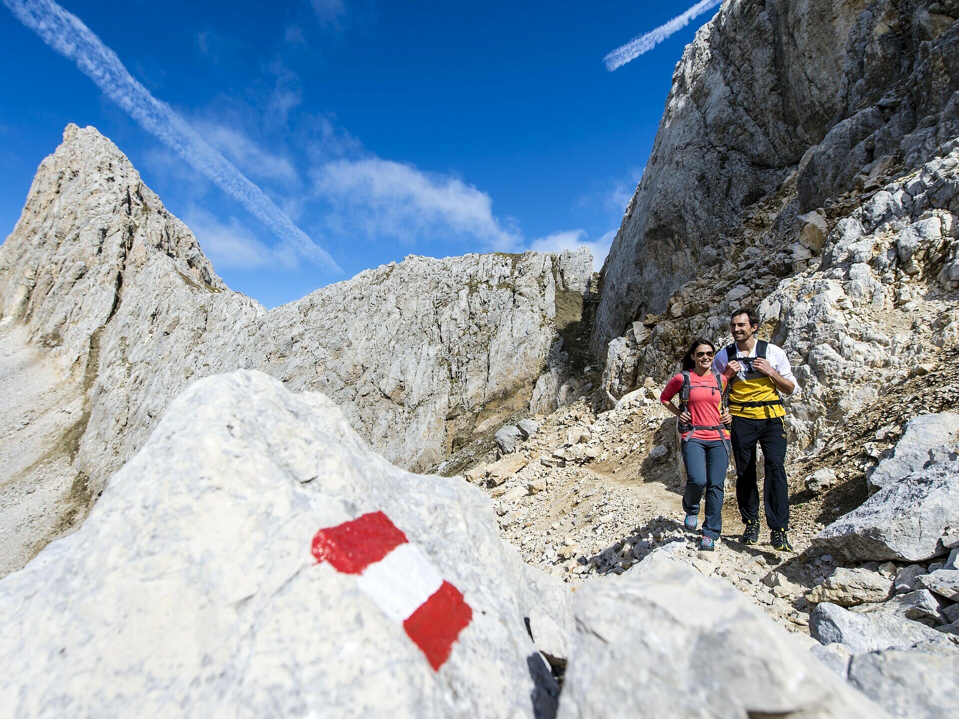
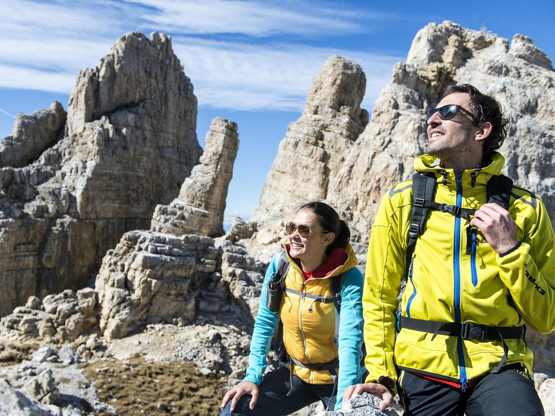
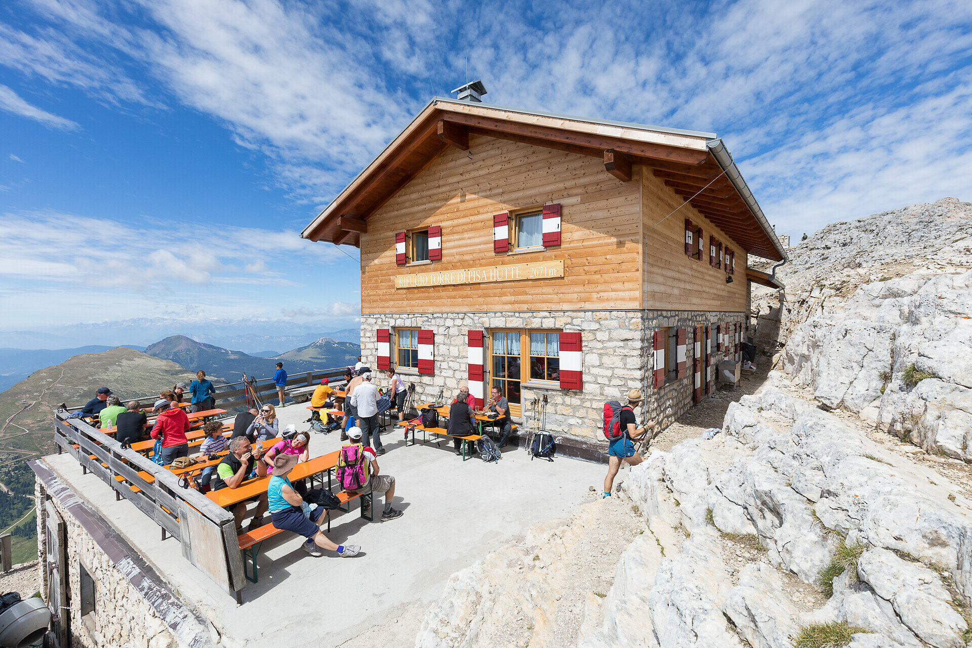
From Welschnofen | Nova Levante, the trail leads below the imposing Rosengarten | Catinaccio to the Latemar, also known as the shape-shifter. The pale mountain shows itself in different shapes depending on the location, and the destination of this hike is the only managed refuge hut in the middle of this quiet rocky scenery. The hut is also called the "Torre di Pisa hut" because of a striking, sloping pinnacle about 20 m high, reminiscent of the leaning tower of Pisa.

Tags
  • Linear route
Route info
Intermediate
Distance
23,5 km
Activity time
5 h 30 min
Ascent
1.406 m
Descent
1.026 m
Physical effort
Scenary
Highest point
2.685 m
Lowest point
1.022 m
You might be interested in
Discover related tours
Intermediate
Add to favourites
Deutschnofen
Randonnée de Laab Alm au refuge Neuhütt Alm & Petersberger Leger Alm
Distance 8,5 km
Activity time 2 h 32 min
Ascent 273 m
Descent 373 m
Status
open
Intermediate
Add to favourites
Karersee, Steinegg
Randonnée de cinq jours sur le sentier en boucle Perlenrundwanderweg - 1ère étape
Distance 16,5 km
Activity time 5 h 53 min
Ascent 1.402 m
Descent 658 m
Status
open
Intermediate
Add to favourites
Karersee, Welschnofen
Randonnée familiale du col de Karer au Mitterleger et aux prairies du Latemar
Distance 8,3 km
Activity time 2 h 32 min
Ascent 383 m
Descent 383 m
Status
open
Steinegg
Randonnée circulaire du village étoilé à Steinegg
Distance 6,4 km
Activity time 1 h 57 min
Ascent 300 m
Descent 300 m
Status
open
Welschnofen
Courte boucle autour du lac de Carezza
Distance 1,3 km
Activity time 20 min
Ascent 21 m
Descent 28 m
Status
open
Deutschnofen
Randonnée au Weißhorn
Distance 17,7 km
Activity time 6 h 00 min
Ascent 834 m
Descent 835 m
Status
closed