Top

Stadlalm Tour

Welschnofen
Add to favourites
Difficulty
Easy
Activity time
2:00
Duration in hours
Distance
7.7
Distance in km
Suggested period
Jan
Feb
Mar
Apr
May
Jun
Jul
Aug
Sep
Oct
Nov
Dec
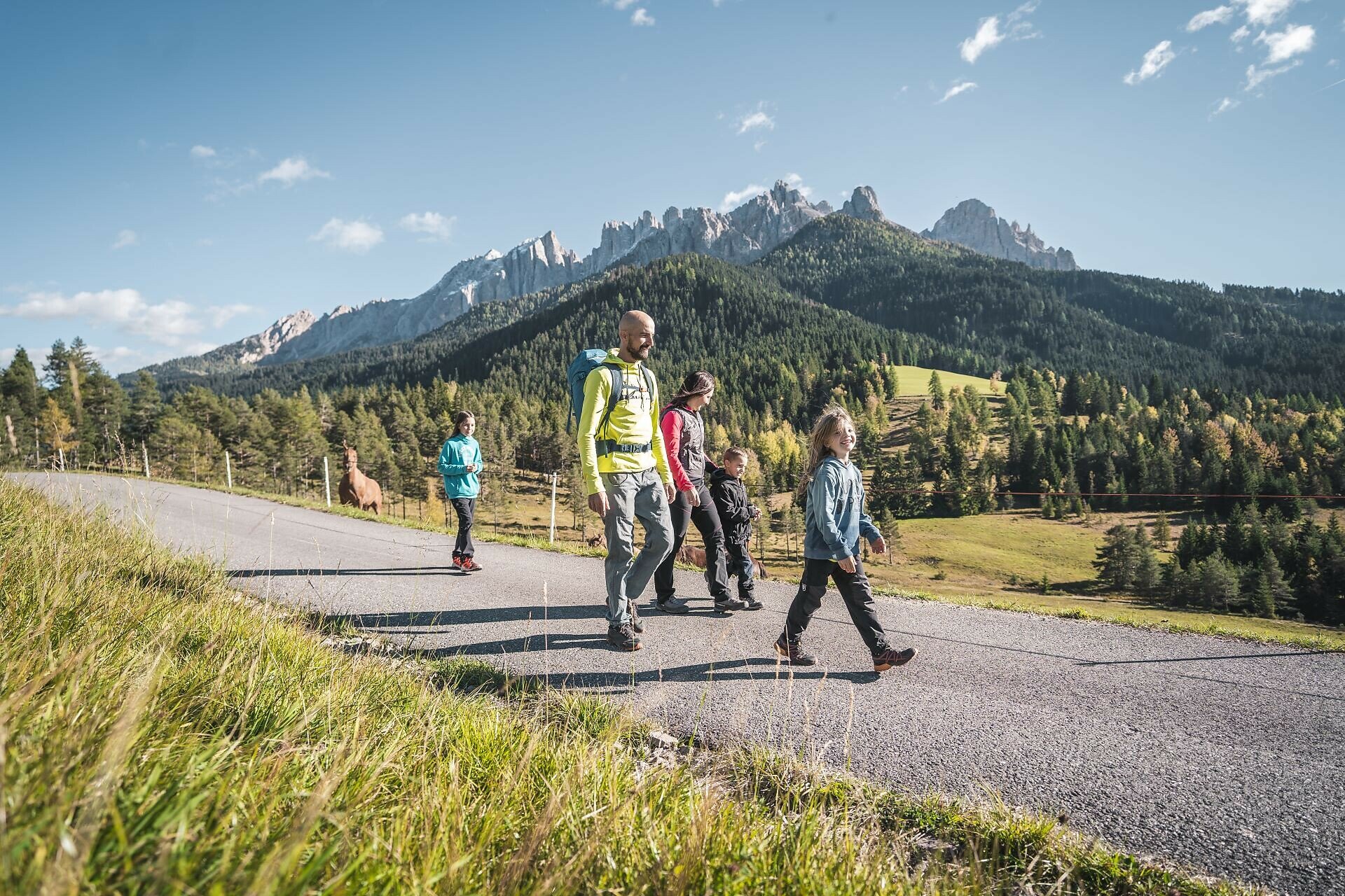
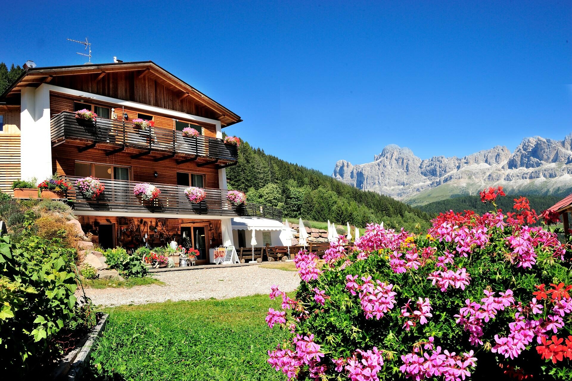
Leisurely family hike along the Templ path to the Stadl Alm hut with stunning Dolomite views, animals, playground, and regional cuisine. Perfect for all ages.
This leisurely family hike to the Stadl Alm hut leads along the Templ path through the idyllic Latemar Forest and delights with a legendary view of the Dolomite peaks Rosengarten and Latemar. Once at the destination, both young and old are welcomed by numerous farm animals, a playground, and hearty dishes made from seasonal and homegrown products.
Route info
Easy
Distance
7,7 km
Activity time
2 h 00 min
Ascent
203 m
Descent
203 m
Physical effort
Scenary
Highest point
1.550 m
Lowest point
1.381 m
Suggestions
Refreshment stops:
Directions
The hike starts at the Lake Carezza (Karer See | Lago di Carezza) parking lot (1,519 m). From there, the path goes through the underpass and then along the right side of the lake to the Templ path [8]. Follow the wide forest road [8] to the turnoff to the Stadl Alm hut. Continue on paths [25A] and [25] until you reach the Stadl Alm hut, where a playground, petting zoo, and lawn area await both young and old (the hut is only open in summer).
The return path leads via trail [27] down to the bus stop at Hotel Adler. From there, take bus lines 180 or 184 back to the starting point.

Refreshment stops:

Alternatives return:

  • Option 1: Return from Stadl Alm hut along the same path back to Lake Carezza, then take the bus (lines 180 or 184) to Welschnofen | Nova Levante.
  • Option 2: From Hotel Adler, take trail [10A] back to Lake Carezza.
public transportation
Getting to the starting point of the tour by public transport is easy and convenient.

By public bus line:
- 180 from Bozen | Bolzano, Birchabruck | Ponte Nova
- 180 or 184 from Karerpass | Passo Costalunga
- 184 from Weissenstein | Pietralba, Petersberg | Monte San Pietro, Deutschnofen | Nova Ponente, Stenk (or 181 and change 180)
- 184 from Obereggen, Eggen | Ega (or 184 and change 180)
- 187 from Steinegg | Collepietra, Gummer | San Valentino (or 182 and change 180)
- 180 from Val di Fassa

Bus stop: Karersee | Lago di Carezza. Online timetable search at www.suedtirolmobil.info/en/

How to get there
Getting to the starting point of the tour by public transport is easy and convenient.
 
By public bus line:
- 180 from Bozen | Bolzano, Birchabruck | Ponte Nova, Welschnofen | Nova Levante
- 180 from Fassatal | Val di Fassa, Karer Pass | Passo Costalunga, Karersee | Carezza
- 184 from Weissenstein | Pietralba, Petersberg | Monte San Pietro, Deutschnofen | Nova Ponente, Stenk with change 180 (or 181 and change 180)
- 184 from Obereggen, Eggen | Ega with change 180 (or 184 and change 180)
- 186 from St. Zyprian | S. Cipriano, Nigerpass | Passo Nigra with change 180
- 187 from Steinegg | Collepietra, Gummer | San Valentino with change 180 (or 182 and change 180)

Bus stop: Karer See | Lago di Carezza. Online timetable search at www.suedtirolmobil.info/en/

By car: 
Destination: Karersee | Carezza
Parking: Parking lot Karer See | Lago di Carezza
Where to park

Parking: Parking lot Karer See | Lago di Carezza (with costs): https://goo.gl/maps/w4SVXQJJyxtUaLdUA

You might be interested in
Discover related tours
Intermediate
Add to favourites
Steinegg
Mountain Cinema in the Eggental - Furner Oach
Distance 10,7 km
Activity time 3 h 30 min
Ascent 540 m
Descent 540 m
Karersee, Welschnofen
Hike: Nigerpass – Hagner Alm – Schiller Hof
Distance 14,2 km
Activity time 3 h 53 min
Ascent 207 m
Descent 207 m
Deutschnofen
Hike to the Häusler Sam
Distance 3,9 km
Activity time 1 h 10 min
Ascent 133 m
Descent 139 m
Deutschnofen
Hike to the huts Schönrast - Schmieder - Lahner
Distance 15,5 km
Activity time 4 h 30 min
Ascent 491 m
Descent 491 m
Welschnofen
From Paolina to Lake Carezza
Distance 3,9 km
Activity time 1 h 06 min
Ascent 93 m
Descent 93 m
Intermediate
Add to favourites
Deutschnofen
Excursion to the Stone Age settlement of Enzbirch
Distance 12,9 km
Activity time 3 h 50 min
Ascent 397 m
Descent 397 m