Top

Sur la chaire de Poppe dans le Latemar

Karersee, Welschnofen
Add to favourites
Category
Difficulty
Difficult
Activity time
2:26
Duration in hours
Distance
7
Distance in km
Status
closed
Suggested period
Jan
Feb
Mar
Apr
May
Jun
Jul
Aug
Sep
Oct
Nov
Dec
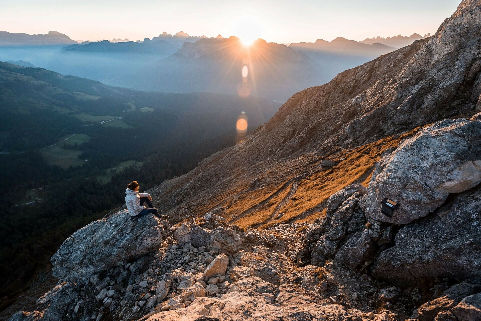
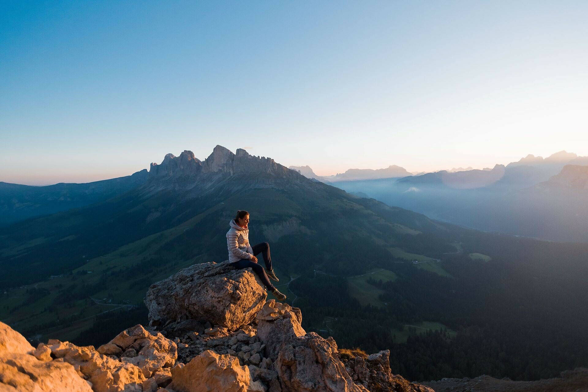
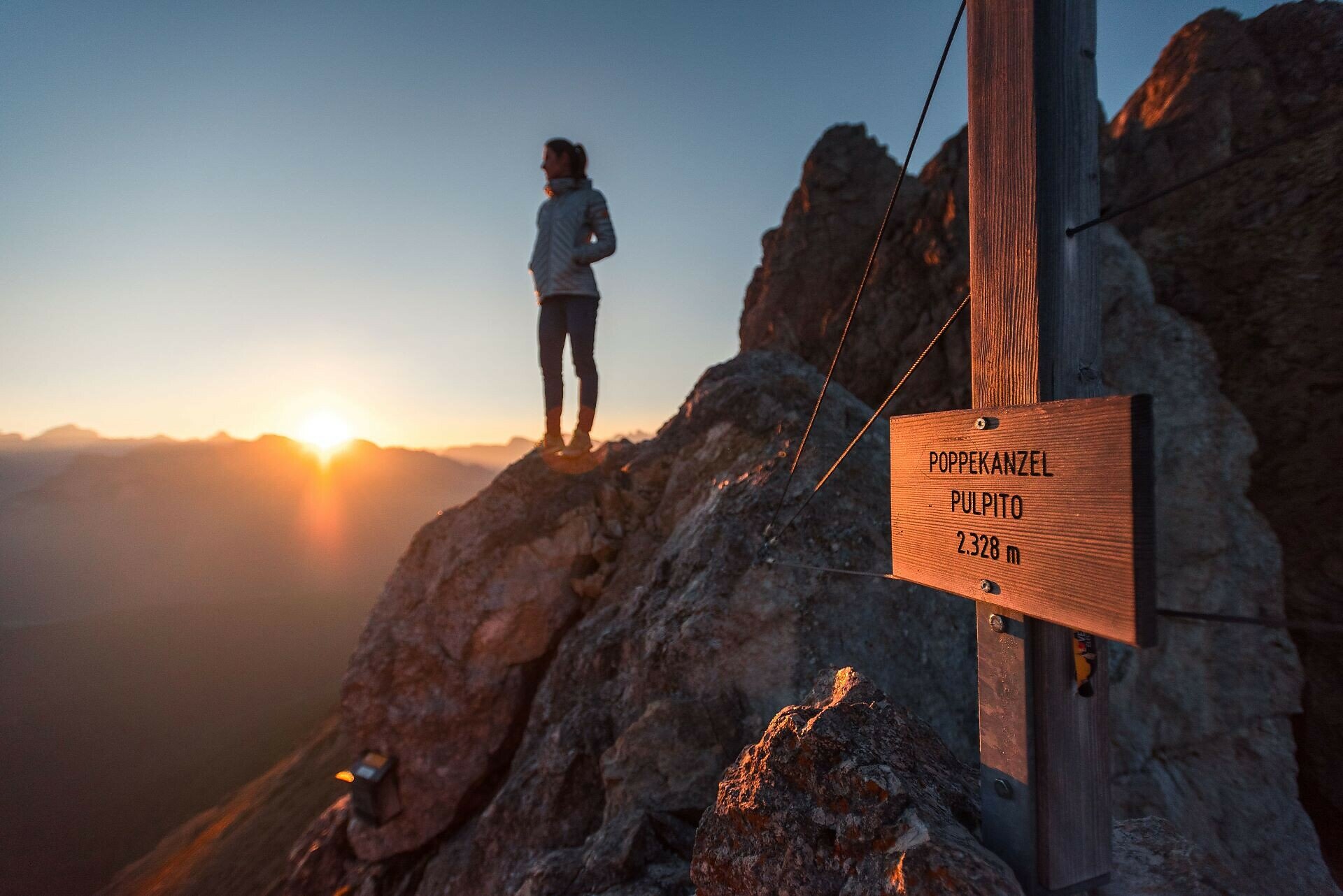
Across the Latemar meadows to the Latemar cinema and further on to the Poppekanzel – a challenging route, but with breathtaking views over the legendary Dolomite landscape.
Across the beautiful Latemar meadows, you reach the Latemar cinema, which – true to its name – already offers stunning panoramic views of the Rosengarten | Catinaccio. The following steep ascent to the Poppekanzel | Pulpito peak might be a bit of a challenge, but the spectacular view at the top rewards every effort. From here, your gaze stretches far across the majestic Pala group, the striking Sella massif, the mighty Marmolada, the iconic Langkofel | Sassolungo, the Ortler | Ortles, the Ötztal Alps, and many other impressive peaks of the Dolomites.
Tags
  • Out and back
Route info
Difficult
Distance
7,0 km
Activity time
2 h 26 min
Ascent
560 m
Descent
566 m
Physical effort
Scenary
Highest point
2.315 m
Lowest point
1.750 m
Suggestions
Refreshment stops:
You might be interested in
Discover related tours
Intermediate
Add to favourites
Karersee
Par le Schafsteig du Val di Fassa au refuge Paolina
Distance 5,8 km
Activity time 2 h 01 min
Ascent 459 m
Descent 316 m
Status
closed
Karersee, Welschnofen
Tour de la Roseraie
Distance 10,7 km
Activity time 5 h 01 min
Ascent 835 m
Descent 858 m
Karersee, Welschnofen
Au cœur de la roseraie - Vajolon
Distance 10,7 km
Activity time 3 h 47 min
Ascent 887 m
Descent 868 m
Karersee, Deutschnofen, Welschnofen
Chemin en altitude du Latemar au Rosengarten
Distance 31,3 km
Activity time 6 h 30 min
Ascent 1.582 m
Descent 1.964 m
Obereggen, Deutschnofen
Randonnée circulaire Lavazè-Zanggen-Reiterjoch
Distance 11,3 km
Activity time 4 h 25 min
Ascent 763 m
Descent 763 m
Status
closed
Obereggen, Deutschnofen
Randonnée vers le refuge Latemar | Rifugio Torre di Pisa
Distance 8,1 km
Activity time 4 h 00 min
Ascent 719 m
Descent 719 m