Top

Winter Hike Bühl

Deutschnofen
Add to favourites
Category
Difficulty
Intermediate
Activity time
1:57
Duration in hours
Distance
7.4
Distance in km
Status
open
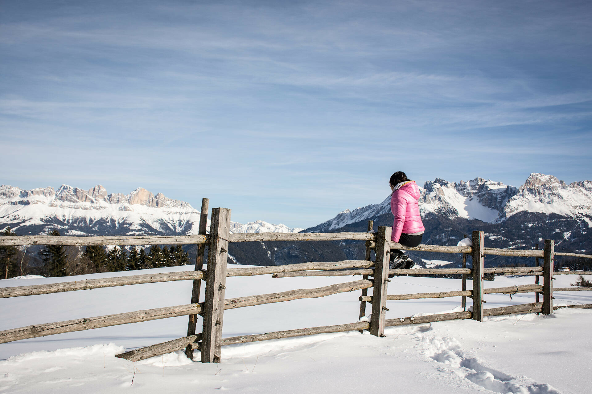
Scenic circular winter hike near Deutschnofen – perfect for nature lovers and those seeking peaceful alpine landscapes.
The winter circular hike around Bühl offers a peaceful nature experience above Deutschnofen, surrounded by snowy forests and open meadows. Gently winding paths lead through a silent winter wonderland, revealing stunning panoramic views of the Dolomites, especially the majestic Latemar. The crisp mountain air, the crunch of snow underfoot, and the serene silence of the landscape create a deeply relaxing atmosphere. Perfect for those seeking calm, inspiration, and a mindful connection with nature – whether hiking solo, as a couple, or with the family. Along the way, sunny spots invite you to pause and soak in the magic of South Tyrol's winter beauty.
Tags
  • Round trip
Route info
Intermediate
Distance
7,4 km
Activity time
1 h 57 min
Ascent
130 m
Descent
130 m
Technical skills
Physical effort
Scenary
Highest point
1.456 m
Lowest point
1.342 m
You might be interested in
Discover related tours
Welschnofen
Circuit hivernal moyen au lac de Carezza
Distance 2,7 km
Activity time 44 min
Ascent 64 m
Descent 69 m
Status
open
Intermediate
Add to favourites
Deutschnofen
Randonnée hivernale de Deutschnofen via Unterkaplun jusqu’au Wölflhof
Distance 7,5 km
Activity time 2 h 05 min
Ascent 194 m
Descent 195 m
Status
open
Welschnofen
Randonnée hivernale du parking Paolina au lac de Carezza
Distance 2,0 km
Activity time 29 min
Ascent 0 m
Descent 91 m
Status
open
Intermediate
Add to favourites
Welschnofen, Karersee
Randonnée d'hiver jusqu'au Schillerhof
Distance 12,4 km
Activity time 3 h 32 min
Ascent 368 m
Descent 368 m
Status
open
Karersee, Welschnofen
Randonnée hivernale à la cabane Messnerjoch
Distance 3,8 km
Activity time 1 h 17 min
Ascent 239 m
Descent 239 m
Status
open
Welschnofen
Randonnée hivernale du lac de Karer à l'alpage de Frommer
Distance 5,3 km
Activity time 1 h 40 min
Ascent 274 m
Descent 92 m
Status
open