Top

Winter hike from Ega to Novale

Deutschnofen
Add to favourites
Category
Difficulty
Difficult
Activity time
2:05
Duration in hours
Distance
6.6
Distance in km
WSEN
Suggested period
Jan
Feb
Mar
Apr
May
Jun
Jul
Aug
Sep
Oct
Nov
Dec
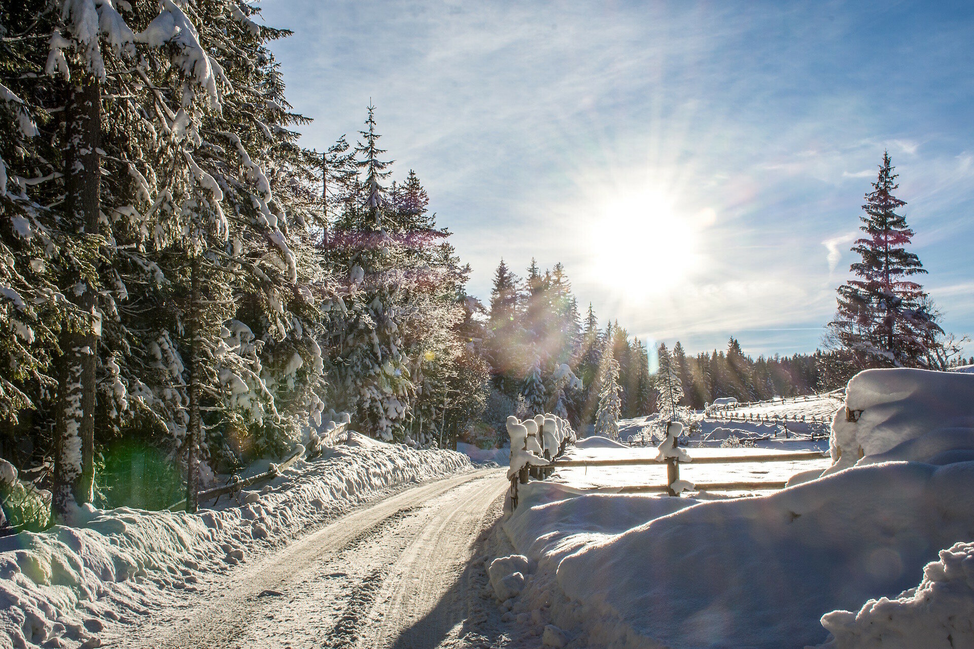
Winter hike from Eggen to Rauth: gentle ascent, snowy forests & peaceful scenery. Perfect for families and leisure hikers, with cozy stops back in Eggen.

The winter hike from Eggen to Rauth is a peaceful and pleasant walk through snowy forests and quiet alpine landscapes. Starting in the village center of Eggen, the trail gently ascends through pristine nature, accompanied by the crunch of snow and crisp mountain air. Open clearings along the way offer lovely views of the surrounding peaks.

Whether as a relaxed family outing or a peaceful solo escape, this tour is ideal for anyone who wants to experience winter away from the ski slopes. Back in Eggen, cozy stops like Dorfhotel Moar am Latemar or Gasserhof invite you to warm up and enjoy local hospitality.

Route info
Difficult
Distance
6,6 km
Activity time
2 h 05 min
Ascent
352 m
Descent
352 m
Technical skills
Physical effort
Scenary
Highest point
1.349 m
Lowest point
1.104 m
You might be interested in
Discover related tours
Welschnofen
Randonnée hivernale du parking Paolina au lac de Carezza
Distance 2,0 km
Activity time 29 min
Ascent 0 m
Descent 91 m
Intermediate
Add to favourites
Steinegg, Welschnofen
Winter hike at Obergummer
Distance 11,9 km
Activity time 3 h 27 min
Ascent 391 m
Descent 391 m
Deutschnofen
Winter hike to the huts Schönrast - Schmieder - Lahner
Distance 15,5 km
Activity time 4 h 30 min
Ascent 491 m
Descent 491 m
Deutschnofen, Welschnofen
Randonnée d'hiver du lac de Karer à Obereggen via le "Templweg"
Distance 7,1 km
Activity time 1 h 55 min
Ascent 77 m
Descent 90 m
Steinegg
Randonnée hivernale à l'observatoire de Gummer
Distance 4,8 km
Activity time 1 h 16 min
Ascent 57 m
Descent 57 m
Deutschnofen, Welschnofen
Randonnée hivernale d'Obereggen au lac de Care par le "Templweg".
Distance 7,0 km
Activity time 1 h 50 min
Ascent 77 m
Descent 92 m