Top

Winter hike from the Karerpass | Passo Costalunga to Lake Carezza

Karersee, Welschnofen
Add to favourites
Category
Difficulty
Intermediate
Activity time
1:10
Duration in hours
Distance
4.7
Distance in km
Suggested period
Jan
Feb
Mar
Apr
May
Jun
Jul
Aug
Sep
Oct
Nov
Dec
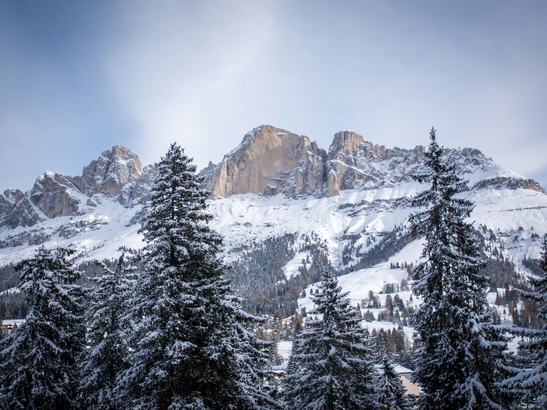
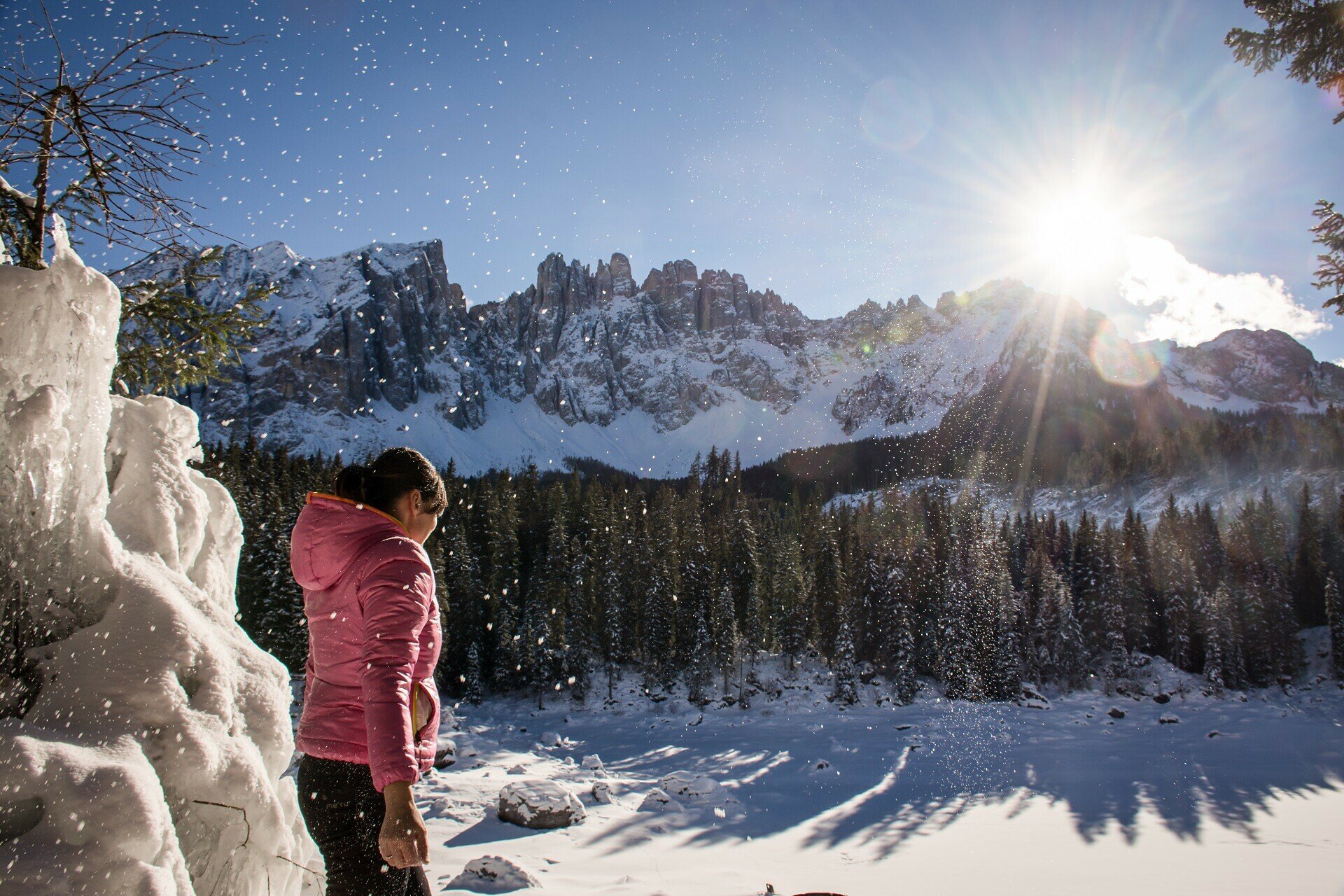
This winter hike leads from the Karerpass | Passo Costalunga through the Latemar forest, to the impressive Lake Carezza, framed by a picturesque Dolomite backdrop.
The hike leads from the Karerpass | Passo Costalunga first into the Latemar forest, where the hazel tree grows, which is used especially for the production of string instruments. For this reason, the wood has also been called ‘tonewood’. From the Latemar forest you reach the Lake Carezza (Karer See | Lago di Carezza), which is considered one of the most magnificent alpine lakes in the Dolomites and is surrounded by a special mountain backdrop.
Route info
Intermediate
Distance
4,7 km
Activity time
1 h 10 min
Ascent
11 m
Descent
221 m
Technical skills
Physical effort
Scenary
Highest point
1.760 m
Lowest point
1.540 m
Directions
The route first leads from the Karerpass | Passo Costalunga across a meadow to trail [21]. Via trail [21] you reach the junction with trail [13]. Continue on trail [13] along a pleasant forest path to trail [10], which leads to Lake Carezza (Karer See | Lago di Carezza).
public transportation

Getting to the starting point of the tour by public transport is easy and convenient.

By public bus line:
- 180 from Bozen | Bolzano, Birchabruck | Ponte Nova, Welschnofen | Nova Levante, Karer See | Lago di Carezza, Karersee | Carezza
- 180 from Fassatal | Val di Fassa
- 184 from Weissenstein | Pietralba, Petersberg | Monte San Pietro, Deutschnofen | Nova Ponente, Stenk with change 180 (or 181 and change 180)
- 184 from Obereggen, Eggen | Ega with change 180 (or 184 and change 180)
- 186 from St. Zyprian | S. Cipriano, Nigerpass | Passo Nigra
- 187 from Steinegg | Collepietra, Gummer | San Valentino with change 180 (or 182 and change 180)

Bus stop: Karerpass | Passo Costalunga. Online timetable search at www.suedtirolmobil.info/en/

How to get there

Getting to the starting point of the tour by public transport is easy and convenient.

By public bus line:
- 180 from Bozen | Bolzano, Birchabruck | Ponte Nova, Welschnofen | Nova Levante, Karer See | Lago di Carezza, Karersee | Carezza
- 180 from Fassatal | Val di Fassa
- 184 from Weissenstein | Pietralba, Petersberg | Monte San Pietro, Deutschnofen | Nova Ponente, Stenk with change 180 (or 181 and change 180)
- 184 from Obereggen, Eggen | Ega with change 180 (or 184 and change 180)
- 186 from St. Zyprian | S. Cipriano, Nigerpass | Passo Nigra
- 187 from Steinegg | Collepietra, Gummer | San Valentino with change 180 (or 182 and change 180)

Bus stop: Karerpass | Passo Costalunga. Online timetable search at www.suedtirolmobil.info/en/

By car:
Destination: Karerpass | Passo Costalunga
Parking: Parking lot Karerpass | Passo Costalunga
Where to park

Parking: Parking lot Karerpass | Passo Costalunga, https://goo.gl/maps/fEKaHiNBt874UHzF8

Good winter equipment is required (winter boots, possibly also crampons if needed, etc.).
You might be interested in
Discover related tours
Karersee, Welschnofen
Winter alpine hut hike from Karersee | Carezza to Welschnofen | Nova Levante
Distance 19,5 km
Activity time 5 h 19 min
Ascent 346 m
Descent 821 m
Intermediate
Add to favourites
Deutschnofen
Winter Hike Bühl
Distance 7,4 km
Activity time 1 h 55 min
Ascent 130 m
Descent 158 m
Welschnofen
Winter hike from Lake Carezza to the Frommer Alm hut
Distance 5,3 km
Activity time 1 h 40 min
Ascent 274 m
Descent 92 m
Deutschnofen, Welschnofen
Winter hike from Lake Carezza to Obereggen via the path "Templweg"
Distance 7,1 km
Activity time 1 h 55 min
Ascent 77 m
Descent 90 m
Intermediate
Add to favourites
Deutschnofen
Winter hike from the Laab hut to the Neuhütt hut
Distance 5,6 km
Activity time 1 h 35 min
Ascent 140 m
Descent 140 m
Intermediate
Add to favourites
Welschnofen
Winter hike from Welschnofen | Nova Levante to the Schiller Hof hut
Distance 8,2 km
Activity time 2 h 34 min
Ascent 429 m
Descent 429 m