Top

Winter hike to Wölfl farm

Deutschnofen
Add to favourites
Category
Difficulty
Intermediate
Activity time
0:45
Duration in hours
Distance
2.5
Distance in km
WSEN
Suggested period
Jan
Feb
Mar
Apr
May
Jun
Jul
Aug
Sep
Oct
Nov
Dec
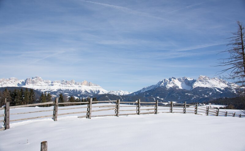
Leisurely winter hike from Deutschnofen to Wölflhof with a cozy hut stop. Perfect for families, nature lovers and those seeking a peaceful winter walk.

This winter hike to Wölflhof is perfect for those who enjoy peaceful snowy landscapes. Starting from the village center of Deutschnofen, the trail winds through gentle hills and quiet woods. At Wölflhof, you’re welcomed with warm South Tyrolean hospitality and delicious local food – an ideal stop for a cozy break. Whether with family or on your own, this hike offers a relaxing winter experience for all ages.

Route info
Intermediate
Distance
2,5 km
Activity time
45 min
Ascent
72 m
Descent
145 m
Technical skills
Physical effort
Scenary
Highest point
1.429 m
Lowest point
1.284 m
Directions

The winter hike starts at Gibitzplatz in Deutschnofen, near the village center. Follow the European long-distance trail [E5] toward Gattererhof, across gently rolling snowy hills and open forest.
After about 30 minutes, you reach Gattererhof, with a lovely view of the Eggental valley. Continue along trail [E5] to reach Wölflhof, a welcoming stop with traditional South Tyrolean food. The total walking time is about 1 hour one way.
Return on the same trail back to Deutschnofen.

public transportation

Getting to the starting point of the tour by public transport is easy and convenient.

By public bus line:
- 181 from Bozen | Bolzano,
- 180 or 184 from Karersee | Lago di Carezza, Karerpass | Passo Costalunga, Welschnofen | Nova Levante
- 184 or 181 from Birchabruck | Ponte Nova
- 184 from Stenk, Eggen | Ega, Obereggen
- 184 or 181 from Weissenstein | Pietralba, Petersberg | Monte San Pietro, Deutschnofen | Nova Ponente
- 182 from Steinegg | Collepietra, Gummer | San Valentino
- 180 from Val di Fassa

Bus stop: Deutschnofen | Nova Ponente Church; online timetable search at www.suedtirolmobil.info/en/
Meeting point: Parking lot : https://goo.gl/maps/UwWfytu3jmCJTRhM6

How to get there

Getting to the starting point of the tour by public transport is easy and convenient.

By public bus line:
- 181 from Bozen | Bolzano,
- 180 or 184 from Karersee | Lago di Carezza, Karerpass | Passo Costalunga, Welschnofen | Nova Levante
- 184 or 181 from Birchabruck | Ponte Nova
- 184 from Stenk, Eggen | Ega, Obereggen
- 184 or 181 from Weissenstein | Pietralba, Petersberg | Monte San Pietro, Deutschnofen | Nova Ponente
- 182 from Steinegg | Collepietra, Gummer | San Valentino
- 180 from Val di Fassa

Bus stop: Deutschnofen | Nova Ponente Church; online timetable search at www.suedtirolmobil.info/en/
Meeting point: Parking lot : https://goo.gl/maps/UwWfytu3jmCJTRhM6

By car:
Destination: Deutschnofen | Nova Ponente
Parking: parking lot Gibitz
Meeting point: Parking lot Gibitz square Deutschnofen | Nova Ponente: https://goo.gl/maps/UwWfytu3jmCJTRhM6

Where to park

Parking: parking lot Gibitz
Meeting point: Parking lot Gibitz square Deutschnofen | Nova Ponente: https://goo.gl/maps/UwWfytu3jmCJTRhM6

You might be interested in
Discover related tours
Steinegg
Winter hike at the Steinegg Ridgeway
Distance 10,6 km
Activity time 3 h 00 min
Ascent 209 m
Descent 210 m
Welschnofen
Winter hike on the Sissi Promenade in Karersee | Carezza
Distance 10,8 km
Activity time 2 h 58 min
Ascent 220 m
Descent 220 m
Welschnofen
Winter hike from Lake Carezz to the Stadl Alm hut
Distance 8,0 km
Activity time 2 h 08 min
Ascent 111 m
Descent 111 m
Intermediate
Add to favourites
Deutschnofen, Welschnofen
Winter hike from Obereggen to Lake Carezza via the path "Templweg"
Distance 7,0 km
Activity time 1 h 50 min
Ascent 77 m
Descent 92 m
Deutschnofen
Winter hike from Obereggen to the Oberholz hut
Distance 9,0 km
Activity time 3 h 00 min
Ascent 519 m
Descent 519 m
Deutschnofen
Winter hike to the Lieg hut
Distance 8,3 km
Activity time 2 h 40 min
Ascent 474 m
Descent 469 m