Top

Circular Hike from Lake Carezza to Franzin Alm

Welschnofen
Add to favourites
Difficulty
Easy
Activity time
2:02
Duration in hours
Distance
7
Distance in km
Suggested period
Jan
Feb
Mar
Apr
May
Jun
Jul
Aug
Sep
Oct
Nov
Dec
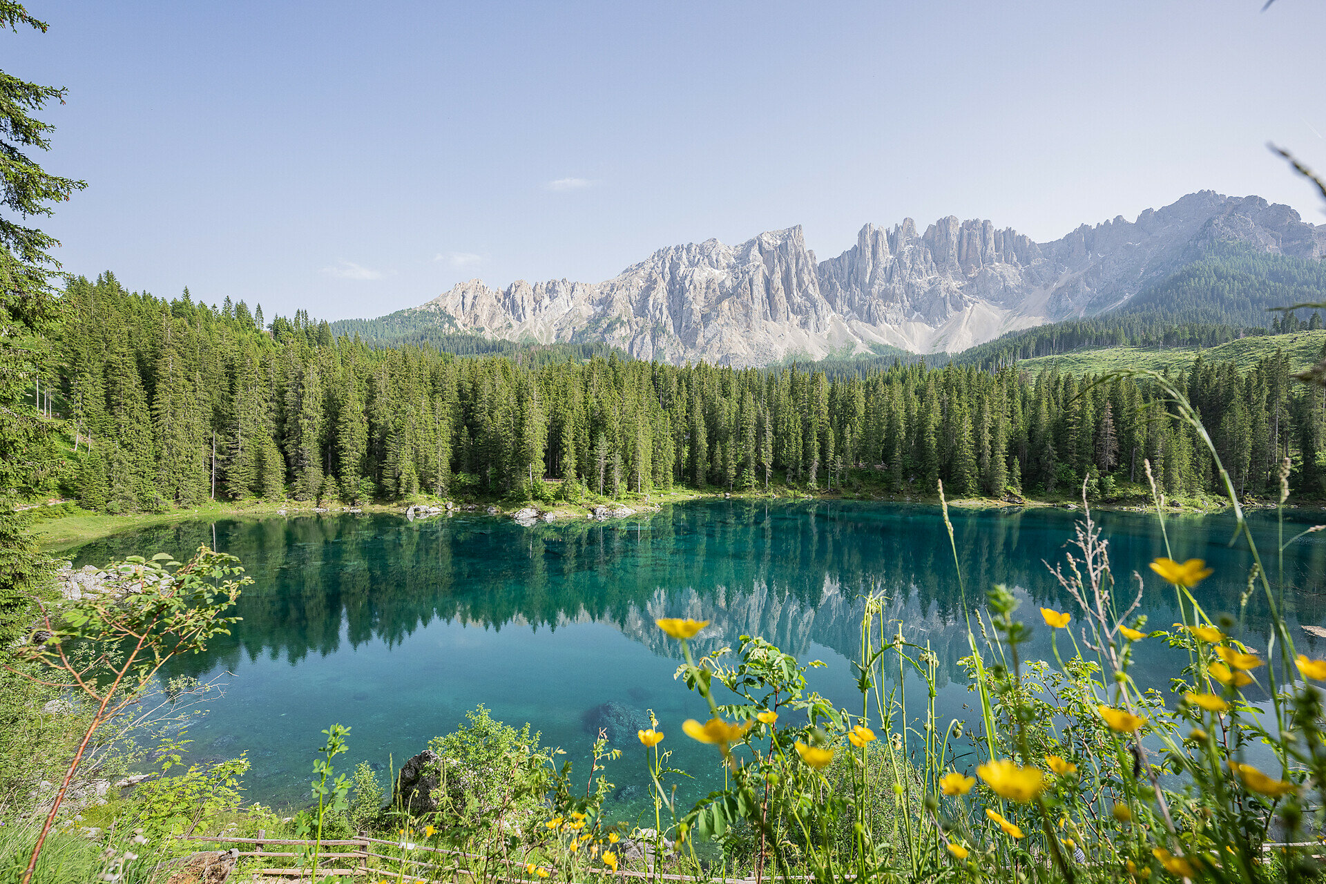
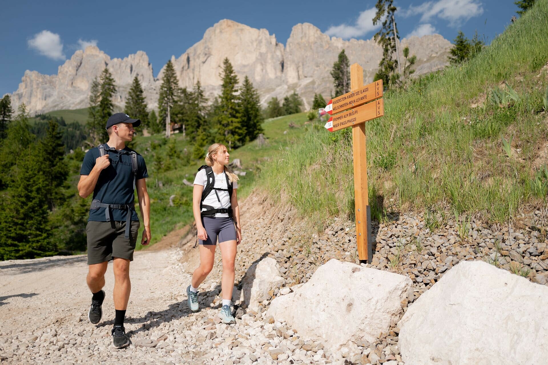
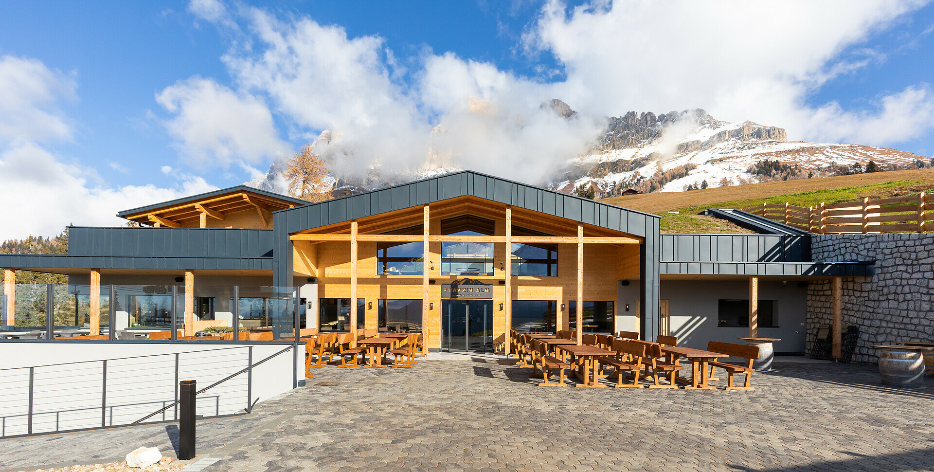
Scenic circular hike from Lake Carezza to Franzin Alm via Moseralm, featuring forests, stunning views, and a relaxing break.

The circular hike from Lake Carezza to Franzin Alm combines breathtaking landscapes, historical sites, and local culinary delights. Passing through dense forests with stunning views of the Catinaccio, the trail leads to Franzin Alm. A special highlight is the Kaiserstein, a large rock named after Empress Elisabeth "Sissi," who once visited this place.

Route info
Easy
Distance
7,0 km
Activity time
2 h 02 min
Ascent
242 m
Descent
252 m
Physical effort
Scenary
Highest point
1.772 m
Lowest point
1.541 m
Suggestions

Refreshment stops:

Directions

This scenic circular hike starts at Lake Carezza (1550 m), one of the most picturesque alpine lakes in the Dolomites. From the parking lot, the trail crosses a suspension bridge, following forest path [6] to the historic grain mill at the foot of the Catinaccio massif. The route then continues along trail [9] to the Hotel Moseralm (1576 m), gradually ascending to the Kaiserstein parking lot on the road Nigerstraße | Via Nigra. From there, trail [6C] leads directly to the hut Franzin Alm, a perfect spot to relax and enjoy traditional local dishes. After a well-deserved break, the hike continues along a short section of the road Nigerstraße | Via Nigra towards Karerpass | Passo Costalunga. The return route passes through the Carezza settlement, first following König-Laurin-Straße | Via Rel Laurino, then along Rotwandstraße | Via Croda Rossa and Christomannosstraße | Via Christomannos. Below the Angerle Alm riding center, the path follows the scenic Schönblickweg | Via Bellavista and trail [6] back to Lake Carezza.

Tip: From the Kaiserstein parking lot, a 10-minute walk along trail [9B] leads to the striking Kaiserstein rock (1801). Named after Empress Elisabeth "Sissi", who once visited the site, the rock now features a wooden staircase leading to a panoramic viewpoint. It is also a popular spot for rock climbing enthusiasts.

Refreshment stops:


public transportation
Getting to the starting point of the tour by public transport is easy and convenient.

By public bus line:
- 180 from Bozen | Bolzano, Birchabruck | Ponte Nova
- 180 or 184 from Karerpass | Passo Costalunga
- 184 from Weissenstein | Pietralba, Petersberg | Monte San Pietro, Deutschnofen | Nova Ponente, Stenk (or 181 and change 180)
- 184 from Obereggen, Eggen | Ega (or 184 and change 180)
- 187 from Steinegg | Collepietra, Gummer | San Valentino (or 182 and change 180)
- 180 from Val di Fassa

Bus stop: Karer See | Lago di Carezza. Online timetable search at www.suedtirolmobil.info/en/

How to get there
Getting to the starting point of the tour by public transport is easy and convenient.
 
By public bus line:
- 180 from Bozen | Bolzano, Birchabruck | Ponte Nova, Welschnofen | Nova Levante
- 180 from Fassatal | Val di Fassa, Karer Pass | Passo Costalunga, Karersee | Carezza
- 184 from Weissenstein | Pietralba, Petersberg | Monte San Pietro, Deutschnofen | Nova Ponente, Stenk with change 180 (or 181 and change 180)
- 184 from Obereggen, Eggen | Ega with change 180 (or 184 and change 180)
- 186 from St. Zyprian | S. Cipriano, Nigerpass | Passo Nigra with change 180
- 187 from Steinegg | Collepietra, Gummer | San Valentino with change 180 (or 182 and change 180)

Bus stop: Karer See | Lago di Carezza. Online timetable search at www.suedtirolmobil.info/en/

By car: 
Destination: Karersee | Carezza
Parking: Parking lot Karer See | Lago di Carezza
Where to park

Parking: Parking lot Karer See | Lago di Carezza (with costs): https://goo.gl/maps/w4SVXQJJyxtUaLdUA

You might be interested in
Discover related tours
Deutschnofen
Family-hike to the farms of Petersberg/Monte San Pietro
Distance 4,1 km
Activity time 1 h 05 min
Ascent 95 m
Descent 95 m
Deutschnofen
Family-hike from Weissenstein/Pietralba to the Petersberger Leger Hut
Distance 4,6 km
Activity time 1 h 20 min
Ascent 140 m
Descent 140 m
Intermediate
Add to favourites
Deutschnofen
Hike through the Bletterbachschlucht Gorge
Distance 11,5 km
Activity time 4 h 00 min
Ascent 588 m
Descent 588 m
Obereggen, Deutschnofen
LATEMAR.PANORAMA: Family-hike on the nature-trail
Distance 10,6 km
Activity time 3 h 50 min
Ascent 471 m
Descent 991 m
Intermediate
Add to favourites
Welschnofen, Karersee
Between Catinaccio/Rosengarten and Latemar
Distance 15,7 km
Activity time 4 h 33 min
Ascent 517 m
Descent 517 m
Intermediate
Add to favourites
Deutschnofen
Adventure hiking trail "Kirchsteig"
Distance 9,5 km
Activity time 2 h 55 min
Ascent 361 m
Descent 361 m