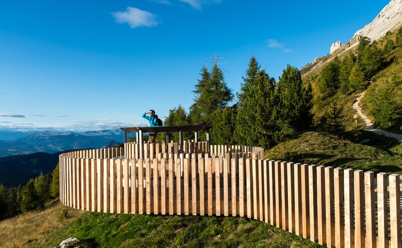
The short hike to the LATEMAR.360° panoramic platform is a must for families and nature lovers alike. From the top station of the Oberholz panoramic chairlift, an easy, well-maintained trail leads in just a few minutes to one of the most impressive viewpoints in the region. At 2,200 m altitude, the 360° view opens up across the Dolomites – from the jagged Latemar peaks to the Rosengarten, Schlern and even the Zillertal Alps in the distance. Large, informative panels explain the surrounding mountains, making this a fun and educational stop for children and curious hikers. With its easy access, stunning scenery and informative design, LATEMAR.360° is a perfect destination for all ages.
- Out and back
- Family-friendly
The hike starts at the top station of the Oberholz panoramic chairlift in Obereggen. From there, trail [18] leads gently uphill to the LATEMAR.360° viewing platform, reached in about 10 minutes.
Located at around 2,200 m, the platform offers a full 360° view of the Dolomites and surrounding peaks. Return via the same trail to the lift station.
Getting to the starting point of the tour by public transport is easy and convenient.
By public bus line:
- 180 and 184 from Bozen | Bolzano,
- 180 and 184 from Karersee | Lago di Carezza, Karerpass | Passo Costalunga, Welschnofen | Nova Levante
- 184 from Birchabruck | Ponte Nova, Stenk, Eggen | Ega
- 184 from Weissenstein | Pietralba, Petersberg |Monte San Pietro, Deutschnofen | Nova Ponente
- 182 and 184 from Steinegg | Collepietra, Gummer | San Valentino
- 180 and 184 from Val di Fassa
Bus stop: Obereggen; online timetable search at www.suedtirolmobil.info/en/
Getting to the starting point of the tour by public transport is easy and convenient.
By public bus line:
- 180 from Bozen | Bolzano,
- 180 or 184 from Karersee | Lago di Carezza, Karerpass | Passo Costalunga, Welschnofen | Nova Levante
- 184 from Birchabruck | Ponte Nova, Stenk, Eggen | Ega
- 184 from Weissenstein | Pietralba, Petersberg |Monte San Pietro, Deutschnofen | Nova Ponente - 182 from Steinegg | Collepietra, Gummer | San Valentino
- 180 from Val di Fassa
Bus stop:Obereggen; online timetable search at www.suedtirolmobil.info/en/
Meeting point: valley station Oberholz: https://goo.gl/maps/TmQLBAvhDtbhWoHV6
By car:
Destination: Obereggen
Parking: Parking lot Obereggen
Meeting point: valley station Oberholz: https://goo.gl/maps/TmQLBAvhDtbhWoHV6
Parking: Parking lot Obereggen
Meeting point: valley station Oberholz: https://goo.gl/maps/TmQLBAvhDtbhWoHV6


