Top

LATEMAR.360

Deutschnofen
Add to favourites
Difficulty
Easy
Activity time
0:25
Duration in hours
Distance
1
Distance in km
WSEN
Suggested period
Jan
Feb
Mar
Apr
May
Jun
Jul
Aug
Sep
Oct
Nov
Dec
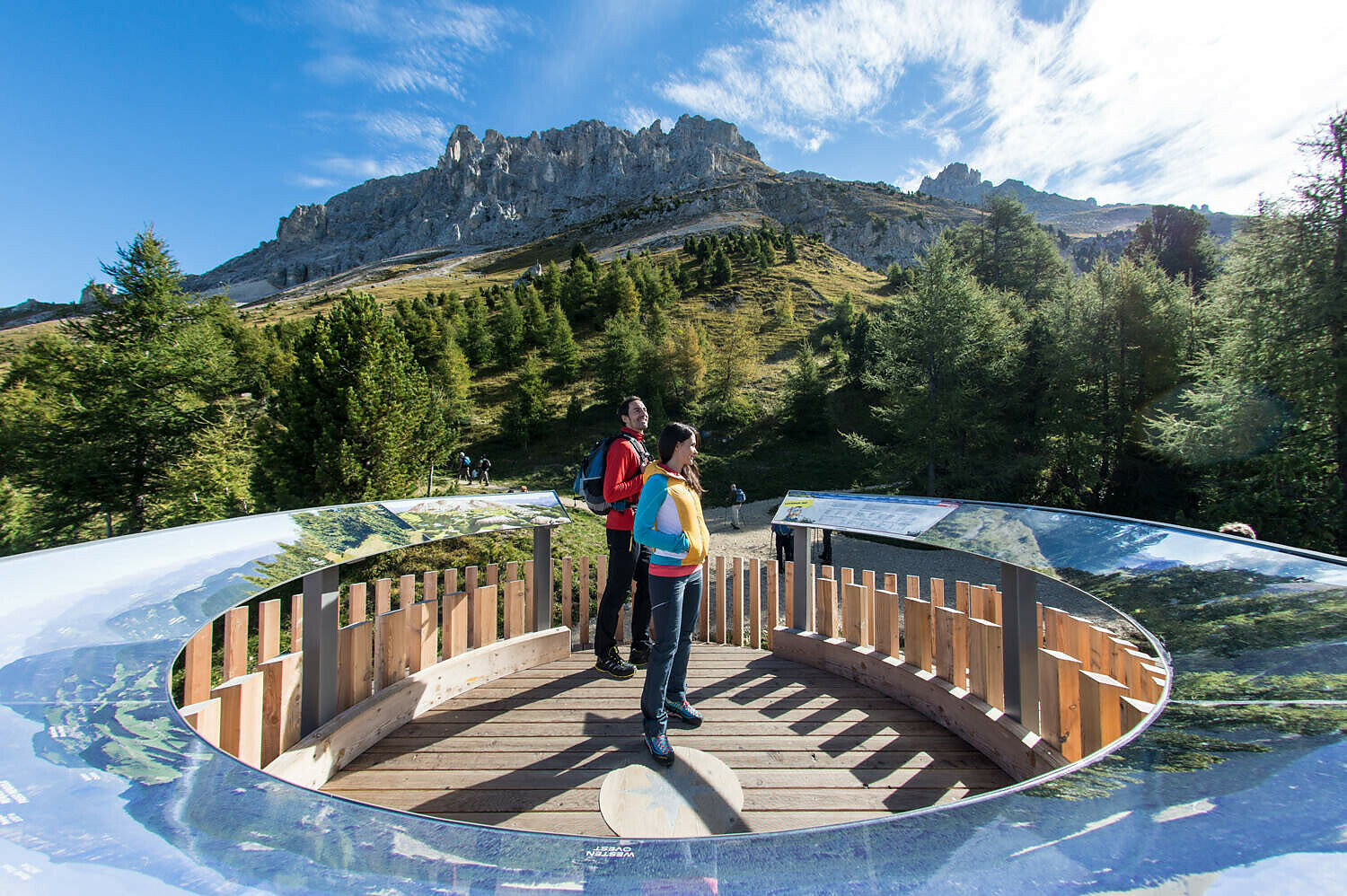
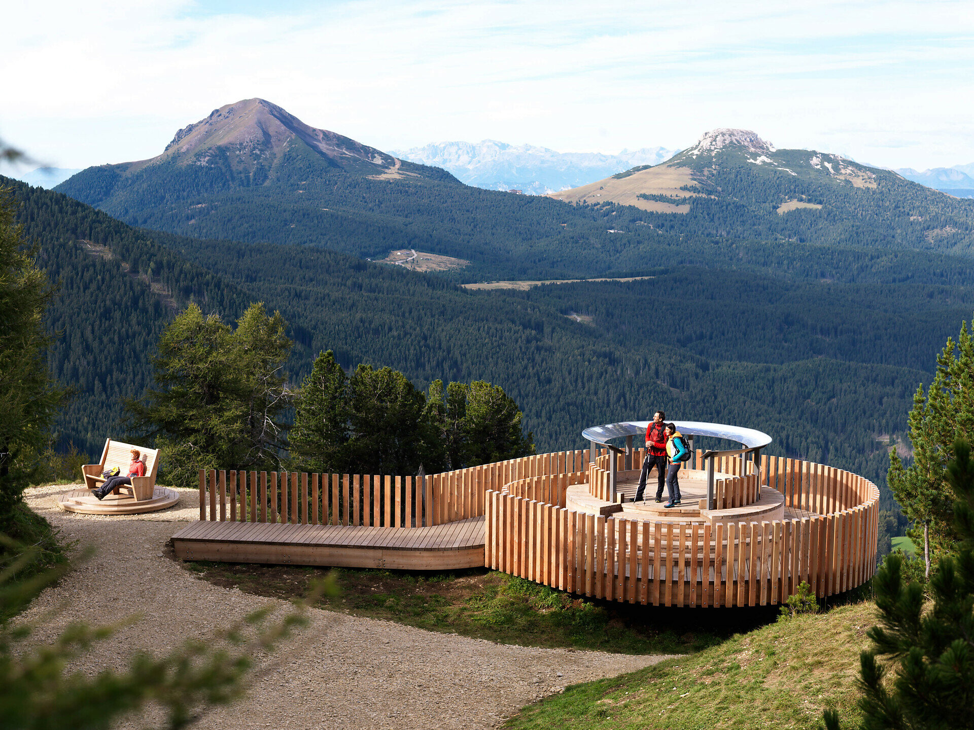
Short hike, big views: To LATEMAR.360° with Dolomite panoramas and clear info panels. Perfect for families, nature lovers and casual hikers.

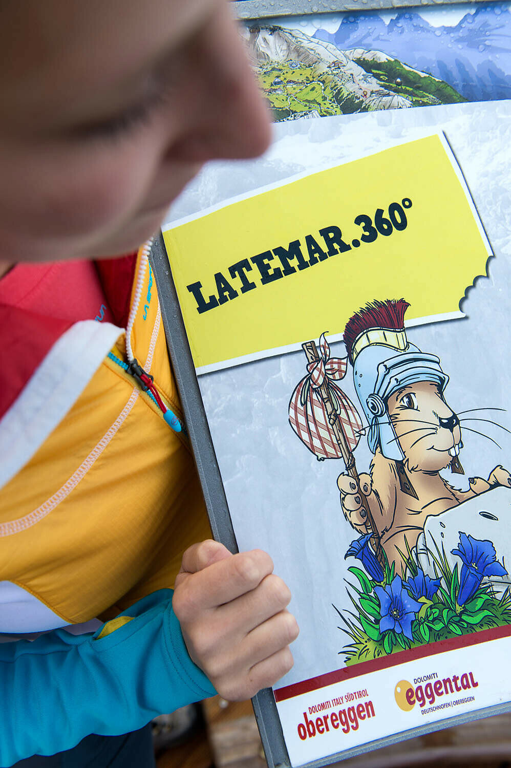
The short hike to the LATEMAR.360° panoramic platform is a must for families and nature lovers alike. From the top station of the Oberholz panoramic chairlift, an easy, well-maintained trail leads in just a few minutes to one of the most impressive viewpoints in the region. At 2,200 m altitude, the 360° view opens up across the Dolomites – from the jagged Latemar peaks to the Rosengarten, Schlern and even the Zillertal Alps in the distance. Large, informative panels explain the surrounding mountains, making this a fun and educational stop for children and curious hikers. With its easy access, stunning scenery and informative design, LATEMAR.360° is a perfect destination for all ages.

Tags
  • Out and back
  • Family-friendly
Route info
Easy
Distance
1,0 km
Activity time
25 min
Ascent
86 m
Descent
89 m
Physical effort
Scenary
Highest point
2.169 m
Lowest point
2.080 m
You might be interested in
Discover related tours
Welschnofen
Du parking du Kaiserstein au refuge Masarè
Distance 1,5 km
Activity time 39 min
Ascent 189 m
Descent 0 m
Status
closed
Welschnofen
Randonnée familiale en circuit depuis l'hôtel Moseralm jusqu'aux prairies de Frin et à l'Ochsenhütte
Distance 6,6 km
Activity time 1 h 58 min
Ascent 267 m
Descent 267 m
Intermediate
Add to favourites
Steinegg
Chemin des pyramides à Steinegg
Distance 5,7 km
Activity time 1 h 52 min
Ascent 355 m
Descent 355 m
Intermediate
Add to favourites
Deutschnofen
Randonnée à travers les gorges du Bletterbach
Distance 11,5 km
Activity time 4 h 00 min
Ascent 588 m
Descent 588 m
Welschnofen
De la Frommer Alm au lac Karer
Distance 5,6 km
Activity time 1 h 31 min
Ascent 97 m
Descent 275 m
Status
closed
Deutschnofen
LATEMAR.ADVENTURE : La colère de Vaia
Distance 2,5 km
Activity time 2 h 00 min
Ascent 177 m
Descent 39 m