- Family-friendly
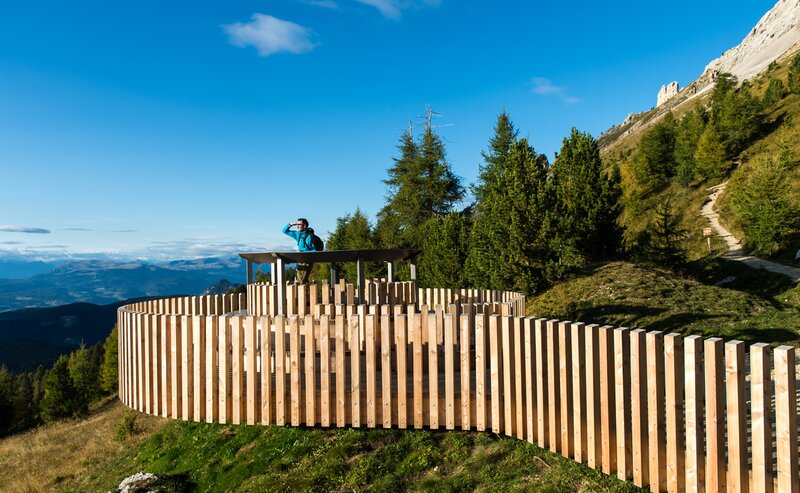
The hike begins at the top station of the Oberholz chairlift in Obereggen. From there, follow trail [18] to the spectacular Latemar.360° platform with 360° views of the UNESCO Dolomites. Continue along trail [22] to reach the Eggental Mountain Cinema, a unique viewing spot with large wooden loungers and an unforgettable alpine panorama. The trail continues to the junction above the Absam-Maierl lift station, then leads down to the cozy Mayrl Alm, perfect for a break. The return follows trail [23], which leads past a variety of educational nature stations back to the Oberholz top station. The entire loop is well signposted, scenic, and suitable for families.
By public bus line:
- 181 from Bozen | Bolzano
- 180 and change 181 from Karersee | Lago di Carezza, Karerpass | Passo Costalunga, Welschnofen | Nova Levante
- 184 or 181 from Deutschnofen | Ponte Nova, Stenk
- 184 from Eggen | Ega, Obereggen
- 181 or 184 from Weissenstein | Pietralba, Petersberg | Monte San Pietro
- 182 and change 181 from Steinegg | Collepietra, Gummer | San Valentino
- 180 and change 181 from Val di Fassa
Bus stop: Obereggen; online timetable search at www.suedtirolmobil.info/en/
Location: Mountain Cinema - Latemar.Natura (https://goo.gl/maps/TgaiZsXjt3UDiWm6A)
By public bus line:
- 181 from Bozen | Bolzano
- 180 and change 181 from Karersee | Lago di Carezza, Karerpass | Passo Costalunga, Welschnofen | Nova Levante
- 184 or 181 from Deutschnofen | Ponte Nova, Stenk
- 184 from Eggen | Ega, Obereggen
- 181 or 184 from Weissenstein | Pietralba, Petersberg | Monte San Pietro
- 182 and change 181 from Steinegg | Collepietra, Gummer | San Valentino
- 180 and change 181 from Val di Fassa
Bus stop: Deutschnofen | Nova Ponente, Bar Luise; online timetable search at www.suedtirolmobil.info/en/
By car:
Destination: Deutschnofen | Nova Ponente, Laab Alm Hut
Parking: Parking lot Laab Alm Hut
Location: Mountain Cinema - Latemar.Natura (https://goo.gl/maps/TgaiZsXjt3UDiWm6A)
Location: Mountain Cinema - Latemar.Natura (https://goo.gl/maps/TgaiZsXjt3UDiWm6A)


