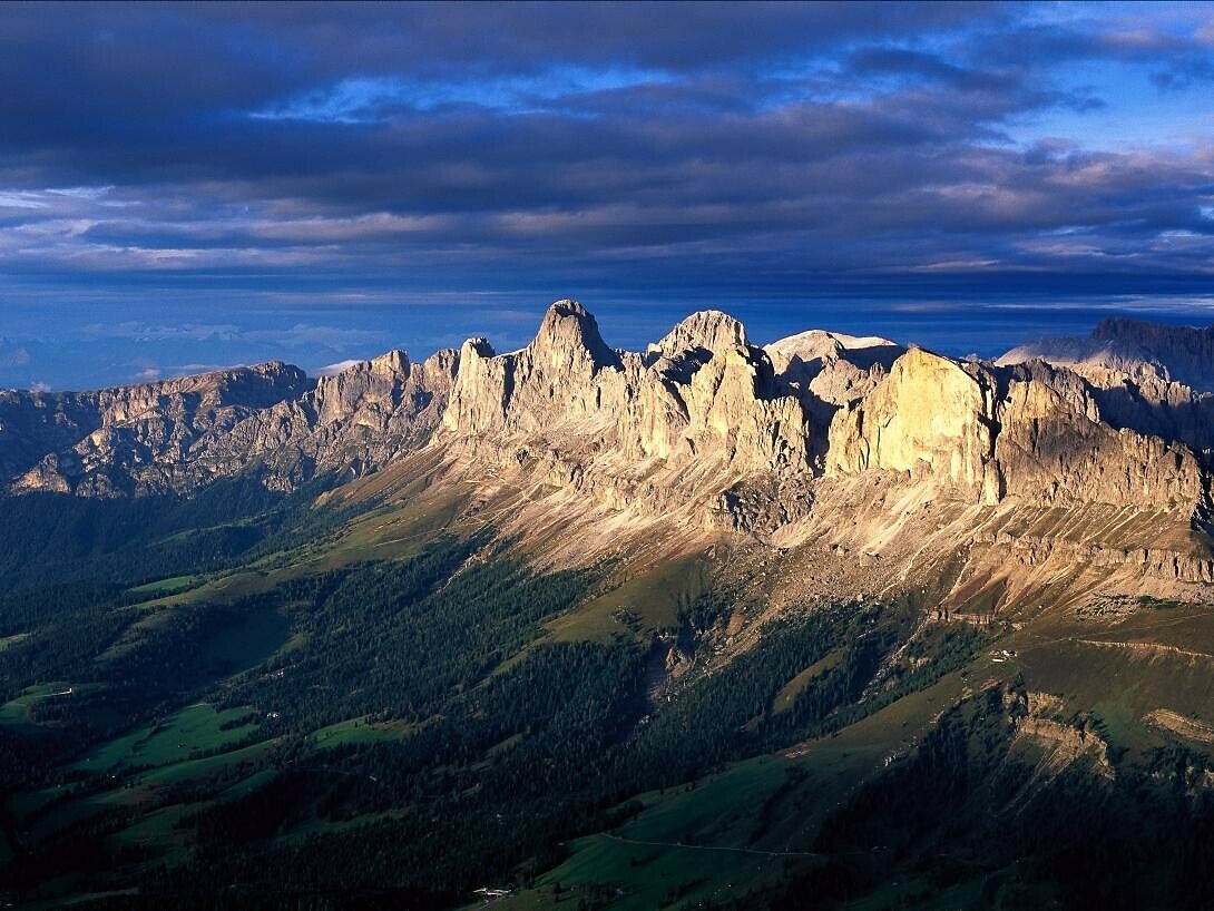
Multi-Day hike from the Catinaccio to the Sciliar

Karersee, Welschnofen
Add to favourites
Category
Difficulty
Difficult
Activity time
17:49
Duration in hours
Distance
49.3
Distance in km
Status
closed
Suggested period
Jan
Feb
Mar
Apr
May
Jun
Jul
Aug
Sep
Oct
Nov
Dec

Challenging and unique multi-day hike from the area of the Catinaccio to the area of the Sciliar.

Route info
Difficult
Distance
49,3 km
Activity time
17 h 49 min
Ascent
4.209 m
Descent
4.209 m
Technical skills
Physical effort
Scenary
Highest point
2.726 m
Lowest point
1.060 m
Directions

The starting place of the four-day hike is Nova Levante in the Val d'Ega. The hike takes to the Baita Messnerjoch Hütte then the signposted detour of path [1] goes to the famous Hirzelsteig trail (path masaré). The trail leads to the well-known Christomannos monument and the first overnight accommodation, the Rif. Roda di Vael.

The second stage of the multi-day hike leads to the Rif. Vajolet, the second accommodation. After the Check-in an ascent to the Passo Santner and the hut of the same name is possible.

The third stage starts with the crossing of the Passo Principe to the Alpe di Tires and to the Rif. Bolzano. The final effort to reach the peak of the Sciliar, the Monte Petz opens up a beautiful panorama to the surrounding mountains.

The fourth day begins with the descent from the sella Cavaccio trough the Orsara to San Cipriano. The valle Nigra path brings to the Passo Nigra and also back to the starting point Nova Levante.

General information:
The tour takes four days with three overnight stays. It is recommended to book the accommodation even before. The multi-day hike does not contain any fixed rope routes. 
Necessary conditions for the tour: good stamina, alpine experience, head for heights and an appropriate equipment. 
The indicated duration of the hike are an average value for small groups up to 4 people and indicate only the time for the route without stays. 
In bad weather periods the multi-day hike is not recommended.

public transportation

Getting to the starting point of the tour by public transport is easy and convenient.

By public bus line:
- 180 from Bozen | Bolzano, Birchabruck | Ponte Nova
- 180 or 184 from Karersee | Carezza, Karerpass | Passo Costalunga
- 184 from Weissenstein | Pietralba, Petersberg | Monte San Pietro, Deutschnofen | Nova Ponente, Stenk (or 181 and change 180)
- 184 from Obereggen, Eggen | Ega (or 184 and change 180)
- 187 from Steinegg | Collepietra, Gummer | San Valentino (or 182 and change 180)
- 180 from Val di Fassa

Bus stop: Welschnofen | Nova Levante centre (Despar); online timetable search at www.suedtirolmobil.info/en/

How to get there

Getting to the starting point of the tour by public transport is easy and convenient.

By public bus line:
- 180 from Bozen | Bolzano, Birchabruck | Ponte Nova
- 180 or 184 from Karersee | Carezza, Karerpass | Passo Costalunga
- 184 from Weissenstein | Pietralba, Petersberg | Monte San Pietro, Deutschnofen | Nova Ponente, Stenk (or 181 and change 180)
- 184 from Obereggen, Eggen | Ega (or 184 and change 180)
- 187 from Steinegg | Collepietra, Gummer | San Valentino (or 182 and change 180)
- 180 from Val di Fassa

Bus stop: Welschnofen | Nova Levante centre (Despar); online timetable search at www.suedtirolmobil.info/en/

By car:
Destination: Welschnofen | Nova Levante
Parking: Parking lot cable car

Where to park

Parking: parking lot cable car Welschnofen | Nova Levante Laurin I, https://g.page/Kabinenbahn?share

You might be interested in
Discover related tours
Karersee, Welschnofen
Multi-Day hike from the Catinaccio to the Sciliar - 4. Stage
Distance 16,8 km
Activity time 6 h 24 min
Ascent 772 m
Descent 2.064 m
Status
closed
Intermediate
Add to favourites
Karersee, Obereggen, Steinegg, Welschnofen, Deutschnofen
Multi-day Hike - Alpine Pearls
Distance 86,1 km
Activity time 28 h 32 min
Ascent 3.606 m
Descent 3.606 m
Status
closed
Intermediate
Add to favourites
Karersee, Welschnofen, Deutschnofen
Multiday Hike - Alpine Pearls - 3. stage
Distance 13,6 km
Activity time 3 h 54 min
Ascent 404 m
Descent 610 m
Status
closed
Intermediate
Add to favourites
Welschnofen, Karersee
Multi day trekking "Sentiero Italia" - Stage: Rif. Fronza A. Coronelle-San Cipriano (Tires)
Distance 14,2 km
Activity time 3 h 50 min
Ascent 236 m
Descent 1.562 m
Status
closed
Intermediate
Add to favourites
Obereggen, Deutschnofen
Multiday Hike - Alpine Pearls - 4. stage
Distance 22,6 km
Activity time 6 h 30 min
Ascent 666 m
Descent 879 m
Status
closed
Intermediate
Add to favourites
Karersee, Obereggen, Welschnofen, Deutschnofen
Dolomites World Heritage Geotrail II - stage 2: from the Lavazèjoch Pass to the Karer Pass
Distance 21,4 km
Activity time 6 h 24 min
Ascent 842 m
Descent 879 m
Status
closed