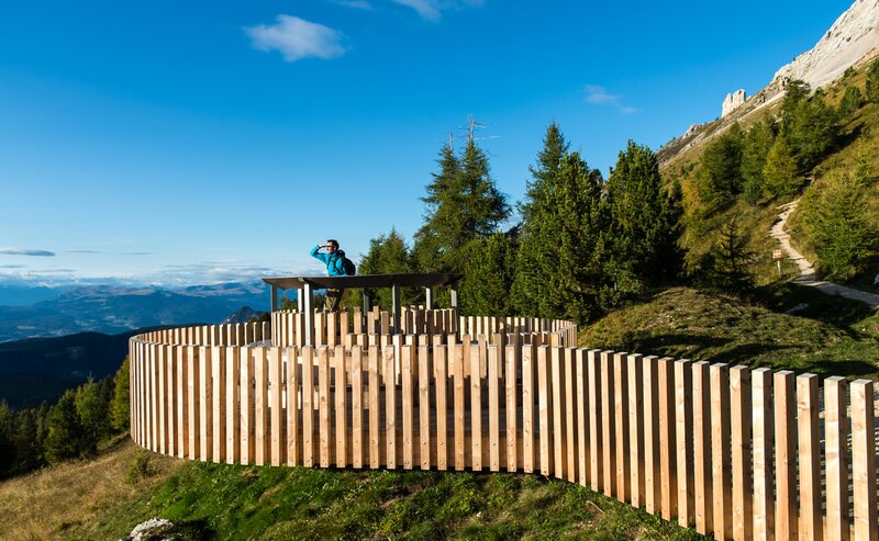
The alpine loop hike at Passo Oclini offers a scenic and relaxing nature experience for all ages. This well-marked trail leads through peaceful alpine meadows and quiet forests, with breathtaking views of the White Horn, Black Horn, and Zanggen mountain. Along the way, cozy mountain huts invite hikers to take a break and enjoy traditional South Tyrolean dishes. The route is perfect for families, leisure hikers, and anyone looking to enjoy the serene beauty of the South Tyrolean landscape at a comfortable pace. A highlight of this circular hike is the panoramic view over the surrounding peaks and the colorful alpine flora.
The starting point of this loop hike is the Auerleger Alm parking area, easily accessible by car and located at the Lavazè Pass / Passo Oclini.
From the parking lot, follow trail [2] to Jochgrimm. The route continues to Gurndin Alm, then along trail [12A] to the charming Isi Hut.
Return via trail [7], which winds through peaceful alpine pastures back to Jochgrimm and the Auerleger Alm.
Getting to the starting point of the tour by public transport is easy and convenient.
By public bus line:- 180 from Bozen | Bolzano
- 180 or 184 from Karersee | Lago di Carezza, Karerpass | Passo Costalunga, Welschnofen | Levante
- 184 from Birchabruck | Ponte Nova, Stenk, Eggen | Ega, Obereggen
- 184 from Weissenstein | Pietralba, Petersberg |Monte San Pietro, Deutschnofen | Nova Ponente
- 182 from Steinegg | Collepietra, Gummer | San Valentino
- 180 from Val di Fassa
Bus stop: Jochgrimm |Passo Oclini; online timetable search at www.suedtirolmobil.info/en/
Meeting point: Parking lot Malga Ora: https://goo.gl/maps/UwWfytu3jmCJTRhM6
Getting to the starting point of the tour by public transport is easy and convenient.
By public bus line:
- 180 from Bozen | Bolzano
- 180 or 184 from Karersee | Lago di Carezza, Karerpass | Passo Costalunga, Welschnofen | Nova Levante
- 184 from Birchabruck | Ponte Nova, Stenk, Eggen | Ega, Obereggen
- 184 from Weissenstein | Pietralba, Petersberg |Monte San Pietro, Deutschnofen | Nova Ponente
- 182 from Steinegg | Collepietra, Gummer | San Valentino
- 180 from Val di Fassa
Bus stop: Jochgrimm |Passo Oclini; online timetable search at www.suedtirolmobil.info/en/
By car:
Destination: Jochgrimm | Passo Oclini - Malga Ora
Parking: parking lot Malga Ora
Meeting point: Parking lot Malga Ora: https://goo.gl/maps/UwWfytu3jmCJTRhM6
Meeting point: Parking lot Malga Ora: https://goo.gl/maps/UwWfytu3jmCJTRhM6


