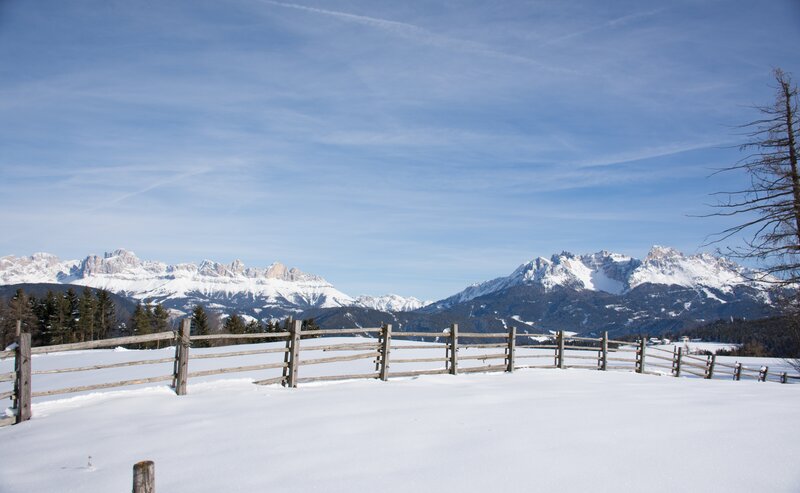
A walk that speaks to the soul: Starting from the well-known pilgrimage site of Maria Weissenstein, this peaceful path leads through meadows, forested sections, and quiet countryside to the small settlement of St. Leonhard. The route is easy and suitable for anyone seeking tranquility, reflection, or a gentle way to experience nature.
Along the way, you’ll enjoy scenic views of the Eggental landscape, pass by traditional farmhouses, and experience a rare, calming silence. Blending nature, local culture and a touch of spirituality, this walk offers a truly meaningful experience – perfect for families, seniors, and mindful wanderers.
- Out and back
- Family-friendly
The walk begins at the pilgrimage site Maria Weissenstein at 1,520 m altitude.
From the parking area or the monastery itself, follow the well-marked trail [4]. The route leads through a peaceful forest and then opens into wide meadows with scenic views of the Eggental area.
After about 1.5 km, you reach the settlement of St. Leonhard, located at approximately 1,460 m.
The route is around 2 km long, gently downhill, and takes about 40 minutes. You can return via the same path or continue on a longer loop if desired.
Getting to the starting point of the tour by public transport is easy and convenient.
By public bus line:
- 180 or 181 from Bozen | Bolzano
- 180 or 184 from Karersee | Lago di Carezza, Karerpass | Passo Costalunga, Welschnofen | Nova Levante
- 184 from Birchabruck | Ponte Nova, Stenk, Eggen | Ega
- 184 from Petersberg | Monte San Pietro, Deutschnofen | Nova Ponente
- 182 from Steinegg | Collepietra, Gummer | San Valentino
- 180 from Val di Fassa
Bus stop: Weissenstein | Pietralba; online timetable search at www.suedtirolmobil.info/en/
Meeting point: Weissenstein | Pietralba: https://goo.gl/maps/BNSP7XGxA78ptriZ7
Getting to the starting point of the tour by public transport is easy and convenient.
By public bus line:
- 180 or 181 from Bozen | Bolzano
- 180 or 184 from Karersee | Lago di Carezza, Karerpass | Passo Costalunga, Welschnofen | Nova Levante - 184 from Birchabruck | Ponte Nova, Stenk, Eggen | Ega
- 184 from Petersberg | Monte San Pietro, Deutschnofen | Nova Ponente
- 182 from Steinegg | Collepietra, Gummer | San Valentino
- 180 from Val di Fassa
Bus stop: Weissenstein | Pietralba; online timetable search at www.suedtirolmobil.info/en/
Meeting point: Weissenstein | Pietralba: https://goo.gl/maps/BNSP7XGxA78ptriZ7
By car:
Destination: Weissenstein | Pietralba
Parking: Parking lot Weissenstein | Pietralba
Meeting point: Weissenstein | Pietralba: https://goo.gl/maps/BNSP7XGxA78ptriZ7
Parking: Parking lot Weissenstein | Pietralb
Meeting point: Weissenstein | Pietralba: https://goo.gl/maps/BNSP7XGxA78ptriZ7


