Top

Winter Hike Bühl

Deutschnofen
Add to favourites
Category
Difficulty
Intermediate
Activity time
1:55
Duration in hours
Distance
7.4
Distance in km
WSEN
Suggested period
Jan
Feb
Mar
Apr
May
Jun
Jul
Aug
Sep
Oct
Nov
Dec
Scenic circular winter hike near Deutschnofen – perfect for nature lovers and those seeking peaceful alpine landscapes.
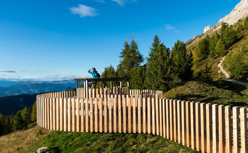
The winter circular hike around Bühl offers a peaceful nature experience above Deutschnofen, surrounded by snowy forests and open meadows. Gently winding paths lead through a silent winter wonderland, revealing stunning panoramic views of the Dolomites, especially the majestic Latemar. The crisp mountain air, the crunch of snow underfoot, and the serene silence of the landscape create a deeply relaxing atmosphere. Perfect for those seeking calm, inspiration, and a mindful connection with nature – whether hiking solo, as a couple, or with the family. Along the way, sunny spots invite you to pause and soak in the magic of South Tyrol's winter beauty.
Route info
Intermediate
Distance
7,4 km
Activity time
1 h 55 min
Ascent
130 m
Descent
158 m
Technical skills
Physical effort
Scenary
Highest point
1.456 m
Lowest point
1.342 m
Directions

The hike starts in the village center of Deutschnofen. Follow trail [1] toward the Arche bar/parking area. Just before the parking lot, turn right toward Hotel Pfösl. This is where the panoramic trail begins, leading you toward Bühl with stunning views of the Dolomites. From Bühl, follow trail [1] back toward Arche and return to the village center.

public transportation

Getting to the starting point of the tour by public transport is easy and convenient.

By public bus line:
- 181 from Bozen | Bolzano
- 180 or 184 from Karersee | Lago di Carezza, Karerpass | Passo Costalunga, Welschnofen | Nova Levante
- 184 or 181 from Birchabruck | Ponte Nova
- 184 from Stenk, Eggen | Ega, Obereggen
- 184 or 181 from Weissenstein | Pietralba, Petersberg | Monte San Pietro, Deutschnofen | Nova Ponente
- 182 from Steinegg | Collepietra, Gummer | San Valentino
- 180 from Val di Fassa

Bus stop: Deutschnofen | Nova Ponente Church; online timetable search at www.suedtirolmobil.info/en/
Meeting point: Parking lot : https://goo.gl/maps/UwWfytu3jmCJTRhM6

How to get there

Getting to the starting point of the tour by public transport is easy and convenient.

By public bus line:
- 181 from Bozen | Bolzano
- 180 or 184 from Karersee | Lago di Carezza, Karerpass | Passo Costalunga, Welschnofen | Nova Levante
- 184 or 181 from Birchabruck | Ponte Nova
- 184 from Stenk, Eggen | Ega, Obereggen
- 184 or 181 from Weissenstein | Pietralba, Petersberg | Monte San Pietro, Deutschnofen | Nova Ponente
- 182 from Steinegg | Collepietra, Gummer | San Valentino
- 180 from Val di Fassa

Bus stop: Deutschnofen | Nova Ponente Church; online timetable search at www.suedtirolmobil.info/en/
Meeting point: Parking lot : https://goo.gl/maps/UwWfytu3jmCJTRhM6

By car:
Destination: Deutschnofen | Nova Ponente
Parking: parking lot Gibitz
Meeting point: Parking lot Gibitz square Deutschnofen | Nova Ponente: https://goo.gl/maps/UwWfytu3jmCJTRhM6
Where to park

Parking: parking lot Gibitz
Meeting point: Parking lot Gibitz square Deutschnofen | Nova Ponente: https://goo.gl/maps/UwWfytu3jmCJTRhM6

You might be interested in
Discover related tours
Welschnofen
Winter hike from the Paolina car park to Lake Carezza
Distance 2,0 km
Activity time 29 min
Ascent 0 m
Descent 91 m
Intermediate
Add to favourites
Welschnofen
Winter hike on the Sissi Promenade in Karersee | Carezza
Distance 10,8 km
Activity time 2 h 58 min
Ascent 159 m
Descent 159 m
Welschnofen
Long winter circular hike at Lake Carezza
Distance 5,4 km
Activity time 1 h 30 min
Ascent 129 m
Descent 129 m
Deutschnofen
Winter Hike from Obereggen to the Eggentaler Almen
Distance 11,3 km
Activity time 3 h 40 min
Ascent 524 m
Descent 524 m
Intermediate
Add to favourites
Deutschnofen
Winter hike from the Laab hut to the Neuhütt hut
Distance 5,6 km
Activity time 1 h 35 min
Ascent 140 m
Descent 140 m
Intermediate
Add to favourites
Deutschnofen
Winter hike from Eggen/Ega to the Grotthof
Distance 4,0 km
Activity time 1 h 25 min
Ascent 183 m
Descent 182 m