Top

Family walking tour from Lake Carezza to the Stadl Alm hut

Welschnofen
Add to favourites
Difficulty
Easy
Activity time
1:04
Duration in hours
Distance
4.2
Distance in km
Suggested period
Jan
Feb
Mar
Apr
May
Jun
Jul
Aug
Sep
Oct
Nov
Dec
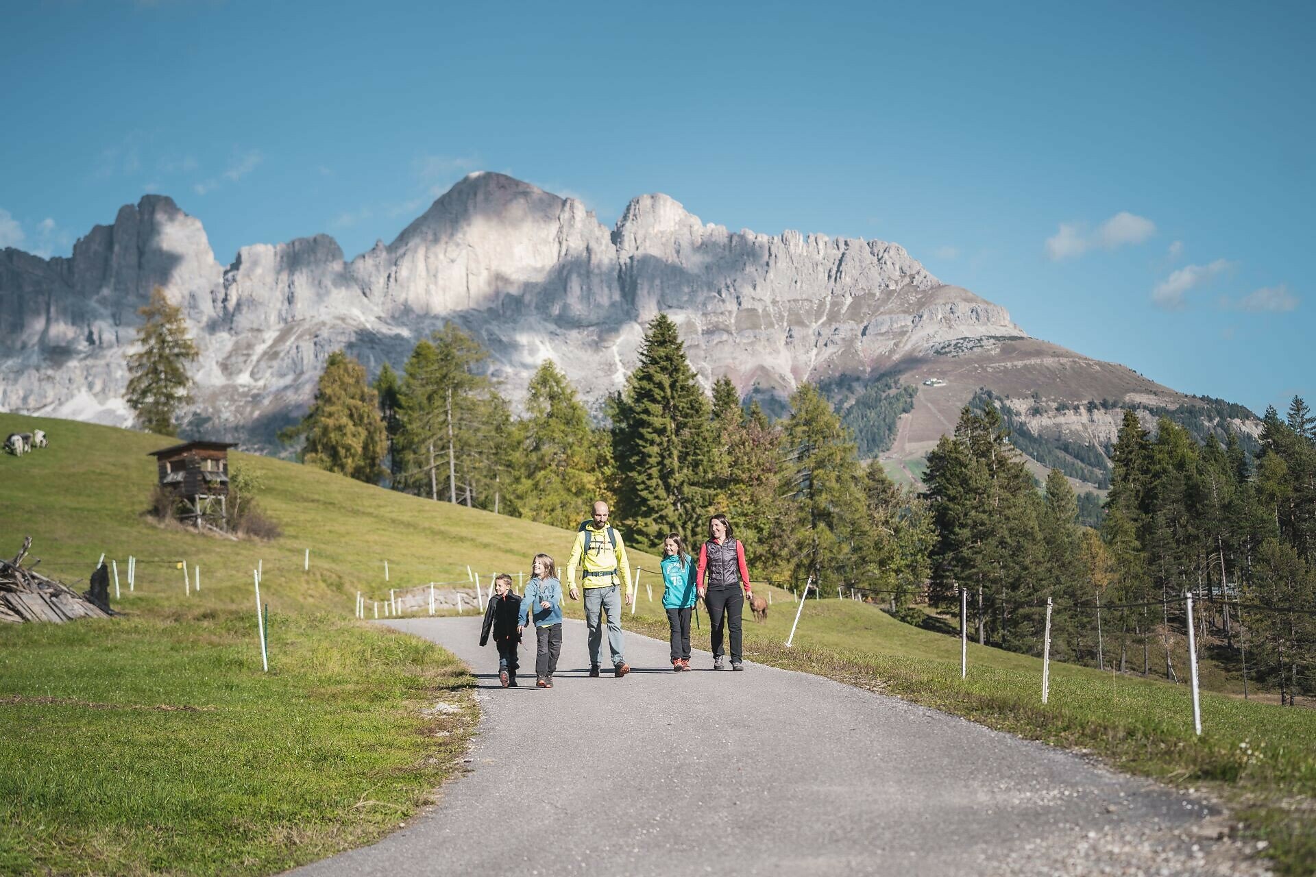
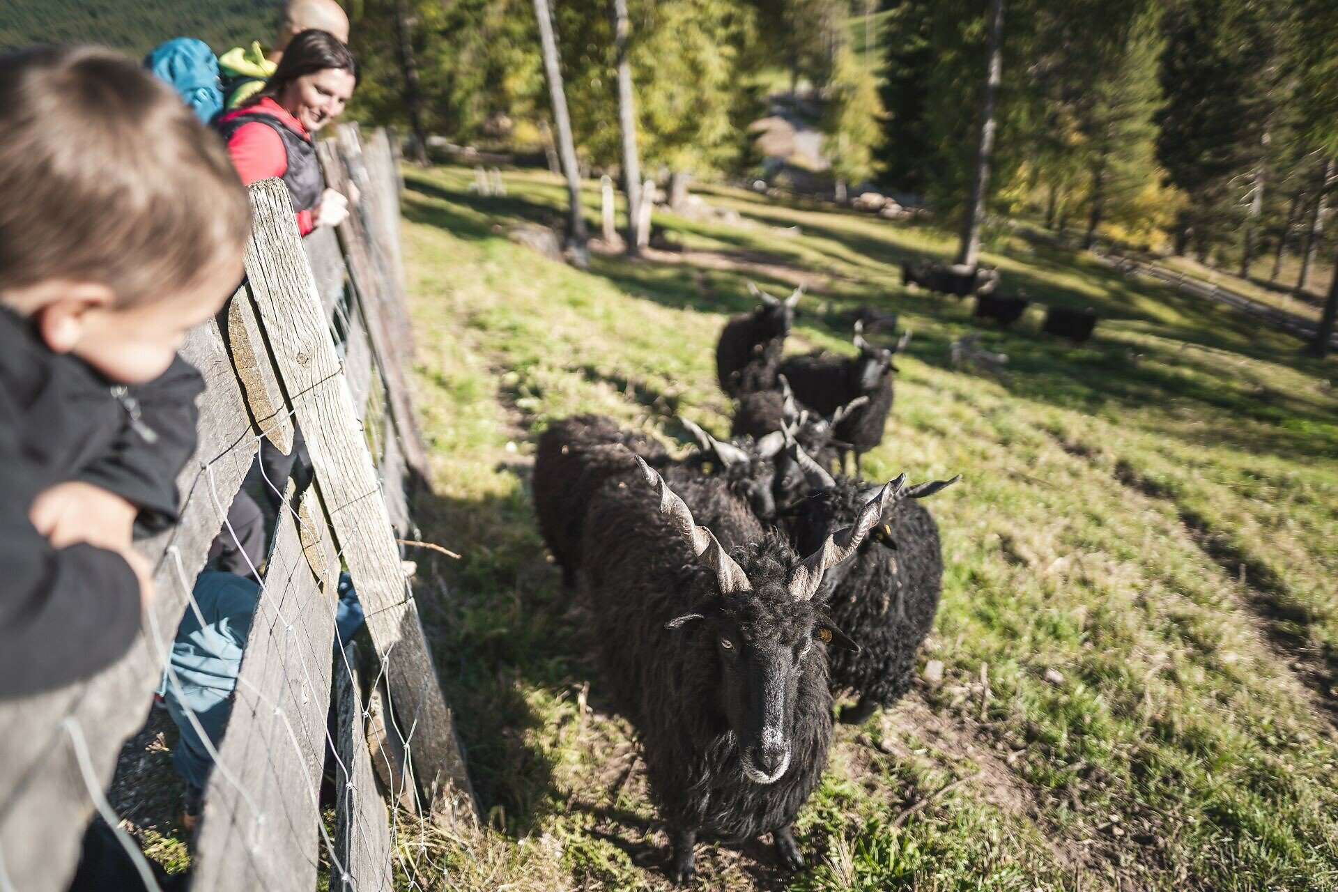
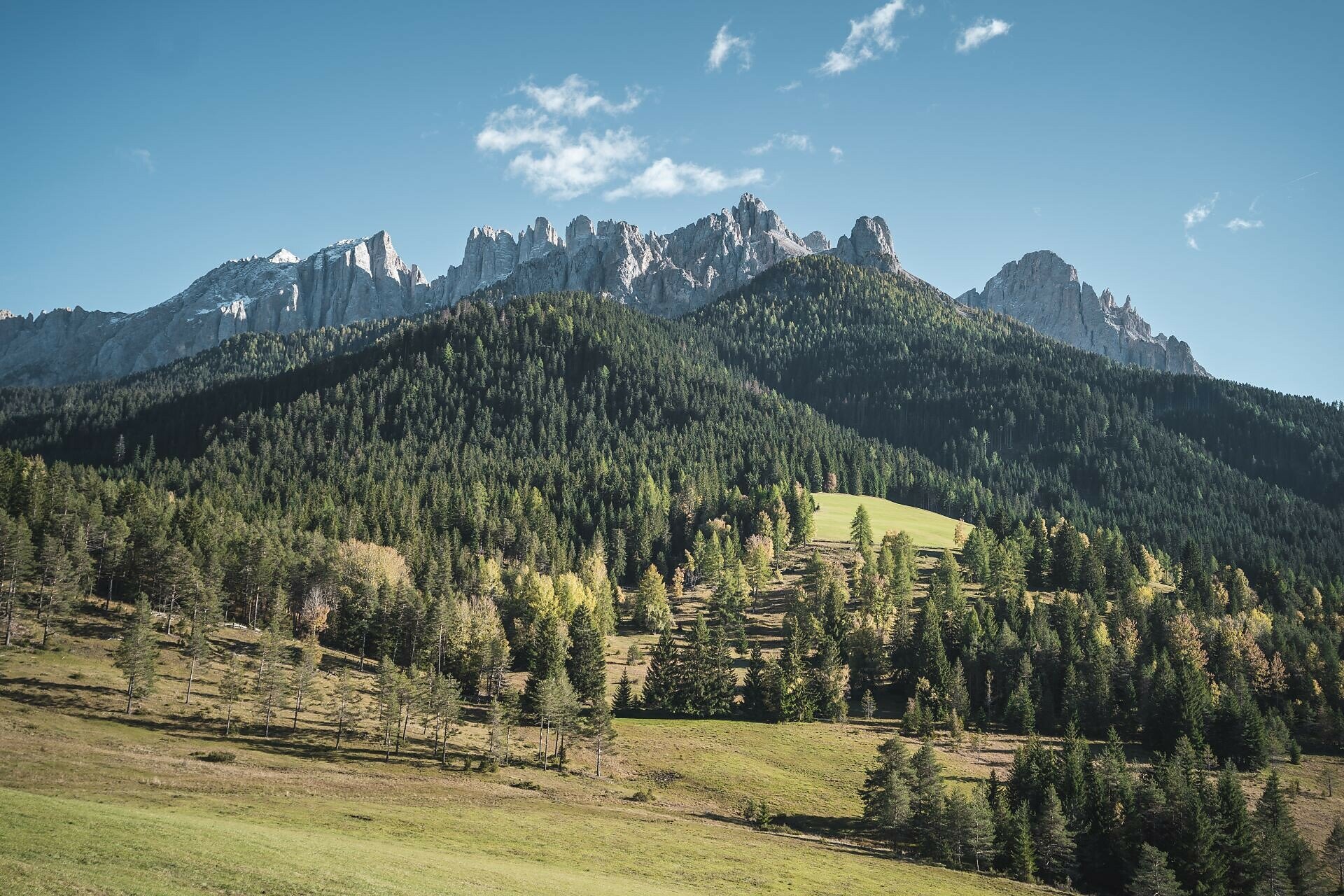
Buggy-friendly family hike to the Stadl Alm with animals, playground, panorama and South Tyrolean cuisine – an experience for young and old at the foot of Rosengarten and Latemar.

The many farm animals and a great playground make this hike an unforgettable experience, especially for children. This leisurely family hike to the Stadl Alm hut, at the foot of the majestic Rosengarten | Catinaccio and Latemar peaks, is a must thanks to its breathtaking views of the Dolomites. For refreshment, both young and old can enjoy seasonal and farm-fresh products, hearty game dishes, and traditional South Tyrolean cuisine.

ds_event.sidebar.tags
  • Suitable for strollers
  • Family-friendly
Route info
Easy
Distance
4,2 km
Activity time
1 h 04 min
Ascent
30 m
Descent
92 m
Physical effort
Scenary
Highest point
1.547 m
Lowest point
1.465 m
Suggestions
Refreshment stops:
Directions

The hike starts at the Lake Carezza (Karer See | Lago di Carezza) parking lot (1,519 m). From there, the path goes through the underpass and then along the right side of the lake to the Templ path [8]. Follow the wide forest road [8] to the turnoff to the Stadl Alm hut. Continue on paths [25A] and [25] until you reach Stadl Alm, where a playground, petting zoo, and lawn area await both young and old (the hut is only open in summer). The path is suitable for baby-buggies.

Refreshment stops:

public transportation
Getting to the starting point of the tour by public transport is easy and convenient.

By public bus line:
- 180 from Bozen | Bolzano, Birchabruck | Ponte Nova
- 180 or 184 from Karerpass | Passo Costalunga
- 184 from Weissenstein | Pietralba, Petersberg | Monte San Pietro, Deutschnofen | Nova Ponente, Stenk (or 181 and change 180)
- 184 from Obereggen, Eggen | Ega (or 184 and change 180)
- 187 from Steinegg | Collepietra, Gummer | San Valentino (or 182 and change 180)
- 180 from Val di Fassa

Bus stop: Karer See | Lago di Carezza. Online timetable search at www.suedtirolmobil.info/en/

How to get there
Getting to the starting point of the tour by public transport is easy and convenient.
 
By public bus line:
- 180 from Bozen | Bolzano, Birchabruck | Ponte Nova, Welschnofen | Nova Levante
- 180 from Fassatal | Val di Fassa, Karer Pass | Passo Costalunga, Karersee | Carezza
- 184 from Weissenstein | Pietralba, Petersberg | Monte San Pietro, Deutschnofen | Nova Ponente, Stenk with change 180 (or 181 and change 180)
- 184 from Obereggen, Eggen | Ega with change 180 (or 184 and change 180)
- 186 from St. Zyprian | S. Cipriano, Nigerpass | Passo Nigra with change 180
- 187 from Steinegg | Collepietra, Gummer | San Valentino with change 180 (or 182 and change 180)

Bus stop: Karer See | Lago di Carezza. Online timetable search at www.suedtirolmobil.info/en/

By car: 
Destination: Karersee | Carezza
Parking: Parking lot Karer See | Lago di Carezza
Where to park
Parking: Parking lot Karer See | Lago di Carezza (with costs): https://goo.gl/maps/w4SVXQJJyxtUaLdUA
You might be interested in
Discover related tours
Obereggen
Summer hike from Baita Gardonè into the dragon forest
Distance 1,5 km
Activity time 25 min
Ascent 32 m
Descent 43 m
Welschnofen
Randonnée familiale de Jolanda à la cabane Messnerjoch
Distance 4,0 km
Activity time 1 h 11 min
Ascent 152 m
Descent 152 m
Deutschnofen
Circular family-hike at Jochgrimm/Passo Oclini
Distance 5,3 km
Activity time 1 h 30 min
Ascent 166 m
Descent 166 m
Intermediate
Add to favourites
Deutschnofen
Hike through the Bletterbachschlucht Gorge
Distance 11,5 km
Activity time 4 h 00 min
Ascent 588 m
Descent 588 m
Intermediate
Add to favourites
Deutschnofen, Welschnofen
Hike from Obereggen to Lake Carezza via the path "Templweg"
Distance 13,2 km
Activity time 3 h 30 min
Ascent 169 m
Descent 171 m
Intermediate
Add to favourites
Deutschnofen
Hike to the Eggentaler Almen Alpine Pastures
Distance 10,9 km
Activity time 3 h 25 min
Ascent 454 m
Descent 455 m