Through an oversized old camera at the beginning of the trail, you start or zoom yourself directly into the universe, so to speak. On the way, you will test a date sundial and a rotating star map, pass the observatory and solar observatory, learn how to orientate yourself in the night sky, children can let off steam in the rocket tree house and finally you will end up at the Mini Star Trail in Steinegg | Collepietra, which is illuminated in the evening in the correct colours of the respective stars.
Possibilities for a break:
- at the farm Untereggerhof at the observatory after 3.5 km (approx. 1 1 /2 hours) from Gummer|S.Valentino
- in the village of Steinegg|Collepietra at the end of the Path of the Stars you will find two local shops and various places to stop for a break:
- Gasthof Pizzeria Unterwirt
- Hotel Berghang
- Hotel Steineggerhof
Video Path of the stars
- Linear route
- Family-friendly
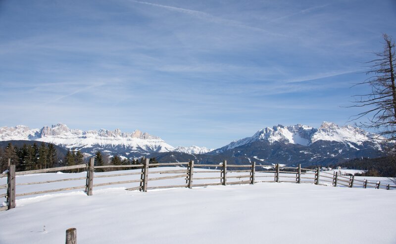
Always on trail [1B] you also reach station 3 with a rotating star map. Continuing along this path, you reach the observatory (station 4) in Obergummer with a wonderful panorama and a unique view of the Latemar Dolomite massif. Here you also have the possibility to stop at the farm Untereggerhof Inn.
Continue along path [5] in the direction of the farm Tschigg and the Pluto planetary station. Cross the Tschiggermoor to reach the idyllically situated "Kaserer Bild" chapel. Here, turn right briefly via path [4]. Turn left at the Soluck car park and continue along the Steinegg Hiking Path [marked yellow shoe]. Cross the Streitmoos to the junction with path [6]. Turn right here and continue along path [6]. Follow the signs for ‘Path of the stars’, keep left above the Kummerhof farm and after a short stretch, take the path [7] on the right to reach the Spitzköfele viewing platform with station 5 (Polarstar as an orientation aid). Descend via trail [8A], then right on trail [8] to trail [2A]. Turn left here to the Rocket Tree House (Station 6). Take trail [2] to Steinegg | Collepietra. Here the Mini Star Trail starts at the main road up to the school (station 7).
In the village of Steinegg|Collepietra you will find two local shops and several places to stop for refreshments.
The way back is via the same path.
It is easy to return by public transport (bus line 182 or 187).
By public bus line
- 182 from Bozen|Bolzano and Steinegg|Collepietra
- 180 from Welschnofen|Nova Levante, Karersee|Lago di Carezza, Karerpass|Passo Costalunga, Val di Fassa*
- 184 from Oberggen, Eggen|Ega*
- 181 from Weissenstein|Pietralba, Petersberg|Monte San Pietro, Deutschnofen|Nova Pontente, Stenk*
*change in Birchabruck | Ponte Nova to the line 182
Bus stop: Gummer|S.Valentino Dorf|Paese
online timetable search at South Tyrol Mobility
Starting point: the hike along the Path of the Stars starts a bit above the bus stop.
Getting to the starting point of the tour by public transport is easy and convenient.
By public bus line
- 182 from Bozen|Bolzano and Steinegg|Collepietra
- 180 from Welschnofen|Nova Levante, Karersee|Lago di Carezza, Karerpass|Passo Costalunga, Val di Fassa*
- 184 from Oberggen, Eggen|Ega*
- 181 from Weissenstein|Pietralba, Petersberg|Monte San Pietro, Deutschnofen|Nova Pontente, Stenk*
*change in Birchabruck | Ponte Nova to the line 182
Bus stop: Gummer|S.Valentino Dorf|Paese
online timetable search at South Tyrol Mobility
Starting point: the hike along the Path of the Stars starts a bit above the bus stop.
By car:
Destination: Gummer|San Valentino in Campo
Parking: free public car park in front of the planetarium
Starting point: the hike along the Path of the Stars starts a bit above the parking lot.
Starting point: the hike along the Path of the Stars starts a bit above the parking lot.


