Top

Randonnée d'Obereggen au lac de Karer via le « parcours du Temple »

Deutschnofen, Welschnofen
Add to favourites
Difficulty
Intermediate
Activity time
3:30
Duration in hours
Distance
13.2
Distance in km
WSEN
Suggested period
Jan
Feb
Mar
Apr
May
Jun
Jul
Aug
Sep
Oct
Nov
Dec
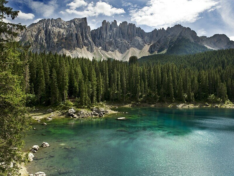
Scenic hike from Obereggen to Lake Carezza via the Tempelweg – perfect for nature lovers seeking forest trails, Dolomite views and emerald alpine waters.
This hike is a true alpine experience – peaceful forest paths, sweeping views of the Dolomites, and a fairytale destination: the emerald waters of Lake Carezza. Starting from the charming village of Obereggen, the trail winds through larch and pine forests, offering refreshing air and spectacular glimpses of the Rosengarten and Latemar ranges. Along the way, you’ll pass sunny clearings, traditional mountain farms and perfect picnic spots. The final reward is breathtaking – the shimmering Karersee, framed by legends and mountain peaks. A perfect choice for nature lovers, families and all who seek beauty and serenity.
Tags
  • Family-friendly
Route info
Intermediate
Distance
13,2 km
Activity time
3 h 30 min
Ascent
169 m
Descent
171 m
Physical effort
Scenary
Highest point
1.560 m
Lowest point
1.469 m
You might be interested in
Discover related tours
Intermediate
Add to favourites
Deutschnofen
Hike & Bike | De Nova Ponente à Obereggen
Distance 12,2 km
Activity time 3 h 35 min
Ascent 442 m
Descent 270 m
Welschnofen
Randonnée familiale du lac de Karer à la Stadl Alm
Distance 4,2 km
Activity time 1 h 04 min
Ascent 30 m
Descent 92 m
Intermediate
Add to favourites
Deutschnofen
Hike & Bike| D'Obereggen à Maria Weissenstein
Distance 16,8 km
Activity time 5 h 00 min
Ascent 555 m
Descent 608 m
Status
closed
Deutschnofen
Randonnée du Jochgrimm au Weißhorn
Distance 1,5 km
Activity time 1 h 00 min
Ascent 306 m
Descent 13 m
Deutschnofen
Hike to the huts Schönrast - Schmieder - Lahner
Distance 15,5 km
Activity time 4 h 30 min
Ascent 491 m
Descent 491 m
Intermediate
Add to favourites
Steinegg
Chemin des pyramides à Steinegg
Distance 5,7 km
Activity time 1 h 52 min
Ascent 355 m
Descent 355 m