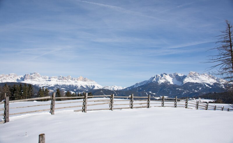
On this wintry hike along a section of the Steinegg Ridgeway, you will pass through forests to beautiful viewpoints with fantastic views of the Rosengarten and Schlern mountains. After about half of the circular hike, you come to the Oberölgart alpine hut - a nice place to stop for a bite to eat and drink, even in winter. Via a tarred road with very little traffic, you come to a very idyllic chapel in the middle of the forest, the ‘Kaserer Bild’ chapel. Continue along the tarred road through the woods to the starting point.
Inform yourself in advance about the opening hours and closing days of the Oberölgart alpine hut in winter.
Special caution is advised here.
The winter hike starts at the car park in the sports zone of Steinegg|Collepietra- between Steinegg|Collepietra and Gummer|San Valentino in Campo. From here, follow the ‘yellow shoe’ markings (Steinegg Ridgeway), but always stay on the tarred road. At the Soluck car park, turn right onto the forest road and continue to follow the "yellow shoe". From a certain point, the hiking trail [6] runs parallel to the Steinegg Ridgeway. Follow this until you reach the Oberölgart Alpine hut (1,201 m). From here, follow the hiking trail [4] along the road to the ‘Kaserer Bild’ chapel and continue to the Soluck car park. From here, take the tarred road back to the starting point - the last section is the same as at the start of the tour.
By public bus line:
- 182 from Bozen | Bolzano
- 187 from Welschnofen | Nova Levante
- 180 from Karersee | Lago di Carezza, Karerpass | Passo Costalunga, Val di Fassa*
- 184 from Eggen | Ega, Obereggen*
- 181 or 184 from Weissenstein | Pietralba, Petersberg | Monte San Pietro, Deutschnofen | Nova Ponente, Stenk*
- 182 from Birchabruck | Ponte Nova
- 187 or 182 from Gummer | San Valentino, Steinegg | Collepietra
*change in Birchabruck on the busline 182
Bus stop: Steinegg Sports Zone; online timetable search at South Tyrol Mobility
Starting point: Steinegg Sports Zone
Getting to the starting point of the tour by public transport is easy and convenient.
By public bus line:
- 182 from Bozen | Bolzano
- 187 from Welschnofen | Nova Levante
- 180 from Karersee | Lago di Carezza, Karerpass | Passo Costalunga, Val di Fassa*
- 184 from Eggen | Ega, Obereggen*
- 181 or 184 from Weissenstein | Pietralba, Petersberg | Monte San Pietro, Deutschnofen | Nova Ponente, Stenk*
- 182 from Birchabruck | Ponte Nova
- 187 or 182 from Gummer | San Valentino, Steinegg | Collepietra
*change in Birchabruck on the busline 182
Bus stop: Steinegg Sports Zone;
online timetable search at South Tyrol Mobility
Starting point: Steinegg Sports Zone
By car:
Destination: Steinegg Sports Zone
Parking lot at the Steinegg Sports Zone
Starting point: Steinegg Sports Zone
Parking lot at the Steinegg Sports Zone
Starting point: Steinegg Sports Zone
Good hiking equipment and hiking boots


