Top

Winter hike at the Steinegg Ridgeway

Steinegg
Add to favourites
Category
Difficulty
Intermediate
Activity time
3:00
Duration in hours
Distance
10.6
Distance in km
Suggested period
Jan
Feb
Mar
Apr
May
Jun
Jul
Aug
Sep
Oct
Nov
Dec
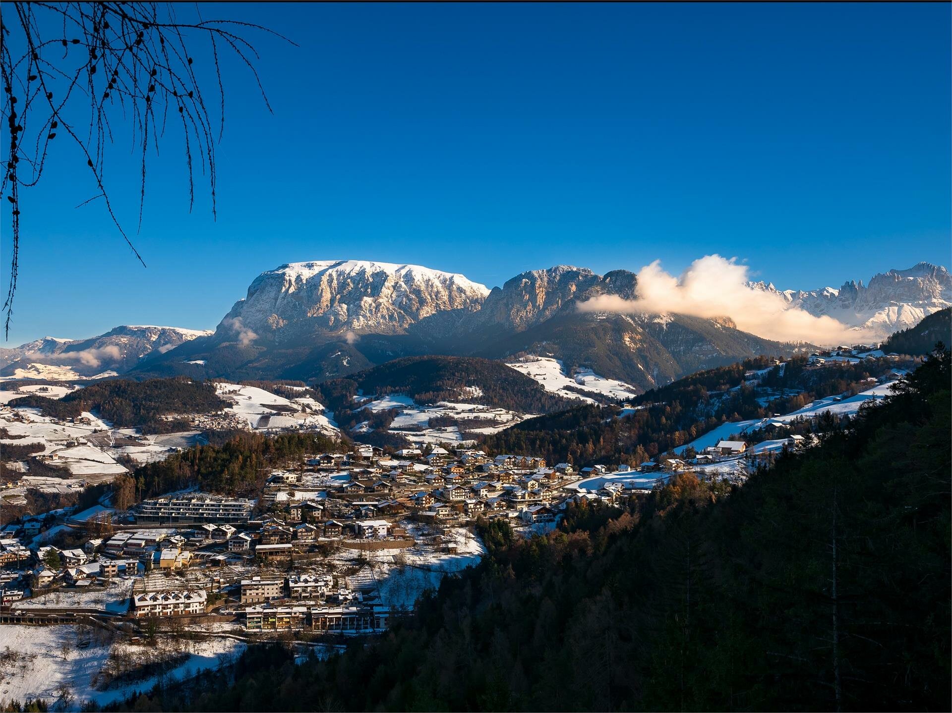
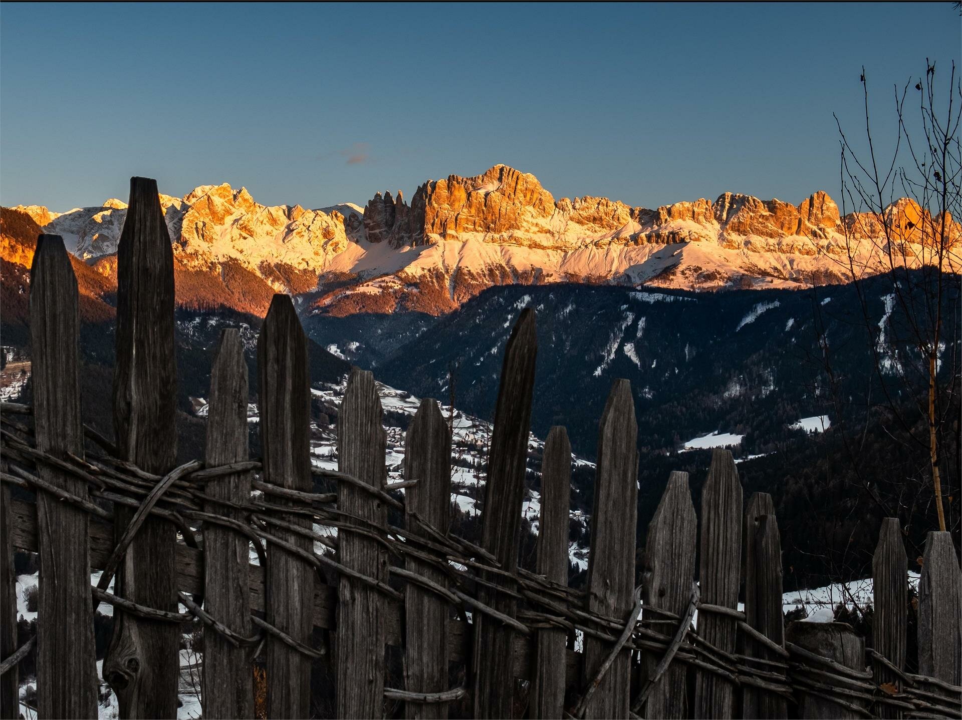
Through the snowy winter landscape along the Ridgeway of Steinegg with views of the mountains Rosengarten and Schlern

On this wintry hike along a section of the Steinegg Ridgeway, you will pass through forests to beautiful viewpoints with fantastic views of the Rosengarten and Schlern mountains. After about half of the circular hike, you come to the Oberölgart alpine hut - a nice place to stop for a bite to eat and drink, even in winter. Via a tarred road with very little traffic, you come to a very idyllic chapel in the middle of the forest, the ‘Kaserer Bild’ chapel. Continue along the tarred road through the woods to the starting point.

Inform yourself in advance about the opening hours and closing days of the Oberölgart alpine hut in winter.

Route info
Intermediate
Distance
10,6 km
Activity time
3 h 00 min
Ascent
286 m
Descent
286 m
Technical skills
Physical effort
Scenary
Highest point
1.281 m
Lowest point
1.179 m
Safety guidelines
In the winter months, sections of the hike can sometimes be very icy.
Special caution is advised here.
Directions

The winter hike starts at the car park in the sports zone of Steinegg|Collepietra- between Steinegg|Collepietra and Gummer|San Valentino in Campo. From here, follow the ‘yellow shoe’ markings (Steinegg Ridgeway), but always stay on the tarred road. At the Soluck car park, turn right onto the forest road and continue to follow the "yellow shoe". From a certain point, the hiking trail [6] runs parallel to the Steinegg Ridgeway. Follow this until you reach the Oberölgart Alpine hut (1,201 m). From here, follow the hiking trail [4] along the road to the ‘Kaserer Bild’ chapel and continue to the Soluck car park. From here, take the tarred road back to the starting point - the last section is the same as at the start of the tour.

public transportation
Getting to the starting point of the tour by public transport is easy and convenient.

By public bus line:
- 182 from Bozen | Bolzano
- 187 from Welschnofen | Nova Levante
- 180 from Karersee | Lago di Carezza, Karerpass | Passo Costalunga, Val di Fassa*
- 184 from Eggen | Ega, Obereggen*
- 181 or 184 from Weissenstein | Pietralba, Petersberg | Monte San Pietro, Deutschnofen | Nova Ponente, Stenk*
- 182 from Birchabruck | Ponte Nova
- 187 or 182 from Gummer | San Valentino, Steinegg | Collepietra
*change in Birchabruck on the busline 182

Bus stop: Steinegg Sports Zone; online timetable search at South Tyrol Mobility
Starting point: Steinegg Sports Zone
How to get there

Getting to the starting point of the tour by public transport is easy and convenient.

By public bus line:
- 182 from Bozen | Bolzano
- 187 from Welschnofen | Nova Levante
- 180 from Karersee | Lago di Carezza, Karerpass | Passo Costalunga, Val di Fassa*
- 184 from Eggen | Ega, Obereggen*
- 181 or 184 from Weissenstein | Pietralba, Petersberg | Monte San Pietro, Deutschnofen | Nova Ponente, Stenk*
- 182 from Birchabruck | Ponte Nova
- 187 or 182 from Gummer | San Valentino, Steinegg | Collepietra
*change in Birchabruck on the busline 182

Bus stop: Steinegg Sports Zone; online timetable search at South Tyrol Mobility
Starting point: Steinegg Sports Zone

By car:
Destination: Steinegg Sports Zone
Parking lot at the Steinegg Sports Zone
Starting point: Steinegg Sports Zone

Where to park

Parking lot at the Steinegg Sports Zone
Starting point: Steinegg Sports Zone

Winter clothing
Good hiking equipment and hiking boots
You might be interested in
Discover related tours
Deutschnofen
Winter hike from Eggen/Ega to the Grotthof
Distance 4,0 km
Activity time 1 h 15 min
Ascent 208 m
Descent 208 m
Intermediate
Add to favourites
Welschnofen
Winter hike on the Sissi Promenade in Karersee | Carezza
Distance 10,8 km
Activity time 2 h 58 min
Ascent 220 m
Descent 220 m
Intermediate
Add to favourites
Deutschnofen
Winter hike to the Lieg hut
Distance 8,3 km
Activity time 2 h 40 min
Ascent 474 m
Descent 474 m
Welschnofen
Winter Panorama Path in Welschnofen | Nova Levante
Distance 5,0 km
Activity time 1 h 25 min
Ascent 143 m
Descent 143 m
Deutschnofen
Winter hike from Nova Ponente to Unterkaplun to the Wölflhof farm
Distance 7,5 km
Activity time 2 h 07 min
Ascent 198 m
Descent 198 m
Deutschnofen, Welschnofen
Winter hike from Lake Carezza to the Häusler Sam hut
Distance 13,0 km
Activity time 3 h 29 min
Ascent 203 m
Descent 203 m
Skier downhill King Laurin slope - Rosengarten in the sunset | © Carezza Dolomites/Harald Wisthaler
Information & prices
Ski passes
Winter 2024/25

Here you will find all important information on skipasses, daily, multi-day, and seasonal tickets at a glance. All ski passes can be purchased quickly and conveniently online. Buy your skipass directly from home and get a 5% discount!

To the ski passes & tickets