
Top
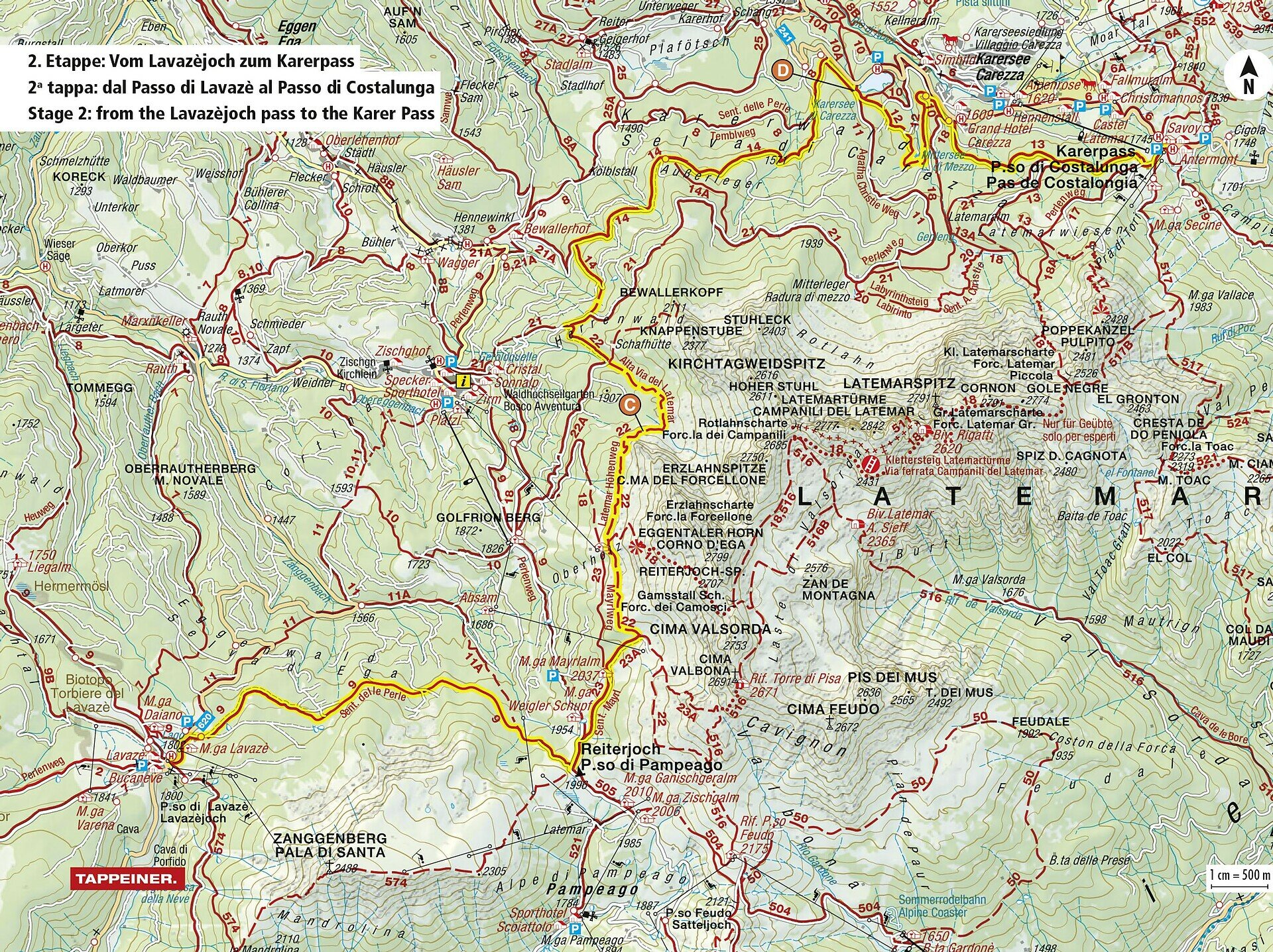
Dolomites World Heritage Geotrail II - 2e étape : du col Lavazè au col de Karer
Karersee, Obereggen, Welschnofen, Deutschnofen
Add to favouritesCategory

Difficulty
IntermediateActivity time
6:50
Duration in hours
Distance
21.4
Distance in km
Status
closed
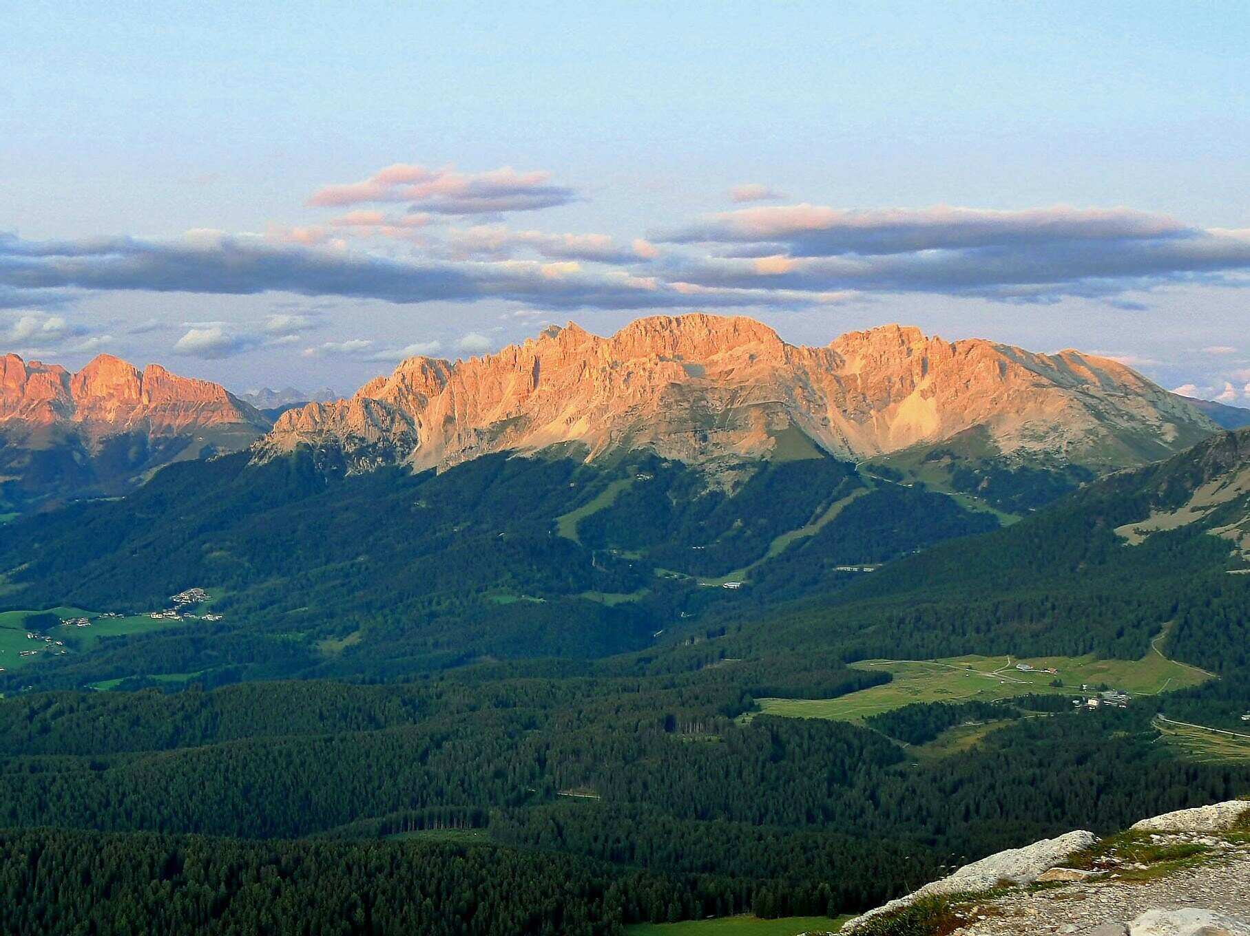
Scenic hike from Lavazè Pass to Karer Pass below Latemar – ideal for geology lovers and experienced mountain hikers.
This stage of the Dolomites World Heritage Geotrail leads through one of the most fascinating landscapes in the Dolomites – from the scenic Lavazè Pass to the legendary Karer Pass. The route winds beneath the mighty Latemar peaks, through peaceful forests, wide alpine meadows, and dramatic scree basins that tell the geological story of this unique region.
A perfect hike for experienced walkers looking for solitude, panoramic views, and a deeper connection to nature. Whether you're a geology enthusiast or simply in love with mountain landscapes, this trail will leave a lasting impression.
You might be interested in
Discover related tours


