Top

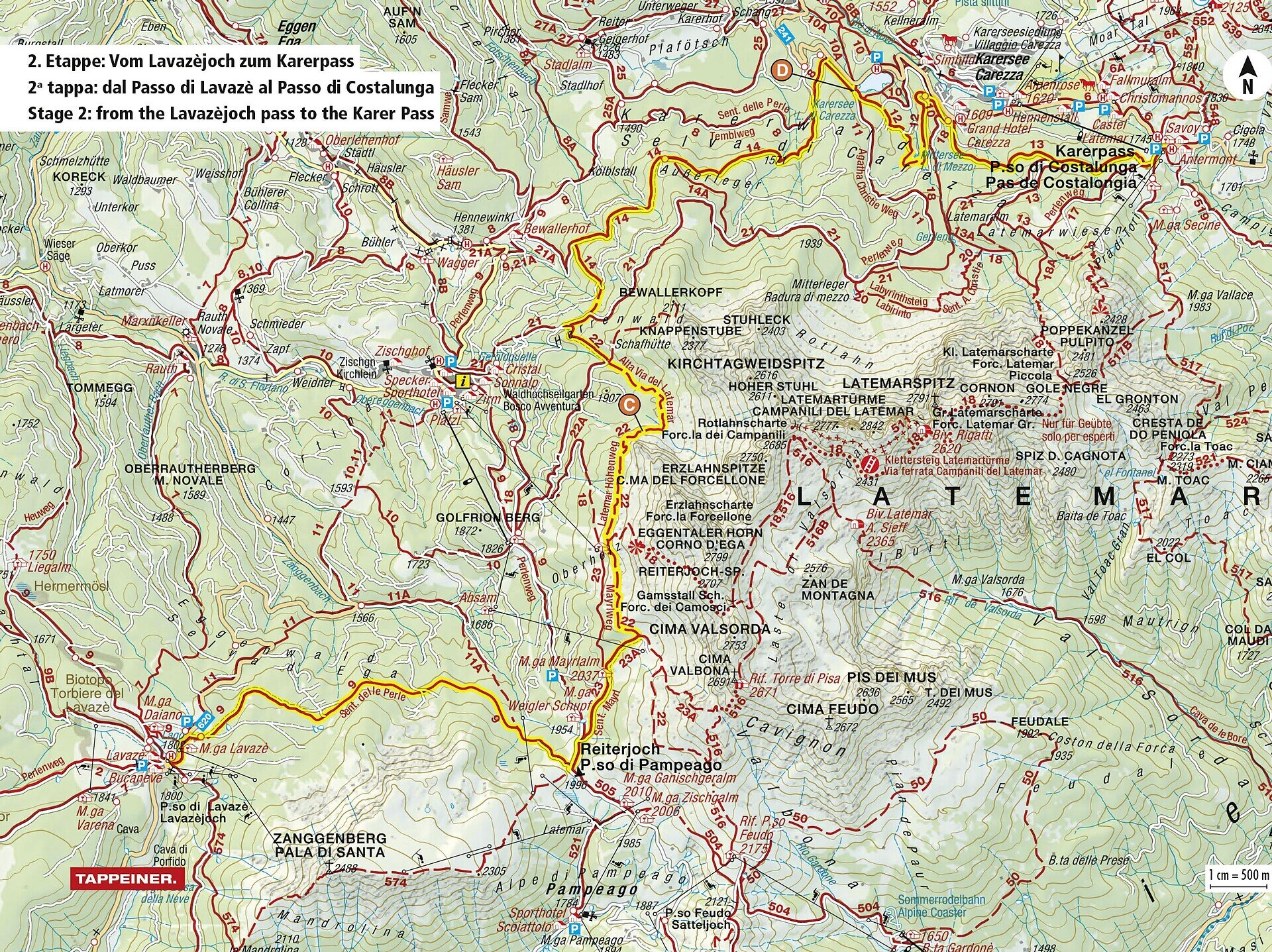
Geotrail des Dolomites, site du patrimoine mondial II – 2e étape : du col du Lavazè au col de Karer

Karersee, Obereggen, Welschnofen, Deutschnofen
Add to favourites
Difficulty
Intermediate
Activity time
6:50
Duration in hours
Distance
21.8
Distance in km
Status
closed
WSEN
Categories
  • Long distance hiking trail
Tags
  • Linear route
Suggested period
Jan
Feb
Mar
Apr
May
Jun
Jul
Aug
Sep
Oct
Nov
Dec
Scenic hike from Lavazè Pass to Karer Pass below Latemar – ideal for geology lovers and experienced mountain hikers.

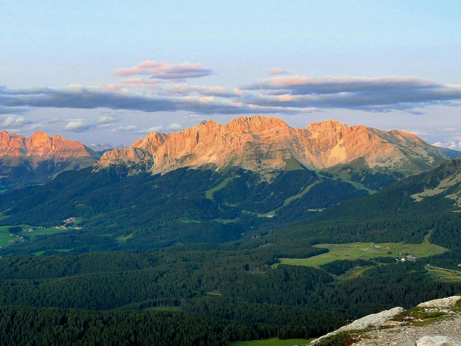
This stage of the Dolomites World Heritage Geotrail leads through one of the most fascinating landscapes in the Dolomites – from the scenic Lavazè Pass to the legendary Karer Pass. The route winds beneath the mighty Latemar peaks, through peaceful forests, wide alpine meadows, and dramatic scree basins that tell the geological story of this unique region.

A perfect hike for experienced walkers looking for solitude, panoramic views, and a deeper connection to nature. Whether you're a geology enthusiast or simply in love with mountain landscapes, this trail will leave a lasting impression.

Gallery
Categories
  • Long distance hiking trail
Tags
  • Linear route
Route info
Intermediate
Distance
21,8 km
Activity time
6 h 50 min
Ascent
708 m
Descent
765 m
Physical effort
Scenary
Highest point
2.171 m
Lowest point
1.498 m
You might be interested in
Discover related tours
Intermediate
Add to favourites
Obereggen, Deutschnofen
Randonnée de plusieurs jours « Sentiero Italia » – Étape : col de Lavazè – Obereggen
Distance 9,1 km
Activity time 2 h 20 min
Ascent 382 m
Descent 251 m
Status
closed
Intermediate
Add to favourites
Karersee, Welschnofen, Deutschnofen
Randonnée de cinq jours sur le circuit de randonnée « Perlenrundwanderweg » – 3e étape
Distance 13,7 km
Activity time 3 h 58 min
Ascent 412 m
Descent 618 m
Status
open
Intermediate
Add to favourites
Welschnofen, Karersee
Randonnée de plusieurs jours « Sentiero Italia » – Étape : refuge Kölner – St. Zyprian (Tiers)
Distance 14,1 km
Activity time 3 h 50 min
Ascent 236 m
Descent 1.562 m
Status
closed
Intermediate
Add to favourites
Steinegg, Deutschnofen
Randonnée de cinq jours sur le circuit de randonnée « Perlenrundwanderweg » – 5e étape
Distance 19,3 km
Activity time 5 h 50 min
Ascent 373 m
Descent 1.423 m
Status
open
Deutschnofen, Welschnofen
Randonnée de plusieurs jours « Sentiero Italia » – Étape : Obereggen – Refuge Kölner
Distance 14,3 km
Activity time 5 h 06 min
Ascent 849 m
Descent 89 m
Status
closed
Karersee, Welschnofen
Randonnée de quatre jours dans la région du Rosengarten et du Schlern
Distance 52,2 km
Activity time 17 h 49 min
Ascent 4.209 m
Descent 4.209 m
Status
closed
© Gabriel Eisath
Neu
Der offizielle WhatsApp-Kanal von Eggental Tourismus!
Abonniere unseren Kanal

Verpasse keine Neuigkeiten mehr! Folge unserem neuen WhatsApp-Kanal und erhalte aktuelle News, Veranstaltungstipps und besondere Highlights aus dem Eggental direkt auf dein Handy.

Wir freuen uns auf dich!