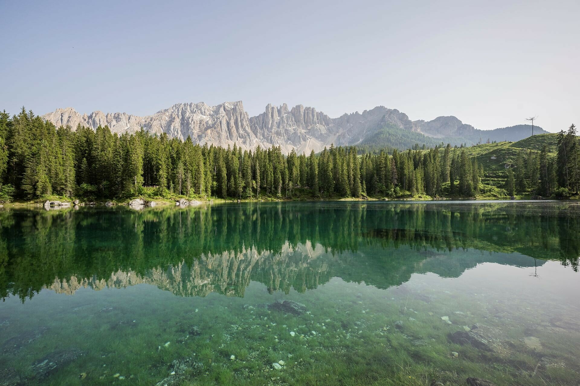
The fairytale lake of the Dolomites, Lake Carezza (Karer See | Lago di Carezza), is a colorful mountain lake where, according to legend, a water nymph is said to reside. In its crystal-clear waters, the Dolomite giants Latemar and Rosengarten are reflected in the mornings and evenings - a sight that amazes many visitors. For this reason, the lake is also called "Lec de Ergobando" - rainbow lake.
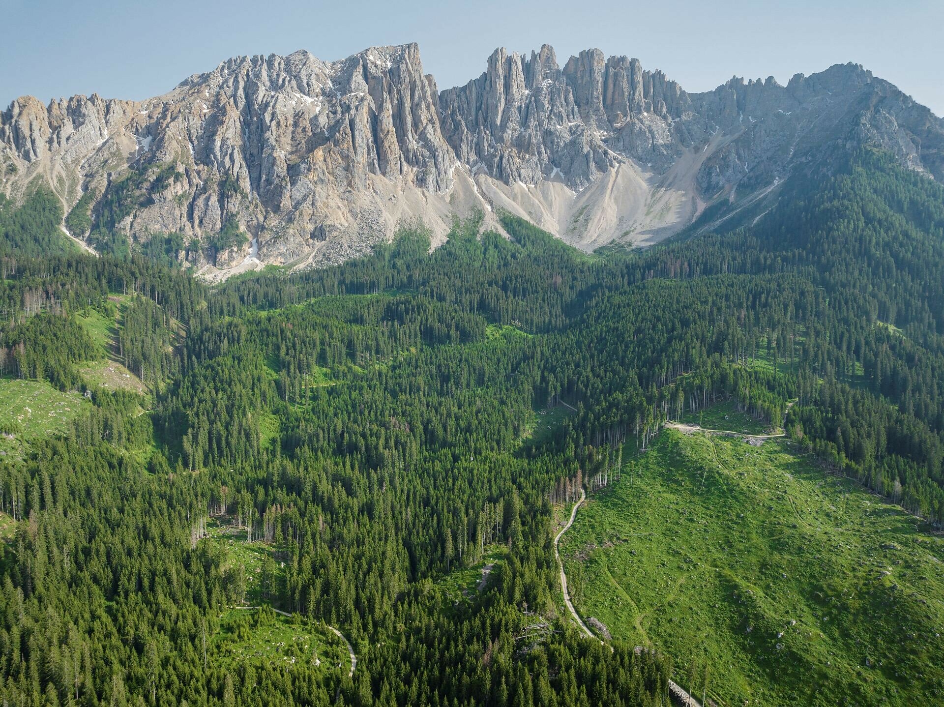
Measuring 300 meters in length and 140 meters in width, Lake Carezza lies at an altitude of 1,520 meters beneath the Latemar massif, at the edge of the Latemar Forest in the municipality of Welschnofen | Nova Levante, near the village of Karersee | Carezza in the Eggental valley. As a protected natural monument, it is fed by underground springs from the Latemar, which means its size and depth vary significantly depending on the season and weather. The greatest recorded depth is 22 meters.
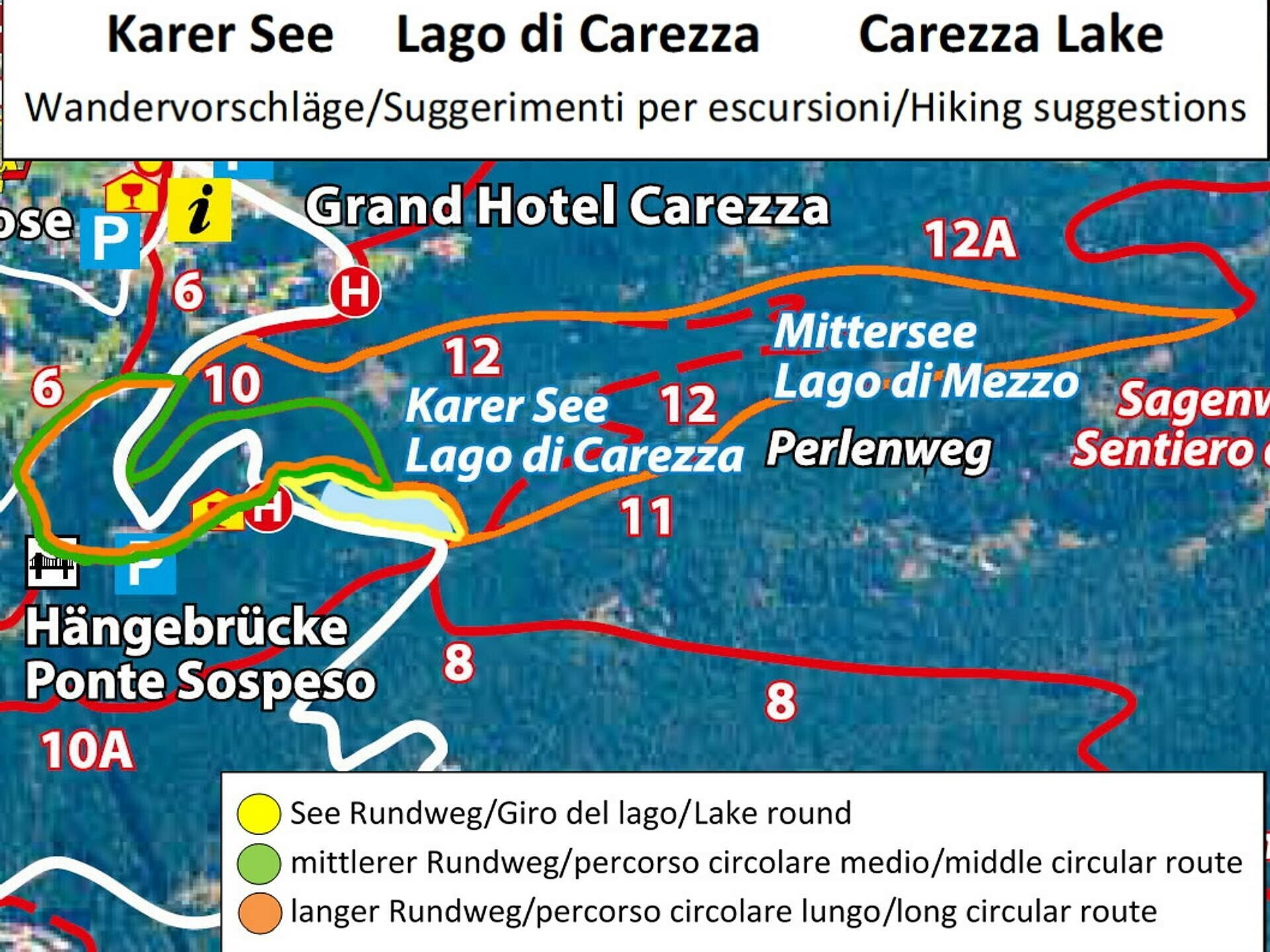
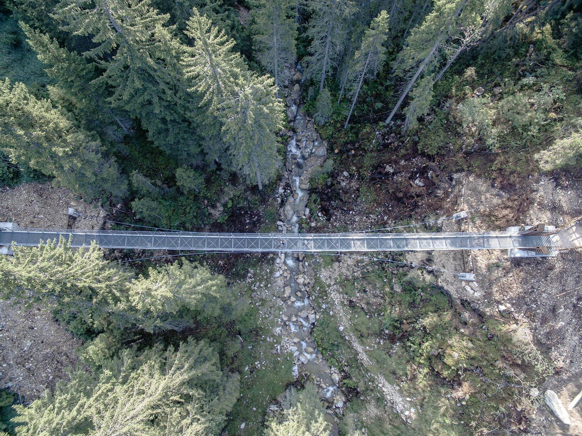
The long circular trail leads from Lake Carezza over the suspension bridge toward the holiday settlement and then through idyllic woodland back to the starting point at the lake. This forest area, known as the Latemar forest, is famous for its high-quality spruce trees, which are prized both as construction timber and for instrument making, particularly for string instruments. Besides Lake Carezza itself, the suspension bridge - built in 2018 as a connection to the Karersee | Carezza settlement - is another special highlight for visitors.
As a protected natural monument, Lake Carezza deserves special respect. It is important to observe the designated protection boundaries so that the beauty of this unique mountain lake can be preserved for future generations.