Top

Farm hike in Welschnofen | Nova Levante

Welschnofen
Add to favourites
Difficulty
Intermediate
Activity time
3:14
Duration in hours
Distance
10.6
Distance in km
Suggested period
Jan
Feb
Mar
Apr
May
Jun
Jul
Aug
Sep
Oct
Nov
Dec
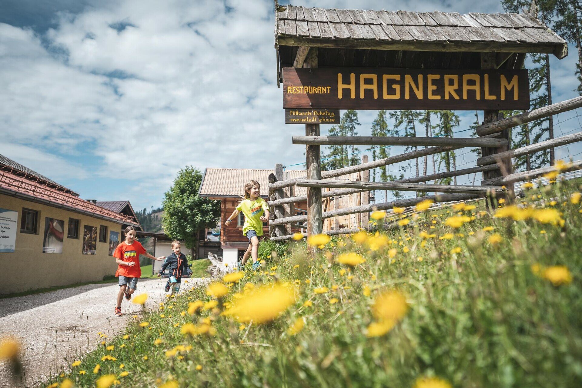
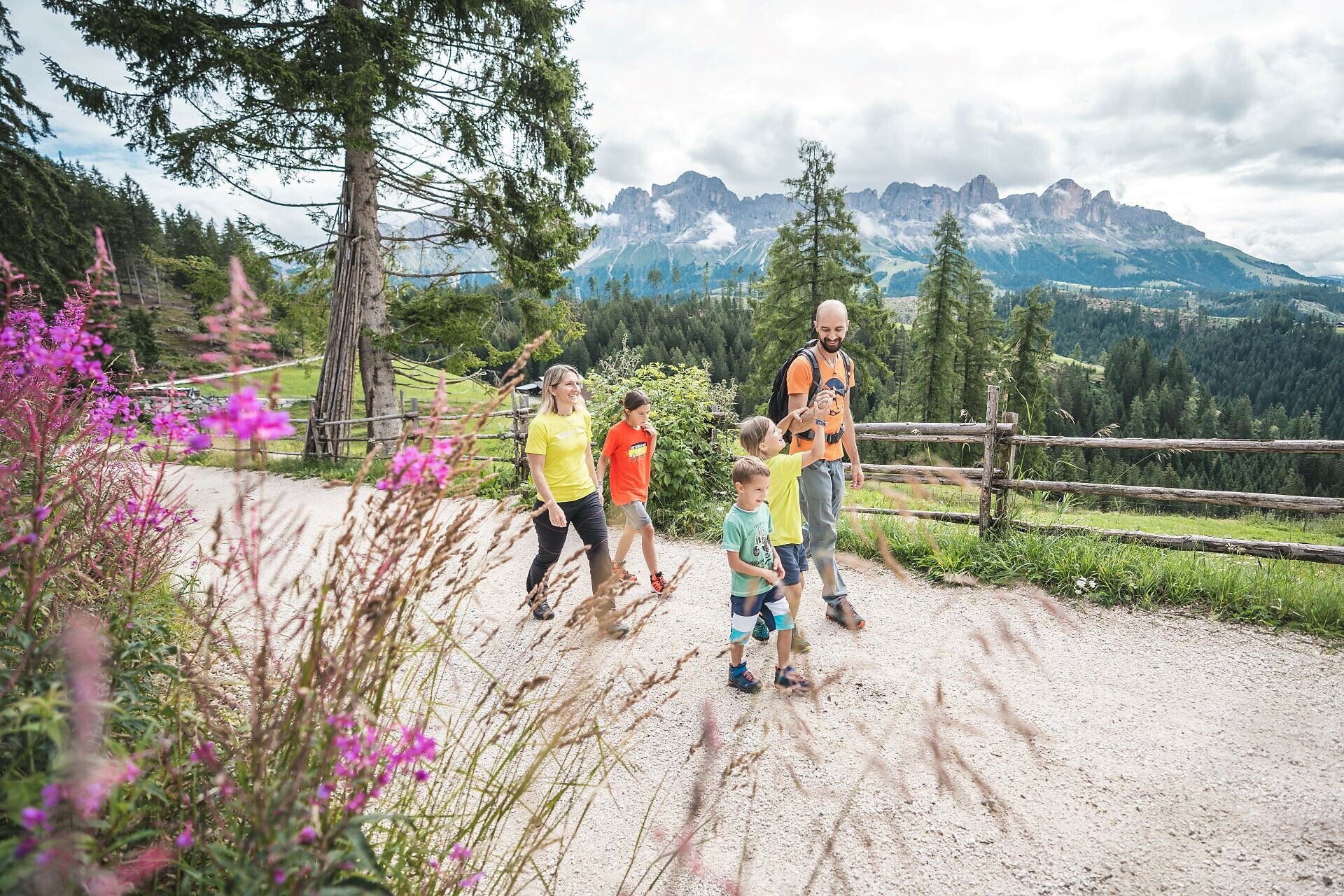
Circular hike past historic sites and traditional farms with fantastic panoramic views of the Latemar and Rosengarten.
This hike not only offers impressive views of the Dolomite peaks Rosengarten | Catinaccio and Latemar, but also a glimpse into the history of Welschnofen | Nova Levante. The path leads through a varied landscape of dense forests, meadows, and open slopes, with wide panoramic views of the surrounding mountains along the way. One of the highlights is the small pilgrimage chapel of Lengeria, built in 1952 and dedicated to the Virgin Mary as a token of gratitude for protection during World War II. Shortly afterward, you reach the “Wolfsgrube” (wolf pit), where the last wolves in the area were trapped in the 18th century. Continuing toward the Hagner Alm hut, the route passes several traditional farms and repeatedly opens onto clearings with breathtaking views of Rosengarten | Catinaccio and Latemar. The Hagner Alm is renowned for its excellent cheese production and makes a perfect stop for a relaxing break.
Route info
Intermediate
Distance
10,6 km
Activity time
3 h 14 min
Ascent
477 m
Descent
477 m
Physical effort
Scenary
Highest point
1.573 m
Lowest point
1.179 m
Suggestions

Refreshment stops:


Attention: Schiller Hof farm permanently closed.
Directions

This circular hike begins at the church square in Welschnofen | Nova Levante. The route leads past the bakery and follows path [5] uphill to the Lengeria pilgrimage chapel and on to the Wolfsgrube (Wolf's Pit). There, you turn right onto path [1] towards the Schiller Hof farm (permanently closed) and then continue on path  [4A] to the Hagner Alm hut. The return to Welschnofen | Nova Levante follows path [4B], [15A], [15], and finally path [5] back to the church square. Alternatively, you can take a shorter route from Hagner Alm hut by following path [4A] and then path [15] and [5] back to the starting point.

Alternative option: An alternative starting point is the valley station of the cable car in Welschnofen | Nova Levante. From there, take the gondola up to the Frommer Alm hut and follow path [1A] to the Nigerpass | Passo Nigra. From there, continue along the forest road [1] and then path [4A] to the Hagner Alm hut. For the return, you have two options: Via path [4A] directly to Welschnofen | Nova Levante (Duration: approx. 3.5 h; Ascent: 37 m; Distance: 12.5 km) or via path [1] to the Wolf's Pit and then path [5] back to the church square (Duration: approx. 3 h; Ascent: 36 m; Distance: 11 km).

Refreshment stops:


Attention: Schiller Hof farm permanently closed.
public transportation
Getting to the starting point of the tour by public transport is easy and convenient.

By public bus line:
- 180 from Bozen | Bolzano, Birchabruck | Ponte Nova
- 180 or 184 from Karersee | Carezza, Karerpass | Passo Costalunga
- 184 from Weissenstein | Pietralba, Petersberg | Monte San Pietro, Deutschnofen | Nova Ponente, Stenk (or 181 and change 180)
- 184 from Obereggen, Eggen | Ega
- 187 from Steinegg | Collepietra, Gummer | San Valentino (or 182 and change 180)
- 180 from Val di Fassa

Bus stop: Welschnofen centre + on foot (6 minutes);
Starting point: church square Welschnofen | Nova Levante (https://goo.gl/maps/fxsfgQF5camh8PgN9)
How to get there

Getting to the starting point of the tour by public transport is easy and convenient.

By public bus line:
- 180 from Bozen | Bolzano, Birchabruck | Ponte Nova
- 180 or 184 from Karersee | Carezza, Karerpass | Passo Costalunga
- 184 from Weissenstein | Pietralba, Petersberg | Monte San Pietro, Deutschnofen | Nova Ponente, Stenk (or 181 and change 180)
- 184 from Obereggen, Eggen | Ega
- 187 from Steinegg | Collepietra, Gummer | San Valentino (or 182 and change 180)
- 180 from Val di Fassa

Bus stop: Welschnofen centre + on foot (6 minutes); online timetable search at www.suedtirolmobil.info/en/
Starting point: church square Welschnofen | Nova Levante (https://goo.gl/maps/fxsfgQF5camh8PgN9)

By car:
Destination: Welschnofen | Nova Levante centre
Parking: parking lot cable car Welschnofen | Nova Levante Laurin I + on foot (6 minutes)
Starting point: church square Welschnofen | Nova Levante (https://goo.gl/maps/fxsfgQF5camh8PgN9)

Where to park
Parking: parking lot cable car Welschnofen | Nova Levante Laurin I + on foot (6 minutes)
Starting point: church square Welschnofen | Nova Levante (https://goo.gl/maps/fxsfgQF5camh8PgN9)
You might be interested in
Discover related tours
Intermediate
Add to favourites
Karersee, Deutschnofen, Welschnofen
Hike & Bike | Obereggen - King Laurin Tour
Distance 36,2 km
Activity time 5 h 07 min
Ascent 2.226 m
Descent 2.584 m
Welschnofen, Karersee
Masarè path
Distance 8,1 km
Activity time 2 h 28 min
Ascent 352 m
Descent 352 m
Deutschnofen
Hike from Weissenstein to Neuhütt to Auerleger
Distance 17,3 km
Activity time 5 h 10 min
Ascent 567 m
Descent 568 m
Obereggen, Deutschnofen
LATEMAR.ALP
Distance 9,1 km
Activity time 2 h 35 min
Ascent 305 m
Descent 305 m
Welschnofen
From Nova Levante to Lake Carezza
Distance 10,1 km
Activity time 3 h 09 min
Ascent 515 m
Descent 515 m
Intermediate
Add to favourites
Karersee, Welschnofen
Highlight circular hike: Lake Carezza - Latemar rock labyrinth - Eggental Mountain Cinema Latemar meadows - Passo Costalunga
Distance 11,7 km
Activity time 3 h 40 min
Ascent 607 m
Descent 607 m
© Carezza Dolomites/Harald Wisthaler
Information & prices
Ski passes
Winter 2024/25

Here you will find all important information on skipasses, daily, multi-day, and seasonal tickets at a glance. All ski passes can be purchased quickly and conveniently online. Buy your skipass directly from home and get a 5% discount!

To the ski passes & tickets