Top

Hike to the Latemarhütte Mountain Hut

Obereggen, Deutschnofen
Add to favourites
Category
Difficulty
Difficult
Activity time
3:55
Duration in hours
Distance
8.2
Distance in km
WSEN
Suggested period
Jan
Feb
Mar
Apr
May
Jun
Jul
Aug
Sep
Oct
Nov
Dec
Chairlift ride, 360° view, and a rocky trail to Torre di Pisa hut – perfect for experienced hikers seeking epic views and a rewarding mountain lunch.
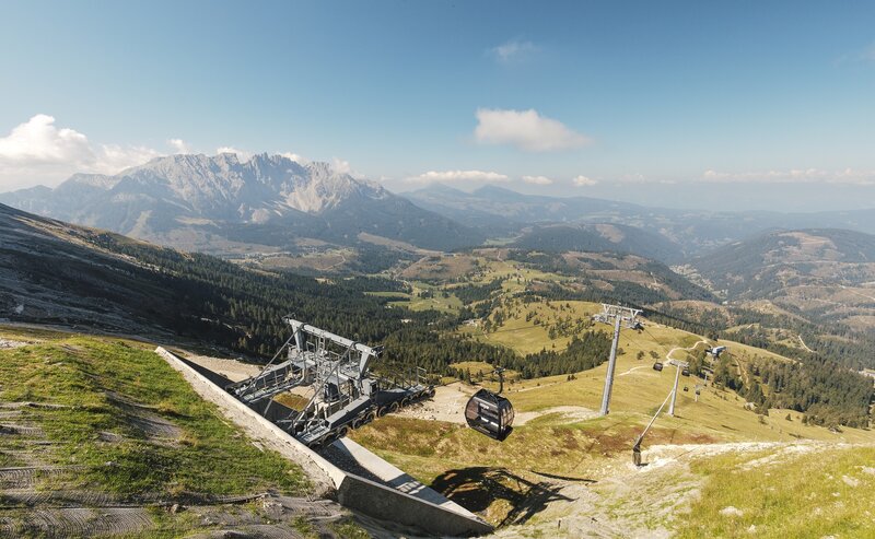
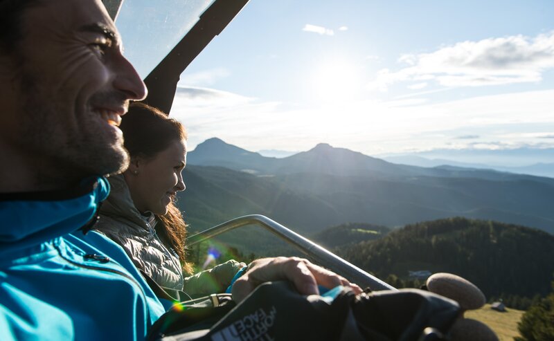
This hike is one of the most impressive adventures in the Eggental region – perfect for experienced hikers looking to immerse themselves in the true spirit of the Dolomites. The journey starts comfortably with a scenic chairlift ride, leading straight into high alpine terrain.
Just a few minutes later, the panoramic platform offers an unforgettable 360° view of the surrounding peaks. From here, the panoramic trail gradually reveals the raw beauty of the Latemar range, with its towering cliffs and dramatic rock formations.
The ascent to the Torre di Pisa hut winds through wild, rocky landscapes, past jagged pinnacles and majestic stone towers. At the top, you'll be rewarded not only with sweeping views but also with a delicious mountain lunch and authentic South Tyrolean hospitality. The descent is via trail [516] and [22] to the Mayrl Alm Alpine farm and back to the Oberholz chairlift.
This is a must-do for well-conditioned hikers who crave a full mountain experience – both challenging and deeply rewarding.
Route info
Difficult
Distance
8,2 km
Activity time
3 h 55 min
Ascent
719 m
Descent
719 m
Physical effort
Scenary
Highest point
2.686 m
Lowest point
2.079 m
Directions
The hike begins in Obereggen at 1,550 m. Take the Oberholz chairlift to the mountain station at 2,096 m.
From there, a short walk leads to the stunning „Latemar.360°“ viewpoint with breathtaking panoramic views of the Dolomites.
The ascent to the hut follows trail [22] („Latemar.panorama“) toward Satteljoch (Feudo Pass), taking about 1 hour.
From the pass, follow trail [516], a scenic but rocky climb, to the Torre di Pisa hut at 2,670 m – about 1.5 hours.
The descent is via trail [516] and [22] to the Mayrl Alm Alpine farm and back to the Oberholz chairlift, then ride down to Obereggen.
public transportation

Getting to the starting point of the tour by public transport is easy and convenient.

By public bus line:
- 180 from Bozen | Bolzano
- 180 or 184 from Karersee | Lago di Carezza, Karerpass | Passo Costalunga, Welschnofen | Nova Levante
- 184 from Birchabruck | Ponte Nova, Stenk, Eggen | Ega
- 184 from Weissenstein | Pietralba, Petersberg |Monte San Pietro, Deutschnofen | Nova Ponente   - 182 from Steinegg | Collepietra, Gummer | San Valentino
- 180 from Val di Fassa
Bus stop: Obereggen; online timetable search at www.suedtirolmobil.info/en/
Meeting point: valley station Oberholz: https://goo.gl/maps/TmQLBAvhDtbhWoHV6
How to get there

Getting to the starting point of the tour by public transport is easy and convenient.

By public bus line:
- 180 from Bozen | Bolzano
- 180 or 184 from Karersee | Lago di Carezza, Karerpass | Passo Costalunga, Welschnofen | Nova Levante
- 184 from Birchabruck | Ponte Nova, Stenk, Eggen | Ega
- 184 from Weissenstein | Pietralba, Petersberg |Monte San Pietro, Deutschnofen | Nova Ponente   - 182 from Steinegg | Collepietra, Gummer | San Valentino
- 180 from Val di Fassa
Bus stop: Obereggen; online timetable search at www.suedtirolmobil.info/en/
Meeting point: valley station Oberholz: https://goo.gl/maps/TmQLBAvhDtbhWoHV6
By car:
Destination: Obereggen
Parking: Parking lot Obereggen
Meeting point: valley station Oberholz: https://goo.gl/maps/TmQLBAvhDtbhWoHV6

Where to park
Parking: Parking lot Obereggen
Meeting point: valley station Oberholz: https://goo.gl/maps/TmQLBAvhDtbhWoHV6
You might be interested in
Discover related tours
Karersee, Welschnofen
To the Poppekanzel | Pulpito in the Latemar
Distance 7,0 km
Activity time 2 h 26 min
Ascent 560 m
Descent 566 m
Karersee, Welschnofen
Hike to the Heart of the Rosengarten Massif – Vajolon Pass
Distance 9,6 km
Activity time 5 h 00 min
Ascent 825 m
Descent 825 m
Hirzel path | © Carezza Dolomites | Thomas Monsorno, Eggental – Val d’Ega
Intermediate
Add to favourites
Karersee, Welschnofen
Circular hike along the Hirzelsteig | Masarè path
Distance 8,1 km
Activity time 2 h 27 min
Ascent 336 m
Descent 339 m
Zanggen | © Günther Pichler, Eggental – Val d’Ega
Intermediate
Add to favourites
Obereggen, Deutschnofen
Hike Lavazè-Zanggen-Pampeago Pass
Distance 11,3 km
Activity time 4 h 25 min
Ascent 763 m
Descent 763 m
Karersee, Welschnofen
Hike round the Rosengarten Massif
Distance 11,0 km
Activity time 5 h 00 min
Ascent 769 m
Descent 770 m
Karersee, Deutschnofen, Welschnofen
Alpine Ridgeway from the Latemar mountain to the Rosengarten mountain
Distance 25,9 km
Activity time 6 h 30 min
Ascent 1.582 m
Descent 1.964 m
Mountain Pass
1 Ticket - 17 lifts - 3 mountains

Holders of the Mountain Pass can use 17 lifts in the heart of the RosengartenLatemar and Schlern/Sciliar any three or five days within a period of seven consecutive days.

More informations