Multi day trekking "Sentiero Italia" - Stage: Passo Lavazè-Obereggen

Obereggen, Deutschnofen
Add to favourites
Category
Difficulty
Intermediate
Activity time
2:06
Duration in hours
Distance
6.4
Distance in km
Status
closed
Suggested period
Jan
Feb
Mar
Apr
May
Jun
Jul
Aug
Sep
Oct
Nov
Dec

A journey through the Wonderland - from north to south!

The "Sentiero Italia" is one of the longest hiking trails in the world: over 7,000 kilometres.

There are about 400 stages that connect the Alps with the Apennines. 

Route info
Intermediate
Distance
6,4 km
Activity time
2 h 06 min
Ascent
410 m
Descent
282 m
Physical effort
Scenary
Highest point
2.093 m
Lowest point
1.792 m
Directions

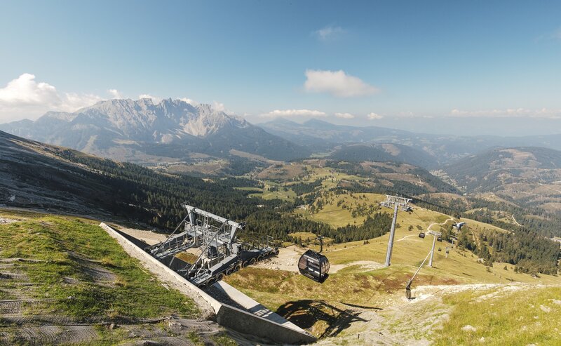
This very short stage with little difference in altitude leads directly to the foot of the Latemar Dolomite massif. From the Lavazè Pass, first follow the main road before turning right into the woods on path [9] The first few kilometres are flat before a short climb that leads to the Reiterjoch/Passo di Pampeago, from where you descend to Alpe di Pampeago, where the Latemar ski lifts start at the border between the Val d'Ega and Val di Fiemme. The Latemar massif has been a UNESCO World Heritage Site since 2009.

public transportation

Getting to the starting point of the tour by public transport is easy and convenient.

By public bus line:
- 180 or 181 from Bozen | Bolzano,
- 180 or 184 from Karersee | Lago di Carezza, Karerpass | Passo Costalunga, Welschnofen | Nova Levante
- 184 from Birchabruck | Ponte Nova, Stenk, Eggen | Ega, Obereggen, Jochgrimm | Passo Oclini
- 184 from Weissenstein  Pietralba, Petersberg | Monte San Pietro,  Deutschnofen | Nova Ponente
- 182 from Steinegg | Collepietra, Gummer | San Valentino
- 180 from Val di Fassa
Bus stop: PassoLavazè; online timetable search at www.suedtirolmobil.info/en/
Meeting point: Passo Lavazè: https://goo.gl/maps/TmQLBAvhDtbhWoHV6
How to get there

Getting to the starting point of the tour by public transport is easy and convenient.

By public bus line:
- 180 or 181 from Bozen | Bolzano,
- 180 or 184 from Karersee | Lago di Carezza, Karerpass | Passo Costalunga, Welschnofen | Nova Levante
- 184 from Birchabruck | Ponte Nova, Stenk, Eggen | Ega, Obereggen, Jochgrimm | Passo Oclini
- 184 from Weissenstein  Pietralba, Petersberg | Monte San Pietro,  Deutschnofen | Nova Ponente
- 182 from Steinegg | Collepietra, Gummer | San Valentino
- 180 from Val di Fassa

Bus stop: PassoLavazè; online timetable search at www.suedtirolmobil.info/en/
Meeting point: Passo Lavazè: https://goo.gl/maps/TmQLBAvhDtbhWoHV6
By car:
Destination: Passo Lavazè
Parking: parcheggio Lavazè
Meeting point: Passo Lavazè: https://goo.gl/maps/TmQLBAvhDtbhWoHV6


Where to park
Parking: parcheggio Lavazè Meeting point: Passo Lavazè: https://goo.gl/maps/TmQLBAvhDtbhWoHV6
You might be interested in
Discover related tours
Karersee, Welschnofen
Dolomites World Heritage Geotrail II - Stage 3: from the Karer Pass to the Tierser Alpl Hut
Distance 15,4 km
Activity time 6 h 25 min
Ascent 1.792 m
Descent 1.094 m
Eye to thel Dolomites - Passo di Pampeago | © Günter Pichler - Obereggen AG, Eggental – Val d’Ega
Intermediate
Add to favourites
Obereggen, Deutschnofen
Multiday Hike - Alpine Pearls - 4. stage
Distance 22,6 km
Activity time 6 h 30 min
Ascent 666 m
Descent 879 m
Status
closed
Hiking | © Eggental Tourismus_Alex Filz, Eggental – Val d’Ega
Intermediate
Add to favourites
Karersee, Obereggen, Steinegg, Welschnofen, Deutschnofen
Multi-day Hike - Alpine Pearls
Distance 86,6 km
Activity time 28 h 50 min
Ascent 3.595 m
Descent 3.595 m
Status
closed
Karersee, Steinegg
Multi-day Hike - Alpine Pearls - 1. stage
Distance 16,5 km
Activity time 5 h 53 min
Ascent 1.402 m
Descent 658 m
Status
closed
Karersee
Multi-Day hike from the Catinaccio to the Sciliar - 2. Stage
Distance 9,1 km
Activity time 4 h 05 min
Ascent 909 m
Descent 938 m
Status
closed
Bödenseen lake and Rifugio Antonio Locatelli mountain hut | © Christjan Ladurner, IDM Südtirol - Alto Adige
Intermediate
Add to favourites
Karersee, Deutschnofen, Obereggen, Welschnofen
Dolomites World Heritage Geotrail II
Distance 201,3 km
Activity time 54 h 00 min
Ascent 11.816 m
Descent 12.052 m
Rosadira Bike Days
11 - 15 June 2025

Experience unforgettable days full of adventure, action, and pure nature amidst the breathtaking backdrop of the UNESCO World Heritage Dolomites.

Highlights of the Rosadira Bike Days:

  • Guided mountain bike and e-bike tours: Discover the stunning landscape between Rosengarten and Latemar on varied trails suitable for all skill levels.

  • Riding technique workshops: Improve your skills with the help of experienced guides and tackle the trails with more confidence and fun.

  • Events and culinary delights: Enjoy South Tyrolean specialties and wrap up the days in good company at various events.

  • Family-friendly program: There are exciting activities for young bikers too, giving them a playful introduction to the world of mountain biking while parents are out on tour.

More informations