Top

Via the sheep path from the Fassa valley to the Paolina hut

Karersee
Add to favourites
Category
Difficulty
Intermediate
Activity time
2:01
Duration in hours
Distance
5.8
Distance in km
Suggested period
Jan
Feb
Mar
Apr
May
Jun
Jul
Aug
Sep
Oct
Nov
Dec
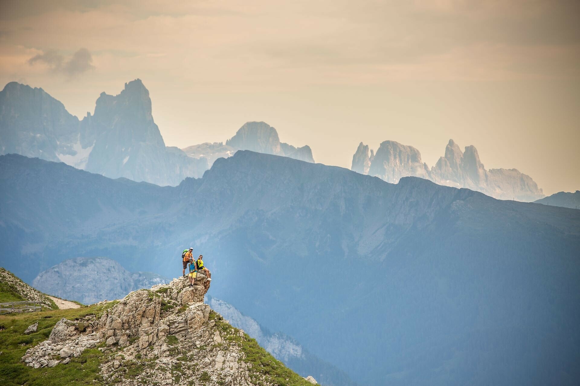
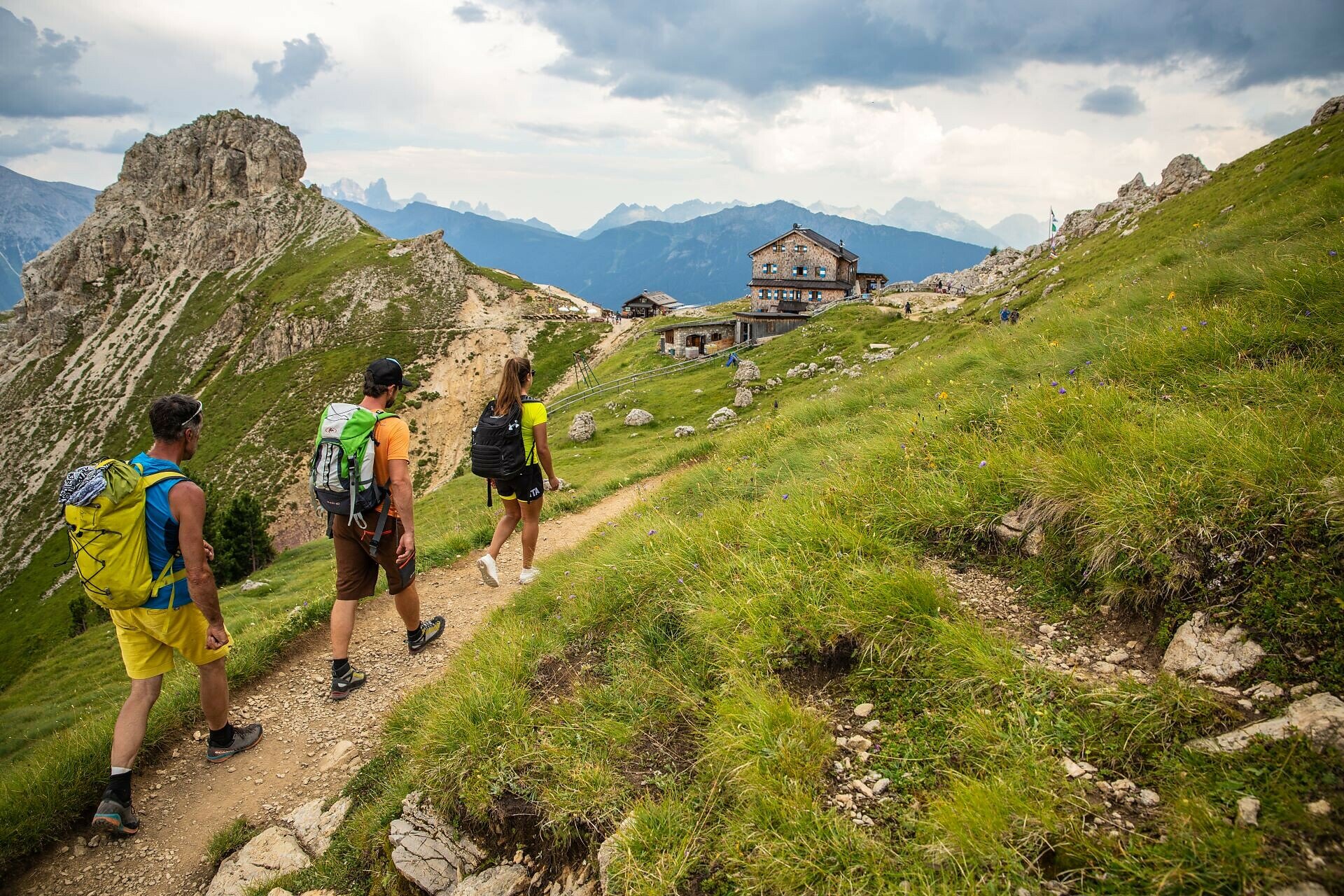
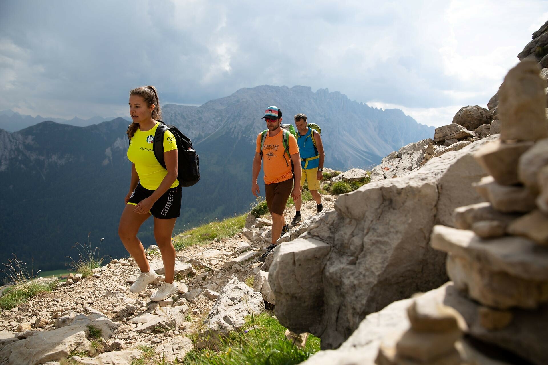
Beautiful high-altitude hike along the narrow sheep path below the Rosengarten with breathtaking panoramic views of the surrounding mountains and valleys.
The sheep path (Schafsteig | Sentiero delle Pecore | Vial de le Feide) on the Rosengarten | Catinaccio is a stunning high-altitude trail between Vigo di Fassa and the Paolina hut. This scenic hike in the Dolomites runs beneath the impressive rock formations of the Rosengarten | Catinaccio massif. It offers spectacular panoramic views of the surrounding valleys, such as the Fassa valley and Eggental valley, as well as the mountain peaks, and passes through alpine meadows and rocky sections. The trail is renowned for its picturesque setting, the combination of nature, rocks, and blooming alpine meadows, and the opportunity to visit cozy mountain huts along the route.
Route info
Intermediate
Distance
5,8 km
Activity time
2 h 01 min
Ascent
459 m
Descent
316 m
Physical effort
Scenary
Highest point
2.289 m
Lowest point
1.928 m
Suggestions
Refreshment stops:
Safety guidelines
Walkers must be well-equipped and have no fear of heights.
Directions
The starting point is at the valley station of the Vigo di Fassa – Ciampedie cableway. You can reach it by bus line 180, which departs from Bozen | Bolzano and stops at Birchabruck | Ponte Nova, Welschnofen | Nova Levante, Karersee | Carezza, and Karerpass | Passo di Costalunga. From the valley station, the cableway takes you up to the mountain station on the plateau Ciampedie (1998 m). The so-called sheep path (Schafsteig | Sentiero delle Pecore | Vial de le Feide) then leads to the Rotwand | Roda di Vael hut (2283 m). The path initially ascends moderately, then becomes narrower and steeper. From the Rotwand | Roda di Vael hut, follow paths [549] and [539] to reach the Paolina hut. The descent continues via the Paolina chairlift, followed by the return journey by bus.

Refreshment stops:
Notice:
Walkers must be well-equipped and have no fear of heights.
public transportation
Getting to the starting point of the tour by public transport is easy and convenient. 

By public bus line:
- 180 from Bozen | Bolzano, Birchabruck | Ponte Nova, Welschnofen | Nova Levante, Karersee | Carezza, Karerpass | Passo di Costalunga + change 180
- 184 from Weissenstein | Pietralba, Petersberg | Monte San Pietro, Deutschnofen | Nova Ponente, Obereggen, Eggen | Ega, Birchabruck | Ponte Nova, Welschnofen | Nova Levante, Karersee | Carezza + change 180
- 187 from Steinegg | Collepietra, Gummer | San Valentino + change 180 (or 182 and change 180)

Bus stop: Vigo di Fassa, Funivia Catinaccio. Online timetable search at www.suedtirolmobil.info/en/
How to get there
Getting to the starting point of the tour by public transport is easy and convenient. 

By public bus line:
- 180 from Bozen | Bolzano, Birchabruck | Ponte Nova, Welschnofen | Nova Levante, Karersee | Carezza, Karerpass | Passo di Costalunga + change 180
- 184 from Weissenstein | Pietralba, Petersberg | Monte San Pietro, Deutschnofen | Nova Ponente, Obereggen, Eggen | Ega, Birchabruck | Ponte Nova, Welschnofen | Nova Levante, Karersee | Carezza + change 180
- 187 from Steinegg | Collepietra, Gummer | San Valentino + change 180 (or 182 and change 180)

Bus stop: Vigo di Fassa, Funivia Catinaccio. Online timetable search at www.suedtirolmobil.info/en/

By car: 
Destination: Karersee | Carezza
Parking: Parking lot Paolina
Where to park
Parking: Parking lot Paolina, https://maps.app.goo.gl/3YHh2Jc8bFskkTXdA + bus 180
You might be interested in
Discover related tours
Obereggen, Deutschnofen
Hike to the Latemarhütte Mountain Hut
Distance 8,1 km
Activity time 4 h 00 min
Ascent 719 m
Descent 719 m
Karersee, Welschnofen
To the Poppekanzel | Pulpito in the Latemar
Distance 7,0 km
Activity time 2 h 26 min
Ascent 560 m
Descent 566 m
Obereggen, Deutschnofen
Hike Lavazè-Zanggen-Pampeago Pass
Distance 11,3 km
Activity time 4 h 25 min
Ascent 763 m
Descent 763 m
Karersee, Welschnofen
Hike to the Heart of the Rosengarten Massif – Vajolon Pass
Distance 9,6 km
Activity time 5 h 00 min
Ascent 825 m
Descent 825 m
Karersee, Welschnofen
Into the heart of the Rosengarten | Catinaccio massif – Vajolon
Distance 10,7 km
Activity time 3 h 47 min
Ascent 887 m
Descent 868 m
Karersee, Welschnofen
Circular hike along the Hirzelsteig | Masarè path
Distance 8,1 km
Activity time 2 h 27 min
Ascent 336 m
Descent 339 m
© Carezza Dolomites/Harald Wisthaler
Information & prices
Ski passes
Winter 2024/25

Here you will find all important information on skipasses, daily, multi-day, and seasonal tickets at a glance. All ski passes can be purchased quickly and conveniently online. Buy your skipass directly from home and get a 5% discount!

To the ski passes & tickets