Top

Farm hike in Welschnofen

Welschnofen
Add to favourites
Difficulty
Intermediate
Activity time
3:14
Duration in hours
Distance
10.6
Distance in km
Suggested period
Jan
Feb
Mar
Apr
May
Jun
Jul
Aug
Sep
Oct
Nov
Dec
Circular hike past historic sites and old farms with fantastic panoramic views of Latemar and Rosengarten.

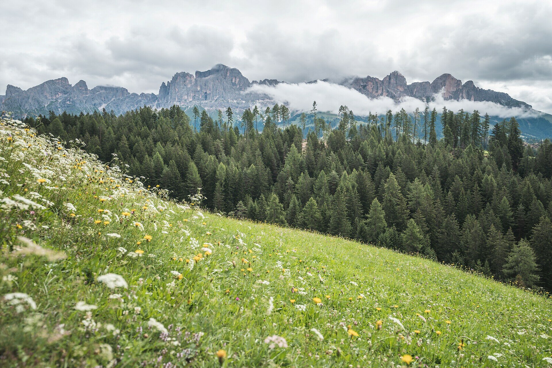
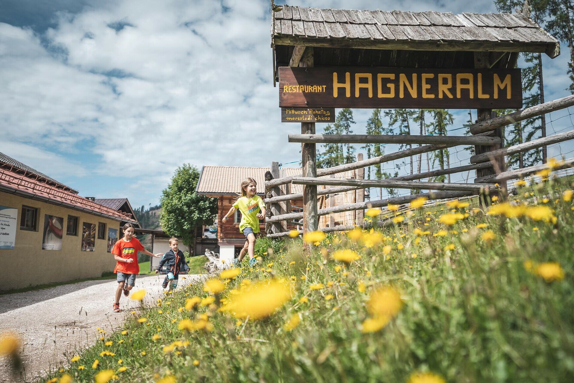
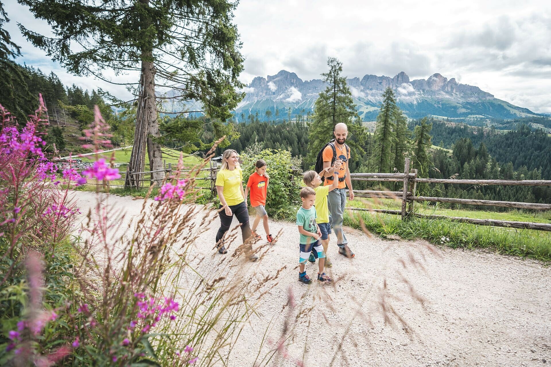
This hike not only offers impressive views of the Dolomite mountains Rosengarten and Latemar but also a small insight into the past of Welschnofen. The path leads through a varied landscape of dense forests, meadows, and open slopes, repeatedly accompanied by wide panoramic views of the surrounding mountains. Along the way, you pass the small pilgrimage chapel Lengeria, which was built in 1952 and dedicated to the Mother of God - as thanks for protection from dangers during the Second World War. Shortly afterwards, you reach Wolfsgrube, where the last wolves in the area were caught in the 18th century. On the further way towards Hagner Alm, you pass many old farms and repeatedly open clearings with impressive views of Rosengarten and Latemar. The Hagner Alm is known for its excellent cheese production and offers an ideal opportunity for a cozy stop.

Route info
Intermediate
Distance
10,6 km
Activity time
3 h 14 min
Ascent
477 m
Descent
477 m
Physical effort
Scenary
Highest point
1.573 m
Lowest point
1.179 m
Suggestions

Places to stop:


Note: Schiller Hof permanently closed.
Directions

This circular hike starts at the church square in Welschnofen. The path leads past the bakery on trail [5] up to the pilgrimage chapel Lengeria and further to Wolfsgrube. There, turn right onto trail [1] towards Schiller Hof (permanently closed) and then follow trail [4A] to Hagner Alm. The return path to Welschnofen goes via trails [4B], [15A], [15], and finally again via trail [5] to the church square. Alternatively, starting from the Hagner Alm, you can take the direct return route via trail [4A] and trails [15] and [5] back to the church square.

Variation: An alternative starting point is the valley station of the cable car in Welschnofen. From there, take the cable car to Frommer Alm and hike on trail [1A] to Nigerpass. Via the forest road [1] and then trail [4A], you reach Hagner Alm. For the return journey, there are two options: via trail [4A] directly back to Welschnofen (duration: approx. 3.5 h; ascent: 37 m; length: 12.5 km) or via trail [1] to Wolfsgrube and then trail [5] to the church square (duration: approx. 3 h; ascent: 36 m; length: 11 km).

Places to stop:


Note: Schiller Hof permanently closed.
public transportation
The starting point of the route is easily and conveniently accessible by public transport. 

By public bus line:
- 180 from Bolzano, Birchabruck
- 180 or 184 from Karersee, Karerpass
- 184 from Weissenstein, Petersberg, Deutschnofen, Stenk (or: 181 and change to 180)
- 184 Obereggen, Eggen
- 187 from Steinegg, Gummer (or: 182 and change to 180) 
- 180 from Fassatal

Stop Welschnofen Zentrum + walk (6 minutes);
Starting point: Church square Welschnofen (https://goo.gl/maps/fxsfgQF5camh8PgN9)
How to get there
The starting point of the route is easily and conveniently accessible by public transport. 

By public bus line:
- 180 from Bolzano, Birchabruck
- 180 or 184 from Karersee, Karerpass
- 184 from Weissenstein, Petersberg, Deutschnofen, Stenk (or: 181 and change to 180)
- 184 Obereggen, Eggen
- 187 from Steinegg, Gummer (or: 182 and change to 180) 
- 180 from Fassatal

Stop Welschnofen Zentrum + walk (6 minutes); online timetable search on Südtirol Mobil: www.suedtirolmobil.info
Starting point: Church square Welschnofen (https://goo.gl/maps/fxsfgQF5camh8PgN9)

By car:
Destination: Welschnofen Zentrum
Parking: Parking lot at Welschnofen Laurin I cable car + walk (6 minutes)
Starting point: Church square Welschnofen (https://goo.gl/maps/fxsfgQF5camh8PgN9)
Where to park
Parking: Parking lot at Welschnofen Laurin I cable car + walk (6 minutes)
Starting point: Church square Welschnofen (https://goo.gl/maps/fxsfgQF5camh8PgN9)
You might be interested in
Discover related tours
Intermediate
Add to favourites
Deutschnofen
Hike & Bike| From Nova POnente to Obereggen
Distance 12,2 km
Activity time 3 h 35 min
Ascent 442 m
Descent 270 m
Intermediate
Add to favourites
Steinegg
Circular hike on the Rittersteig trail from Steinegg|Collepietra to Wiedenhof
Distance 10,4 km
Activity time 3 h 45 min
Ascent 604 m
Descent 601 m
Obereggen, Deutschnofen
LATEMAR.PANORAMA: Family-hike on the nature-trail
Distance 10,6 km
Activity time 3 h 50 min
Ascent 471 m
Descent 991 m
Deutschnofen
Walking trail to St. Leonhard
Distance 1,8 km
Activity time 30 min
Ascent 60 m
Descent 60 m
Welschnofen
Circular Hike from Lake Carezza to Franzin Alm
Distance 7,0 km
Activity time 2 h 02 min
Ascent 242 m
Descent 252 m
Welschnofen
From the Kaiserstein parking lot to the Masarè hut
Distance 1,5 km
Activity time 39 min
Ascent 189 m
Descent 0 m
© Carezza Dolomites/Harald Wisthaler
Information & prices
Ski passes
Winter 2024/25

Here you will find all important information on skipasses, daily, multi-day, and seasonal tickets at a glance. All ski passes can be purchased quickly and conveniently online. Buy your skipass directly from home and get a 5% discount!

To the ski passes & tickets