Top

Into the heart of the Rosengarten | Catinaccio massif – Vajolon

Karersee, Welschnofen
Add to favourites
Category
Difficulty
Difficult
Activity time
3:47
Duration in hours
Distance
10.7
Distance in km
Suggested period
Jan
Feb
Mar
Apr
May
Jun
Jul
Aug
Sep
Oct
Nov
Dec
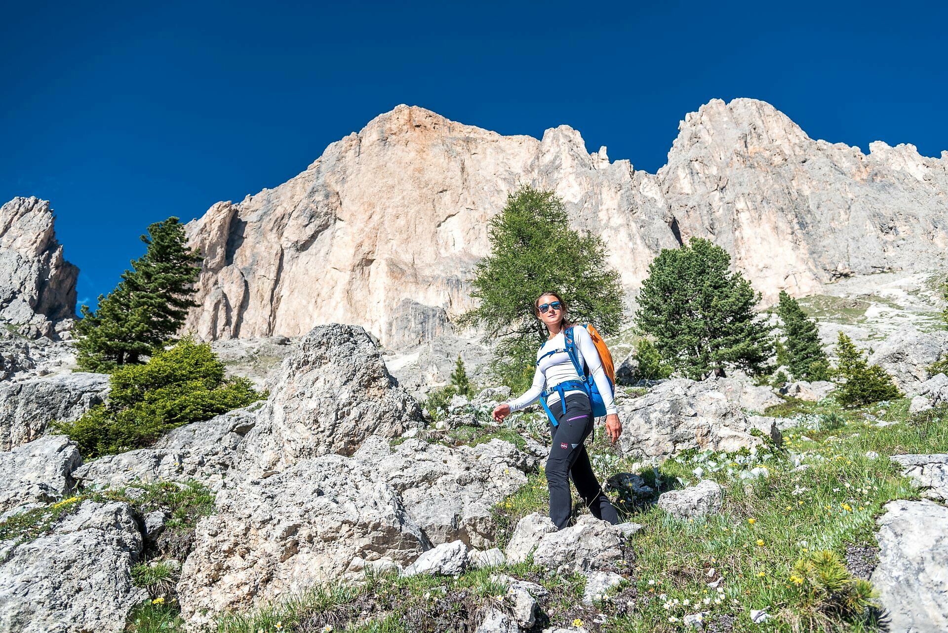
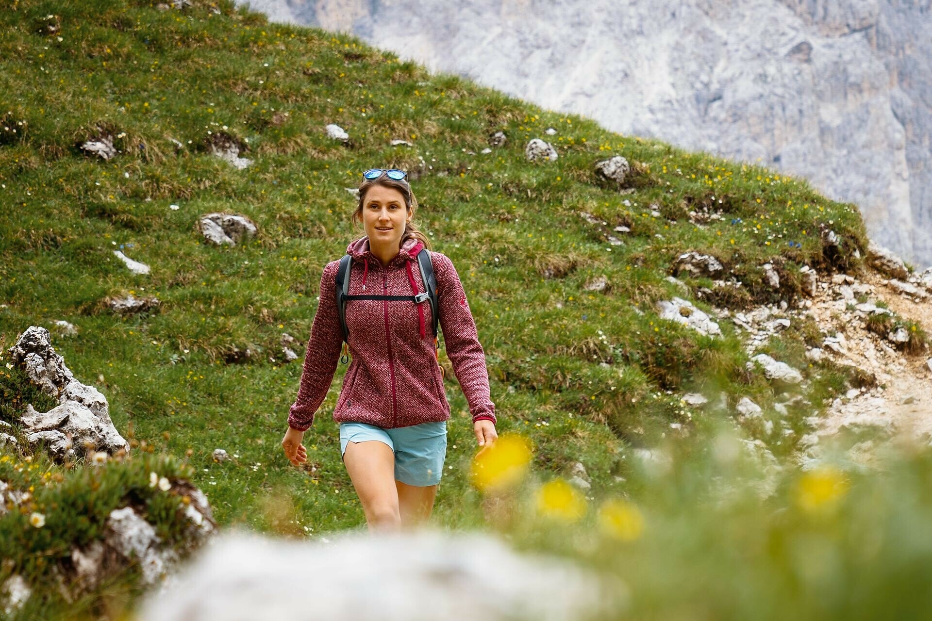
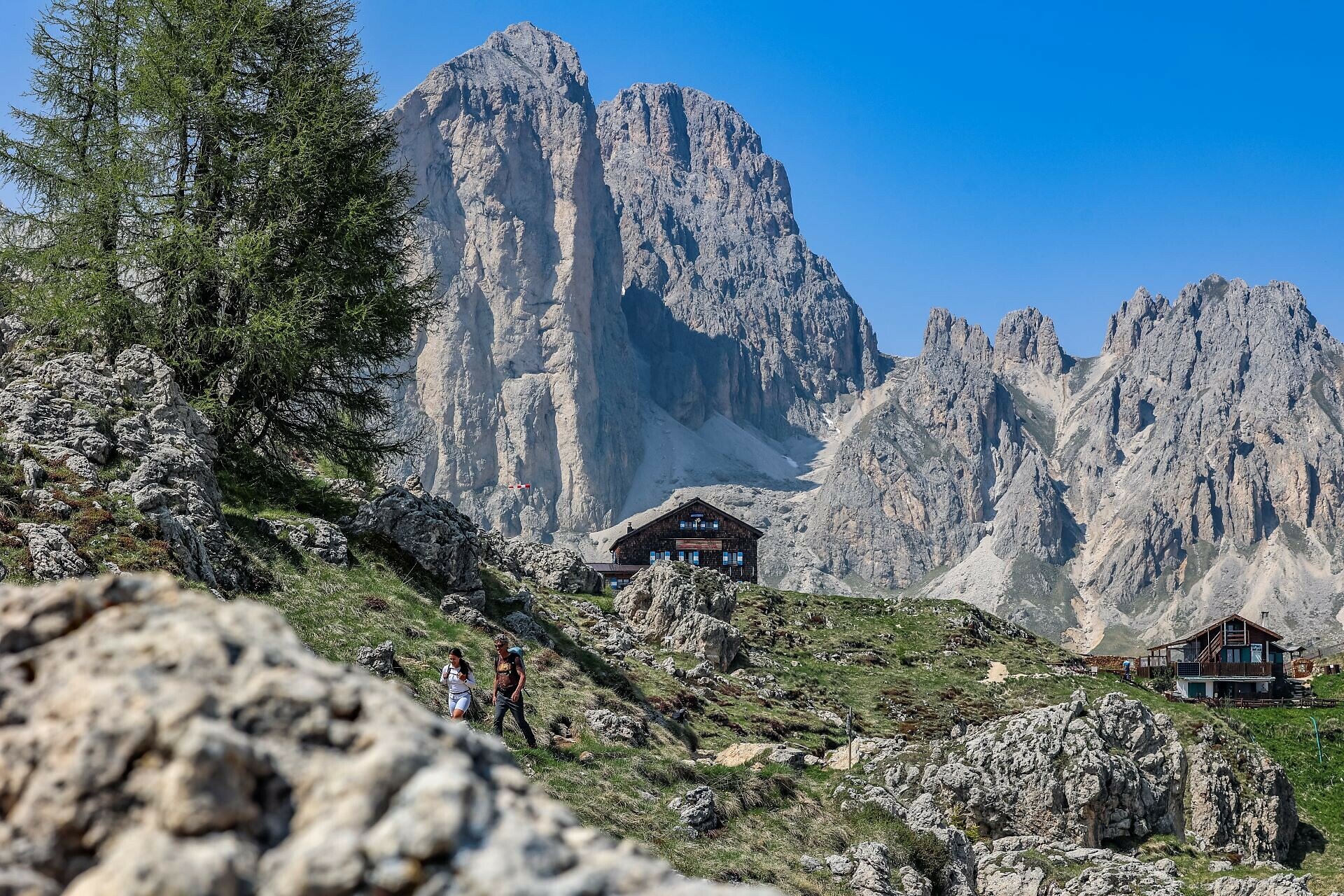
Scenic hike around the centerpiece of the Rosengarten |Catinaccio – the Rotwand | Roda di Vael.

The hike to the Vajolonpass | Passo Vajolon is one of the most scenic tours in the Rosengarten | Catinaccio area. It runs in close proximity to the mighty rock walls of the Rotwand | Roda di Vael and offers a varied landscape along the way - from alpine meadows and dwarf pine slopes to rugged high mountain terrain during the ascent. What makes this tour particularly special is the immediate closeness to the dramatic rock formations of the Rosengarten | Catinaccio, especially the striking Rotwand | Roda di Vael, whose imposing appearance is especially awe-inspiring up close. The Vajolonpass | Passo Vajolon itself is nestled between steep rock faces and offers a spectacular view back over the Eggental valley and across to the Latemar massif.

Route info
Difficult
Distance
10,7 km
Activity time
3 h 47 min
Ascent
887 m
Descent
868 m
Physical effort
Scenary
Highest point
2.573 m
Lowest point
1.754 m
Suggestions

Refreshment stops:

Safety guidelines
Walkers must be well-equipped and have no fear of heights.
Directions

The hike begins at the Karerpass | Passo di Costalunga (1752 m). Just opposite the sports shop, path [1A] starts, initially following a narrow paved road that soon becomes a forest path. At the trail junction, follow path [552], which leads via a short, steep ascent to the Paolina hut. From there, the path continues along narrow paths, past small streams and rocky alpine meadows, until it joins path [9]. This route leads to the Vajolonpass | Passo Vajolonvia a steep couloir, equipped with stairs, a ladder, wooden planks, and steel cables to assist the ascent. At the Vajolonpass | Passo Vajolon (2560 m), you’ll be rewarded with breathtaking views of the surrounding mountains and the Fassa valley below. The descent follows paths [551] and later [541] down to the Rotwand | Roda di Vael hut (2283 m) and the adjacent Pederiva hut. From there, path [548] leads through meadows and forest down to the Karerpass | Passo di Costalunga.

Alternative: Instead of hiking up to the Paolina hut, you can take the chairlift from the Paolina car park and join the route from there. For the return, you can descend from the Rotwand | Roda di Vael hut via the Christomannos monument and take the chairlift back down to the Paolina car park.

Refreshment stops:


Notice:
Walkers must be well-equipped and have no fear of heights.
public transportation

Getting to the starting point of the tour by public transport is easy and convenient. 

By public bus line:
- 180 from Bozen | Bolzano, Birchabruck | Ponte Nova
- 180 or 184 from Welschnofen | Nova Levante, Karersee | Carezza
- 184 from Weissenstein | Pietralba, Petersberg | Monte San Pietro, Deutschnofen | Nova Ponente, Stenk (or 181 and change 180)
- 184 from Obereggen, Eggen | Ega (or 184 and change 180)
- 187 from Steinegg | Collepietra, Gummer | San Valentino (or 182 and change 180)
- 180 from Val di Fassa

Bus stop: Karerpass | Passo Costalunga; online timetable search at www.suedtirolmobil.info/en/

How to get there

Getting to the starting point of the tour by public transport is easy and convenient. 

By public bus line:
- 180 from Bozen | Bolzano, Birchabruck | Ponte Nova
- 180 or 184 from Welschnofen | Nova Levante, Karersee | Carezza
- 184 from Weissenstein | Pietralba, Petersberg | Monte San Pietro, Deutschnofen | Nova Ponente, Stenk (or 181 and change 180)
- 184 from Obereggen, Eggen | Ega (or 184 and change 180)
- 187 from Steinegg | Collepietra, Gummer | San Valentino (or 182 and change 180)
- 180 from Val di Fassa

Bus stop: Karerpass | Passo Costalunga; online timetable search at www.suedtirolmobil.info/en/

By car:
Destination: Karersee | Carezza
Parking: parking lot Karerpass | Passo Costalunga

Where to park
Parking: parking lot Karerpass | Passo Costalunga (with costs), https://maps.app.goo.gl/2RPjavHimeyEhQKSA
You might be interested in
Discover related tours
Karersee, Welschnofen
To the Poppekanzel | Pulpito in the Latemar
Distance 7,0 km
Activity time 2 h 26 min
Ascent 560 m
Descent 566 m
Karersee, Welschnofen
Hike to the Heart of the Rosengarten Massif – Vajolon Pass
Distance 9,6 km
Activity time 5 h 00 min
Ascent 825 m
Descent 825 m
Intermediate
Add to favourites
Obereggen, Deutschnofen
Hike Lavazè-Zanggen-Pampeago Pass
Distance 11,3 km
Activity time 4 h 25 min
Ascent 763 m
Descent 763 m
Karersee, Welschnofen
Hike round the Rosengarten Massif
Distance 11,0 km
Activity time 5 h 00 min
Ascent 769 m
Descent 770 m
Obereggen, Deutschnofen
Hike to the Latemarhütte Mountain Hut
Distance 8,2 km
Activity time 3 h 55 min
Ascent 719 m
Descent 719 m
Karersee, Deutschnofen, Welschnofen
Alpine Ridgeway from the Latemar mountain to the Rosengarten mountain
Distance 25,9 km
Activity time 6 h 30 min
Ascent 1.582 m
Descent 1.964 m
© Carezza Dolomites/Harald Wisthaler
Information & prices
Ski passes
Winter 2024/25

Here you will find all important information on skipasses, daily, multi-day, and seasonal tickets at a glance. All ski passes can be purchased quickly and conveniently online. Buy your skipass directly from home and get a 5% discount!

To the ski passes & tickets