Top

Circular hike around the Rosengarten | Catinaccio massif

Karersee, Welschnofen
Add to favourites
Category
Difficulty
Intermediate
Activity time
5:01
Duration in hours
Distance
10.7
Distance in km
Suggested period
Jan
Feb
Mar
Apr
May
Jun
Jul
Aug
Sep
Oct
Nov
Dec
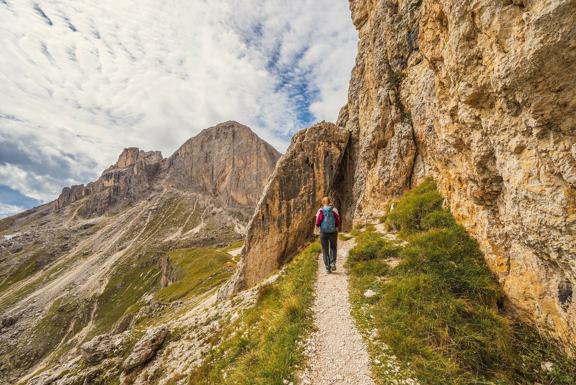
Varied and challenging circular hike around the Rosengarten – Circumnavigating the majestic Rosengarten is an absolute highlight in the Eggental valley.
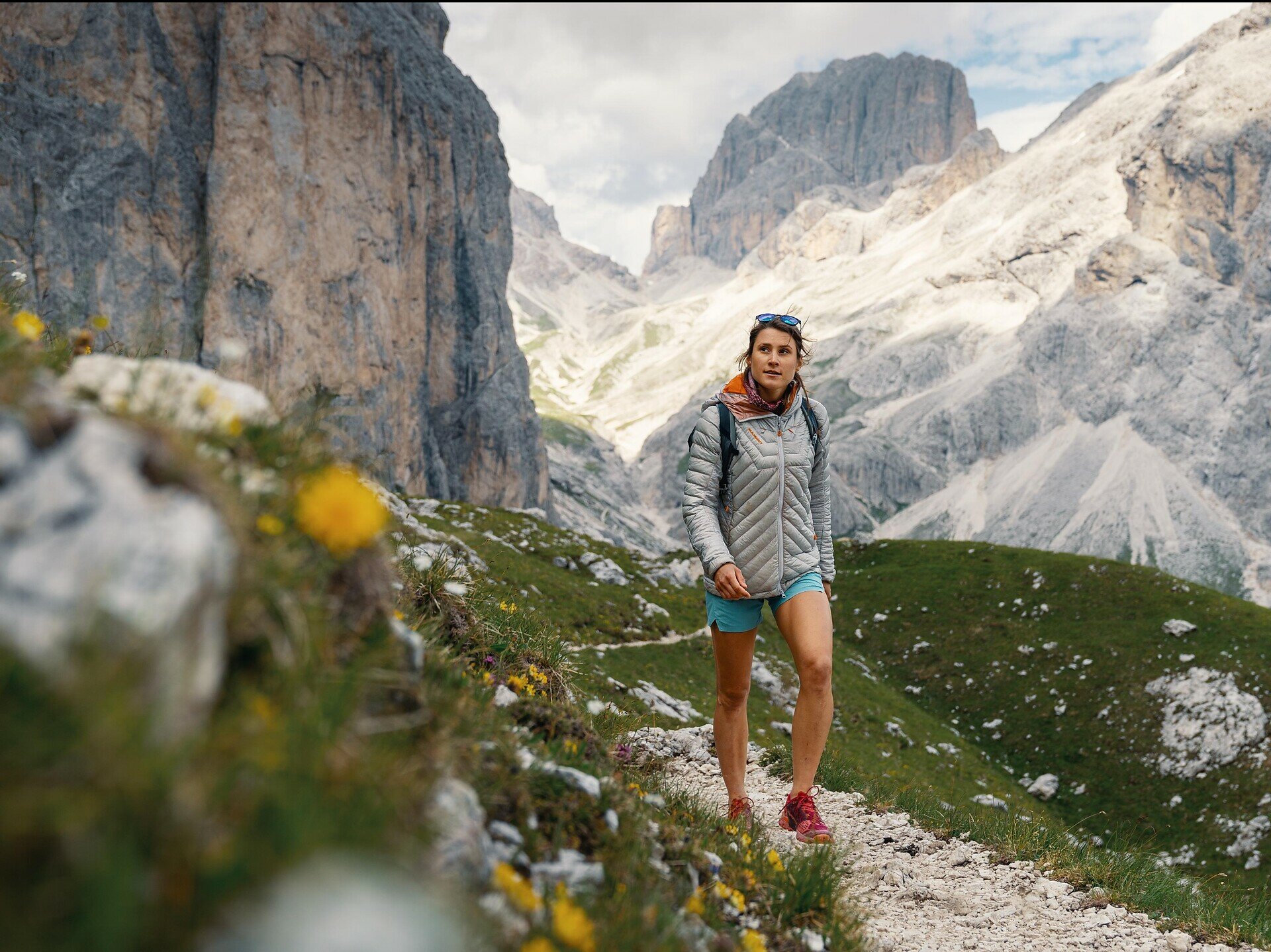
If you decide to go hiking in the Eggental valley, you can experience the UNESCO World Natural Heritage Dolomites with its striking mountains such as the Rosengarten | Catinaccio and the Latemar in many different ways. Whether on leisurely walks along the alpine pastures, where the imposing mountain backdrop is visible on the horizon, or on challenging mountain tours, where you can experience the Dolomites up close and in the midst of it all.

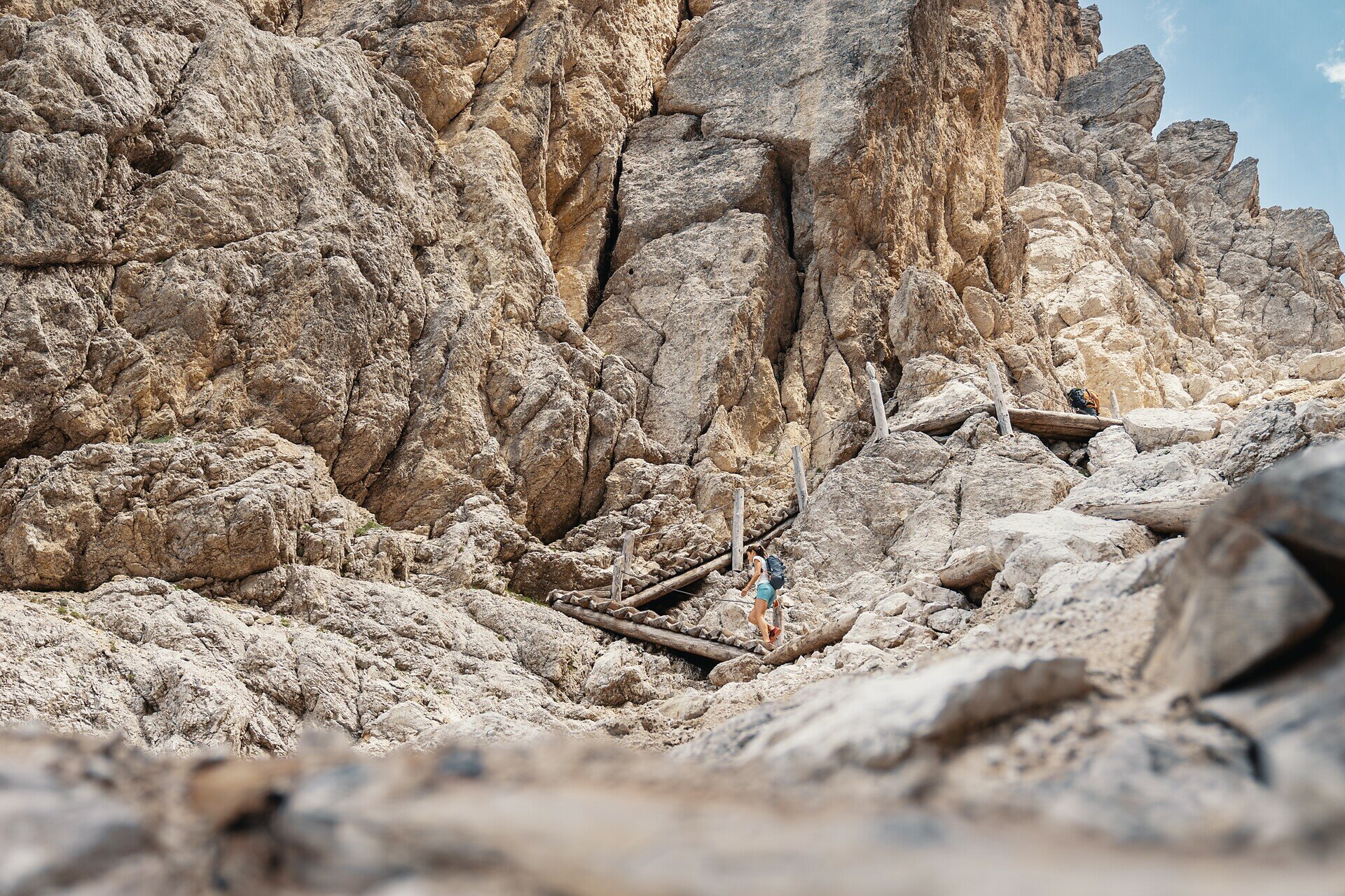
If you want to explore the unique splendour of the region on your own, set out on the enchanting circular tour around the Rosengarten | Catinaccio group. Following in the footsteps of the dwarf King Laurin, to whom, according to legend, the Dolomites owe their magical glow at dusk, the impressive high-altitude hike begins at the Kölner | Fronza alle Coronelle hut. Over a total distance of 12 kilometres, you will climb around 800 metres in altitude.

On the way, you cross the Tschagerjoch | Passo delle Coronelle and the Cigoladepass | Passo delle Cigolade as well as the Hirzel path. On the way back to the starting point, there are always unobstructed views of the surrounding peaks and valleys, showing the beauty of the landscape in all its splendour.
Route info
Intermediate
Distance
10,7 km
Activity time
5 h 01 min
Ascent
835 m
Descent
858 m
Physical effort
Scenary
Highest point
2.631 m
Lowest point
2.222 m
Suggestions
Refreshment stops:
Safety guidelines
Walkers must be well-equipped and have no fear of heights.
Directions
Directly from the centre of Welschnofen | Nova Levante, the Laurin I cable car takes you to the Frommer Alm hut (1743 m), from where you can comfortably take the cable car König Laurin I & II to the Kölner | Fronza alle Coronelle hut (2337 m). From here, the mountain trail [550] leads to the Tschagerjoch | Passo delle Coronelle (2630 m). The route initially climbs a rocky ridge equipped with wire cables. Afterwards, it continues more gently before a steep ascent between rugged rock walls brings you to the Tschagerjoch | Passo delle Coronelle. Several sections are secured with wooden planks and wire ropes.
The steep descent then follows the slope down until, at a junction, trail [541] branches off toward the Cigoladepass | Passo Cigolade (2550 m). This trail traverses debris-laden alpine meadows below jagged rock walls with gentle ups and downs, before climbing steeply to the pass. One section is equipped with a steel cable, and hikers must also overcome a short ladder. Amidst the dramatic rock formations, breathtaking views open up again and again onto the picturesque Fassa and Vajolon valleys.
The trail then continues on a stony descent to a rock passage, which opens into a wide Dolomite amphitheater. Following trail [541], you reach the Rotwand | Roda di Vael hut (2280 m) and the Pederiva hut (2275 m). From here, trail [549] leads to the Christomannos monument - a 2.70 m bronze eagle. The upper Hirzel path [549], which includes a short section with a steel cable, connects the monument back to the Kölner | Fronza alle Coronelle hut. Alternatively, from the Christomannos monument, you can follow the lower Hirzel path [539], trail [552] and [549], and return to the starting point along this well-traveled and easier route.

Alternative:
Take the chair lift Paolina to the Paolina hut (2125 m), where the route starts. From here proceed along the signs [539] and [549] until you reach the Rotwand | Roda di Vaèl hut (2280 m) & Pederiva hut (2.275 m) Continue on path [541] past the Cigoladepass | Passo delle Cigolade (2550 m) and then along path [541] and [550] to Tschagerjoch | Passo delle Coronelle (2630 m). From Tschagerjoch | Passo delle Coronelle go down to the Kölner | Fronza alle Coronelle hut (2337 m) and the Laurins Lounge and then back on paths [549] and [552] to the Paolina hut.

Notice:
Walkers must be well-equipped and have no fear of heights.

Refreshment stops:
public transportation

Getting to the starting point of the tour by public transport is easy and convenient. 

By public bus line:
- 180 from Bozen | Bolzano, Birchabruck | Ponte Nova
- 180 from Fassatal | Val di Fassa, Karersee | Carezza, Karerpass | Passo Costalunga
- 184 from Weissenstein | Pietralba, Petersberg | Monte San Pietro, Deutschnofen | Nova Ponente, Stenk (or 181 and change 180)
- 184 from Obereggen, Eggen | Ega (or 184 and change 180)
- 186 from St. Zyprian | S. Cipriano, Nigerpass | Passo Nigra with change 180
- 187 from Steinegg | Collepietra, Gummer | San Valentino (or 182 and change 180)

Bus stop: Welschnofen Zentrum | Nova Levante centro (centre) + ascent with the cable car; online timetable search at www.suedtirolmobil.info/en/

How to get there
Getting to the starting point of the tour by public transport is easy and convenient. 

By public bus line:
- 180 from Bozen | Bolzano, Birchabruck | Ponte Nova
- 180 from Fassatal | Val di Fassa, Karersee | Carezza, Karerpass | Passo Costalunga
- 184 from Weissenstein | Pietralba, Petersberg | Monte San Pietro, Deutschnofen | Nova Ponente, Stenk (or 181 and change 180)
- 184 from Obereggen, Eggen | Ega (or 184 and change 180)
- 186 from St. Zyprian | S. Cipriano, Nigerpass | Passo Nigra with change 180
- 187 from Steinegg | Collepietra, Gummer | San Valentino (or 182 and change 180)

Bus stop: Welschnofen Zentrum | Nova Levante centro (centre) + ascent with the cable car; online timetable search at www.suedtirolmobil.info/en/

By car: 
Destination: Welschnofen | Nova Levante
Parking: Parking lor cable car Laurin I + ascent with the cable car
Where to park
Parking: parking lot cable car Welschnofen | Nova Levante Laurin I, https://maps.app.goo.gl/sArFu4rWe1AirKsZ7 
Ascent with the cable car.
You might be interested in
Discover related tours
Karersee, Welschnofen
Into the heart of the Rosengarten | Catinaccio massif – Vajolon
Distance 10,7 km
Activity time 3 h 47 min
Ascent 887 m
Descent 868 m
Obereggen, Deutschnofen
Hike Lavazè-Zanggen-Pampeago Pass
Distance 11,3 km
Activity time 4 h 25 min
Ascent 763 m
Descent 763 m
Karersee, Welschnofen
Circular hike along the Hirzelsteig | Masarè path
Distance 8,1 km
Activity time 2 h 27 min
Ascent 336 m
Descent 339 m
Intermediate
Add to favourites
Karersee
Via the sheep path from the Fassa valley to the Paolina hut
Distance 5,8 km
Activity time 2 h 01 min
Ascent 459 m
Descent 316 m
Karersee, Welschnofen
To the Poppekanzel | Pulpito in the Latemar
Distance 7,0 km
Activity time 2 h 26 min
Ascent 560 m
Descent 566 m
Obereggen, Deutschnofen
Hike to the Latemarhütte Mountain Hut
Distance 8,1 km
Activity time 4 h 00 min
Ascent 719 m
Descent 719 m
© Carezza Dolomites/Harald Wisthaler
Information & prices
Ski passes
Winter 2024/25

Here you will find all important information on skipasses, daily, multi-day, and seasonal tickets at a glance. All ski passes can be purchased quickly and conveniently online. Buy your skipass directly from home and get a 5% discount!

To the ski passes & tickets