Top

Hike to the Weißhorn Mountain

Deutschnofen
Add to favourites
Difficulty
Difficult
Activity time
6:30
Duration in hours
Distance
17.7
Distance in km
WSEN
Suggested period
Jan
Feb
Mar
Apr
May
Jun
Jul
Aug
Sep
Oct
Nov
Dec
Scenic summit hike from Maria Weissenstein to the Weißhorn – with 360° views, alpine charm and spiritual moments. For active hikers and mountain lovers.

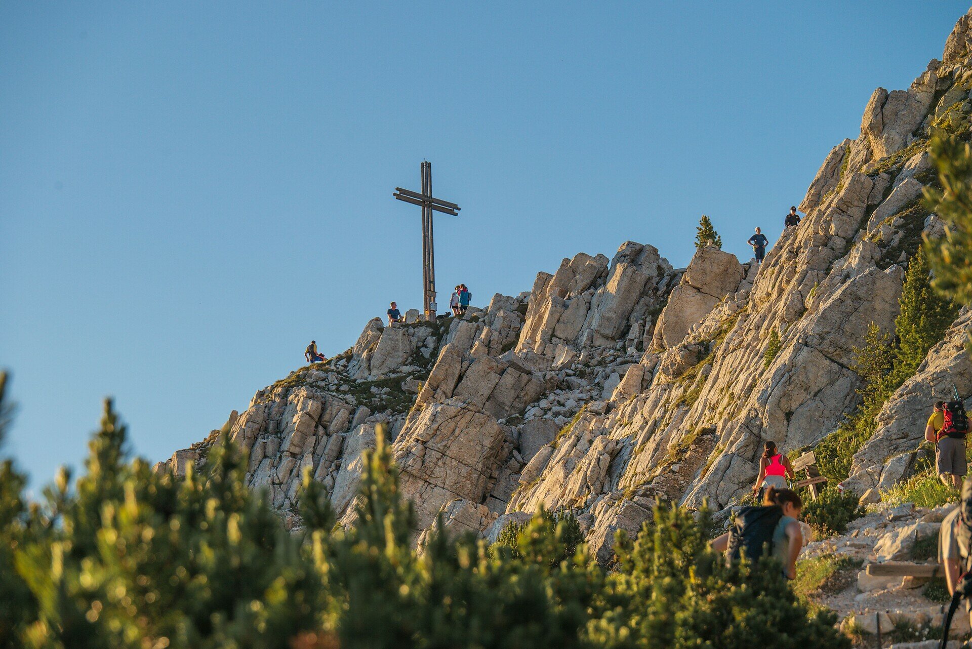
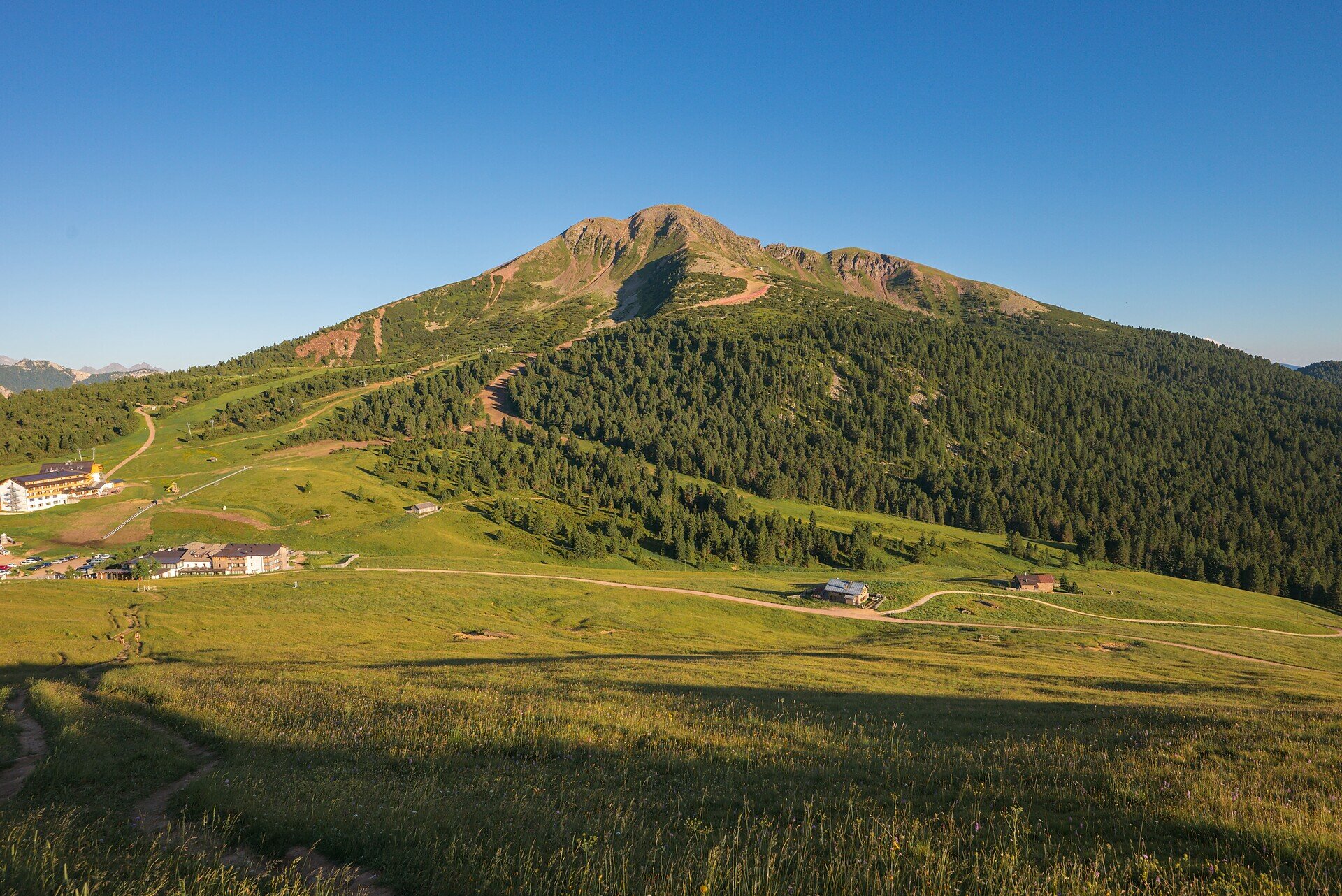
Reaching the summit of the Weißhorn is more than just a hike – it’s an experience that touches body, mind, and soul. Starting at the peaceful Maria Weissenstein sanctuary, the trail leads through the serene Kösertal valley, past alpine pastures and pine scrub, and into rugged high-mountain terrain.
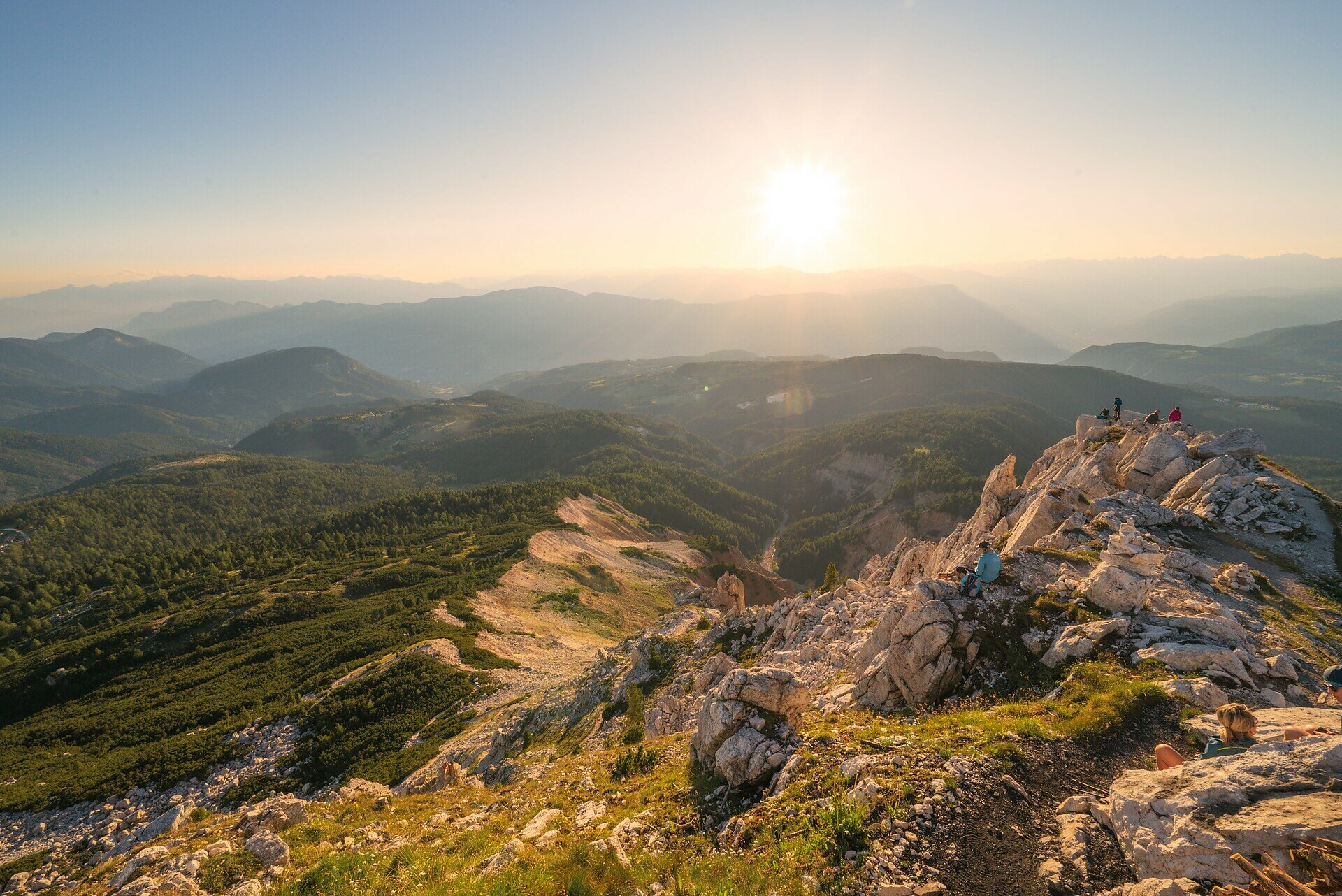
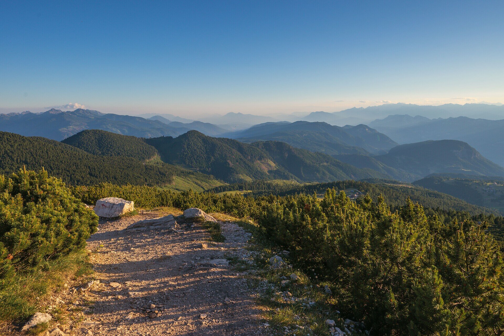
At the top, a breathtaking 360° panorama unfolds: from the Dolomites to the Zillertal and Sarntal Alps, the Rosengarten and even as far as the Ortler. It's a view that stirs the soul.
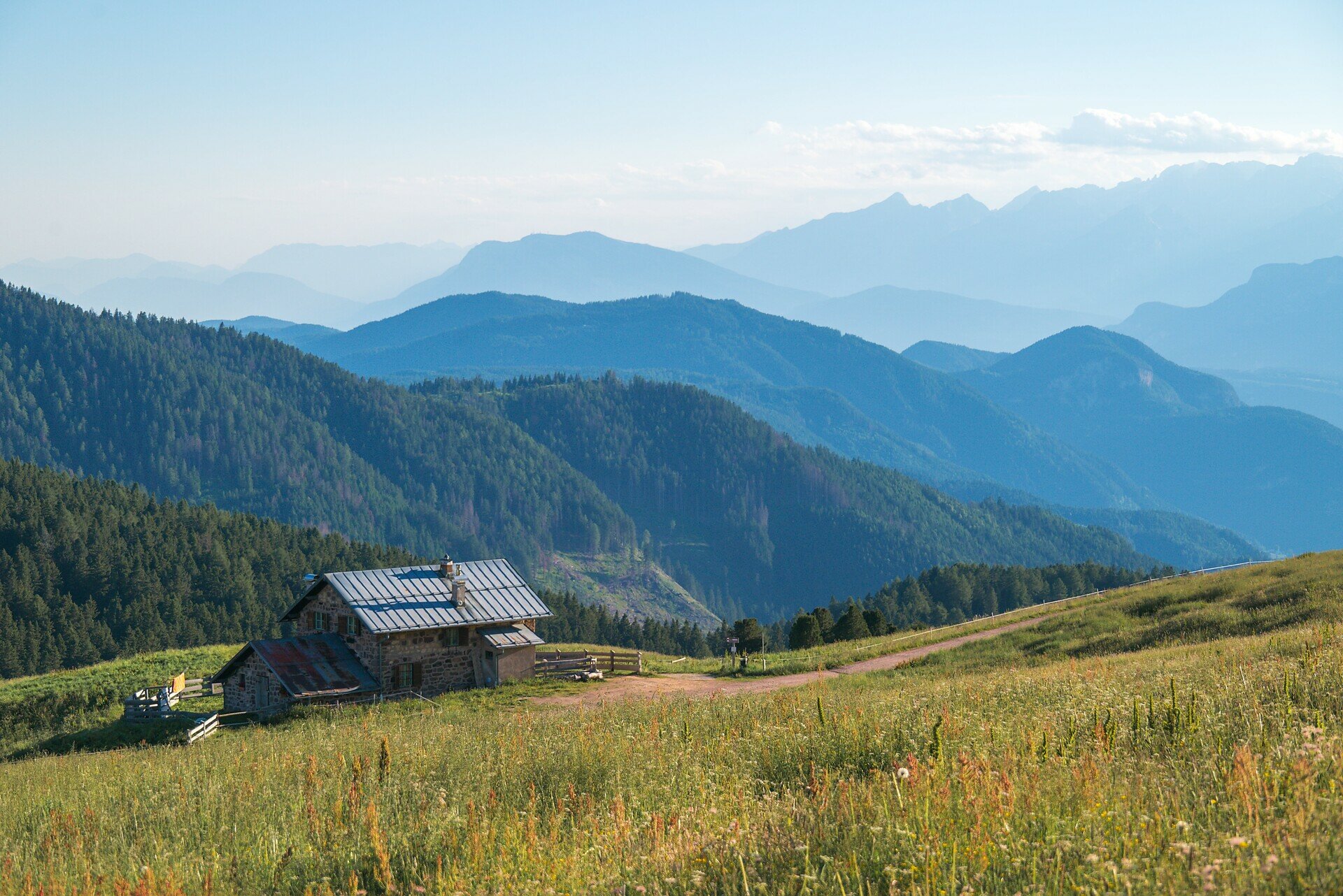
On the way back, a break at the welcoming Neuhütt Alm is the perfect reward before returning to the valley. A hike of contrasts – between alpine wilderness and spiritual quiet, between panoramic views and grounding silence. Perfect for sure-footed mountain lovers seeking depth and inspiration.

Route info
Difficult
Distance
17,7 km
Activity time
6 h 30 min
Ascent
834 m
Descent
834 m
Physical effort
Scenary
Highest point
2.313 m
Lowest point
1.520 m
Directions

The hike begins at the Maria Weissenstein pilgrimage site, at 1,520 m elevation. Follow trail [S] through the picturesque Kösertal valley, across alpine meadows and forest. After approx. 45 minutes, you’ll join the European long-distance trail [E5], heading toward Jochgrimm. From there, continue on the steeper trail [5], which winds through pine scrub and rocky terrain up to the summit of the Weißhorn (2,317 m).
At the top, enjoy a spectacular panoramic view of the Dolomites, Ortler, Zillertal and Sarntal Alps.
The descent follows trail [1] via Jochgrimm (1,989 m) and the Neuhütt Alm (open for refreshments), returning through the Kösertal to Maria Weissenstein.
Total duration: approx. 6 hours (3 h ascent / 3 h descent)

public transportation

Getting to the starting point of the tour by public transport is easy and convenient.

By public bus line:
- 180 or 181 from Bozen | Bolzano
- 180 or 184 from Karersee | Lago di Carezza, Karerpass | Passo Costalunga, Welschnofen | Nova Levante 
- 184 from Birchabruck | Ponte Nova, Stenk, Eggen | Ega
- 184 from Petersberg | Monte San Pietro,  Deutschnofen | Nova Ponente
- 182 from Steinegg | Collepietra, Gummer | San Valentino
- 180 from Val di Fassa

Bus stop: Weissenstein | Pietralba; online timetable search at www.suedtirolmobil.info/en/
Meeting point: Weissenstein | Pietralba: https://goo.gl/maps/BNSP7XGxA78ptriZ7

How to get there

Getting to the starting point of the tour by public transport is easy and convenient.

By public bus line:
- 180 or 181 from Bozen | Bolzano
- 180 or 184 from Karersee | Lago di Carezza, Karerpass | Passo Costalunga, Welschnofen | Nova Levante 
184 from Birchabruck | Ponte Nova, Stenk, Eggen | Ega
- 184 from Petersberg | Monte San Pietro,  Deutschnofen | Nova Ponente
- 182 from Steinegg | Collepietra, Gummer | San Valentino
- 180 from Val di Fassa

Bus stop: Weissenstein | Pietralba; online timetable search at www.suedtirolmobil.info/en/
Meeting point: Weissenstein | Pietralba: https://goo.gl/maps/BNSP7XGxA78ptriZ7

By car:
Destination: Weissenstein  | Pietralba
Parking: Parking lot Weissenstein  | Pietralba#
Meeting point: Weissenstein | Pietralba: https://goo.gl/maps/BNSP7XGxA78ptriZ7

Where to park

Parking: Parking lot Weissenstein  | Pietralba
Meeting point: Weissenstein | Pietralba: https://goo.gl/maps/BNSP7XGxA78ptriZ7

You might be interested in
Discover related tours
Intermediate
Add to favourites
Welschnofen
Middle circular route at Lake Carezza
Distance 2,5 km
Activity time 42 min
Ascent 73 m
Descent 73 m
Karersee, Welschnofen
Hike from the Lake Carezza to the Malga Frommer Alm
Distance 10,1 km
Activity time 3 h 01 min
Ascent 397 m
Descent 133 m
Welschnofen
Kölblegg Hike
Distance 10,3 km
Activity time 3 h 30 min
Ascent 361 m
Descent 359 m
Intermediate
Add to favourites
Deutschnofen, Welschnofen
Hike & Bike |From Obereggen to Lake Carezza and via the Templweg trail back to Obereggen
Distance 20,3 km
Activity time 4 h 25 min
Ascent 603 m
Descent 627 m
Welschnofen
From the Frommer Alm to the Lake Carezza
Distance 5,6 km
Activity time 1 h 31 min
Ascent 70 m
Descent 275 m
Karersee, Welschnofen
Into the heart of the Rosengarten | Catinaccio massif – Vajolon
Distance 10,7 km
Activity time 4 h 30 min
Ascent 918 m
Descent 918 m
Status
open
© Carezza Dolomites/Harald Wisthaler
Information & prices
Ski passes
Winter 2024/25

Here you will find all important information on skipasses, daily, multi-day, and seasonal tickets at a glance. All ski passes can be purchased quickly and conveniently online. Buy your skipass directly from home and get a 5% discount!

To the ski passes & tickets