Top

Circular hike from Steinegg to the Hofschank Wiedenhof

Steinegg
Add to favourites
Difficulty
Intermediate
Activity time
3:03
Duration in hours
Distance
9.7
Distance in km
Suggested period
Jan
Feb
Mar
Apr
May
Jun
Jul
Aug
Sep
Oct
Nov
Dec
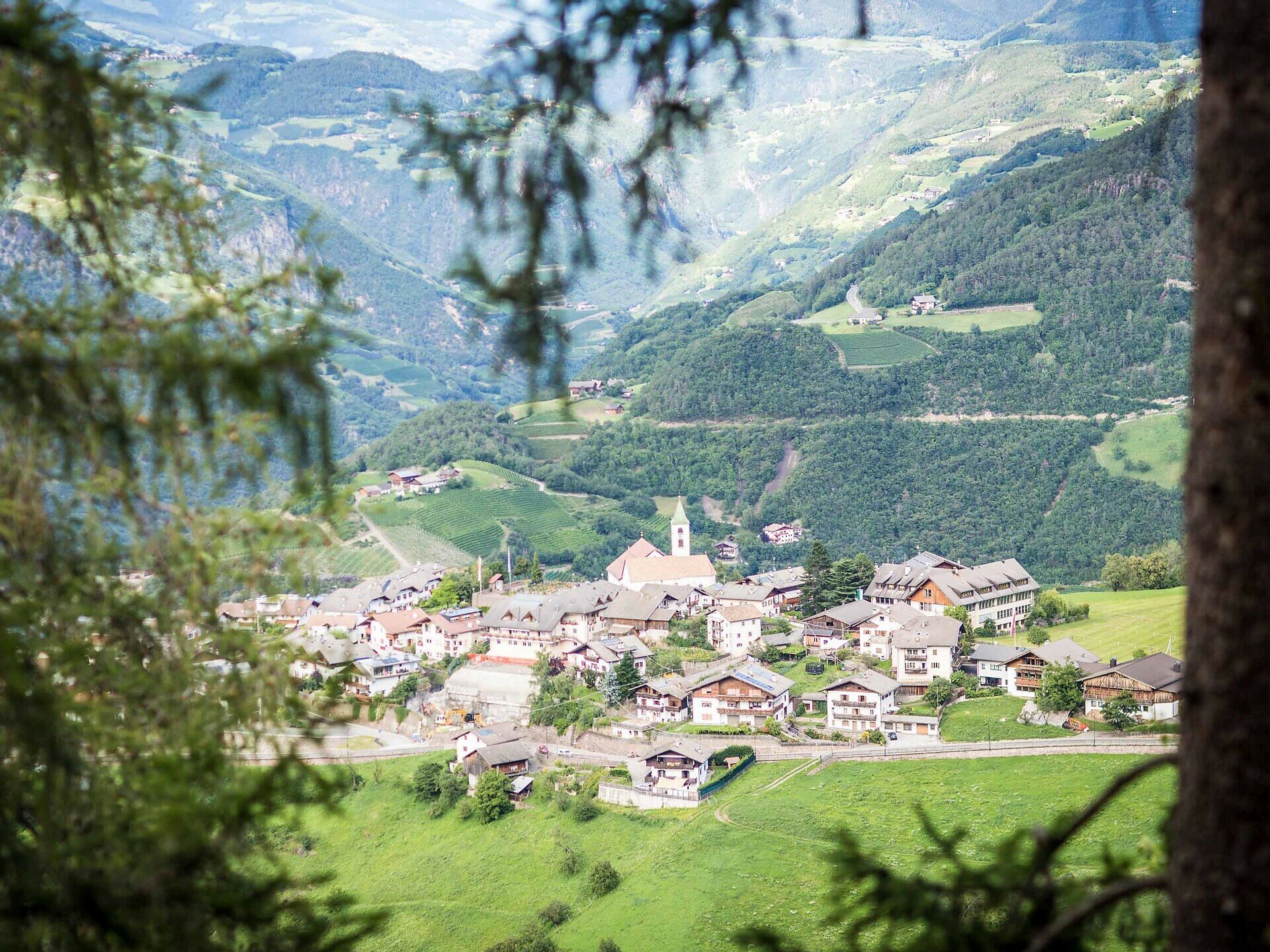
Varied circular hike near Steinegg with beautiful views, the Ölgartner Bild, and a place to stop at the family-friendly Wiedenhof.

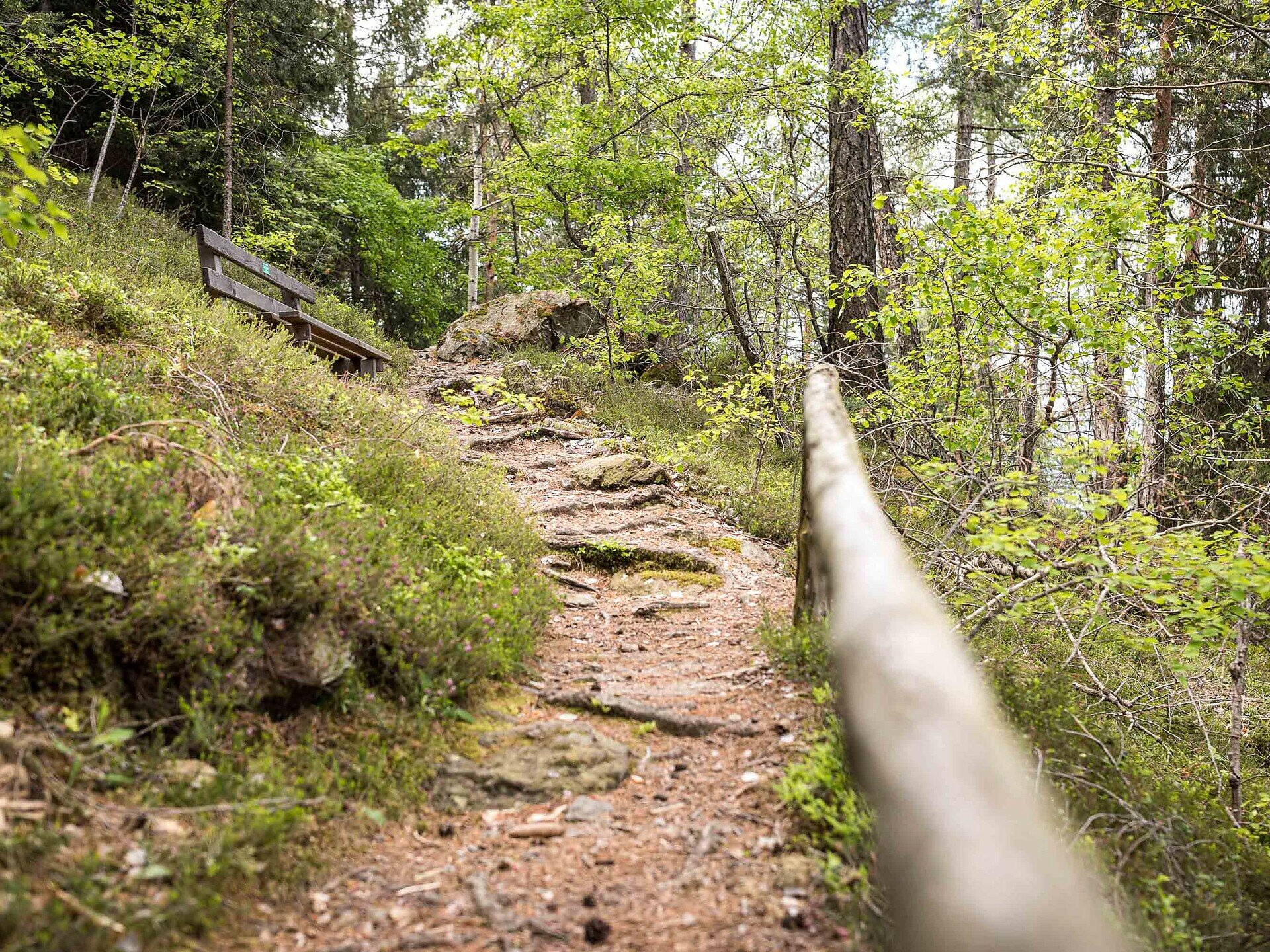
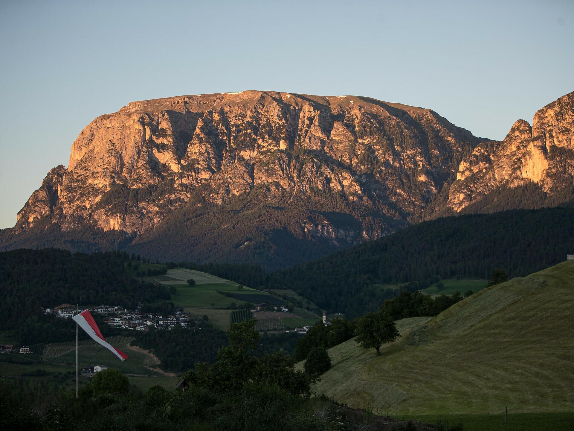
Start right in the idyllic Steinegg and follow a wonderful and partly challenging circular route through forests, meadows, and beautiful views. The path leads you over 9.7 km and about 525 m of altitude gain to romantic spots like the Spitzköfele with breathtaking views of the Schlern and the Rosengarten.

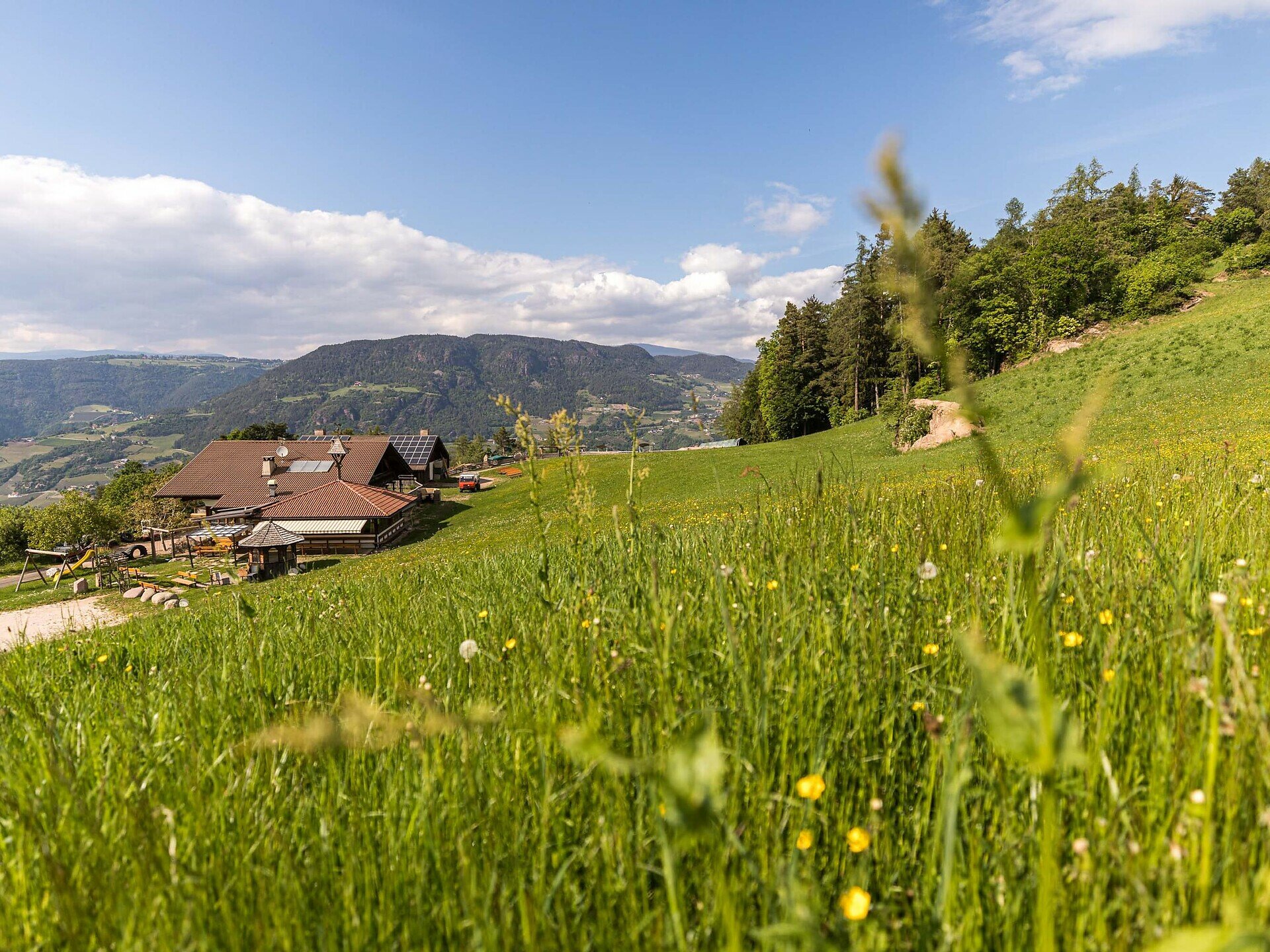
Along the way, you will encounter the lovingly restored Bildstöckl “Ölgartner Bild” and finally arrive at the cozy Hofschank Wiedenhof. There you will find a playground for the little ones and a petting zoo – ideal for families and a relaxing break with regional delicacies.

The loop back to Steinegg is comfortably manageable – and well accessible by public transport or easy to start from the village square.

Route info
Intermediate
Distance
9,7 km
Activity time
3 h 03 min
Ascent
525 m
Descent
521 m
Physical effort
Scenary
Highest point
1.187 m
Lowest point
804 m
Directions

Your route starts in the center of Steinegg (820 m) – directly at the bus stop “Steinegg Dorf” or at the parking lot by the village square. From there, you hike on path [3] to the upper village of Steinegg. Just above the bus garages, turn right onto path [6] and follow it past the Kummer Farm to the viewpoint Spitzköfele – a short detour is worthwhile because the view is magnificent!

Back on the main path, continue on path [7]. Past the lovingly restored Bildstöckl “Ölgartner Bild” (1,102 m) you reach path [6] again. Follow it for a bit until path [8B] branches off to the Hofschank Wiedenhof (920 m) on the right. There you will find a playground and a petting zoo – ideal for a cozy stop with the whole family.

The way back to Steinegg finally leads you comfortably via path [8].

public transportation

The starting point of the route is easy and convenient to reach by public transport.

By public bus line:
- 182 from Bolzano
- 187 from Welschnofen
- 180 from Karersee, Karerpass, Fassatal*
- 184 from Obereggen, Eggen*
- 181 from Weissenstein, Petersberg, Deutschnofen, Stenk*
- 187 or 182 from Gummer
*Change in Birchabruck to line 182

Bus stop: Steinegg, Dorf;
Online timetable search at Südtirol Mobil
Starting point: Steinegg Dorf

How to get there

The starting point of the route is easy and convenient to reach by public transport.

By public bus line:
- 182 from Bolzano
- 187 from Welschnofen
- 180 from Karersee, Karerpass, Fassatal*
- 184 from Obereggen, Eggen*
- 181 from Weissenstein, Petersberg, Deutschnofen, Stenk*
- 187 or 182 from Gummer
*Change in Birchabruck to line 182

Bus stop: Steinegg, Dorf;
Online timetable search at Südtirol Mobil
Starting point: Steinegg Dorf

By car:
Destination: Steinegg
Parking: next to the main road in front of Café Christl at the Dorfplatz Steinegg parking lot
Starting point: Steinegg Dorf

Where to park

Parking: next to the main road in front of Café Christl at the Dorfplatz Steinegg parking lot
Starting point: Steinegg Dorf

Hiking gear and hiking boots
You might be interested in
Discover related tours
Intermediate
Add to favourites
Welschnofen, Steinegg
Circular hike at Taltbühl to Totmoos and Wolfsgrube
Distance 10,3 km
Activity time 3 h 03 min
Ascent 391 m
Descent 387 m
Welschnofen
Stadlalm Tour
Distance 7,7 km
Activity time 2 h 00 min
Ascent 203 m
Descent 203 m
Welschnofen
Family hike from the Frommer Alm hut to the Ochsenhütte hut
Distance 2,1 km
Activity time 38 min
Ascent 102 m
Descent 53 m
Obereggen, Deutschnofen
Family-hike from the Lavazè Mountain Pass to the Lieg Alm Hut
Distance 5,1 km
Activity time 1 h 20 min
Ascent 78 m
Descent 78 m
Obereggen, Deutschnofen
LATEMAR.PANORAMA: Family-hike on the nature-trail
Distance 10,6 km
Activity time 3 h 50 min
Ascent 471 m
Descent 991 m
Intermediate
Add to favourites
Welschnofen, Obereggen, Deutschnofen
Hike & Bike: From Welschnofen | Nova Levante to the hut Latemar/Pisa
Distance 23,5 km
Activity time 5 h 30 min
Ascent 1.406 m
Descent 1.026 m
© Carezza Dolomites/Harald Wisthaler
Information & prices
Ski passes
Winter 2024/25

Here you will find all important information on skipasses, daily, multi-day, and seasonal tickets at a glance. All ski passes can be purchased quickly and conveniently online. Buy your skipass directly from home and get a 5% discount!

To the ski passes & tickets