Top

Hike from Passo Oclini at the top of the Corno Bianco

Deutschnofen
Add to favourites
Difficulty
Easy
Activity time
1:00
Duration in hours
Distance
1.5
Distance in km
WSEN
Suggested period
Jan
Feb
Mar
Apr
May
Jun
Jul
Aug
Sep
Oct
Nov
Dec
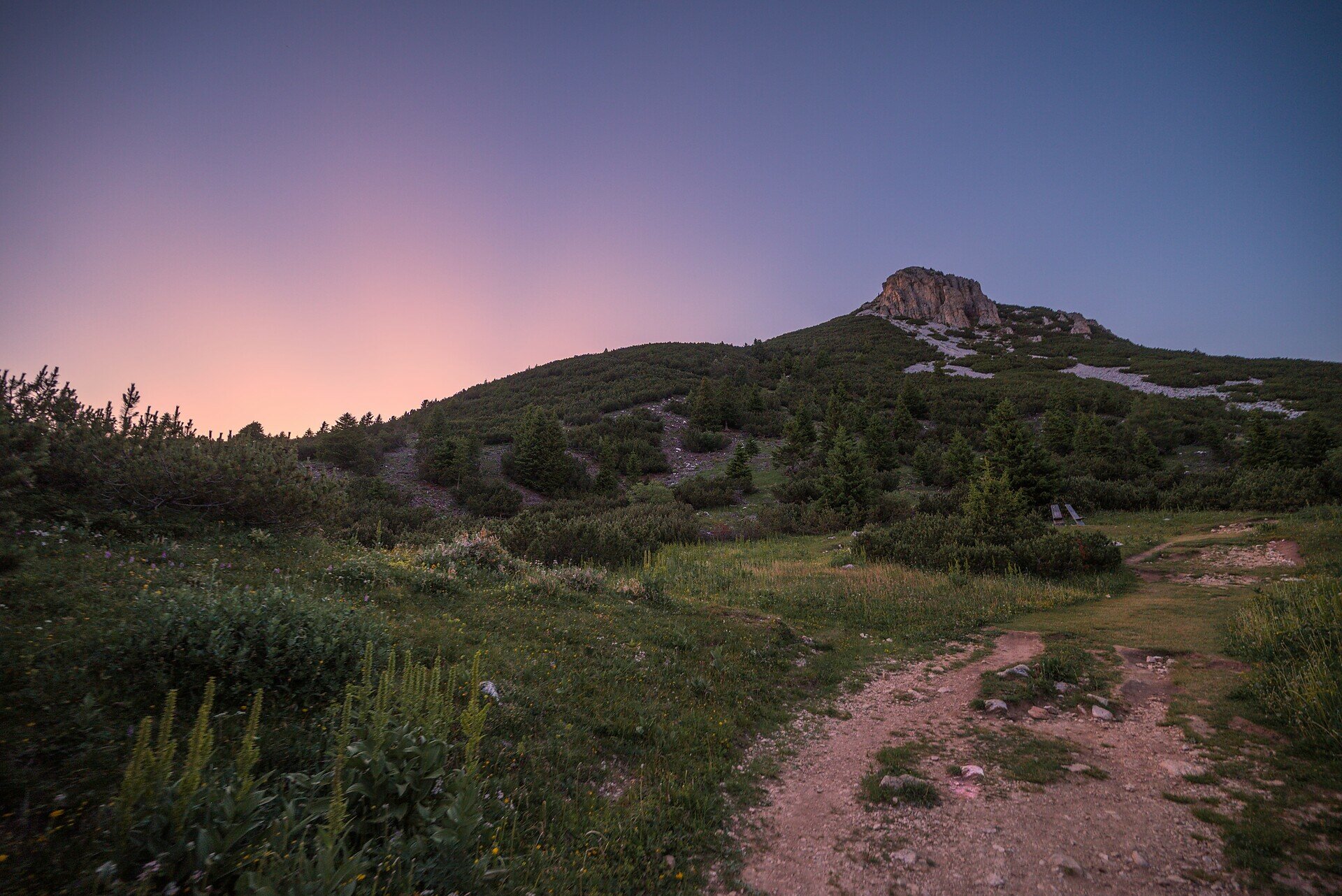
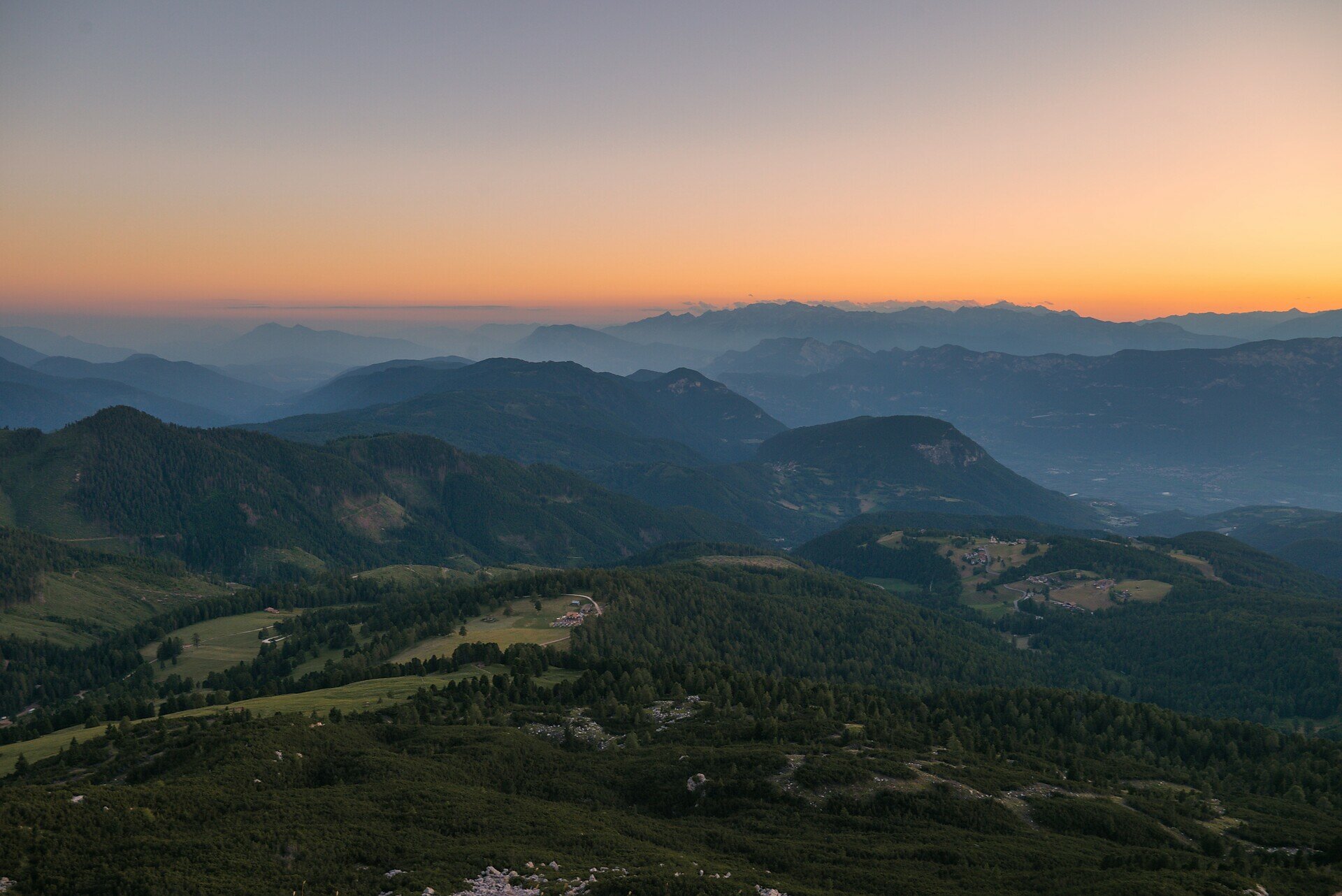
Scenic summit hike from Jochgrimm to Weißhorn – perfect for sure-footed hikers seeking panoramic views and unspoiled mountain nature.

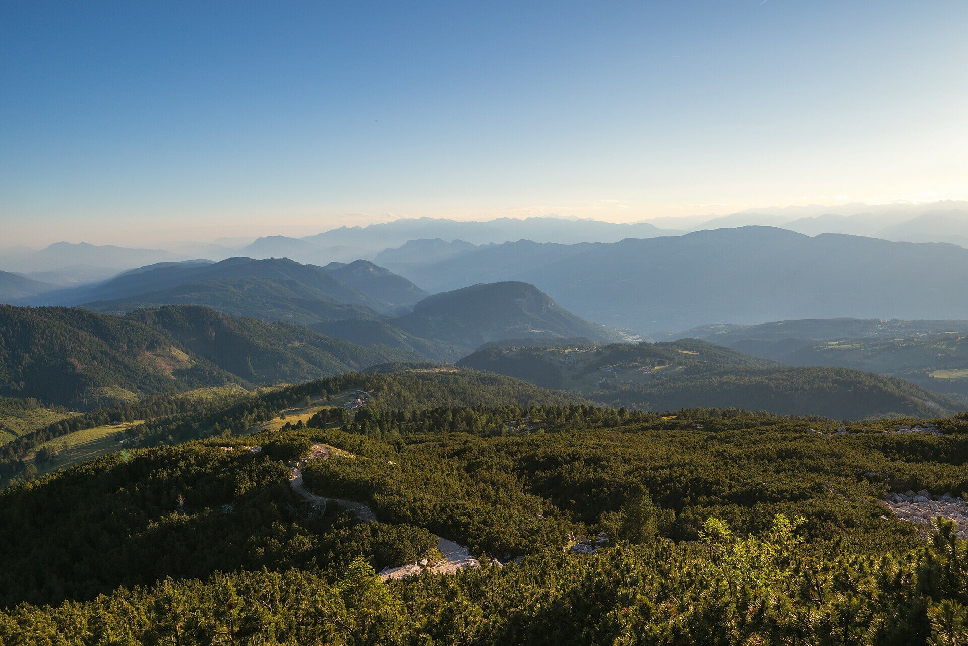
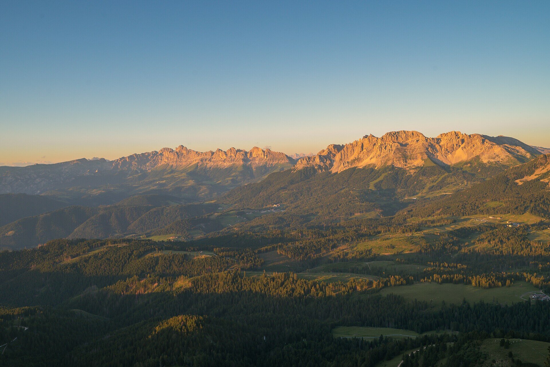
This summit hike is a true highlight for those who love raw mountain nature and sweeping alpine views. Starting from Jochgrimm, the trail climbs gently through wide meadows before transitioning into more rugged terrain as it leads toward the summit. The higher you go, the more spectacular the view becomes – stretching across the Rosengarten, Latemar, Brenta Group and, on clear days, even to the Sexten Dolomites.

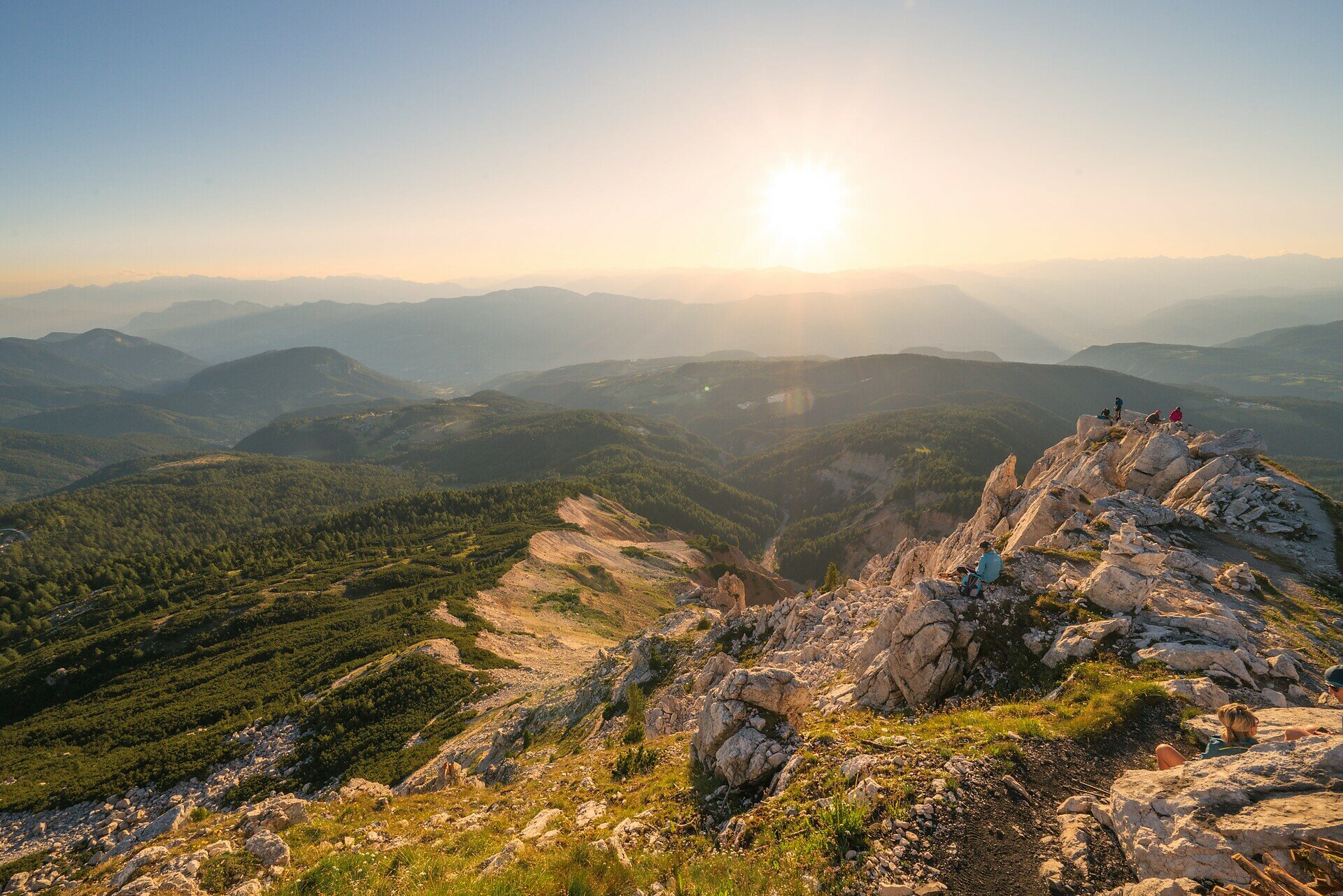
The final section over rocky ground requires a bit of sure-footedness, but the reward at the top is worth every step: a breathtaking 360° panorama and a deep sense of peace await at the summit cross.

Perfect for hikers who seek a combination of movement, scenery, and the quiet majesty of the high mountains.

Route info
Easy
Distance
1,5 km
Activity time
1 h 00 min
Ascent
306 m
Descent
13 m
Physical effort
Scenary
Highest point
2.297 m
Lowest point
1.990 m
Directions

This scenic hike begins at the Jochgrimm parking area (approx. 1,989 m), located between the Schwarzhorn and Weißhorn peaks. Follow the well-marked Trail [H], which starts across gentle alpine meadows.

After about 30 minutes, the trail gradually climbs through pine-covered slopes and rocky areas, some with wooden steps and stone paving. As you ascend, the views expand toward the Rosengarten, Latemar, the Adige Valley, and surrounding Dolomites.

Shortly before reaching the summit, the trail enters rocky terrain. A brief section with a steel safety cable requires sure-footedness, but it’s manageable for most hikers. After roughly 1.5 hours, you reach the summit cross of Weißhorn (2,313 m), offering breathtaking 360° panoramic views.

The descent follows the same Trail [H] back to Jochgrimm.

public transportation

Getting to the starting point of the tour by public transport is easy and convenient.

By public bus line:
- 180 and change 189 from Bozen | Bolzano
- 180 or 184 and change 189 from Karersee | Lago di Carezza, Karerpass | Passo Costalunga, Welschnofen | Nova Levante
- 184 and change 189 from Birchabruck | Ponte Nova, Stenk, Eggen | Ega, Obereggen 
- 184 and change 189 from Weissenstein | Pietralba, Petersberg |Monte San Pietro, Deutschnofen | Nova Ponente  
- 182 and change 189 from Steinegg | Collepietra, Gummer | San Valentino
- 180 and change 189 from Val di Fassa
Bus stop: Jochgrimm |Passo Oclini; online timetable search at www.suedtirolmobil.info/en/
How to get there

Getting to the starting point of the tour by public transport is easy and convenient.

By public bus line:
- 180 and change 189 from Bozen | Bolzano
- 180 or 184 and change 189 from Karersee | Lago di Carezza, Karerpass | Passo Costalunga, Welschnofen | Nova Levante
- 184 and change 189 from Birchabruck | Ponte Nova, Stenk, Eggen | Ega, Obereggen 
- 184 and change 189 from Weissenstein | Pietralba, Petersberg |Monte San Pietro, Deutschnofen | Nova Ponente  
- 182 and change 189 from Steinegg | Collepietra, Gummer | San Valentino
- 180 and change 189 from Val di Fassa 
Bus stop: Jochgrimm | Passo Oclini; online timetable search at www.suedtirolmobil.info/en/

By car:
Destination: Jochgrimm | Passo Oclini P
Parking: parking lot Jochgrimm | Passo Oclini
Meeting point: Parking lot Malga Ora: https://goo.gl/maps/UwWfytu3jmCJTRhM6

Where to park
Parking: parking lot Jochgrimm | Passo Oclini
Meeting point: Parking lot Malga Ora: https://goo.gl/maps/UwWfytu3jmCJTRhM6
You might be interested in
Discover related tours
Welschnofen
Stadlalm Tour
Distance 7,7 km
Activity time 2 h 00 min
Ascent 203 m
Descent 203 m
Intermediate
Add to favourites
Deutschnofen
Excursion to the Stone Age settlement of Enzbirch
Distance 12,9 km
Activity time 3 h 50 min
Ascent 397 m
Descent 397 m
Steinegg
Mountain Cinema in the Eggental - Steineggerhof
Distance 4,8 km
Activity time 1 h 28 min
Ascent 221 m
Descent 221 m
Welschnofen
Kaiserstein Tour
Distance 16,8 km
Activity time 1 h 45 min
Ascent 113 m
Descent 256 m
Welschnofen, Karersee
Hike from Passo Costalunga to Lake Carezza
Distance 4,4 km
Activity time 1 h 07 min
Ascent 16 m
Descent 228 m
Welschnofen
Family walking tour from Lake Carezza to the Stadl Alm hut
Distance 4,2 km
Activity time 1 h 04 min
Ascent 30 m
Descent 92 m
© Carezza Dolomites/Harald Wisthaler
Information & prices
Ski passes
Winter 2024/25

Here you will find all important information on skipasses, daily, multi-day, and seasonal tickets at a glance. All ski passes can be purchased quickly and conveniently online. Buy your skipass directly from home and get a 5% discount!

To the ski passes & tickets