Top

Pyramid Trail in Steinegg

Steinegg
Add to favourites
Difficulty
Intermediate
Activity time
1:52
Duration in hours
Distance
5.7
Distance in km
Suggested period
Jan
Feb
Mar
Apr
May
Jun
Jul
Aug
Sep
Oct
Nov
Dec
A varied circular hike to the impressive earth pyramids of Steinegg – shaped by wind and water over centuries.

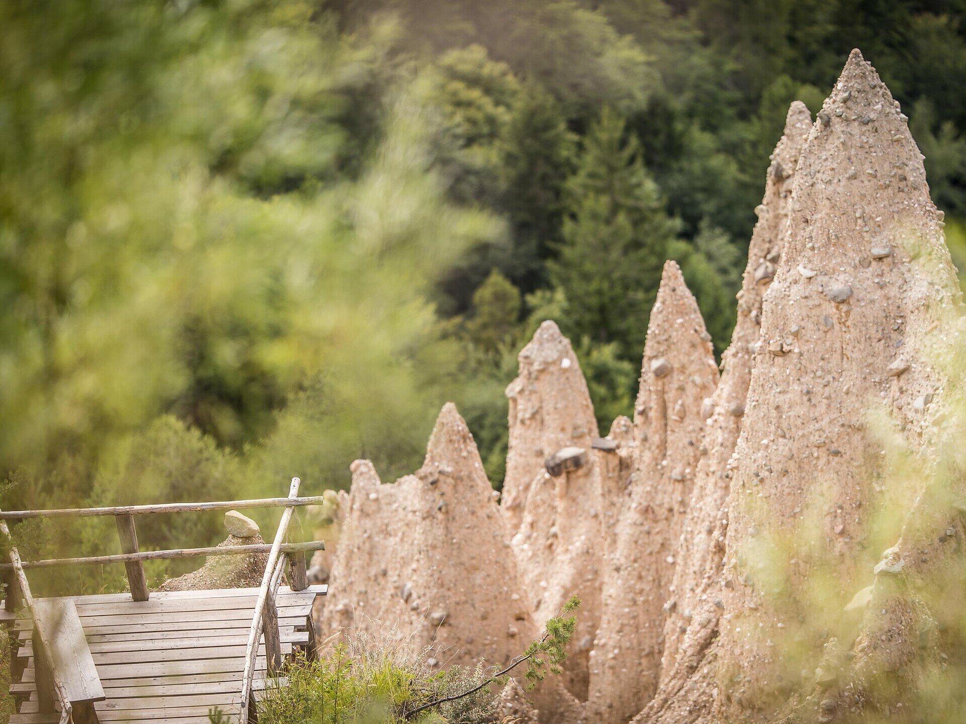
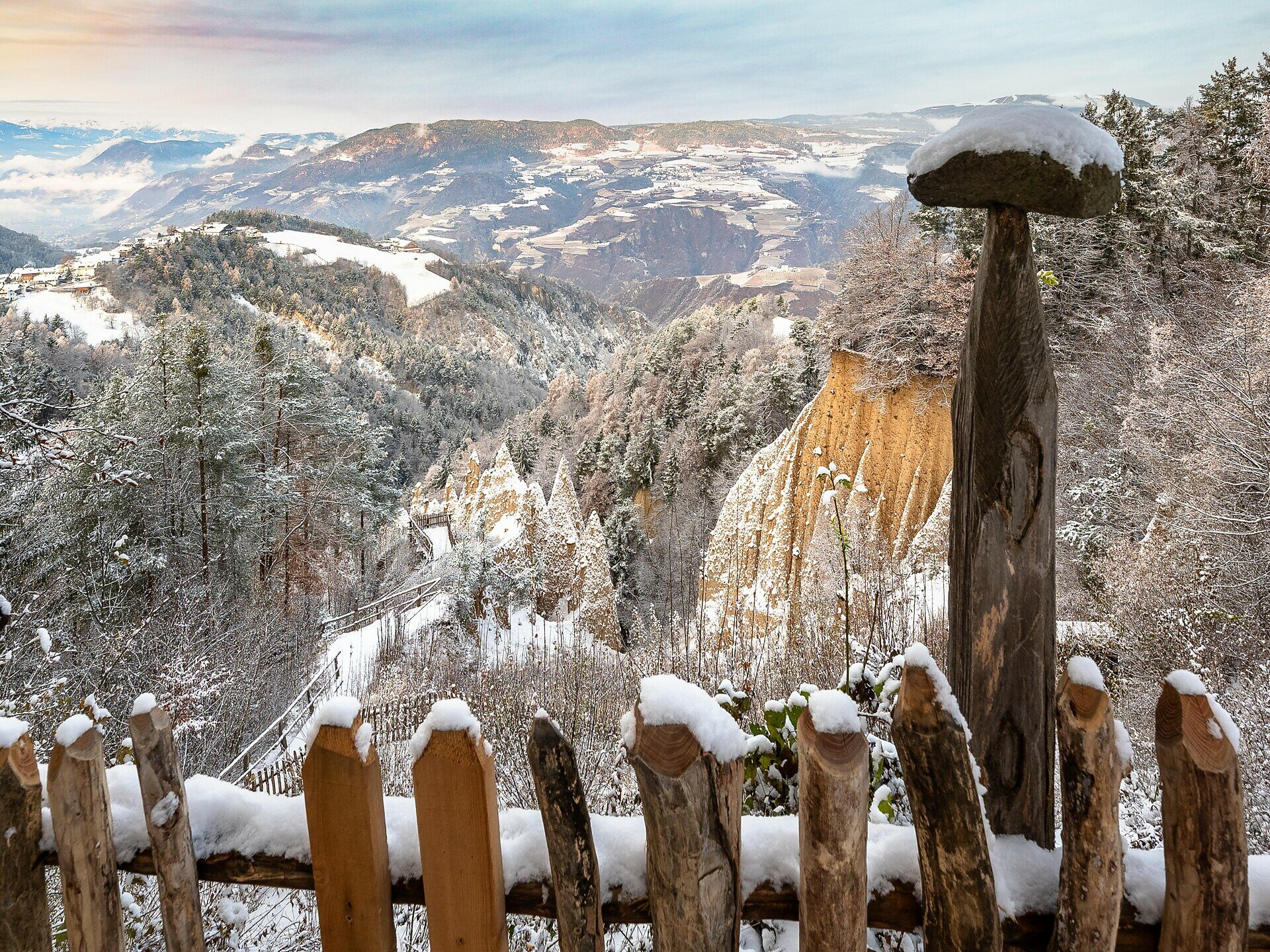
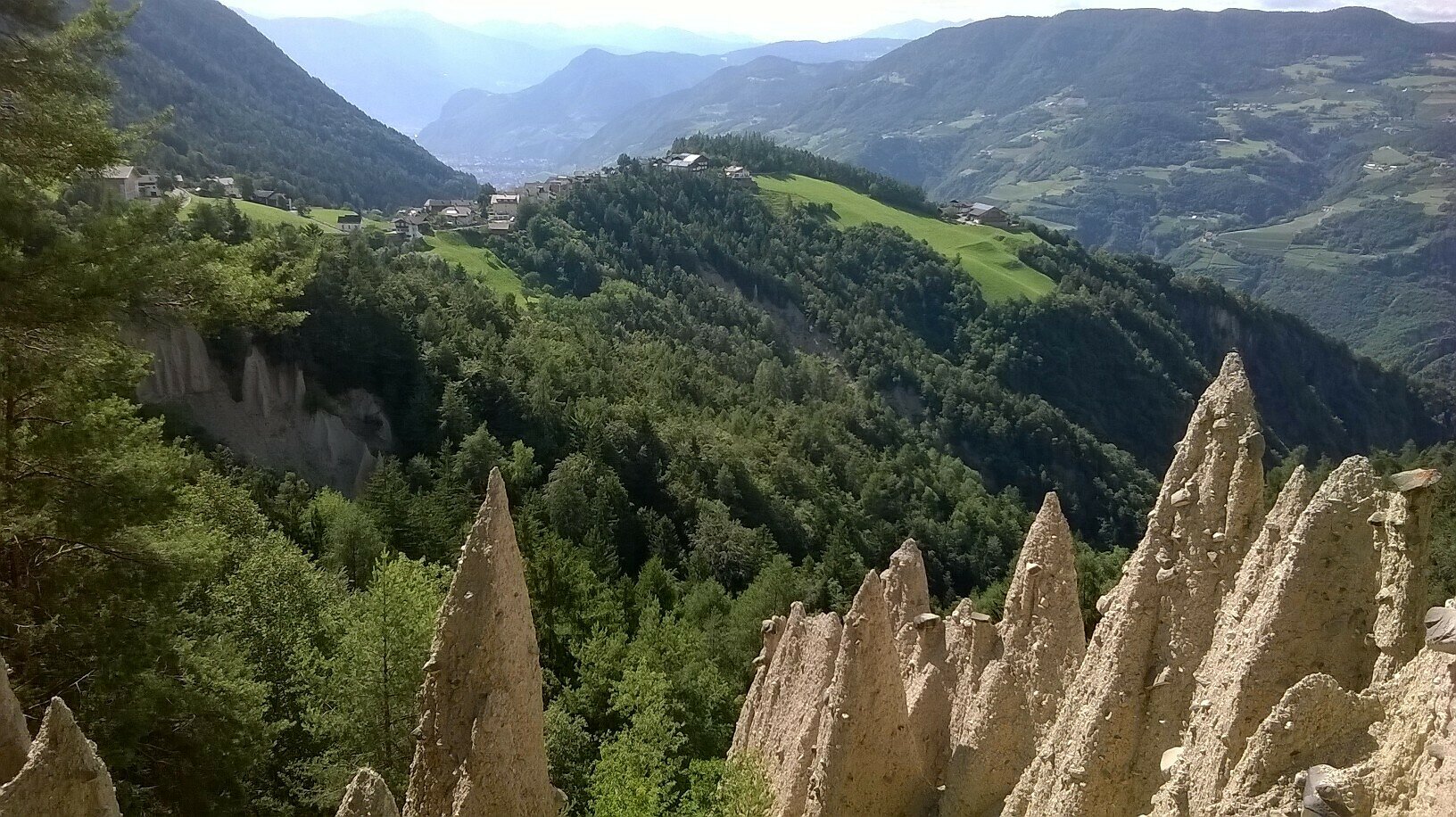
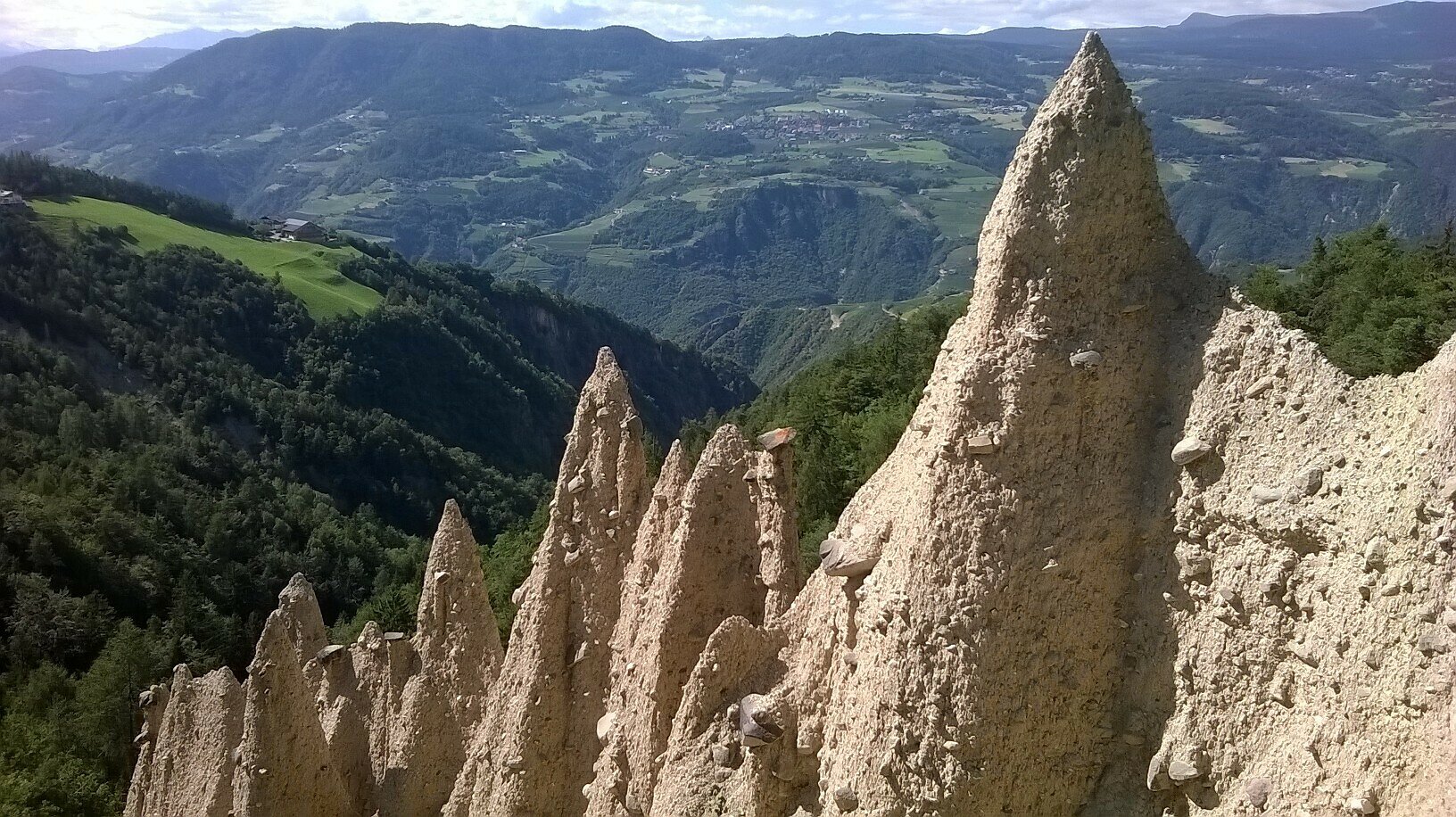
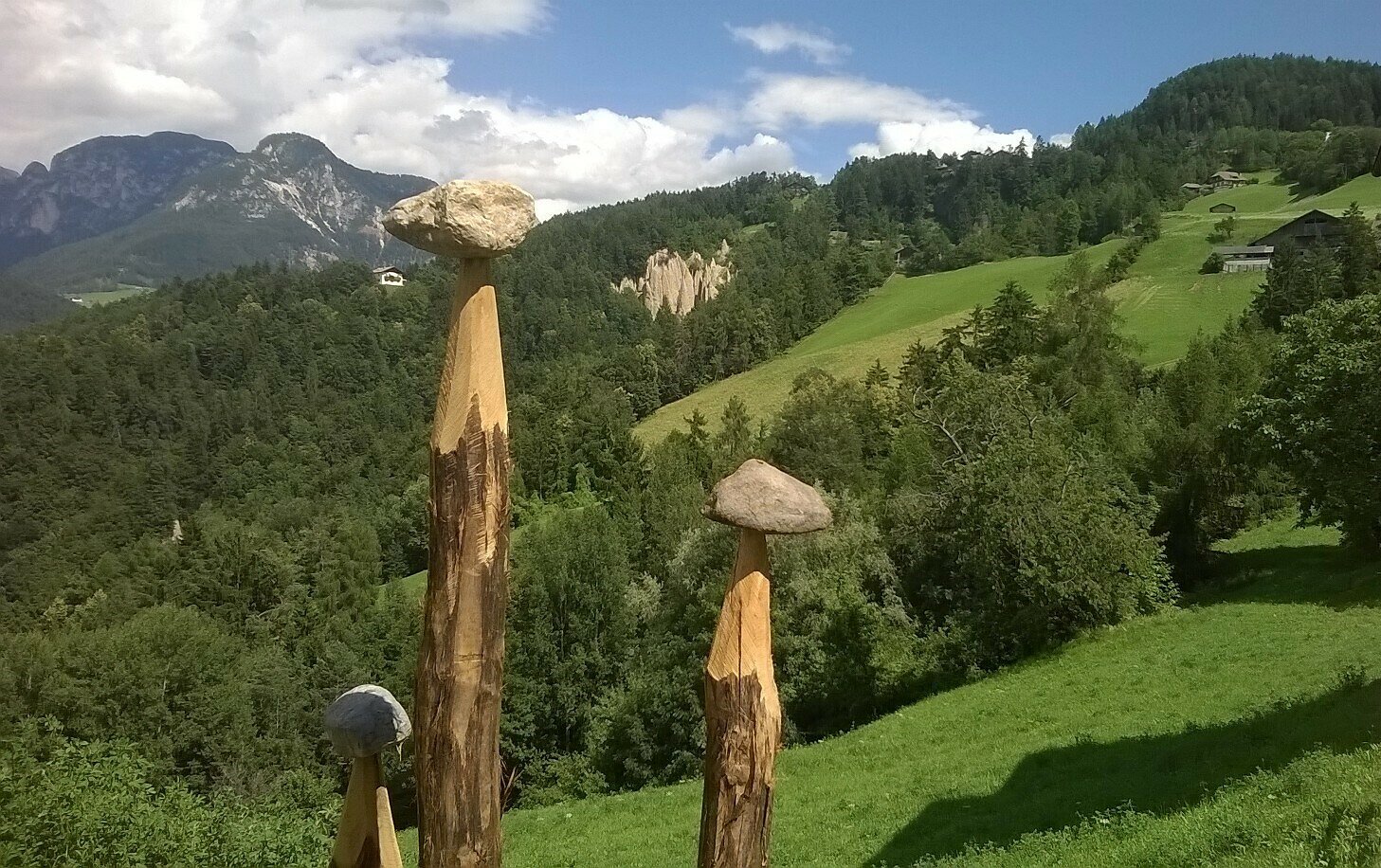
Experience a fascinating natural phenomenon on the Pyramid Trail in Steinegg: the impressive earth pyramids, formed over centuries by erosion of clayey moraine soil.
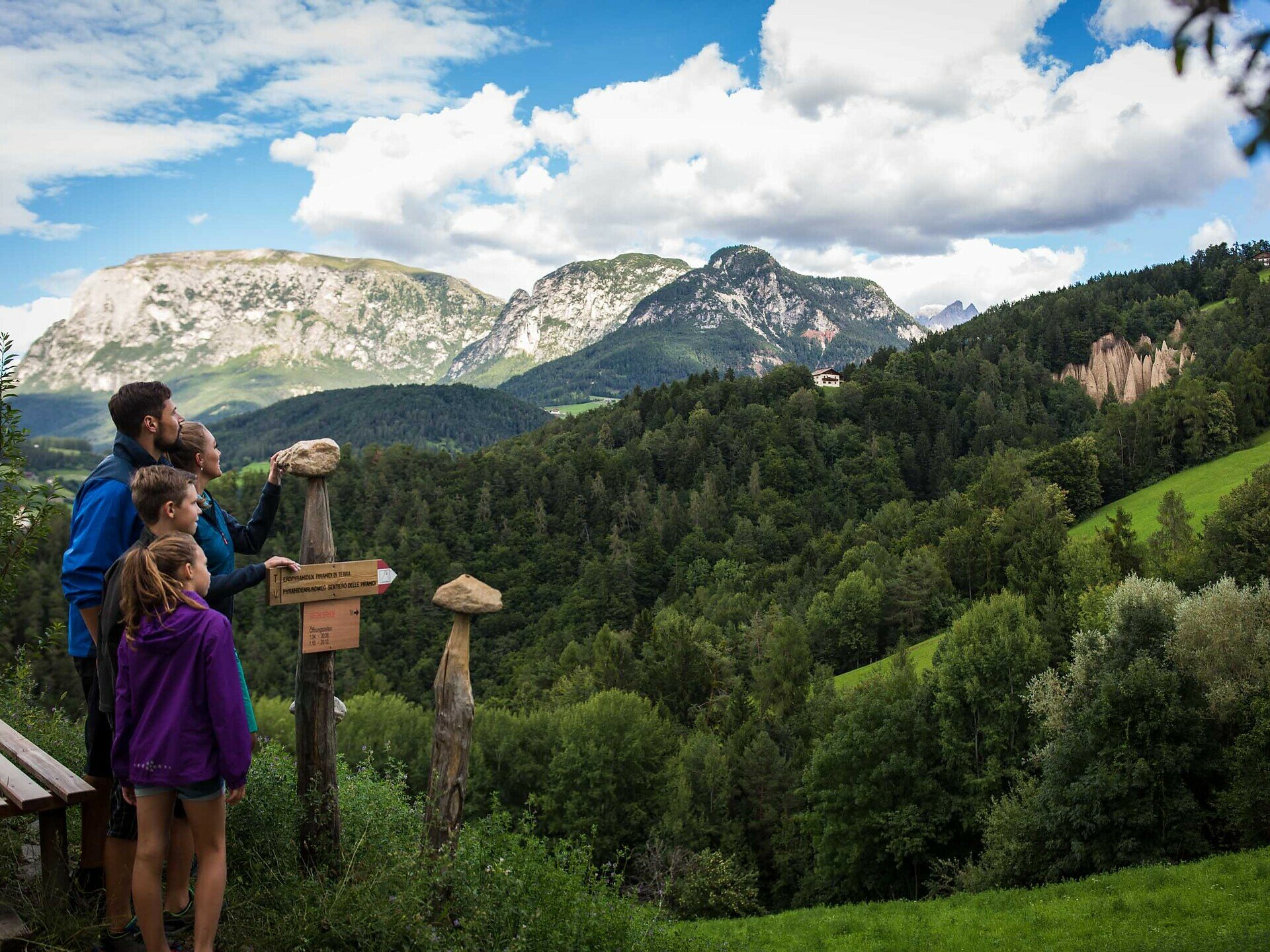
The varied circular route takes you through dense forests, over gentle meadows, and even through a gorge, always accompanied by magnificent views of the Schlern and Rosengarten mountains. Along the way, you can admire the bizarre earth pillars from a distance and then up close – a testimony to the power of wind and water. Enjoy this unique hike through a landscape full of geological wonders.

Please note: There are no refreshment opportunities along the entire circular route. However, at the start and end point in Steinegg, you have various restaurants, cafés, and two village shops available.

Route info
Intermediate
Distance
5,7 km
Activity time
1 h 52 min
Ascent
355 m
Descent
355 m
Physical effort
Scenary
Highest point
998 m
Lowest point
820 m
Directions

You start at the village square of Steinegg and follow path [2B] past Cafè Christl, turn left at the Hotel Oberwirt and continue on path [2B] over the Pstosser Bühl to the barn in front of the chapel "Zum Weißen Bild". Here you turn left onto the Pyramid Trail.
Three wooden pyramids mark the starting point here. You walk downhill over a meadow and enter a mixed forest. You continue descending until you reach the Katzenbach Gorge. You cross it and then it is relatively steep uphill until you reach another meadow. The route continues past Raffeinerhof and along the paved road towards Heiglerhof. Just before this, a trail marked [2] branches off to the right. This leads slightly uphill past Dosserhof to the main road. You continue to Dosser Cross and turn right. Here you descend directly to the earth pyramids and the viewing platform. Path [2] continues, passing the pyramids, to Glirger Cross and over Katzenbachweg back to the chapel "Zum Weißen Bild". Always staying on path [2], you return to the village of Steinegg.

public transportation

The starting point of the route is easily and conveniently accessible by public transport.

By public bus line:
- 182 from Bolzano
- 187 from Welschnofen
- 180 from Karersee, Karerpass, Fassatal*
- 184 from Obereggen, Eggen*
- 181 from Weissenstein, Petersberg, Deutschnofen, Stenk*
- 187 or 182 from Gummer
*Change in Birchabruck to line 182

Stop: Steinegg, Dorf;
Online timetable search at Südtirol Mobil
Starting point: Steinegg Dorf

How to get there

The starting point of the route is easily and conveniently accessible by public transport.

By public bus line:
- 182 from Bolzano
- 187 from Welschnofen
- 180 from Karersee, Karerpass, Fassatal*
- 184 from Obereggen, Eggen*
- 181 from Weissenstein, Petersberg, Deutschnofen, Stenk*
- 187 or 182 from Gummer
*Change in Birchabruck to line 182

Stop: Steinegg, Dorf;
Online timetable search at Südtirol Mobil
Starting point: Steinegg Dorf

By car:
Destination: Steinegg
Parking: next to the main road in front of Cafè Christl at the Dorfplatz Steinegg parking lot
Starting point: Steinegg Dorf

Where to park

Next to the main road in front of Cafè Christl at the Dorfplatz Steinegg parking lot
Starting point: Steinegg Dorf

Hiking equipment and hiking boots
You might be interested in
Discover related tours
Intermediate
Add to favourites
Steinegg
Mountain Cinema in the Eggental - Furner Oach
Distance 10,7 km
Activity time 3 h 30 min
Ascent 540 m
Descent 540 m
Welschnofen
Sissi Tour
Distance 10,3 km
Activity time 2 h 53 min
Ascent 357 m
Descent 357 m
Intermediate
Add to favourites
Karersee, Deutschnofen, Welschnofen
Hike & Bike | Obereggen - King Laurin Tour
Distance 36,2 km
Activity time 5 h 07 min
Ascent 2.226 m
Descent 2.584 m
Steinegg
To the cave dwelling "Mortner Gufl" near Steinegg|Collepietra
Distance 5,7 km
Activity time 1 h 41 min
Ascent 215 m
Descent 216 m
Deutschnofen
Hike to the Häusler Sam
Distance 3,9 km
Activity time 1 h 10 min
Ascent 133 m
Descent 139 m
Deutschnofen, Welschnofen
Family hike from Lake Carezza to the Häusler Sam hut
Distance 13,0 km
Activity time 3 h 30 min
Ascent 214 m
Descent 214 m
© Carezza Dolomites/Harald Wisthaler
Information & prices
Ski passes
Winter 2024/25

Here you will find all important information on skipasses, daily, multi-day, and seasonal tickets at a glance. All ski passes can be purchased quickly and conveniently online. Buy your skipass directly from home and get a 5% discount!

To the ski passes & tickets