Top

Circular hike at Taltbühl to Totmoos and Wolfsgrube

Welschnofen, Steinegg
Add to favourites
Difficulty
Intermediate
Activity time
3:03
Duration in hours
Distance
10.3
Distance in km
Suggested period
Jan
Feb
Mar
Apr
May
Jun
Jul
Aug
Sep
Oct
Nov
Dec
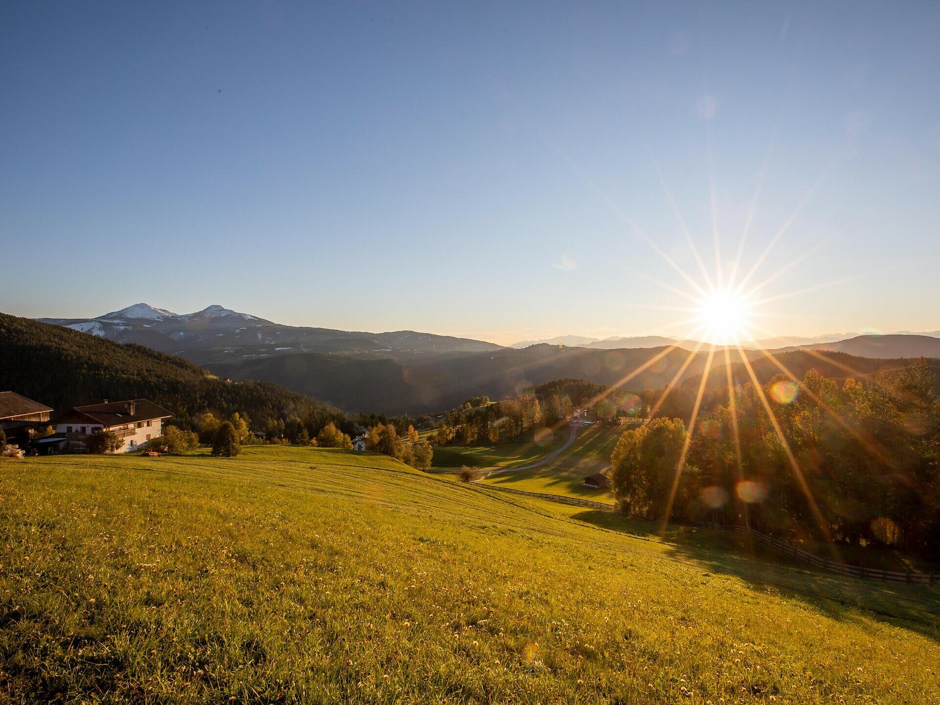
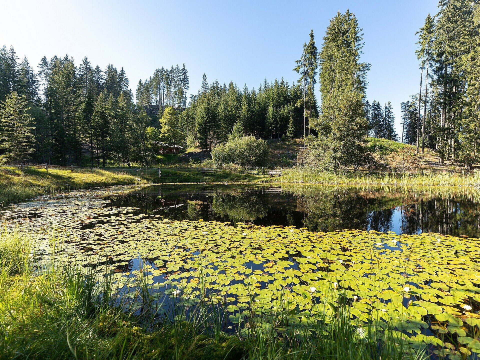
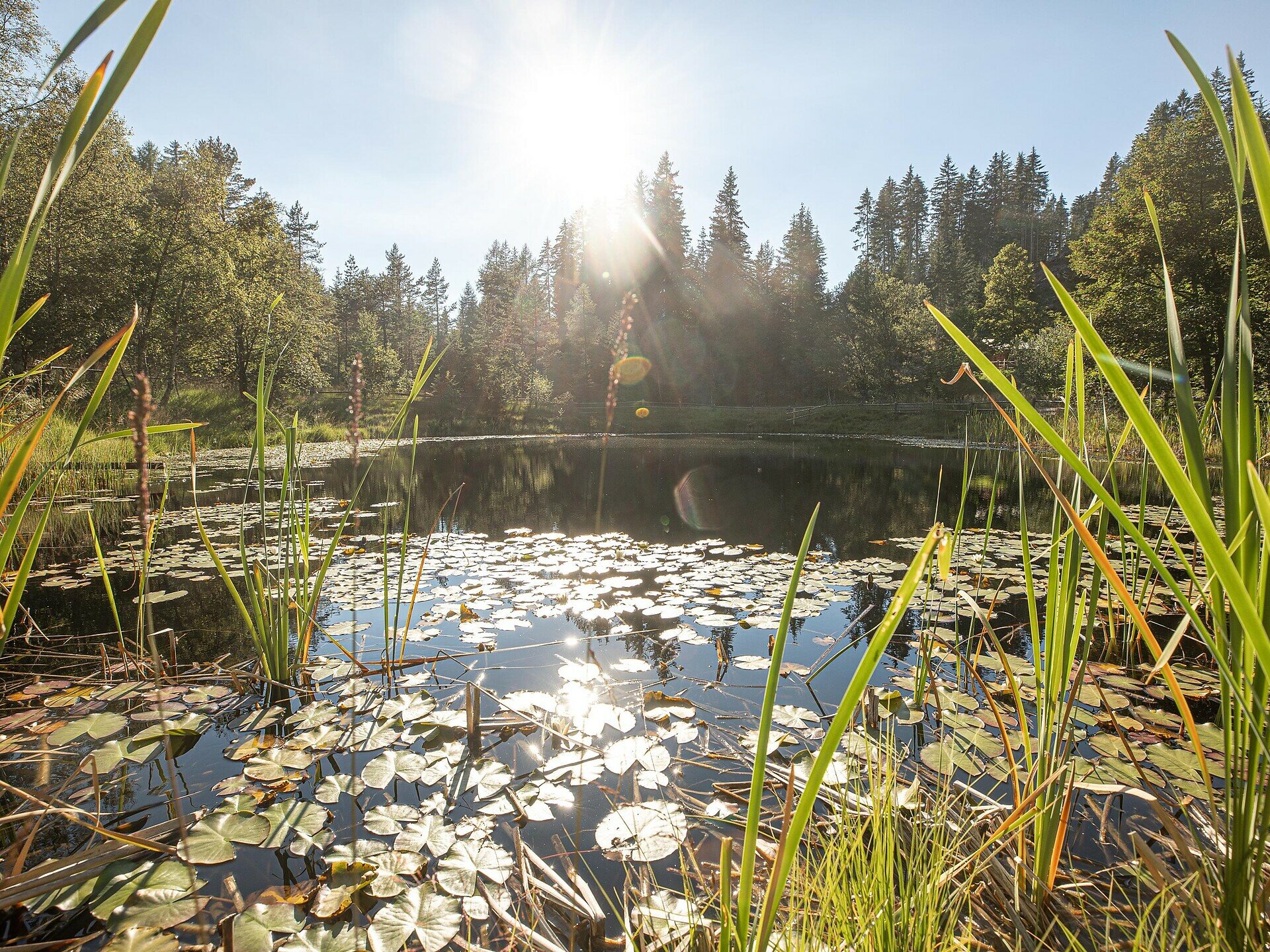
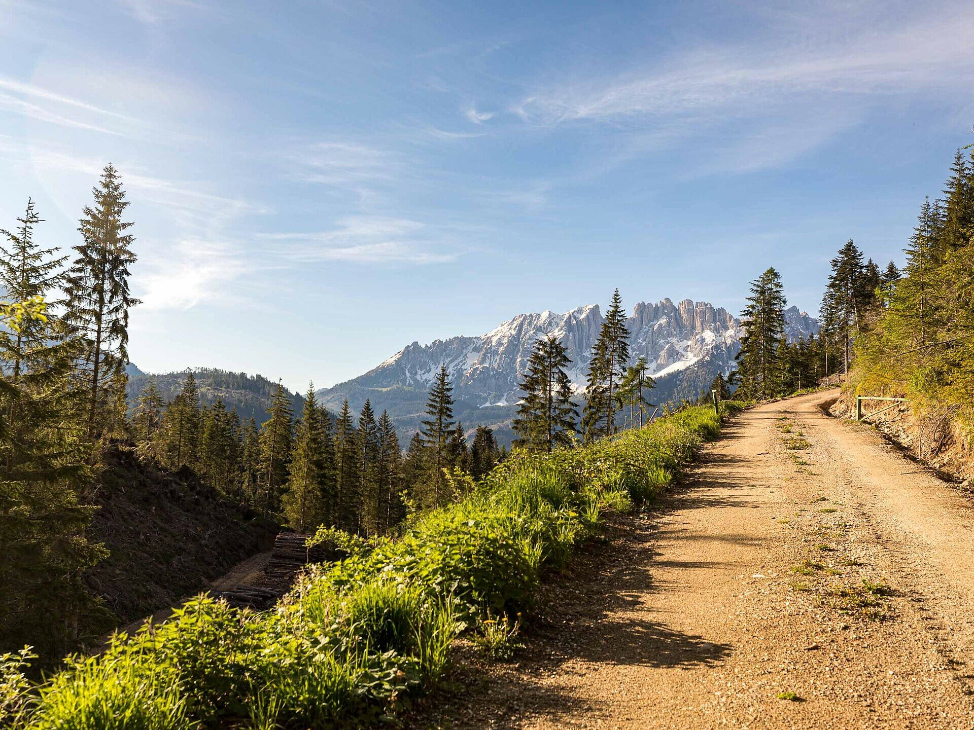
Quiet forests, Totmoos biotope & Wolfsgrube: a peaceful circular hike in Obergummer with panorama and picnic spots in the midst of nature.
This circular hike in Obergummer in the municipality of Karneid takes you through quiet forests, over gentle hills, and past two special places: the natural monument Totmoos, an idyllic biotope with water lilies, and the historic Wolfsgrube, one of the last wolf pits of the region – a place with history in the midst of greenery.

At the Totmoos biotope, seating invites you to a relaxing break – ideal for a picnic in the middle of nature. For those who prefer a cozier atmosphere, a covered seating and table area can be found at the nearby unmanaged forester’s hut – perfect for a short rest.

Again and again, the view opens to the Rosengarten massif, the Schlern, and the Tierser Tal – a panoramic route that combines nature enjoyment and quiet moments. Ideal for those who prefer things a bit quieter.

Please note: There are no refreshment options along the entire circular hike. In the summer months, however, you have the option to make a detour to the Hagneralm and refresh yourself there.
Path from Wolfsgrube to Hagneralm: 2.5 km, approx. 40 minutes walking time


Route info
Intermediate
Distance
10,3 km
Activity time
3 h 03 min
Ascent
391 m
Descent
387 m
Physical effort
Scenary
Highest point
1.630 m
Lowest point
1.343 m
Directions

The starting point is the Obergummer bus stop or the parking lot in front of the Lärchenwald guesthouse (1,350 m). From here, walk on path [3] towards Seaphof/Zipperle. At Hof Weggut turn left and follow path [22] through quiet forest landscape to the Totmoos biotope (1,625 m) – an ideal spot for an initial break.

The path continues to the Wolfsgrube (1,506 m), a historic place in the middle of greenery. From here, take path [1] back to the starting point.

Tip: Those with energy left can make a detour to the Hagner Alm from Wolfsgrube (approx. 2.5 km | walking time approx. 40 minutes) – ideal for a refreshment in the summer months.

public transportation

The starting point of the route is easily and conveniently accessible by public transport.

By public bus line:
- 182 from Bozen
- 187 from Welschnofen
- 180 from Karersee, Karerpass, Fassatal*
- 184 from Obereggen, Eggen*
- 181 from Weissenstein, Petersberg, Deutschnofen, Stenk*
- 187 or 182 from Gummer
*Change at Birchabruck to line 182

Stop: Gummer, Obergummer;
Online timetable search at Südtirol Mobil
Starting point: Bus stop in Obergummer

How to get there

The starting point of the route is easily and conveniently accessible by public transport.

By public bus line:
- 182 from Bozen
- 187 from Welschnofen
- 180 from Karersee, Karerpass, Fassatal*
- 184 from Obereggen, Eggen*
- 181 from Weissenstein, Petersberg, Deutschnofen, Stenk*
- 187 or 182 from Gummer
*Change at Birchabruck to line 182

Stop: Gummer, Obergummer;
Online timetable search at Südtirol Mobil
Starting point: Bus stop in Obergummer

By car:
Destination: Gummer
Parking: public and free parking shortly before the Lärchenwald guesthouse
Starting point: Parking in front of the Lärchenwald guesthouse

Where to park
Public and free parking shortly before the Lärchenwald guesthouse
Starting point: Parking in front of the Lärchenwald guesthouse
Hiking equipment
Hiking boots
Water
Food (no refreshment options directly on the circular hike)
You might be interested in
Discover related tours
Intermediate
Add to favourites
Deutschnofen
Hike & Bike| From Obereggen to Pietralba
Distance 16,8 km
Activity time 5 h 00 min
Ascent 555 m
Descent 608 m
Karersee, Welschnofen
Family hike from the Nigerpass | Passo Nigra to the Messnerjoch hut
Distance 3,9 km
Activity time 1 h 16 min
Ascent 242 m
Descent 242 m
Deutschnofen
Hike to the Little St Agatha Church
Distance 8,9 km
Activity time 2 h 25 min
Ascent 72 m
Descent 565 m
Intermediate
Add to favourites
Karersee, Welschnofen
Family hike from the Karerpass | Passo Costalunga to the Mitterleger | Radura di Mezzo and Latemar meadows
Distance 8,3 km
Activity time 2 h 32 min
Ascent 383 m
Descent 383 m
Deutschnofen
LATEMAR.360°
Distance 1,0 km
Activity time 25 min
Ascent 86 m
Descent 89 m
Deutschnofen
Hike from Passo Oclini at the top of the Corno Bianco
Distance 1,5 km
Activity time 1 h 00 min
Ascent 306 m
Descent 13 m
© Carezza Dolomites/Harald Wisthaler
Information & prices
Ski passes
Winter 2024/25

Here you will find all important information on skipasses, daily, multi-day, and seasonal tickets at a glance. All ski passes can be purchased quickly and conveniently online. Buy your skipass directly from home and get a 5% discount!

To the ski passes & tickets