Top

LATEMAR.PANORAMA: Family-hike on the nature-trail

Obereggen, Deutschnofen
Add to favourites
Difficulty
Easy
Activity time
3:14
Duration in hours
Distance
10.6
Distance in km
WSEN
Suggested period
Jan
Feb
Mar
Apr
May
Jun
Jul
Aug
Sep
Oct
Nov
Dec
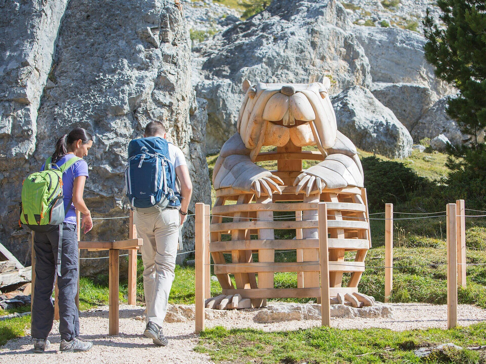
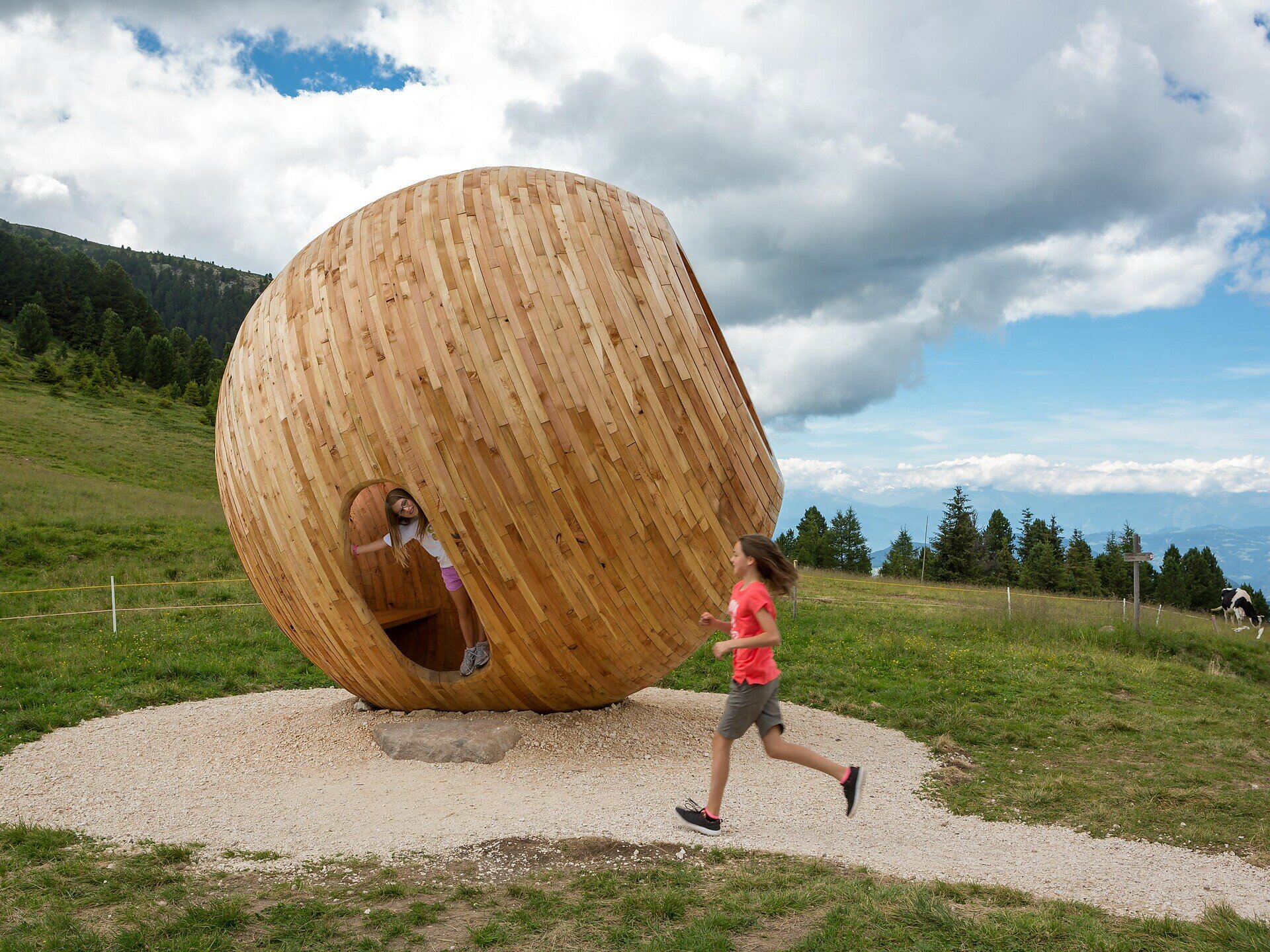
Scenic family hike along an educational trail with panoramic views, interactive stops & cozy alpine huts – perfect for kids and adults alike.
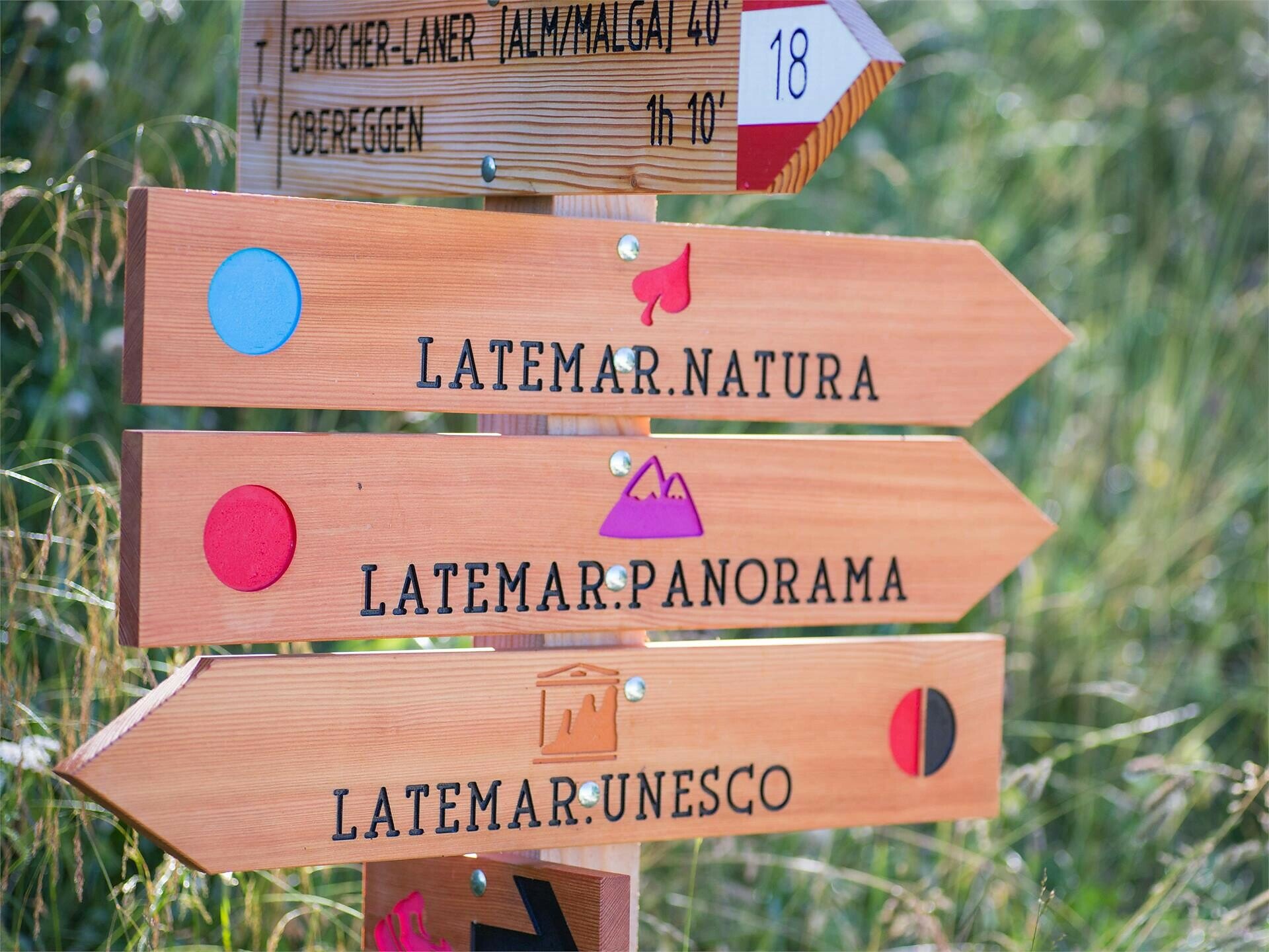
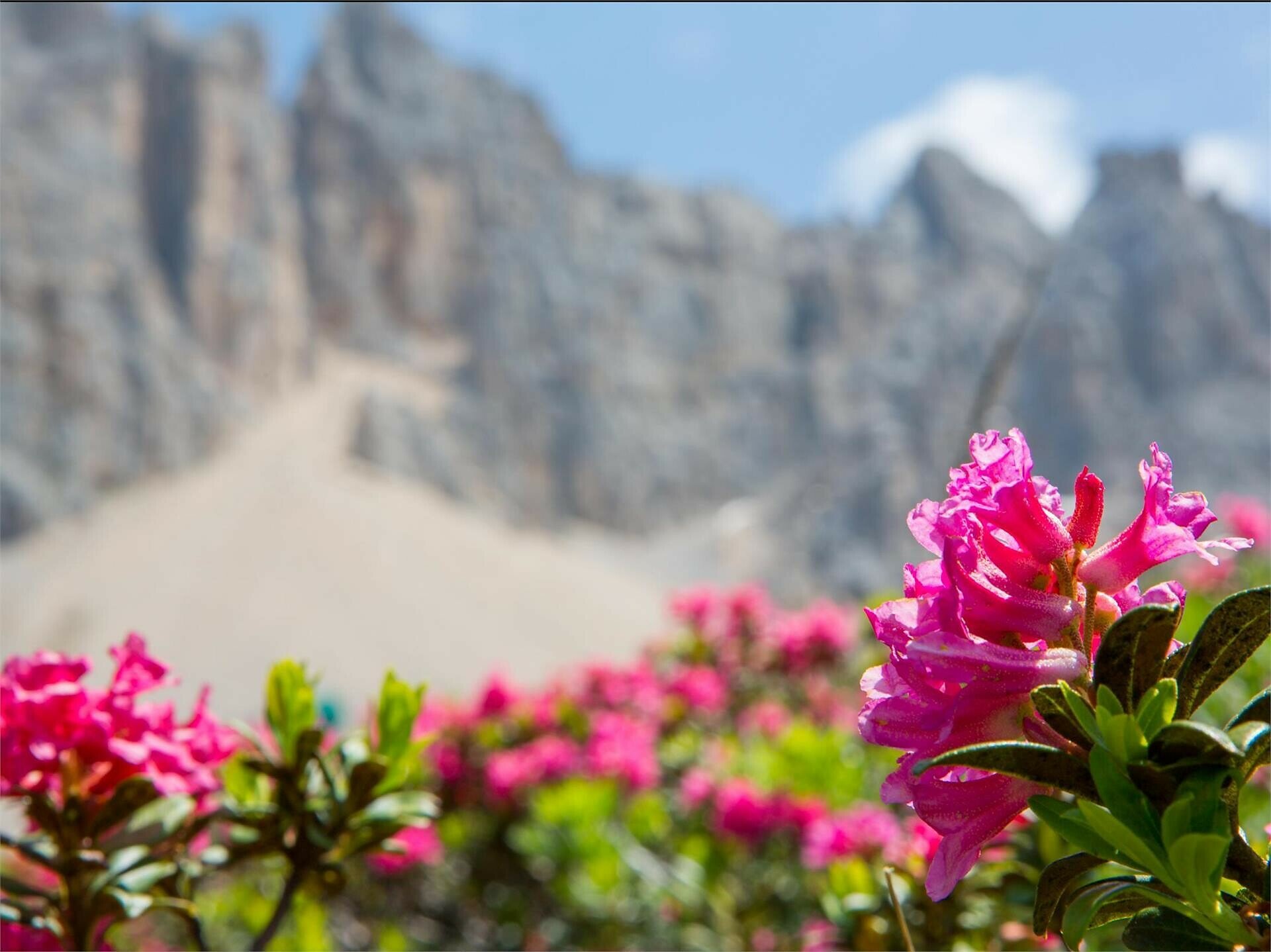
The Latemar.Panorama hike is the perfect outdoor experience for families looking to enjoy nature, move together, and take in the stunning Dolomite scenery. The educational trail leads along easy and varied paths through peaceful alpine meadows, light forests, and breathtaking viewpoints. Along the way, interactive stations invite children and adults alike to explore, observe, and learn about the surrounding environment. Several cozy mountain huts offer delicious regional food and relaxing breaks with panoramic views. This hike combines outdoor fun, nature discovery, and quality family time – all set against the majestic backdrop of the Latemar mountains.
Route info
Easy
Distance
10,6 km
Activity time
3 h 14 min
Ascent
486 m
Descent
1.014 m
Physical effort
Scenary
Highest point
2.506 m
Lowest point
1.549 m
Directions

The hike starts at the top station of the Oberholz chairlift, located at an altitude of 2,096 m. From there, follow trail [22] towards Passo Feudo (2,175 m), offering impressive panoramic views of the Latemar range and the surrounding Dolomites.

From the pass, the route continues across the alpine pastures of Reiterjoch on trail [504/505], passing the Zischg Alm and Ganischger Alm – perfect for a scenic rest with local specialties.

Then follow trail [9] to reach the Epircher Laner Alm, before returning to Obereggen.

Alternative Route:
Alternatively, start at the top station and follow trail [23] to the Mayrl Alm, then continue on trail [9] via the Epircher Laner Alm back down to Obereggen (1,550 m).

Duration: approx. 3 hours
Elevation difference: approx. 510 m
Rest stops: Platzl Mountain Lounge, Oberholz Hut, Zischg Alm, Ganischger Alm, Mayrl Alm, Epircher Laner Alm

public transportation
Getting to the starting point of the tour by public transport is easy and convenient.

By public bus line:
- 181 and change 184 from Bozen | Bolzano
- 180 and change 184 from Karersee | Carezza, Karerpass | Passo Costalunga, Welschnofen | Nova Levante
- 184 from Weissenstein | Pietralba, Petersberg | Monte San Pietro, Deutschnofen | Nova Ponente
- 184 Birchabruck | Ponte Nova
- 182 and change 184 from Steinegg | Collepietra, Gummer | San Valentino

Bus stop: Obereggen; online bus timetables: www.suedtirolmobil.info/en/
How to get there

Getting to the starting point of the tour by public transport is easy and convenient.

By public bus line:
- 181 and change 184 from Bozen | Bolzano
- 180 and change 184 from Karersee | Carezza, Karerpass | Passo Costalunga, Welschnofen | Nova Levante
- 184 from Weissenstein | Pietralba, Petersberg | Monte San Pietro, Deutschnofen | Nova Ponente
- 184 Birchabruck | Ponte Nova
- 182 and change 184 from Steinegg | Collepietra, Gummer | San Valentino

Bus stop: Obereggen; online bus timetables: www.suedtirolmobil.info/en/

By car:
Destination: Obereggen
Parking: parking lot Obereggen
Where to park
Destination: Obereggen
Parking: parking lot Obereggen
You might be interested in
Discover related tours
Obereggen
Summer hike from Baita Gardonè into the dragon forest
Distance 1,5 km
Activity time 27 min
Ascent 70 m
Descent 70 m
Intermediate
Add to favourites
Deutschnofen
Hike to the Wölflhof
Distance 9,0 km
Activity time 3 h 00 min
Ascent 274 m
Descent 285 m
Intermediate
Add to favourites
Deutschnofen
Hike over the Samberg Mountain
Distance 11,8 km
Activity time 3 h 30 min
Ascent 437 m
Descent 437 m
Intermediate
Add to favourites
Welschnofen
Long circular route at Lake Carezza
Distance 5,4 km
Activity time 1 h 30 min
Ascent 129 m
Descent 129 m
Intermediate
Add to favourites
Karersee, Welschnofen
Hike from San Cipriano/Passo Nigra/Malga Frommer hut to Passo Costalunga
Distance 11,6 km
Activity time 3 h 55 min
Ascent 818 m
Descent 89 m
Welschnofen
Spring Hike from the Malga Frommer to the Baita "Ochsenhütte"
Distance 2,1 km
Activity time 38 min
Ascent 102 m
Descent 53 m
© Carezza Dolomites/Harald Wisthaler
Information & prices
Ski passes
Winter 2024/25

Here you will find all important information on skipasses, daily, multi-day, and seasonal tickets at a glance. All ski passes can be purchased quickly and conveniently online. Buy your skipass directly from home and get a 5% discount!

To the ski passes & tickets