Top

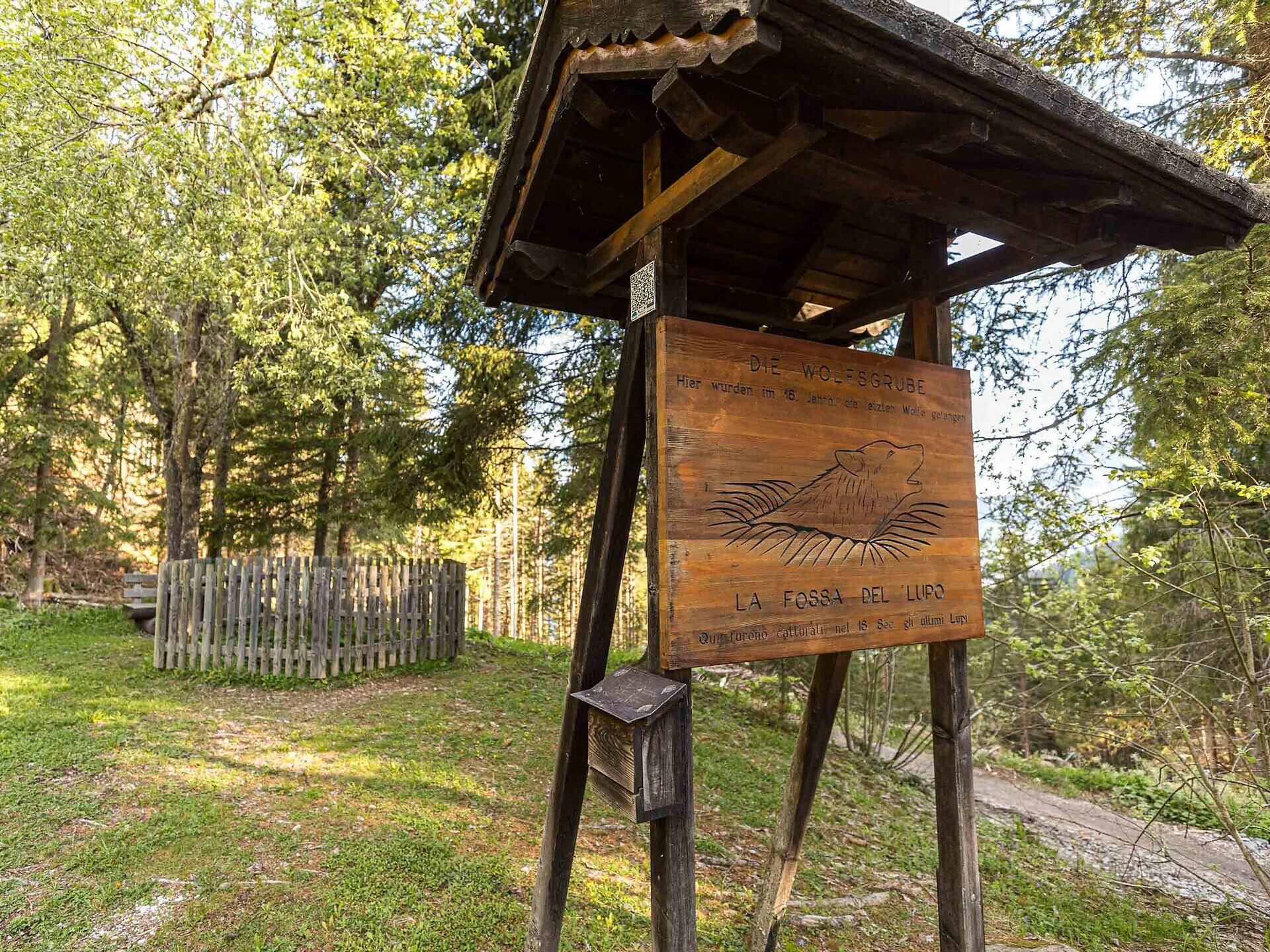
Circular hike at the Taltbühl to the Totmoos and the wolf pit

Steinegg, Welschnofen
Add to favourites
Difficulty
Intermediate
Activity time
3:03
Duration in hours
Distance
10.3
Distance in km
Suggested period
Jan
Feb
Mar
Apr
May
Jun
Jul
Aug
Sep
Oct
Nov
Dec
Quiet forests, Totmoos biotope & wolf pit: a peaceful loop hike in Obergummer|San Valentino di Sopra with panoramic views and picnic spots in the heart of nature.

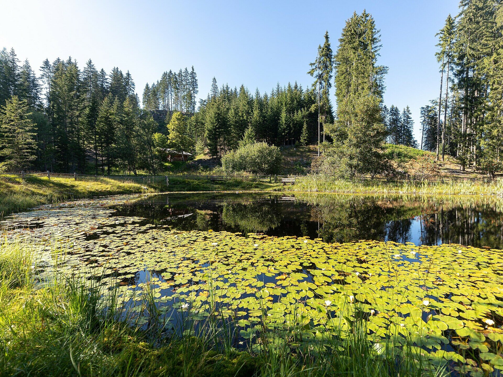
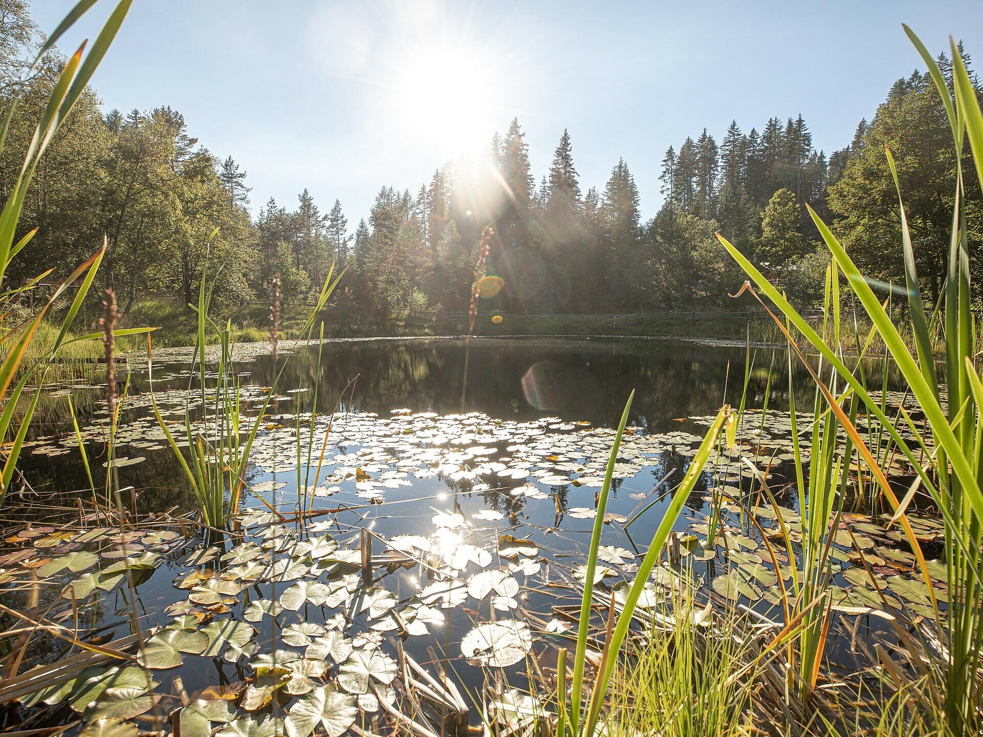
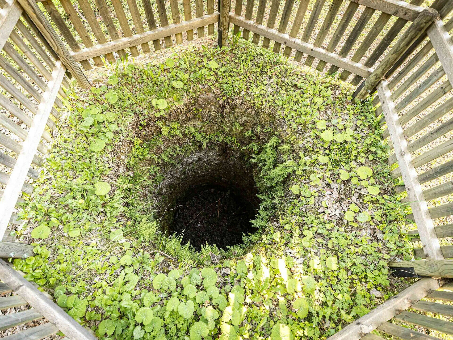
This circular hike in Obergummer|San Valentino di Sopra, located in the municipality of Karneid|Cornedo all'Isarco, leads you through quiet forests, gentle hills and past two unique places: the natural landmark Totmoos, an idyllic pond-like biotope with water lilies, and the historic wolf pit, one of the last remaining of its kind in the region – a place full of history surrounded by greenery.

At the Totmoos biotope, benches invite you to take a relaxing break – perfect for a picnic in the heart of nature. For a more rustic experience, the nearby unmanaged forest hut offers a covered table and benches – ideal for a quiet pause.

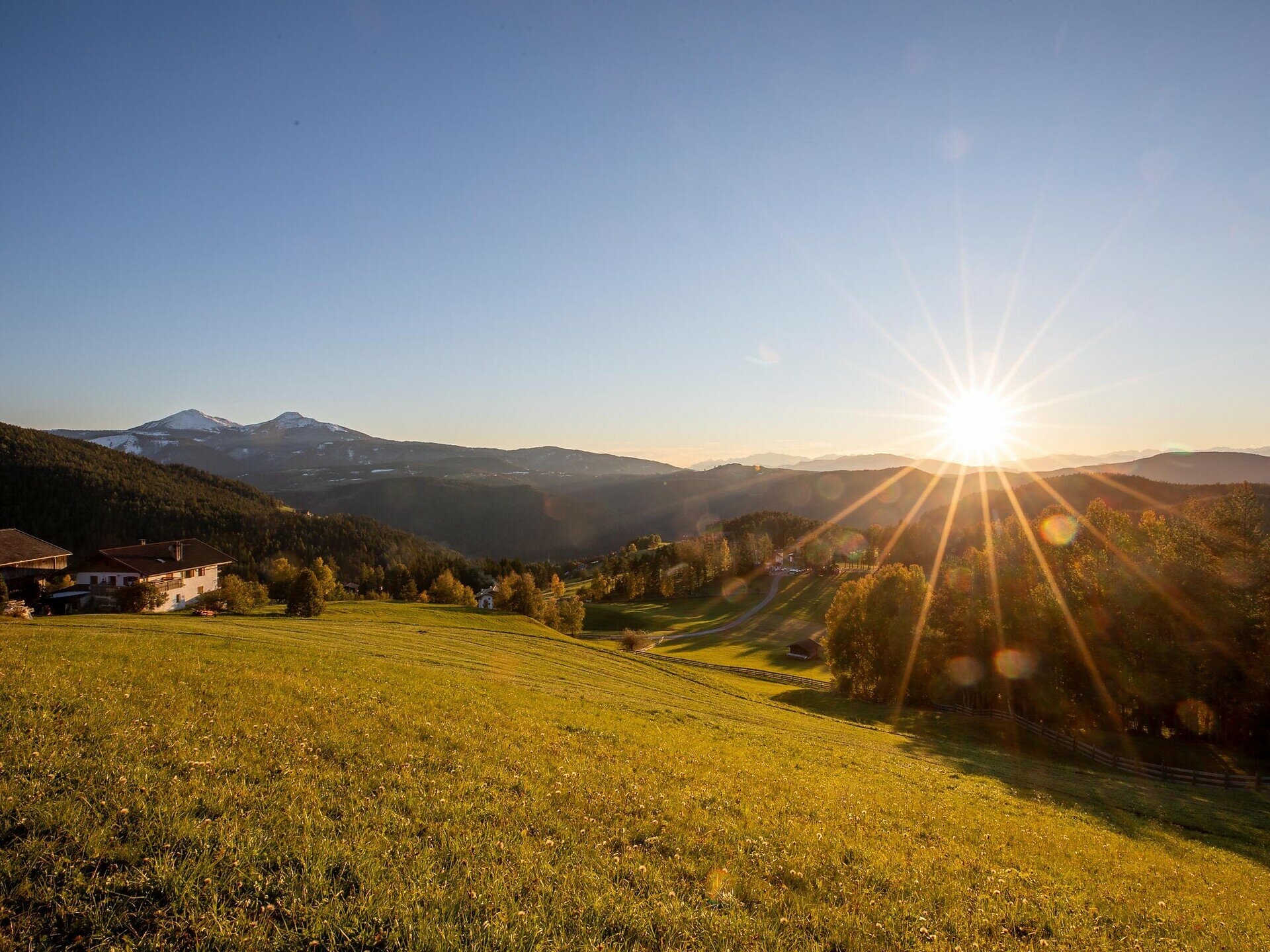
Time and again, the trail opens up to panoramic views of the Rosengarten|Catinaccio massif, the Schlern|Sciliar and the Tiers|Tires Valley – a scenic hike that combines natural beauty with peaceful moments. Ideal for those who appreciate tranquillity.

Please note: There are no refreshment stops along the trail. However, during the summer months, you can make a detour to the malga Hagner hut to enjoy some food and drink.
Distance from the wolf pit to malga Hagner hut: 2.5 km – about 40 minutes on foot.

Route info
Intermediate
Distance
10,3 km
Activity time
3 h 03 min
Ascent
391 m
Descent
387 m
Physical effort
Scenary
Highest point
1.630 m
Lowest point
1.343 m
Directions

The hike starts either at the Obergummer|San Valentino di Sopra bus stop or from the car park near the guesthouse Lärchenwald (1,350 m). Follow trail [3] towards the farm Seaphof/Zipperle. At the farm Weggut, turn left and continue along trail [22] through peaceful woods to the Totmoos biotope (1,625 m) – a great spot for a first break.

The trail continues to the Wolf Pit (1,506 m), a historic site surrounded by greenery. From there, follow trail [1] back to your starting point.

Tip: If you’ve still got energy, make a detour to the malga Hagner hut (2.5 km | approx. 40 minutes’ walk) – a great place for a break during the summer months.

public transportation

Getting to the starting point of the tour by public transport is easy and convenient.

By public bus line
- 182 from Bozen | Bolzano
- 187 from Welschnofen | Nova Levante
- 180 from Karersee | Lago di Carezza, Karerpass | Passo Costalunga, Val di Fassa*
- 184 from Oberggen, Eggen | Ega*
- 181 from Weissenstein | Pietralba, Petersberg | Monte San Pietro, Deutschnofen | Nova Ponente, Stenk*
- 187 or 182 from Gummer | San Valentino in Campo
*change in Birchabruck | Ponte Nova to the line 182

Bus stop: Obergummer | San Valentino di Sopra;
online timetable search at South Tyrol Mobility
Starting point: Busstop in Obergummer|San Valentino di Sopra

How to get there

Getting to the starting point of the tour by public transport is easy and convenient.

By public bus line
- 182 from Bozen | Bolzano
- 187 from Welschnofen | Nova Levante
- 180 from Karersee | Lago di Carezza, Karerpass | Passo Costalunga, Val di Fassa*
- 184 from Oberggen, Eggen | Ega*
- 181 from Weissenstein | Pietralba, Petersberg | Monte San Pietro, Deutschnofen | Nova Ponente, Stenk*
- 187 or 182 from Gummer | San Valentino in Campo
*change in Birchabruck | Ponte Nova to the line 182

Bus stop: Obergummer | San Valentino di Sopra;
online timetable search at South Tyrol Mobility
Starting point: Busstop in Obergummer|San Valentino di Sopra

By car:
Destination: Obergummer | San Valentino di Sopra
Parking: Public and free parking lot near the guesthouse Lärchenwald
Starting point: parking lot near the guesthouse Lärchenwald

Where to park
Public and free parking lot near the guesthouse Lärchenwald
Starting point: parking lot near the guesthouse Lärchenwald
Hiking equipment
Hiking boots
Water
Food (no places to stop for refreshments directly on the circular hike)
You might be interested in
Discover related tours
Intermediate
Add to favourites
Karersee, Deutschnofen, Welschnofen
Hike from Obereggen to Passo Costalunga
Distance 11,0 km
Activity time 3 h 15 min
Ascent 290 m
Descent 104 m
Welschnofen
Kaiserstein Tour
Distance 17,0 km
Activity time 1 h 45 min
Ascent 113 m
Descent 256 m
Intermediate
Add to favourites
Deutschnofen
Hike & Bike| From Nova POnente to Obereggen
Distance 12,2 km
Activity time 3 h 35 min
Ascent 442 m
Descent 270 m
Intermediate
Add to favourites
Steinegg
Path of the Stars
Distance 12,2 km
Activity time 3 h 27 min
Ascent 334 m
Descent 656 m
Obereggen
Summer hike from Baita Gardonè into the dragon forest
Distance 1,5 km
Activity time 25 min
Ascent 32 m
Descent 43 m
Intermediate
Add to favourites
Deutschnofen
Hike to the Wölflhof
Distance 9,0 km
Activity time 2 h 30 min
Ascent 210 m
Descent 210 m
© Carezza Dolomites/Harald Wisthaler
Information & prices
Ski passes
Winter 2024/25

Here you will find all important information on skipasses, daily, multi-day, and seasonal tickets at a glance. All ski passes can be purchased quickly and conveniently online. Buy your skipass directly from home and get a 5% discount!

To the ski passes & tickets